
Dick_LeBoof
-
Posts
44 -
Joined
-
Last visited
1 Follower

About Dick_LeBoof

-

Richmond Metro/Hampton Roads Area Discussion
Dick_LeBoof replied to RIC Airport's topic in Mid Atlantic
Just following along with the radar, you can see the banding form in real time. What a treat. -
Richmond Metro/Hampton Roads Area Discussion
Dick_LeBoof replied to RIC Airport's topic in Mid Atlantic
Go clipper go! -
Richmond Metro/Hampton Roads Area Discussion
Dick_LeBoof replied to RIC Airport's topic in Mid Atlantic
some decent banding that ended up setting up here! Fun stuff. -
Richmond Metro/Hampton Roads Area Discussion
Dick_LeBoof replied to RIC Airport's topic in Mid Atlantic
Here is the observed snow total map from the Wakefield NWS office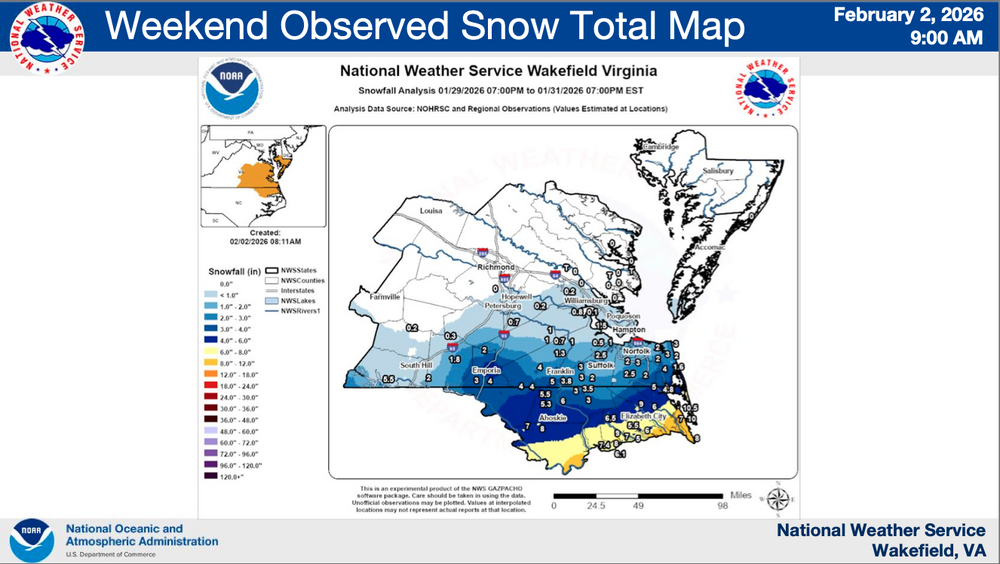
-
Richmond Metro/Hampton Roads Area Discussion
Dick_LeBoof replied to RIC Airport's topic in Mid Atlantic
"..impactful accumulations expected in areas like Richmond, VA ... " In addition to language that seems to indicate they believe the precipitation shield will be more widespread than the current suite of Global models that point to dry air intrusion suppressing snow totals. -
Richmond Metro/Hampton Roads Area Discussion
Dick_LeBoof replied to RIC Airport's topic in Mid Atlantic
Whoa that's a big update for Richmond! Is the WPC a national-level group? -
Richmond Metro/Hampton Roads Area Discussion
Dick_LeBoof replied to RIC Airport's topic in Mid Atlantic
I assume this doesn't take into account the latest 18Z euro run? -
Richmond Metro/Hampton Roads Area Discussion
Dick_LeBoof replied to RIC Airport's topic in Mid Atlantic
Something I've noticed with all the EPS (and GEFS) runs is that the individual members have been noticeably clustering towards the western edge of where the ULL forms
-
Richmond Metro/Hampton Roads Area Discussion
Dick_LeBoof replied to RIC Airport's topic in Mid Atlantic
I always feel a bit dirty looking at the Kuchera-ratio clown maps, but even the Wakefield NWS office posted expectations of "15:1 to 18:1" ratios in their most recent forecast discussion -
Richmond Metro/Hampton Roads Area Discussion
Dick_LeBoof replied to RIC Airport's topic in Mid Atlantic
We've been edging this whole damn winter. I can't edge anymore captain! -
Richmond Metro/Hampton Roads Area Discussion
Dick_LeBoof replied to RIC Airport's topic in Mid Atlantic
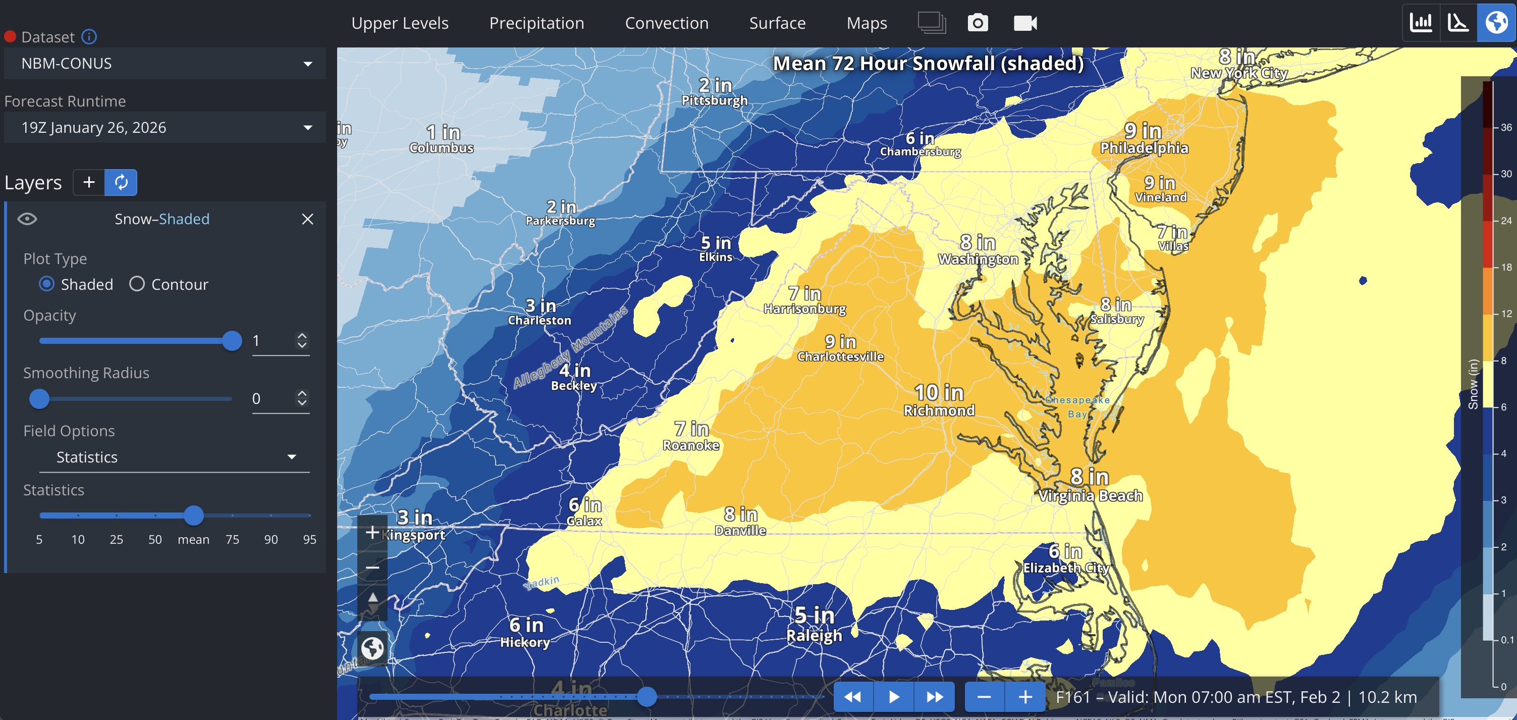
Everyone is obviously focused on the recent ECMWF 18z runs, but I'm going to throw in the 19Z NBM output anyway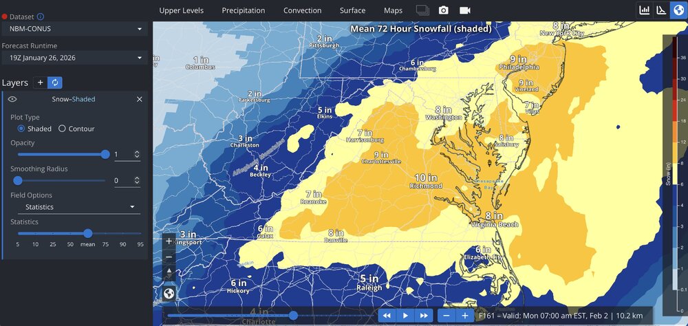
-
Richmond Metro/Hampton Roads Area Discussion
Dick_LeBoof replied to RIC Airport's topic in Mid Atlantic
The snow signature from the visible GOES band is really impressive. What a storm.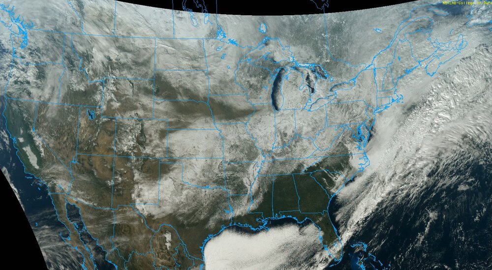
-
Richmond Metro/Hampton Roads Area Discussion
Dick_LeBoof replied to RIC Airport's topic in Mid Atlantic
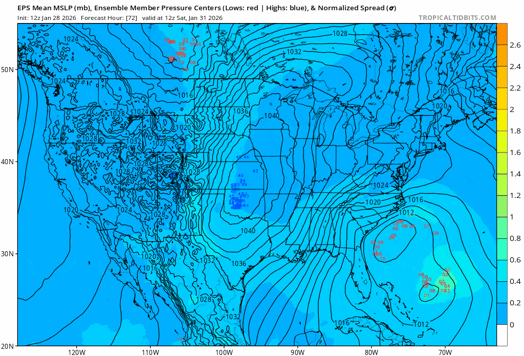
Here's the EPS Ensemble pressure centers from last nights run (06Z). Will hopefully see the members tighten up around the coast in the next run.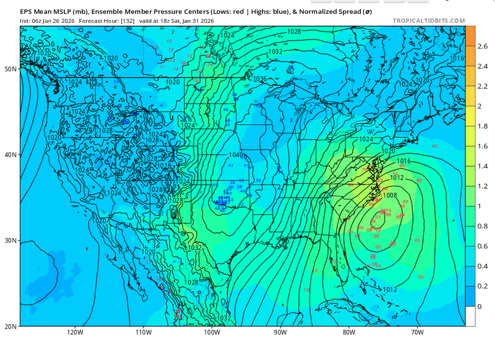
-
Richmond Metro/Hampton Roads Area Discussion
Dick_LeBoof replied to RIC Airport's topic in Mid Atlantic
How nice is this? It's the tiniest little clipper you can imagine on the radar right now haha. -
Richmond Metro/Hampton Roads Area Discussion
Dick_LeBoof replied to RIC Airport's topic in Mid Atlantic
We’ve got flakes coming down now in Church hill .