

MSUgulfcoaster
-
Posts
38 -
Joined
-
Last visited
Content Type
Profiles
Blogs
Forums
American Weather
Media Demo
Store
Gallery
Posts posted by MSUgulfcoaster
-
-
1 minute ago, WxWatcher007 said:
When that core collapsed in the southern Gulf that was the ballgame on a landfalling major.
Yep.
-
Can someone post the link to the interactive water levels map? It has different sites all along the coast that you can click on. Can’t find it in my favorites. Thanks.
-
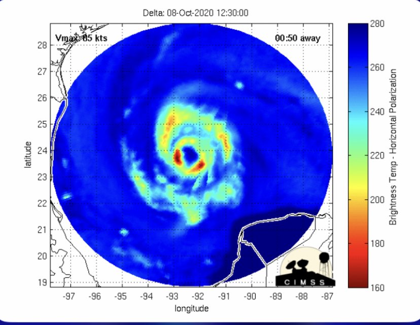
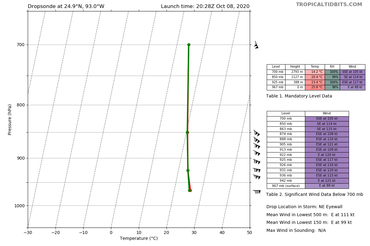
Oh wow, 121 kt just above the surface in the NE eye wall. That’s muchhhhhh higher than expected and not a good sign.
New update- cat 3 with 115mph winds, 959 mb

-
2 minutes ago, Moderately Unstable said:
Both of you are correct! More to the point, the FL winds just measured are around 15 knots higher than the most recent aircraft fix prior to this one. The SE Eyewall sonde that just came in has a pressure of 966, and was not at the center of the storm. I agree, evidence suggests that, as was forecast, the storm has re-intensified to a low cat 3. The next forecasting elements are going to be determining the timing of the turn, speed as it approaches landfall (since that will affect the impacts along the coast). In the process of typing, the eye sonde came in at 959.
MU
A lot of others said basically the same as this above, and it’s spot on. This is a cat 3 storm right now, it’s intensifying rapidly, and the strong winds will mix down. Things are going to get really interesting over the next 6 hours as Delta pushes its upper limits of intensification. Good thing we will have recon flying through there for the entirety.
when the pressure plummets, and FL winds drastically increase, it’s never a good thing, especially when it is out in the middle of the GoM. Prayers go out to LA, been a tough year for the Northern Gulf.
-
 3
3
-
-
Just now, Alfoman said:
954.2 mb with 91 kt SFMR in the SW quadrant on that pass
Wow, with that being in the SW quadrant, Delta is a Cat 3 right now.
-
-
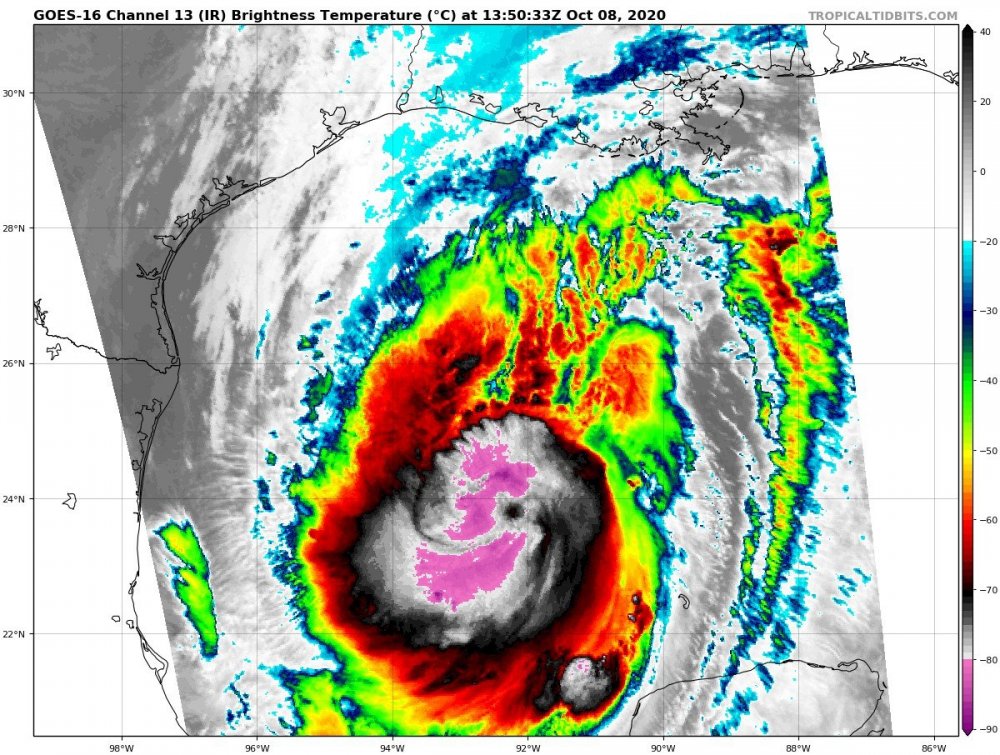
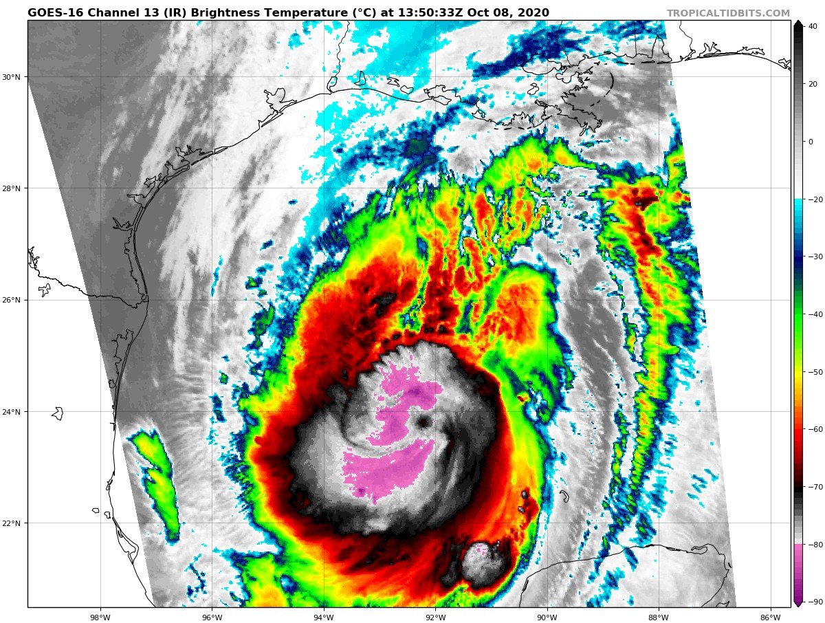
The bones are sturdy, if this is in GMT then this is a couple hours old, it CDT then current. Either way, the inner structure is looking really good. Satellite porn to follow.
-
It’s currently moving into an intensification phase, all systems go for the next 12 hours or so
-
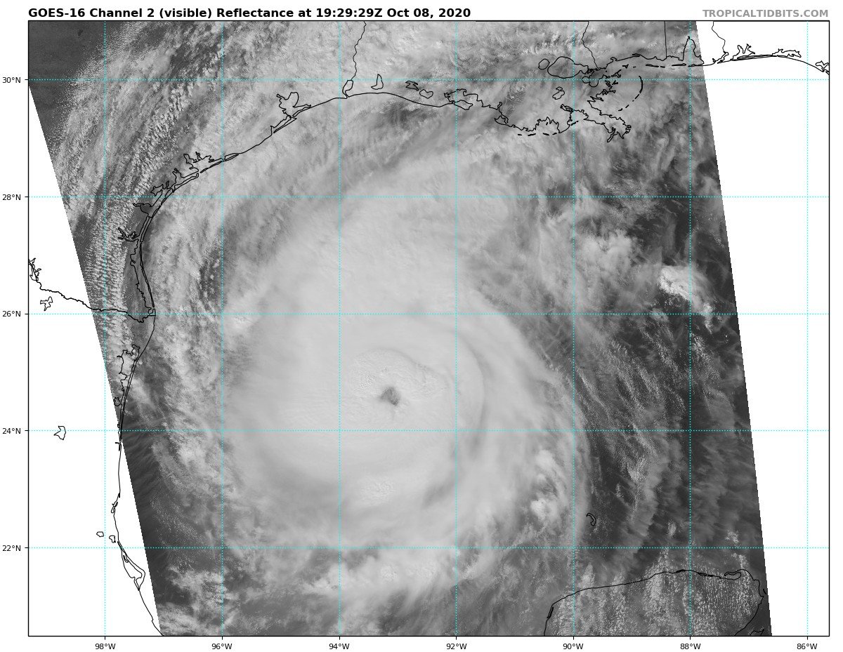
Eye see you!
-
1
-
Major Hurricane Delta
in Tropical Headquarters
Posted
Repost to get this on the current page.
Can someone post the link to the interactive water levels map? It has different sites all along the coast that you can click on. Can’t find it in my favorites. Thanks.