
.jpg.0d116cf1ef87110697ff67fc9ad286ea.jpg)
BYG Jacob
-
Posts
251 -
Joined
-
Last visited
Content Type
Profiles
Blogs
Forums
American Weather
Media Demo
Store
Gallery
Posts posted by BYG Jacob
-
-
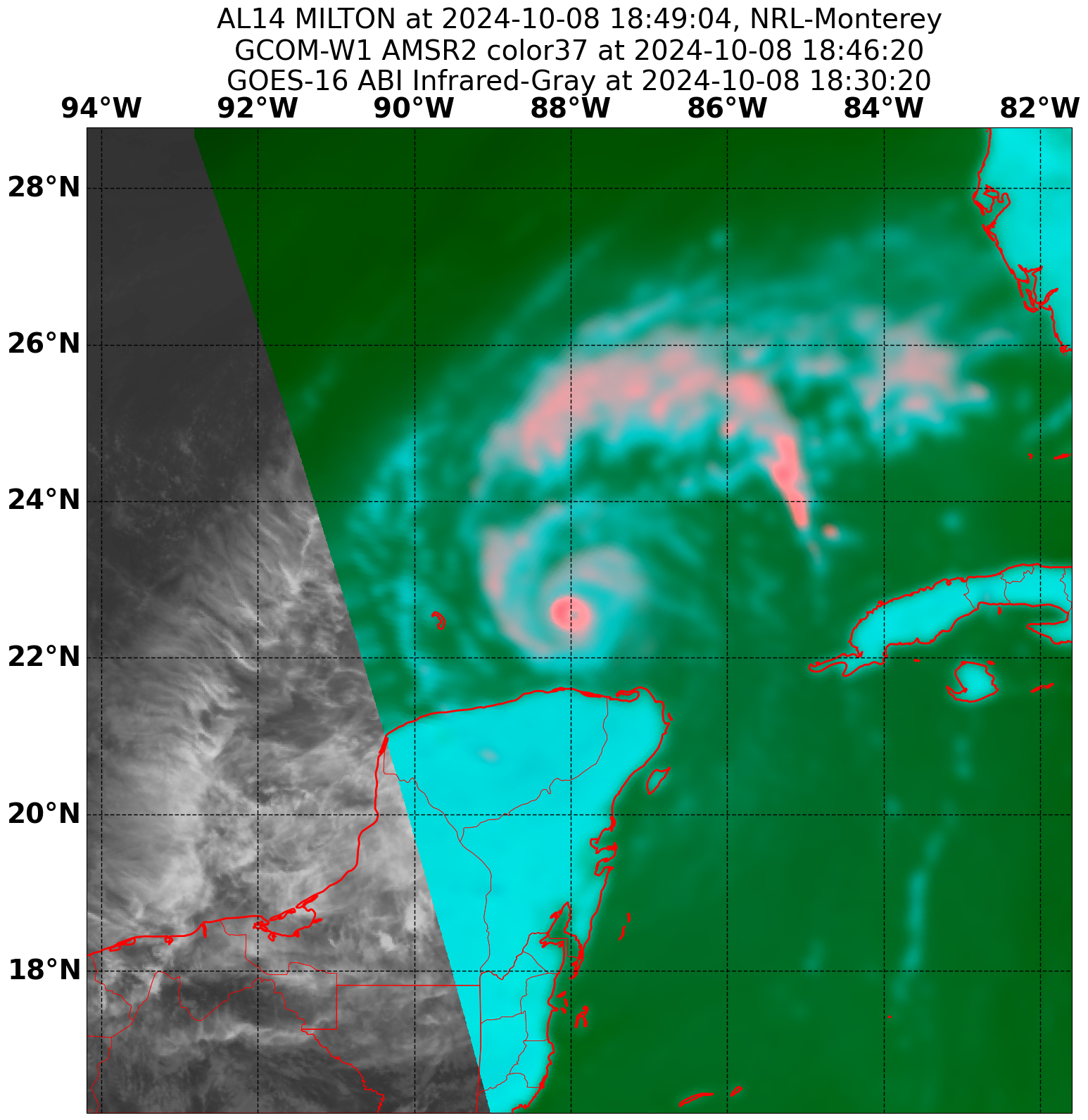
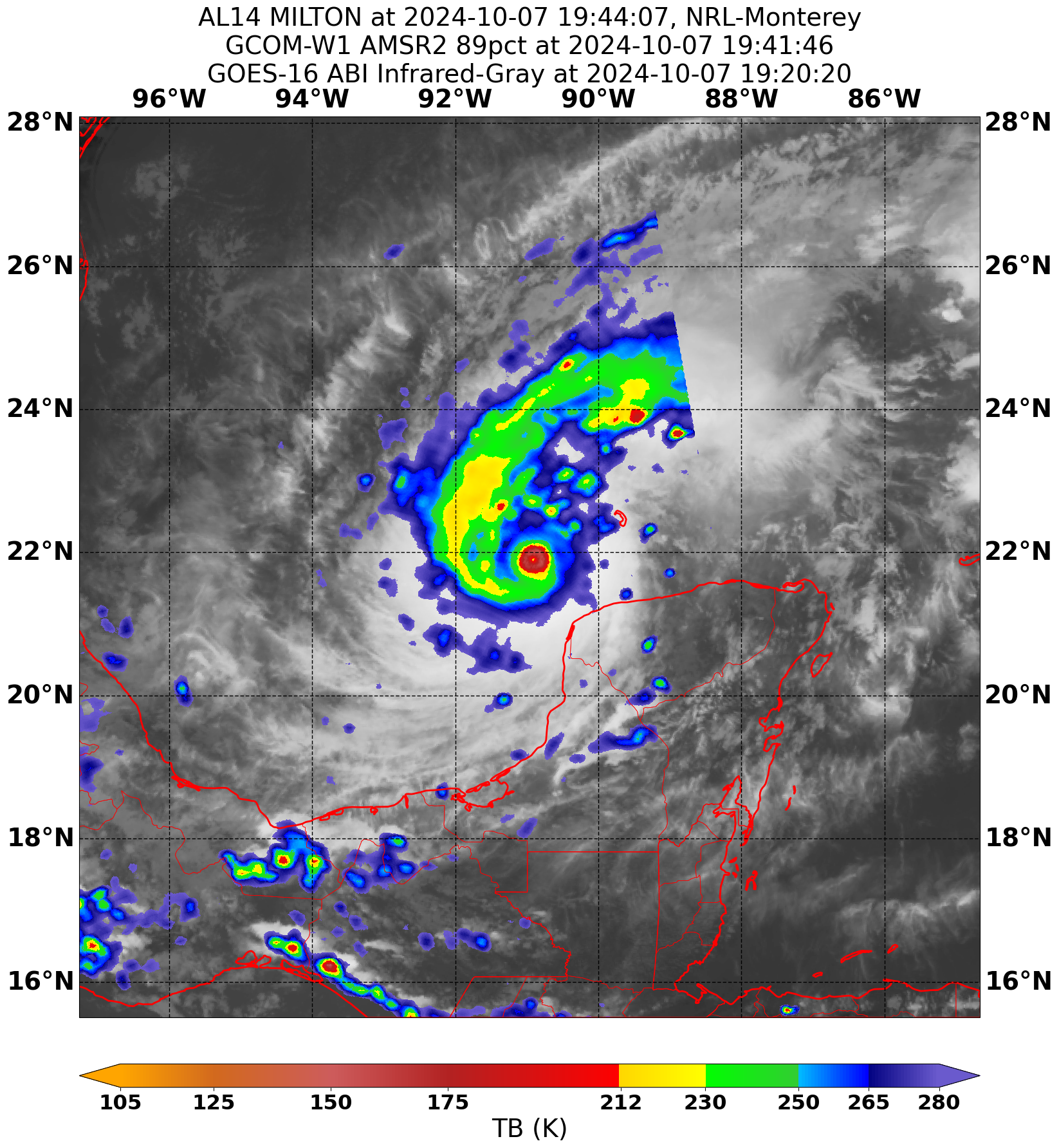
Milton making a bit of a comeback on IR
-
 4
4
-
-
-
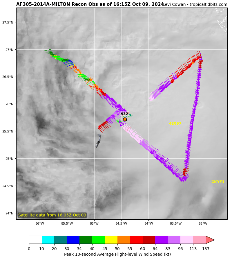
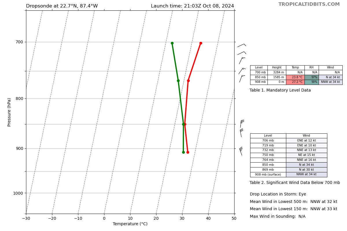
202
URNT12 KNHC 082136
VORTEX DATA MESSAGE   AL142024
A. 08/21:03:30Z
B. 22.69 deg N 087.44 deg W
C. 700 mb 2277 m
D. 908 mb
E. 340 deg 34 kt
F. CLOSED
G. C10
H. 138 kt
I. 286 deg 7 nm 21:01:30Z
J. 357 deg 137 kt
K. 278 deg 5 nm 21:02:00Z
L. 153 kt
M. 092 deg 7 nm 21:07:00Z
N. 194 deg 159 kt
O. 092 deg 7 nm 21:07:00Z
P. 11 C / 3053 m
Q. 24 C / 3064 m
R. 10 C / NA
S. 12345 / 7
T. 0.02 / 1 nm
U. AF303 1614A MILTON    OB 05
MAX FL WIND 159 KT 092 / 7 NM 21:07:00Z
-
 2
2
-
-
Both planes are having transmission issues.
-
2
-
 1
1
-
 2
2
-
-
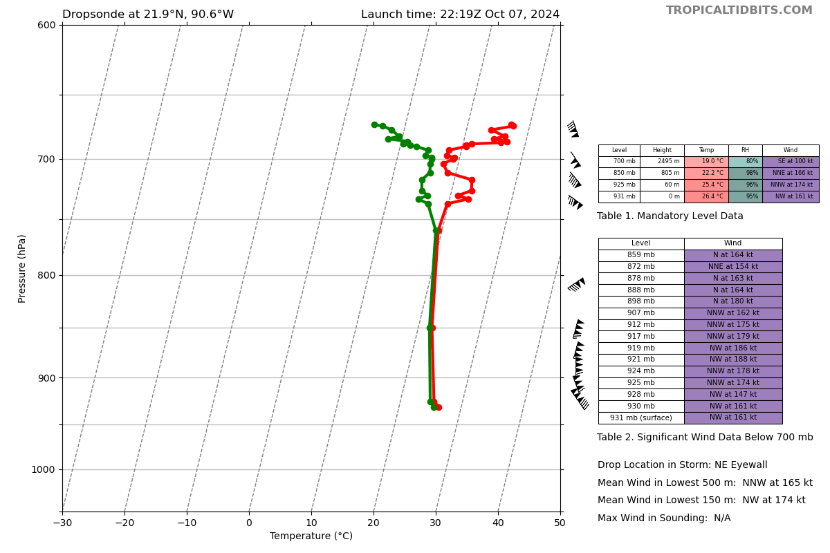
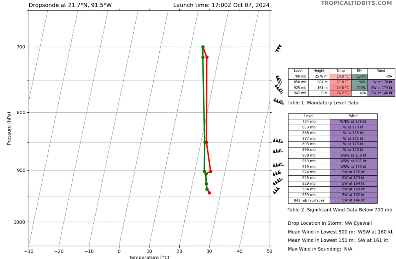
2 minutes ago, WxSynopsisDavid said:
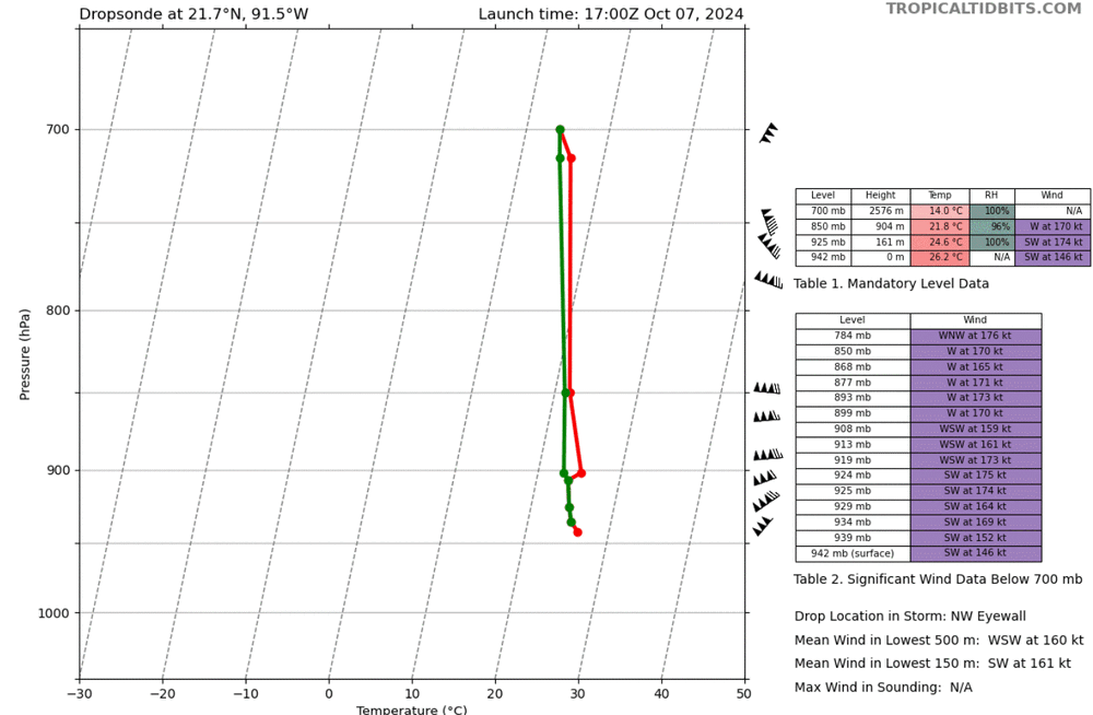
Is that correct, NW eyewall? That’s an impressive reading in the NW quad if that’s correct. Since winds are much more intense in NE quad, that would make me believe winds are around 180-185.
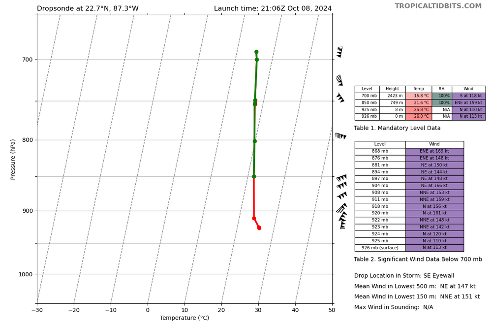
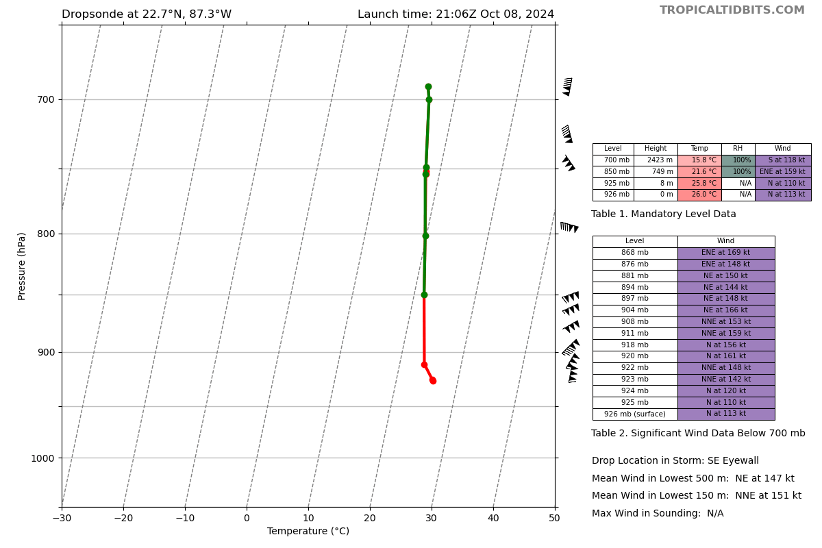
SE eyewall, NE winds, that sonde got blown around and went for a ride.
-
3
-
-
1 minute ago, Random Chaos said:
144kt surface wind NW dropsonde. 150kt average over lowest 150m.
That one went for a ride
-
1
-
-
-
1 minute ago, nycwinter said:
has a storm ever gone sub 900mb twice before?
Not in the Atlantic, Allen was the closest, but its first peak was 911 and its third was 909.
-
1
-
-
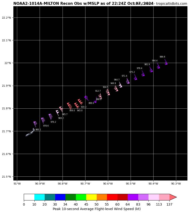
155 knot SFMR
-
902.4 extrap, waiting on the sonde
-
-
2 minutes ago, HKY_WX said:
The overall structure looks solid right now. Not seeing any issues of shear or dry air like last night. I think it's all systems go until about 10am tomorrow and then it will level out and slowly weaken. That said the damage may already be done. The amount of weakening is probably being overplayed too IMO.
The weakening was always overplayed IMO. It takes more than that to kill a hurricane like Milton.
-
1
-
7
-
1
-
-
1 minute ago, bdgwx said:
Raw T# - determined using the current scene
Adj T# - with basic constraint limit rules applied
Fnl T# - adjusted value average of the last 3 hours
CI# - average of the last 3 hours and with the full suite of rules applied
I’m asking because that’s where 7.7 is coming from
-
Sustained and very intense lightning in the eyewall
-
2 minutes ago, bdgwx said:
I'm not seeing that. I do see a raw of 7.6, final of 7.1 and CI of 7.1 with 915 mb estimate though. I'm looking at ADTv9.1 provided by UW-CIMSS. NOAA's ADTv9.0 is weaker.
What does CI mean on the ADT readout?
-
Watching a hurricane physically push out dry air away from its core is mesmerizing to watch.
-
4
-
4
-
-
The eye is clearing out
-
-
-
-
This storm has had a consistent EEL signature for basically the whole day. I would bank on the storm still intensifying.
-
1
-
-
3 minutes ago, gymengineer said:
And an all timer of an eyewall dropsonde- look at the mean wind in the lowest 150 m and the surface wind.
That’s up there with the batshit drops from Dorian/Irma/Maria, and that’s the weakest quad.
-
The insane SFMR was in the storms weakest quadrant.
-
154 FL and unflagged 176 knot SFMR, may also be a bit lower than 914 given the wind reading it occurred with

Major Hurricane Milton
in Tropical Headquarters
Posted
https://x.com/jntblake0812/status/
jesus