

notlikethis
-
Posts
14 -
Joined
-
Last visited
Content Type
Profiles
Blogs
Forums
American Weather
Media Demo
Store
Gallery
Posts posted by notlikethis
-
-
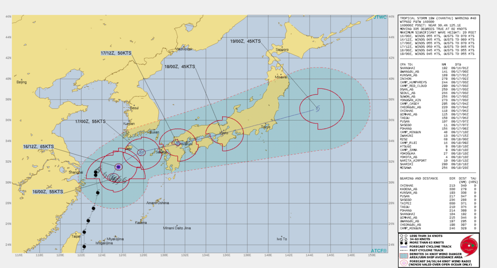
After sitting & spinning east of Shanghai for 3 days it's now ejecting directly over the Japanese archipelago as a high-end tropical storm. I'm forecast to be right near the center (along with >50% of Japan's population):
-
2 hours ago, Chinook said:
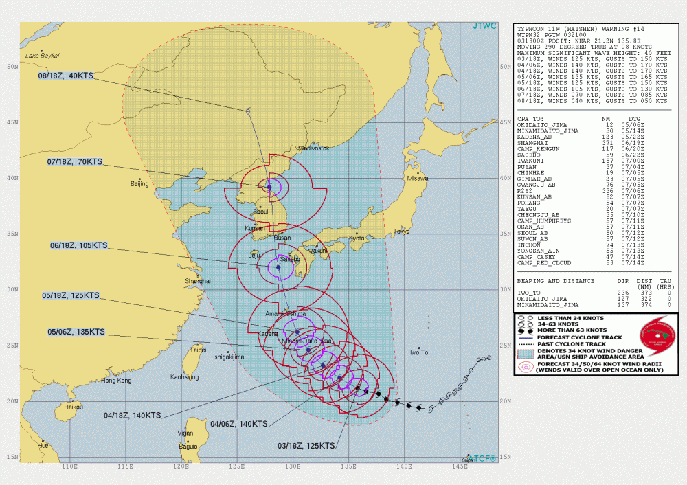
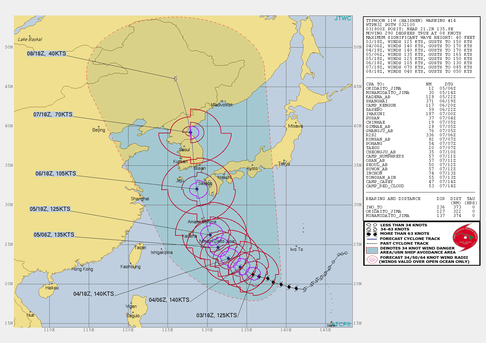
Did Haishen achieve Category 5 status (137 kt or higher)? I'm so intrigued that the US Gulf faced a double storm threat, now, southern Japan to Korea is certainly facing a double large storm threat just 1 week later, or roughly one week.
I'm not sure how the Japan Meteorological Agency defines sustained vs gusting winds, but I believe it's forecast to peak in intensity today with the following:
Central pressure 915 hPa Maximum wind speed near center 55 m/s (110 kt) Maximum wind gust speed 80 m/s (155 kt) I don't think that would quite be Cat 5 but their measurements might be different too, I'm not really sure.
Here's how the Japanese government is talking about it (with help from Google Translate):
The Meteorological Agency and the Ministry of Land, Infrastructure, Transport and Tourism held a joint press conference one after another on the 3rd and 4th, calling for the maximum caution against the approaching typhoon No. 10 using the word "special warning level". The "special alert" is one of the largest alerts that indicates an "emergency situation", such as once every several decades. It is unusual to mention from an early stage that the forecast may change depending on the future course of the typhoon. In order not to cause a serious life-threatening situation. If there is an unprecedented danger, it is necessary to be fully prepared and vigilant.
-
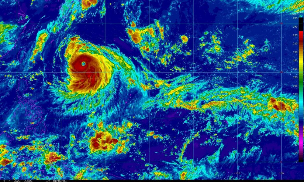
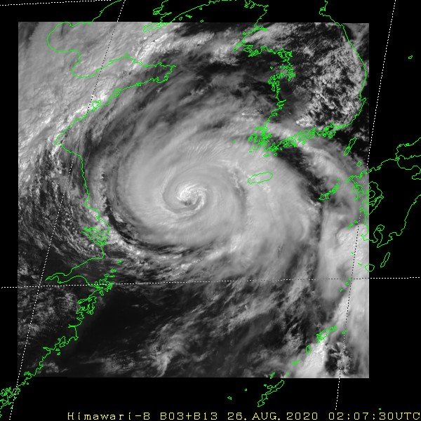
Classic satellite representation and will achieve super typhoon status later today, as shaggy noted:
-
A similar Marco/Laura situation unfolding for the Korean peninsula as another yet-to-be-named typhoon is forecasted to follow on Maysak's heels into the Korean peninsula after impacting Kyushu & Shikoku in southern Japan as a strong typhoon.

-
 1
1
-
-
3 minutes ago, the ghost of leroy said:
english is a fluid language and you should try not being bothered by people who manage to communicate their thoughts effectively, even if technically incorrect.
It's called a pet peeve for a reason
")
-
Storm chaser pet peeves:
It's "historic", not "historical" when talking about the current moment
The singular form is of vortices is vortex, not vort or vortice

-
1
-
-
The Lake Charles NWS office homepage does a very bad job at highlighting the severity of the situation...
-
Didn't see this thread before posting about Bavi in the Marco/Laura banter thread. King Jong-un better hold onto his toupee!

-
1
-
-
12 minutes ago, Doorman said:
Speak to me of that Typhoon Rule that teleconnects to Laura ......so a Cat 5 is on the table?????
The outflow channel from Bavi across the ITCZ back to the Gulf is particularly impressive for this time of year!
-
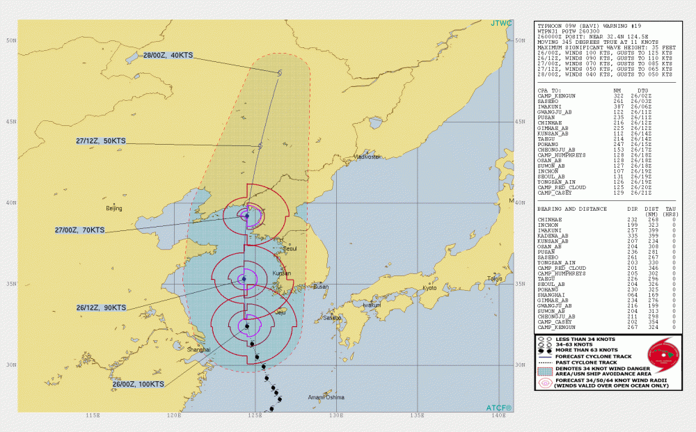
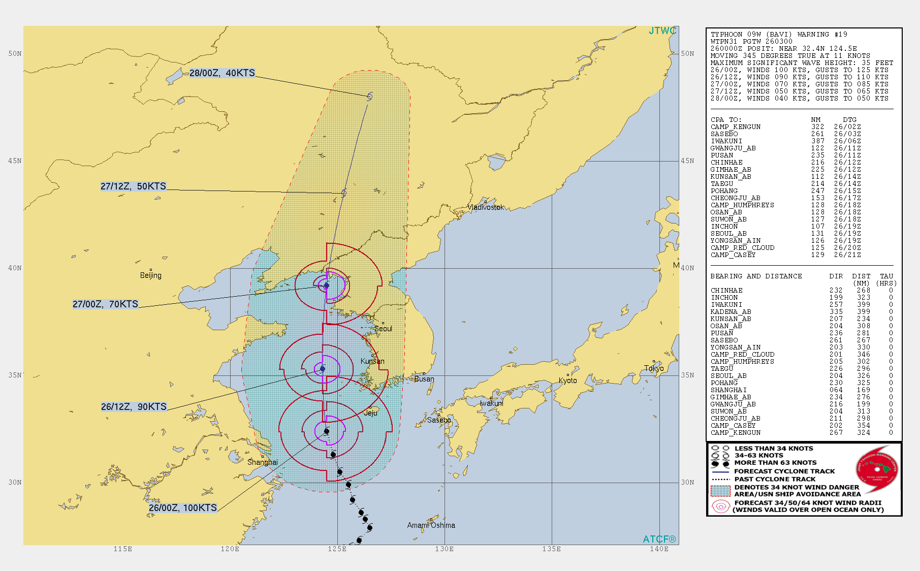
Obviously paying close attention to Laura, but meanwhile in the west Pacific, Typhoon Bavi is undergoing steady intensification to a peak of around 105-110 kts today as it enters the Yellow Sea on an approach to the North Korea/China border
https://himawari8-dl.nict.go.jp/himawari8/movie/720/20200826_pir3.mp4
-
1
-


WPAC, Indian Ocean, and Southern Hemisphere Tropical Cyclones
in Tropical Headquarters
Posted
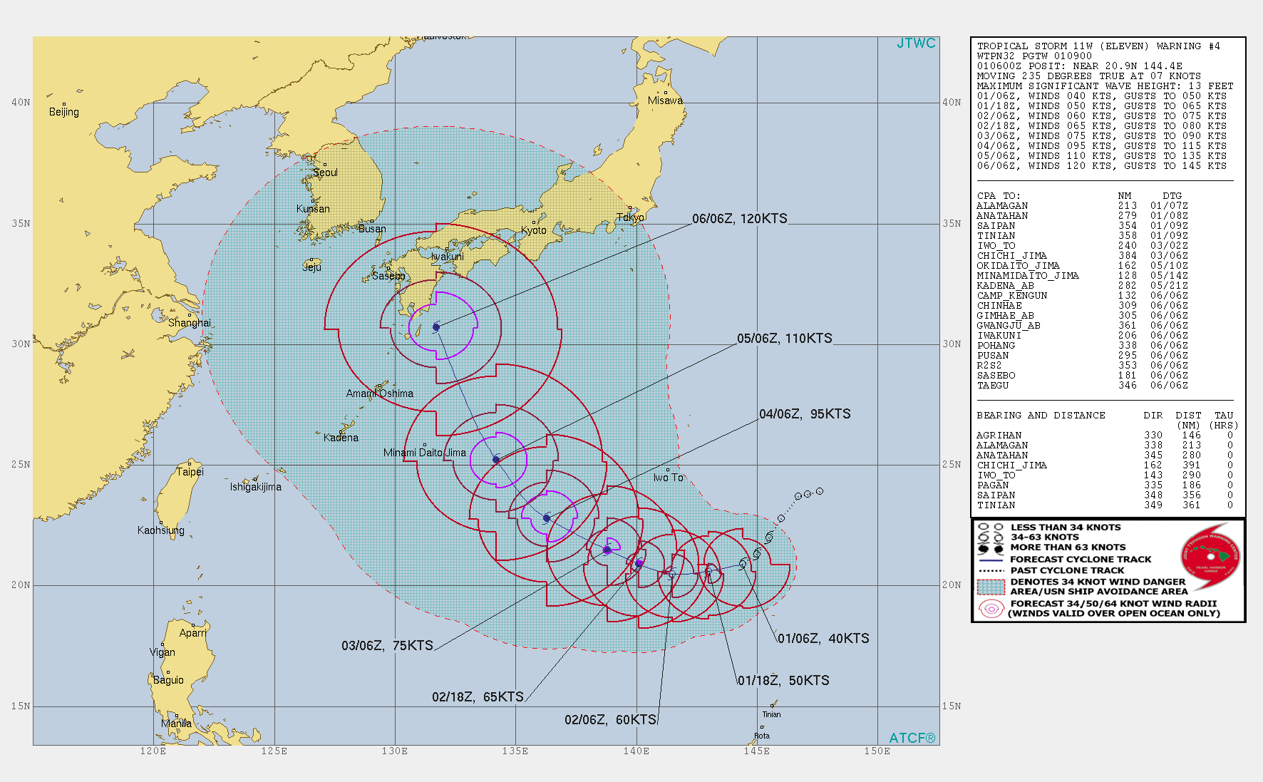
WPAC is about to spin up a 130kt monster with basically all models in good agreement on likely RI sometime in the next 48-72 hours: