

NEILwxbo
-
Posts
147 -
Joined
-
Last visited
Content Type
Profiles
Blogs
Forums
American Weather
Media Demo
Store
Gallery
Posts posted by NEILwxbo
-
-
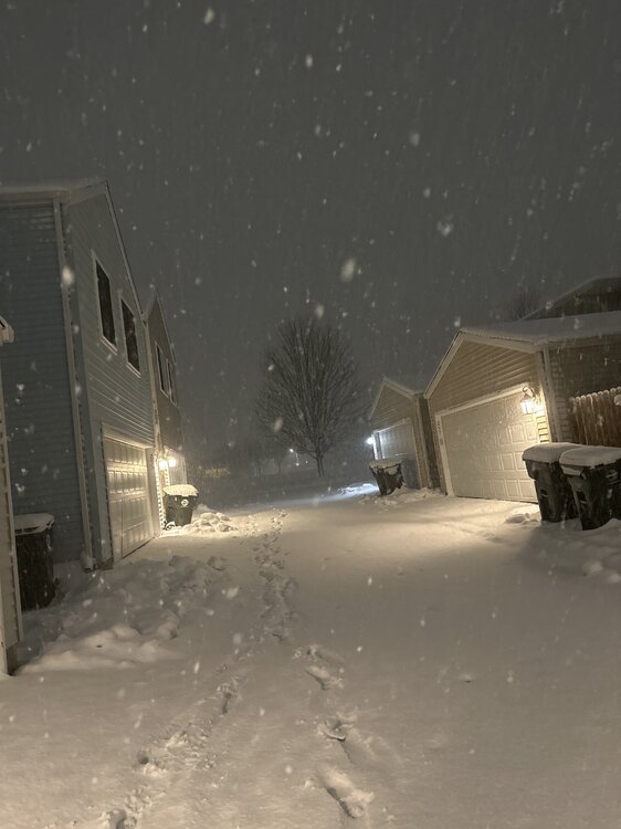
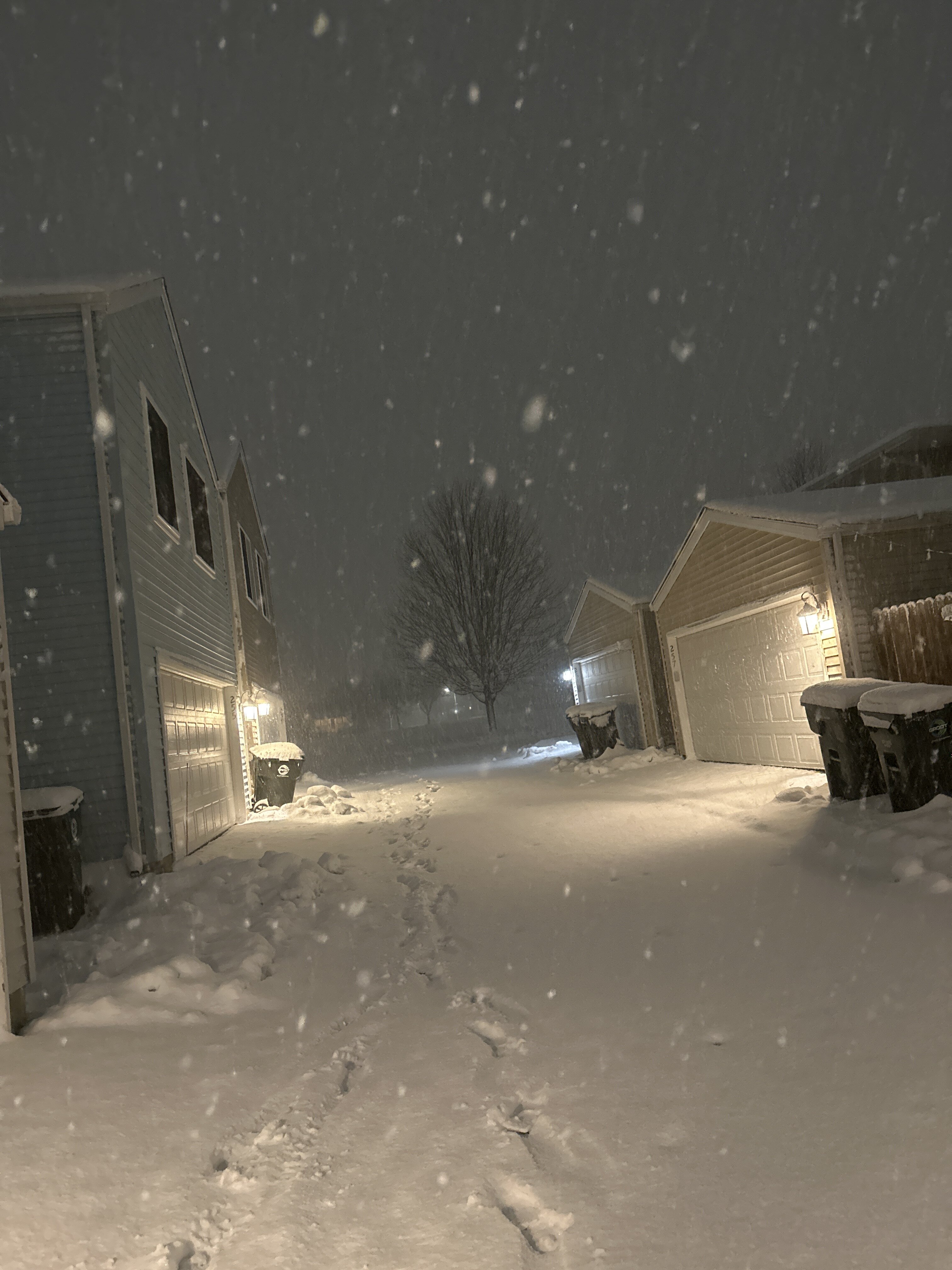
Tomorrow’s LE event could be the real deal. If anyone was curious what it was like to be in upstate NY last weekend, here’s your chance
-
 1
1
-
-
2 minutes ago, A-L-E-K said:
trends have been drier today
sad
Tonight’s northern fgen band has basically vanished on hi res short term
-
Gonna be a great LE day for Michigan. I need to move to an LE snow belt lol
-
Just north of 4” is the 2 hour total here. Still +SN
-
2 minutes ago, Radtechwxman said:
Hrrr nailed the waa snow tonight. Nam/rap only clipped me briefly with it. It's been snowing here since midnight with some impressive periods of moderate to heavy snow. Wind pretty intense in these mesoscale bursts. Looks like it's about to end here. Sadly that will start my warm up and set stage for rain or mix through afternoon before changeover. Hoping it doesn't all melt what fell tonight. Looks like a good 2-3in outside but hard to say cuz it's really blowing around.
This is more along the lines of what I was expecting tuesday AM but didn’t really pan out. Let er rip
-
This seems dramatic but I don’t think I’ve seen rates like this since 2011. If there was a time since it was short lived for sure. Gonna exceed 5” by 5:30 at this rate.
-
4
-
-
Feels like I’m in an LE band. 2.7” in 1 hour
-
7
-
-
Absolutely dumping in the fox valley. Rates from Tuesday easily matched in the first hour
-
3
-
-
Dumping in Aurora. A few tenths already, here we go
-
1
-
-
I must say, I have a pretty good feeling watching radar & seeing lightning strikes galore from STL-Quincy
-
2
-
-
I've always been a big GFS fan

-
Hope the trend in hi-res data for it to absolutely rip tomorrow AM continues
-
3 minutes ago, SchaumburgStormer said:
This run is going to be a thing of beauty for NE IL. Still absolutely ripping at hr 26
Probably still some south/east adjustments to be made with it, too. But I think we'd all take this one, please
-
1
-
-
The HRRR/RAP are both crushers for N IL. TSSN a possibility for sure. HRRR gives us 5-9" just during morning hours...
-
1
-
-
Not really a thread for this, but tonight’s clipper system looks mildly potent. It’s trended back south in the last 12-18 hours, and should deliver a good 1-2” along/north of 80 in IL, could see there being a localized 3-4” if steadier banding occurs
-
1
-
-
Incase anyone didn’t have enough fun watching heavy white rain yesterday, you’ll have another opportunity to do it just 3 days later! How exciting
-
 2
2
-
-
Widespread 1-2 foot monster storm for N IL, SE WI, & MI on 18z euro. Damn
-
1
-
-
9 minutes ago, homedis said:
Just changed to mostly snow here in Deerfield.
Makes sense, ORD is reporting 1/2SM SN FG
-
1
-
-
24 minutes ago, Baum said:
btw would want no part of a 6" 6:1 ratio snowfall. The damage to trees will be enormous.

-
22 minutes ago, WestMichigan said:
6Z GFS is saying the SE trend is alive and well. The 6Z NAM has a different approach and the snow band goes more NE whereas the GFS doesn't cut as hard to the NW. The NAM 3kM is closer to the GFS solution. THE RAP AND HRRR are somewhere in between the two models. You would think being about 24 hours out there would be better consensus at this point....
How many times have we said that last sentence so far this winter
-
-
28 minutes ago, Chicago WX said:
6z Euro went east too. Waving the white flag on this one. Good luck to the peeps in Indiana and Michigan. Hope it over performs.
")
I’m not sure I’d be waving the white flag if I lived in kankakee…
-
I mean if you look at it this way, the NAM and Euro are in pretty good agreement…
-
1
-
-
10 minutes ago, beavis1729 said:
This seems inflated, a result of IMO poor standard operating procedure for snowfall measurements. Should be every 12 hours, not 6. If snow depth is down to 2” within basically 12 hours of an event starting, how can a reasonable person say that 3.5” actually fell?
If the snow compacts/melts 24 hours after the event ends, that’s another thing. But during the event…it just doesn’t pass the reasonability test.
Again, I’m not questioning the measurer - just the SOP.
When one looks at the historical records after today’s snowfall, it will only look like a slightly below normal snowfall month through 1/25. But that’s ridiculous, because it has hardly snowed in January and has been extremely mild. The worst January ever, but it won’t look that bad in the historical records. When situations like that can be allowed to happen, it should cause the experts to revisit the measuring methodology.
So if it snowed 1” and melts by observation time it shouldn’t count as snow?
-
1
-
 1
1
-
Winter 2023/24 Medium/Long Range Discussion
in Lakes/Ohio Valley
Posted
Have a feeling the beginning of next week is going to be quite icy