

diatae
-
Posts
257 -
Joined
-
Last visited
Content Type
Profiles
Blogs
Forums
American Weather
Media Demo
Store
Gallery
Posts posted by diatae
-
-
Not sure what our low was, but currently 30 with heavy frost in some areas and a coating ice in others?
-
8 flurries, 21 rain drops, 3 ice chips
-
 2
2
-
-
Just eyeballing it, but just over 13"? La Plata, MD.


-
2
-
 10
10
-
-
Neighbor says we flipped to snow in La Plata.
-
My neighbor says we flipped to snow in La Plata.
-
Yall seeing anything yet? I'm in Florida and missing the snow tv.
-
I'm in Florida at my parent's house. 60/54, prob not gonna stick here.

-
1
-
4
-
-
71. I saw a bug outside.

-
1
-
-
-
-
Ob: today was wintry af.

-
7
-
-
10 minutes ago, vastateofmind said:
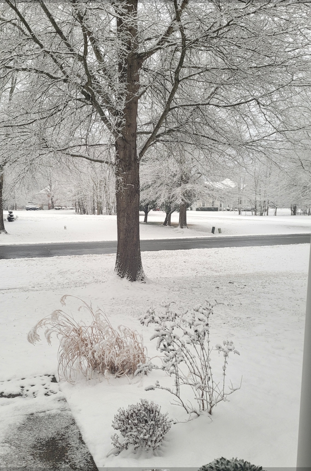
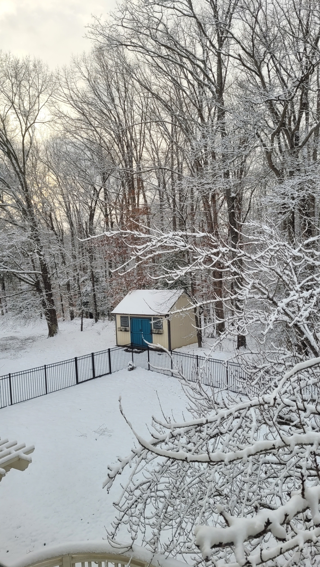
That IS gorgeous...OMG, all of the tree stickage! Love that in these types of storms...
")
Me toooooo! Just stunning when every branch is perfectly painted.
-
1
-
-
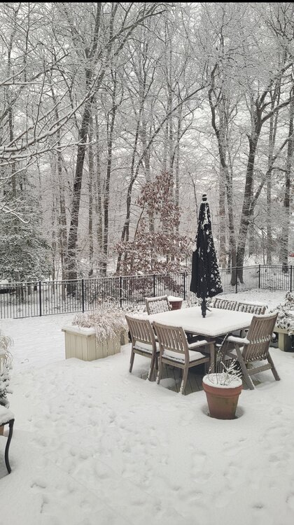
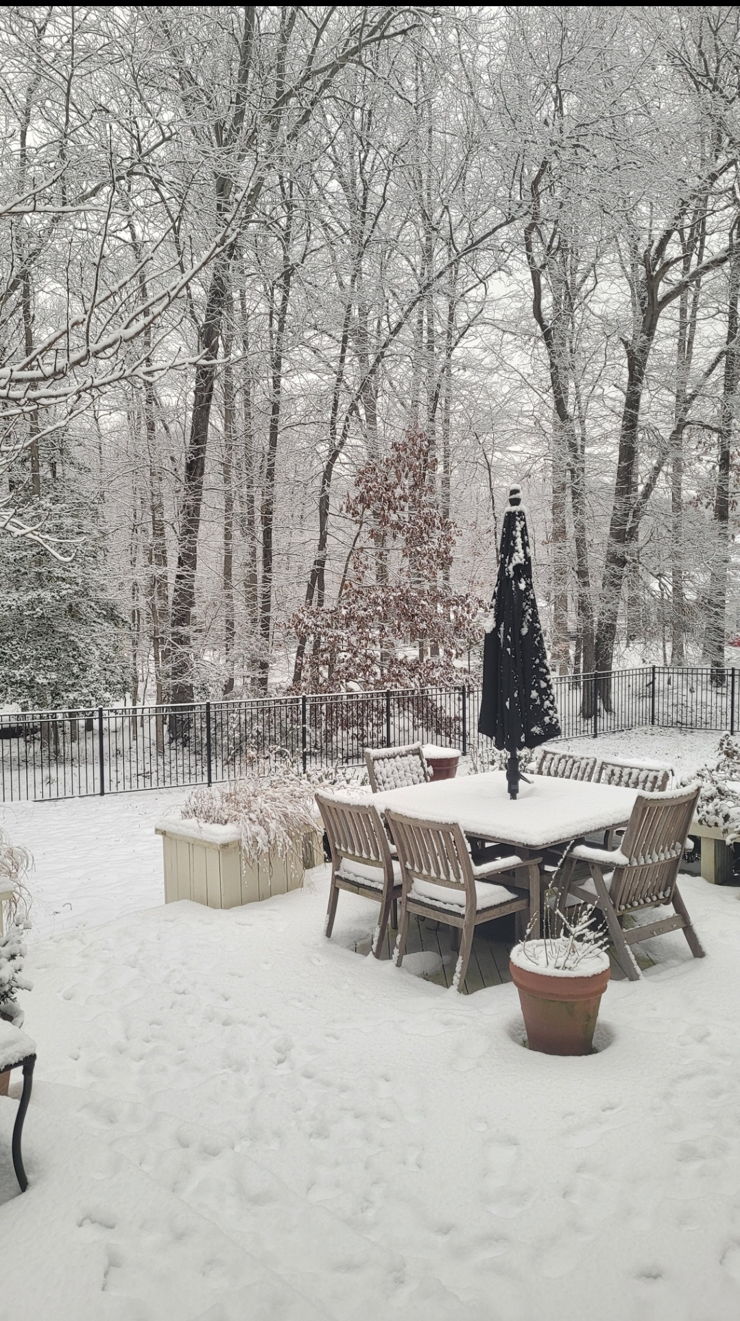
Obligatory deck pic! Been snowing lightly or flurries all day since the initial thump, but not much more depth gained after that couple inches. Still a beautiful day out there nonetheless.
-
8
-
 1
1
-
-
Measured just over an inch of fresh fallen on top of the iceburg. Super official I'm sure. While the radar is clear overhead, light snow falls. 30/30 La Plata, Alaska
-
2
-
 1
1
-
-
Final update: mailbox is frozen shut.

-
1
-
-
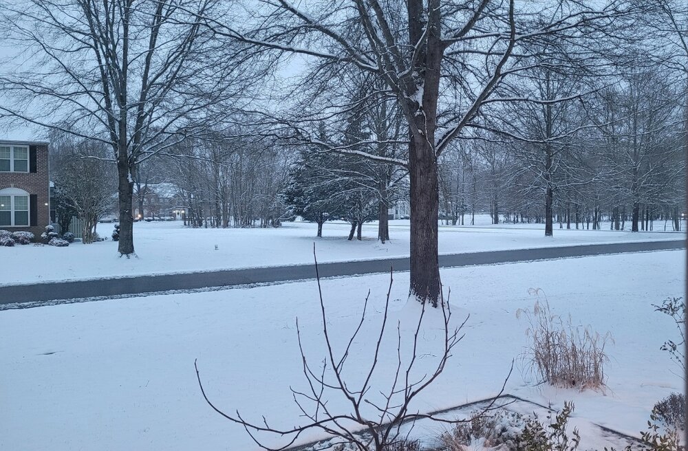
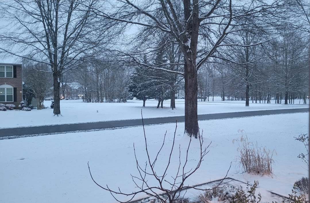
Current view. This never gets old. *swoon*
-
12
-
-
13 minutes ago, BristowWx said:
That batch of precip is just arriving here in what I will call the midlands as tiny flakes. Yep I just coined my own region geography and I am sticking with it…probably not even a word
This Midlands and High Midlands sound like proper snow towns. We shall pray for tiny flakes.

-
1
-
-
1 minute ago, BristowWx said:
Rain? What’s your temp there?
27/27 but the lowlands don't care about temps without a bribe or a sacrifice.
-
Measuring 2.5 before the "freezing rain". 27/27 It was a very pretty event and fun to wander in! Total 3.5 on the season. #snowtown #thewestmimsterofcharlescounty lol
-
3
-
-
1 minute ago, Ravens94 said:
Nice batch coming up from the SW
.gif.7e4e8cc16cc253108fcc4da850fb04bd.gif)
If it's cold rain it can shut right off.

-
Hit 2" and wasn't mad at it. 27/27
-
4
-
-
9 minutes ago, Steve25 said:
Side note, how do you guys attach your pics in here. I've tried and every pic I took with my phone today it's saying are too large to attach. Just normal phone camera
It's a janky solution but I screenshot the pics I take and then post the screenshot. Lol.
-
1
-
-
2 minutes ago, yoda said:
Well shit... guess we're all fucked (no I didn't edit it at all... go read the afternoon AFD from LWX just issued and you'll see it yourself)
Precipitation chances overspread the area overnight Thursday into
Friday as model guidance indicates an area of low pressure
developing and travelling up the east coast. With high temperatures
forecast in the low to mid 300s for most (teens and 20s at higher
elevations), any precipitation will be snow. We will continue to
monitor this event as it gets closer in time.

As the aforementioned upper level trough pivots out of the area,
upper level ridging and high pressure at the surface build over the
area. Upslope snow showers continue through Saturday afternoon along
and west of the Alleghenies with dry conditions expected elsewhere
through Sunday. Saturday will be the coolest day of the long term
period with highs staying in the 20s for most. Those in metro areas
or located near the Chesapeake Bay will get into the low 30s while
higher elevations dip into the low teens.
Shit. It was nice knowing y'all.
-
1
-
5
-
-
21 minutes ago, ravensrule said:
Crap, the real Chuck is back.
I'm kinda glad. It was weird understanding his posts.
-
1
-
March Banter 2024
in Mid Atlantic
Posted
I cussed it out just this morning. Janky through and through.