

Thor
-
Posts
171 -
Joined
-
Last visited
Content Type
Profiles
Blogs
Forums
American Weather
Media Demo
Store
Gallery
Posts posted by Thor
-
-
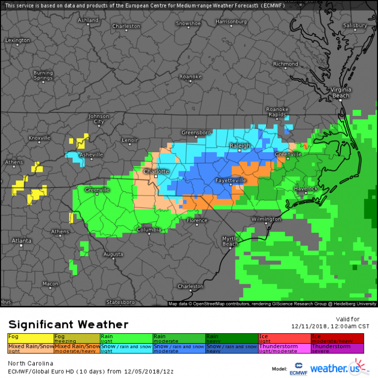
Just now, FallsLake said:
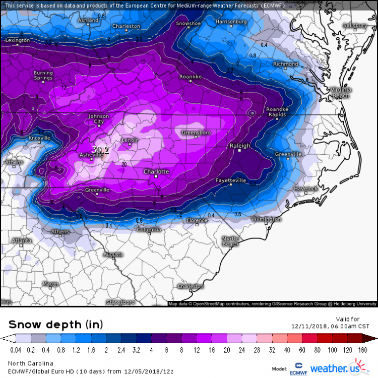
Too bad RDU folks can't take the FV3 to the bank. Foot+ snows next weekend, followed by a small mixed precip system a few days later, then a major sleet fest at day 14.
That would personally push this winter to an A.
Haha Snow seems to follow you around this year. For us SE of Raleigh and the coastal plains we would love to see the suppression continue for about another 3 days. GEFS seems to be tightening some today

-
 1
1
-
-
1 minute ago, Orangeburgwx said:
I'm gonna vent...
Some 13 year old in the Discord server I'm in has only been studying the weather since 2016, yet he is trying to tell me "Florida never has pure snow" despite me posting multiple storm totals from various years, and all models that show FL snow are wrong. I have been studying weather for 18 years, I know what the hell I'm talking about.
Is pure snow the kind that isn't yellow? Because I'm guessing in Florida there's not a whole lot of "pure" anything. So he may have a point haha
-
-
Been interesting watching the evolution of the high pressure over the lakes relative to the Low location. Still a lot to be worked out this late in the game for many.
-
-
High keeps retreating, driving the warm up.
-
1
-
-
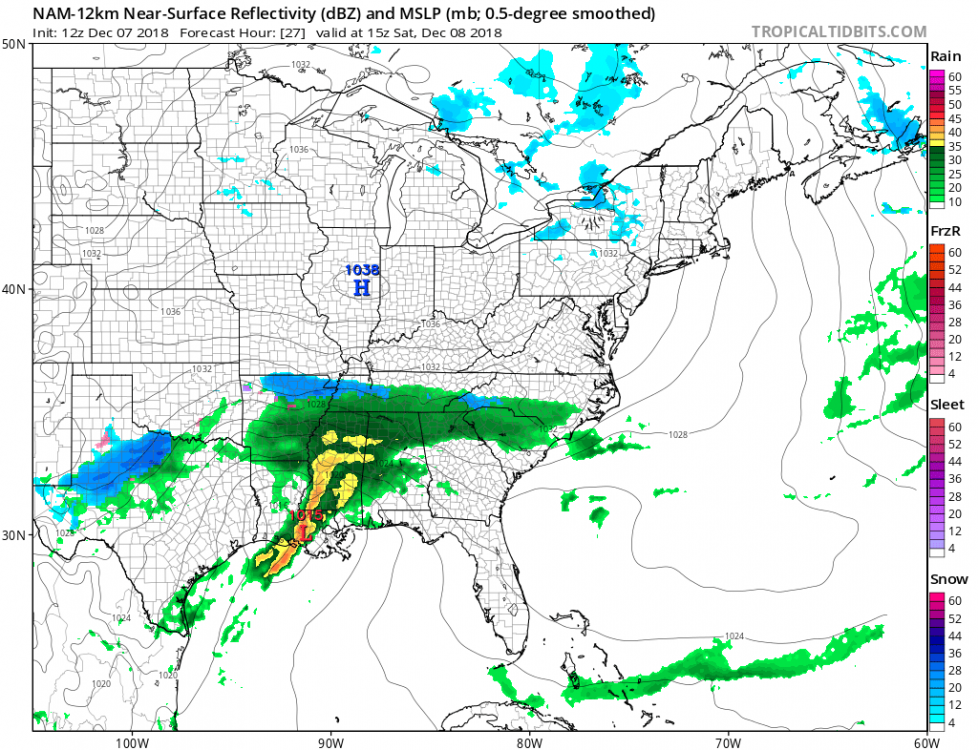
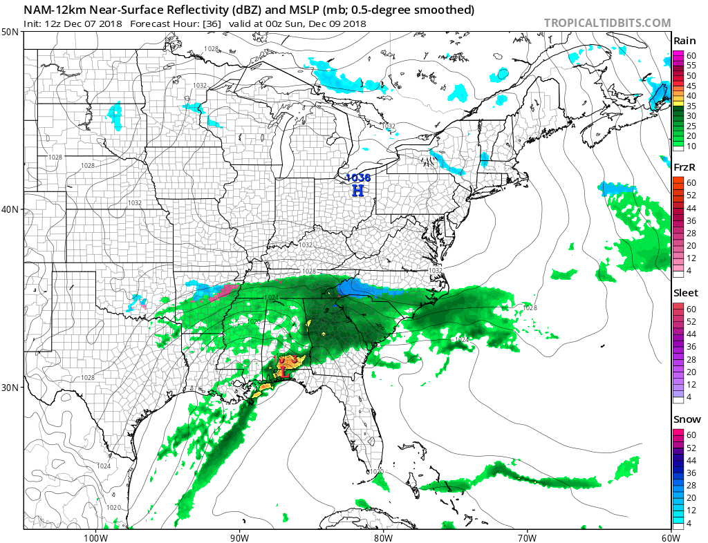
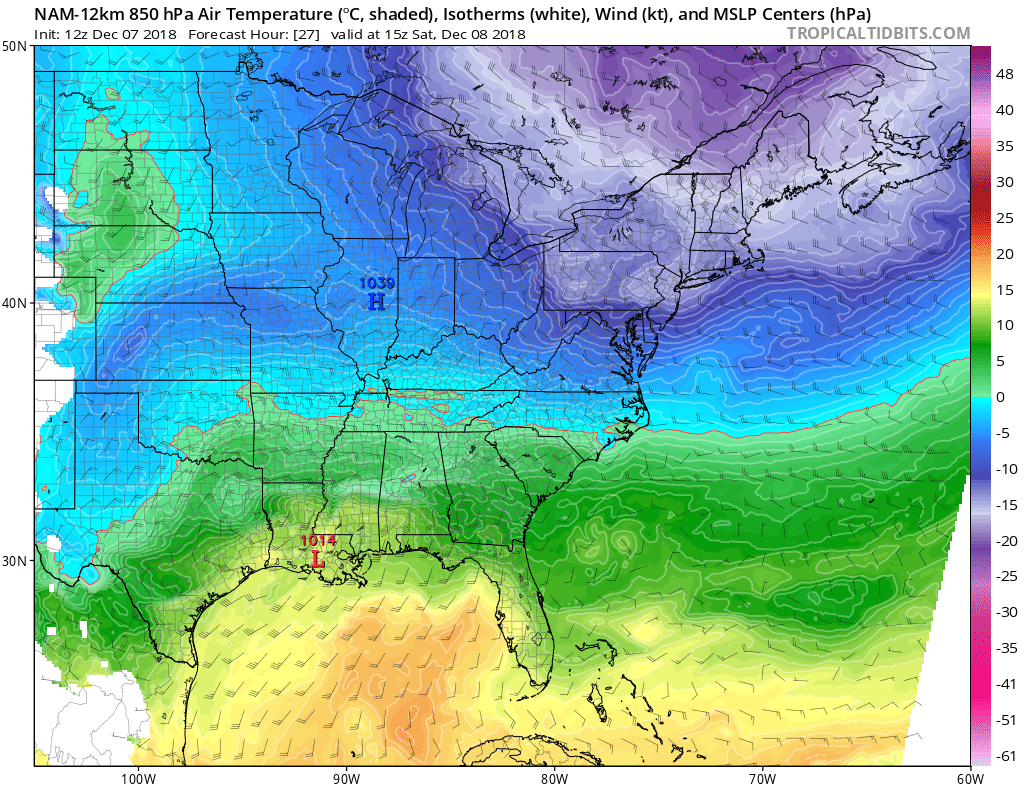
2 minutes ago, FallsLake said:
I really like the initial cold air that's in place before the storm.
12z NAM dew points:
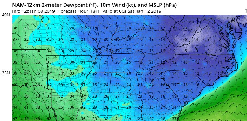
Just remembering the past few storms but does the Nam tend to overdo the cold at it's outer range? Always seems to show a great solution initially and trend warmer closer to the event. Probably depends on the system.
-
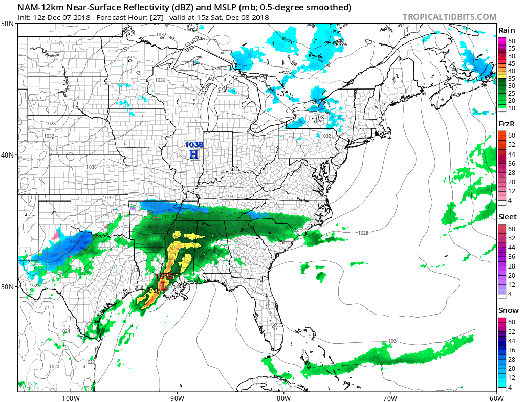
Just now, FallsLake said:
Mixing with snow now!
Appreciate the updates!
-
Living in Johnston and working in Durham is punishment on many levels the hours of commuting every day and them getting 10+"s while I get rain every storm. Time to move.
-
1 minute ago, PackGrad05 said:
Topped out at 1.75" down near Fuquay. Grass barely covered! It has been a rain/sleet mix for the past 2 hours.
About the same here just across the Johnston county line, maybe a little less but first time I've seen the ground white at all in December at my house since I moved down in 2010.
-
7 minutes ago, Cold Rain said:
Who’s a good pbp person that has good mojo with the terms “much colder” and “much more snow”? Application toward Raleigh a plus.
Sref is picking up on some Monday morning snow this run. This has been the model showing the least the whole time.
-
1
-
-
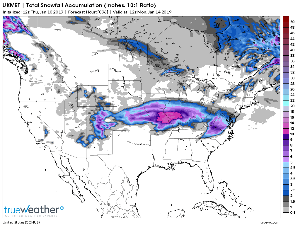
2 minutes ago, NC_hailstorm said:
Heights are a little lower on the Ukie with the 570dm deeper into the upstate and south of CLT this run compared to 42.
It's only 20-25 miles maybe but every mile counts now.
Also kind of doubt the precipitation minimum showing up over NE NC on the Ukie, haven't seen that on many models
-
I shall break this precip wall with mine hammer, but i doubt precip extent shown I think the big take is much colder look
-
-
Pretty amazing wall the moisture is hitting on 12z nam
-
Looks a bit colder with 850s and DPs on the 12z NAM so far
-
4 minutes ago, Iceagewhereartthou said:
 Maybe start a group therapy thread for Upstate and RDU peeps, get out all our pain about how bad our areas are for winter weather. Someone from Columbia can moderate. "Hi I'm Iceage, I'm addicted to snow and live in the upstate!"
I vote for field trips the snowiest places we can find. Being on the edge is always the most frustrating thing and Upstate, Clt, Rdu are always on the edge. Makes it so hard to enjoy snow(when it happens) because your always waiting for the shoe to drop.
-
 1
1
-
-
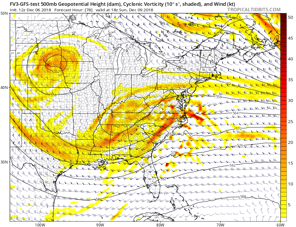
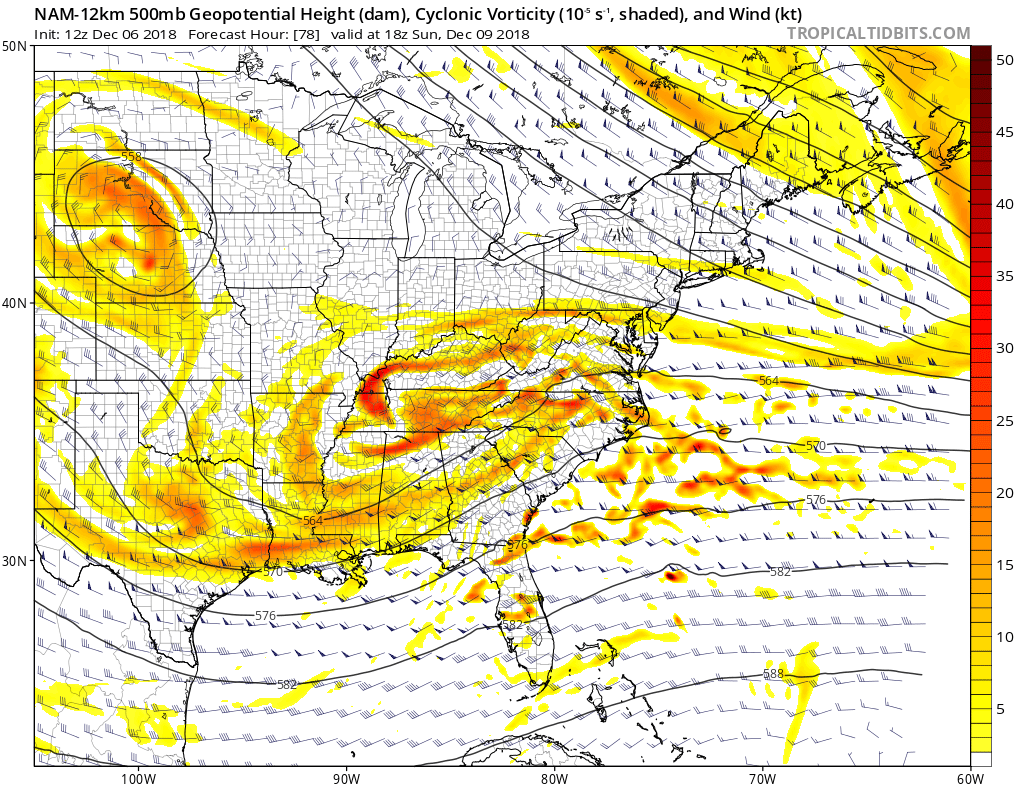
You can see the differences at 500 pretty well, between Nam and FV3. Temp profiles don't mean much when the setup is different.


-
1
-
-
41 minutes ago, Iceagewhereartthou said:
The amount of whinning from the RDU crowd on the board is CRAZY. I know we all think our own backyard gets left out but they take it to another level.

RDU averages more snow than the upstate, despite being a lower elevation and further from the mtns. Wasn't it just last year many of them got a big snow?
The upstate is home to some of the biggest whiners in the SE. But everyone should know better at this point but still do not. Based on the SREF plumes the GFS won't be pretty either so this may become the main board. But maybe we need a sub board about whining about whiners.
-
Very long duration possible, bring your laptops home
-
1
-
-
Obviously caveats
-
1
-
-
We can say what we want about the models but the below GFS run was from a week ago. Pretty good all things considered.
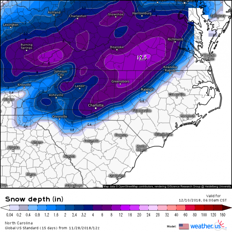
-
Basically the models showing the weaker highs have more North movement still. So pretty much the same thing we have been tracking for the last week. I'll be watching the short range models more today to see how the high is developing out west.
-
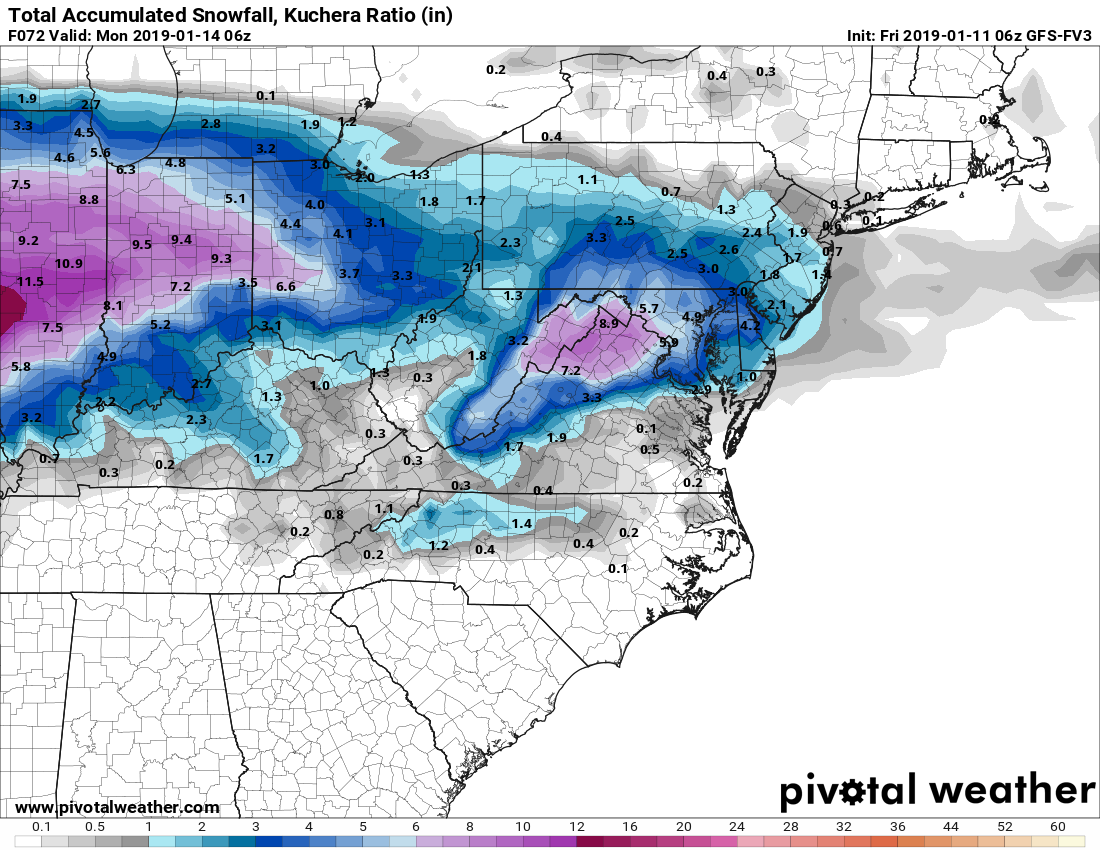
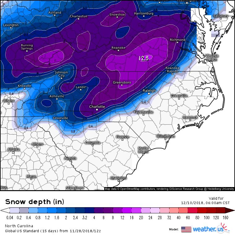
11 minutes ago, FallsLake said:
The 6z ICON (compared to 0z) shifted the heaviest snow totals from western NC into SW VA.
Looks like the 6Z Navgem did as well


Mid to Long Term Discussion 2019
in Southeastern States
Posted
Not sure if everyone is still keeping an eye on the Coastal. But just for example this is the GEFS for the storm about to hit NE. So over the course of 6 model runs went from well out to sea to a pretty large event for them. Usually it seems to follow this pattern where two camps set up of LP's and then eventually they come back together over the corrected location. Luck hasn't been in our favor this year obviously but the NW trend is alive and well.