

TullyHeel
-
Posts
12,875 -
Joined
-
Last visited
Content Type
Profiles
Blogs
Forums
American Weather
Media Demo
Store
Gallery
Posts posted by TullyHeel
-
-
Euro seems ok so far. All snow for NC between 54 and 66 except at the SC border.
-
Canadian wasn't too bad.


-
 4
4
-
-
2 minutes ago, BornAgain13 said:
Who pulled the plug on the Canadian?

-
3
-
 4
4
-
-
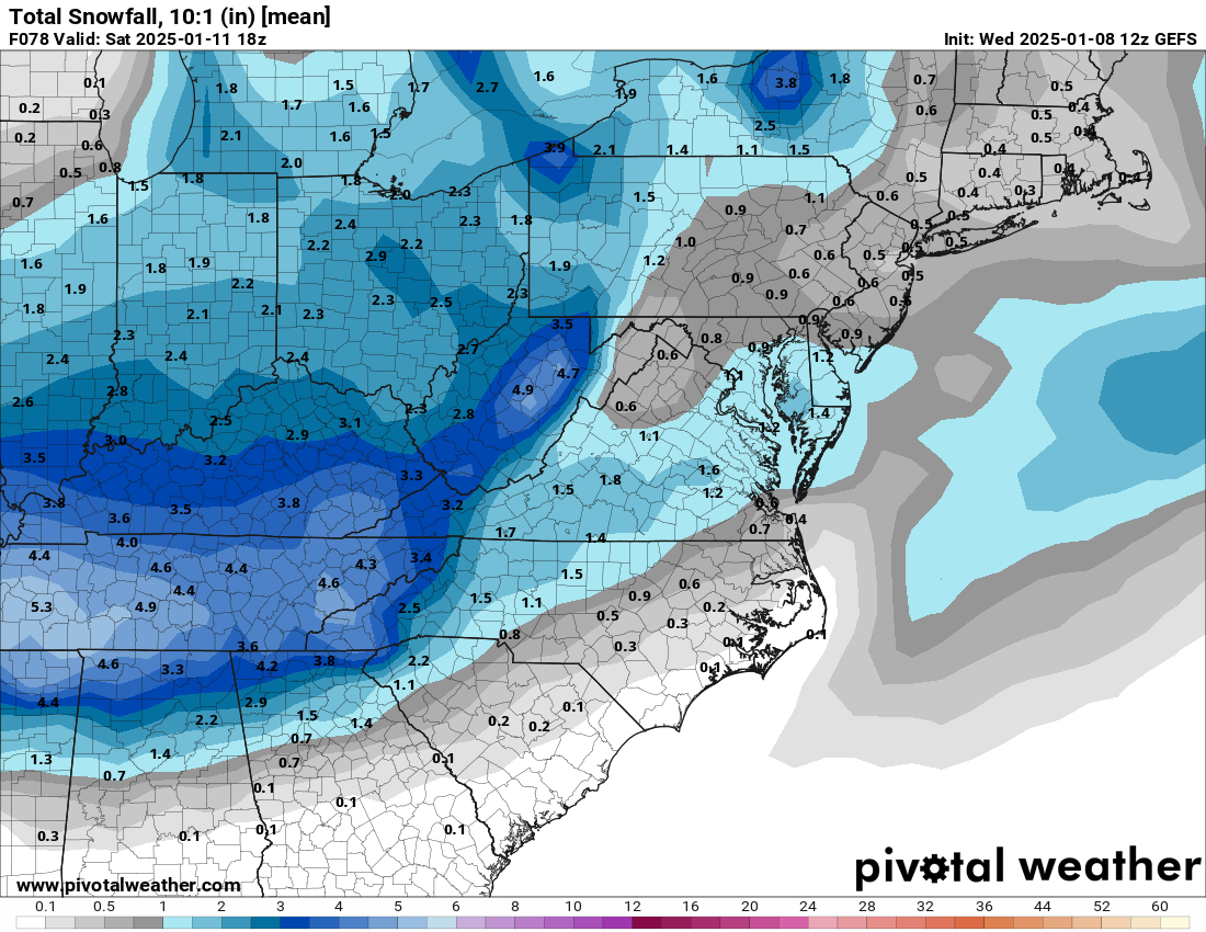
GEFS slightly better than the op.
-
1
-
-
8 minutes ago, wncsnow said:
The UK actually improved for NC
.thumb.png.6cb978e271bf9a54e42ea997154d439f.png)
These swings with the models aren't going to affect me at all.

-
8
-
-
All we can hope for now is a Christmas 2010 miracle.
-
3
-
-
-
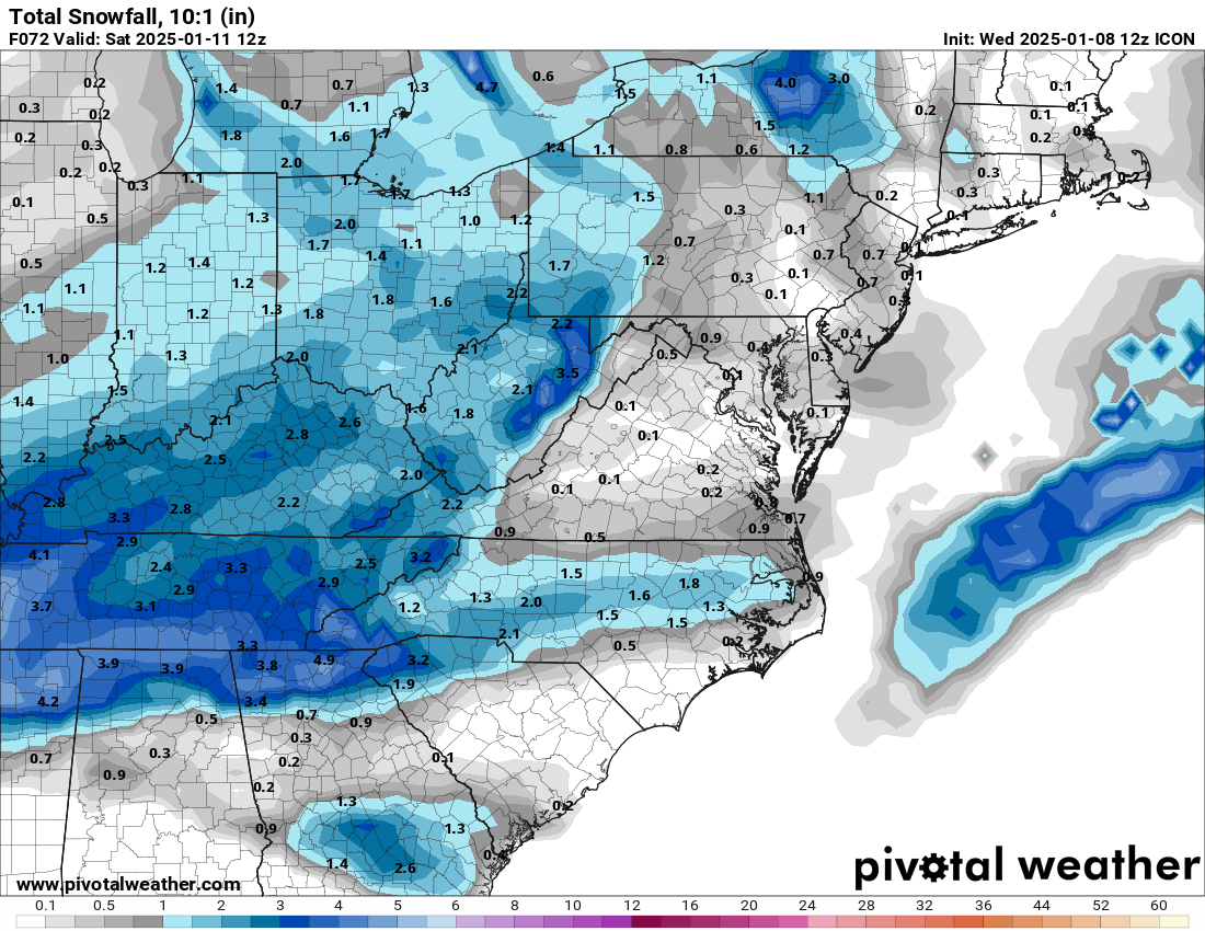
ICON is colder but with less precip.
-
1
-
 1
1
-
-
-
Just now, BooneWX said:
This thing is trending earlier and earlier
And worse and worse.
-
3
-
-
-
-
Blame it on the freezing rain that was fallin, fallin.

-
-
Just now, BooneWX said:
Fwiw, it is a more moist run overall, so there’s that.
Yeah, if you don't have the precip it doesn't matter. Looks like I get some snow up here, though.
-
-
-
-
NAM looks pretty good with precip to me.

-
-
2 minutes ago, StantonParkHoya said:
2 inches is honestly perfect. Just give me 4-6 hours of afternoon/evening viewing with some nice bourbon, a few hours Saturday morning to build a snowman with the kids, and then it can melt off.
Sounds great.
-
9 minutes ago, olafminesaw said:
Can we cash this out?

I'll take it.
-
1
-
-
How is it so hard to get things to come together for just one good snow storm here each winter?
-
2
-
-
I will be okay with getting 1 to 2 inches of snow. At least something is better than nothing. I just don't like the trends since yesterday. I think today is going to be very telling in what eventually happens.
-
5
-
.png.e9ee83f29f2e0379db054fe286428c7b.png)


January 10/11 Winter Storm Potential - May the Odds be Ever in our Favor
in Southeastern States
Posted
Euro was a little better. Stayed mostly snow for most of NC, but with light precip.