

Cary_Snow95
-
Posts
361 -
Joined
-
Last visited
Content Type
Profiles
Blogs
Forums
American Weather
Media Demo
Store
Gallery
Posts posted by Cary_Snow95
-
-
1 hour ago, SnoSki14 said:
I disagree. I think this one can develop over time. Each day that passes climo works in its favor.
MJO moving to a more favorable phase 2 as well
It’s moving into a harsh environment with high shear soon and dry air is already having its way.
-
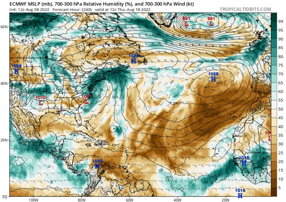
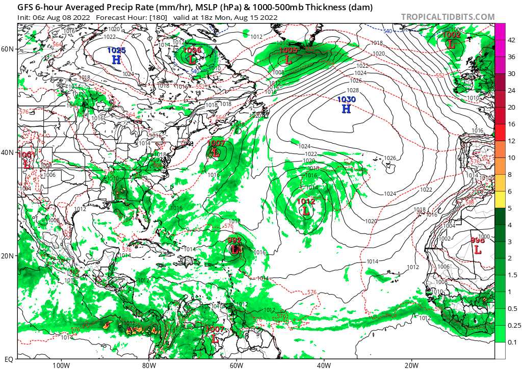
End of Euro continues to advertise major outbreaks of dry air -
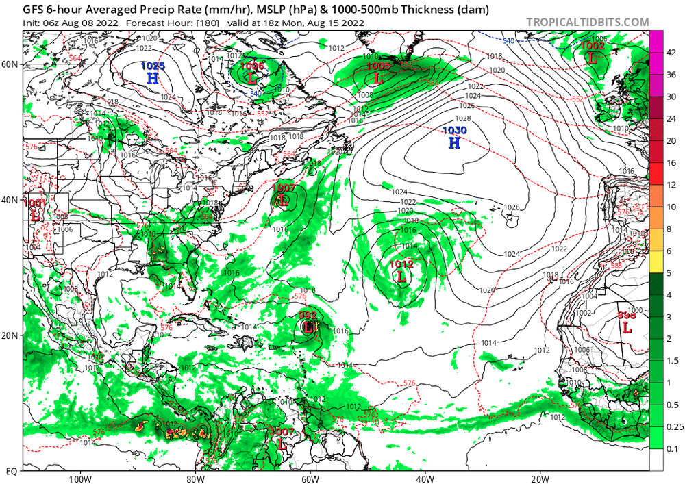
As expected GFS is trending towards other guidance with a weaker system
-
GFS coming in much weaker and more realistic imo. Think we will see euro and gfs begin to agree on a weak TD
-
Wave breaking continues to wreak havoc on the MDR. Mid Latitude dry air is being consistently driven into the MDR. Latest Euro further strengthens the sub tropical low sending a surge of dry air south
-
18z HWRF is into the Central GOM fwiw

-
GEFS continues to speed it up pretty drastically
-

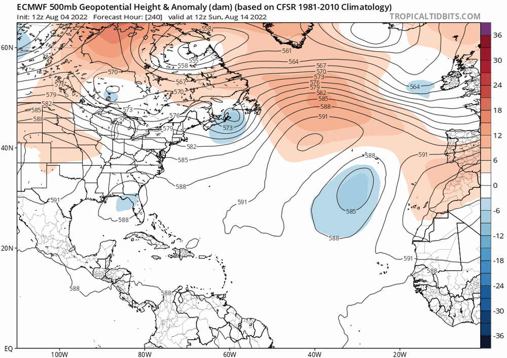
With this kind of 500mb look is a GOM threat favored? With a lifting trough and a building high I feel like getting anything up the east coast would be hard. I could be completely wrong tho
-
Euro still looked fine and is a few minor tweaks from a major. Gfs sucks but is on an island compared to the euro, icon, and cmc
-
 1
1
-
-
31 minutes ago, PackGrad05 said:
A rain to snow changeover as cold air surges in... not really showing any accumulations.
4-6 across the area. And temps afterwards are extremely cold for multiple days. Snow would be around a while. Perfect setup on the 12z. And looking at the H5 maps, it was close to a monster
-
1
-
-
Just now, FallsLake said:
For what it's worth, the 12 NAM did shift considerably west with the coastal storm. Still not enough to get much precip inland but it was a big shift. Just another small shift westward and a little stronger storm and we would be in business.
RGEM has interaction much earlier as well. GFS will be telling if this trend will continue
-
2
-
-
18 minutes ago, TARHEELPROGRAMMER88 said:
Still need cold air and so far temps on the models are not going to cut it.
It’s a storm that depends on dynamical cooling and a strong cyclone to drag 850s down. Need a phase
-
1
-
-
Just now, WarmNose said:
That’s odd. Looks eerily similar to the last dud we tracked at this range. Definitely feels like we’re stuck but it can’t not snow forever
The setups are completely different at H5 and this setup verbatim would have a nice cold high to the north
-
1
-
-
Early maps clobber central NC. 6 around Wake with higher amounts to the NE. Low bombs out and pulls 850s with it
-
Pretty good look...

-
1
-
-
1 minute ago, griteater said:
The new UKMet looks pretty much identical with the GFS on the early maps
Does it continue its idea of a low further off the coast?
-
The 0z is continuing the idea of keeping the low further of the coast

-
1
-
-
17 minutes ago, cbmclean said:
Somebody mentioned Brick earlier this evening. Does anybody know what happened to him?
He's active on the other board
-
1 minute ago, Rhart said:
Can you link HRR
It's on TT and pivotal
-
1
-
-
Feel free to lock this if unwanted, but I felt like the last thread is getting to be long, so here's a little house keeping. Discuss away! Let's bring the mojo!
Mid to Long Range Discussion ~ 2023
in Southeastern States
Posted
Euro control run is very active around 2/3 time frame