

JacobChgo19
-
Posts
76 -
Joined
-
Last visited
About JacobChgo19

-

Severe Weather April 23rd 2021
JacobChgo19 replied to weatherextreme's topic in Central/Western States
I was on this storm for pretty much it’s lifetime. I counted 7 total tornados, I could be off.. we did have two on the ground at one point very briefly. Nasty hail, but very photogenic and it treated us to a rainbow as well.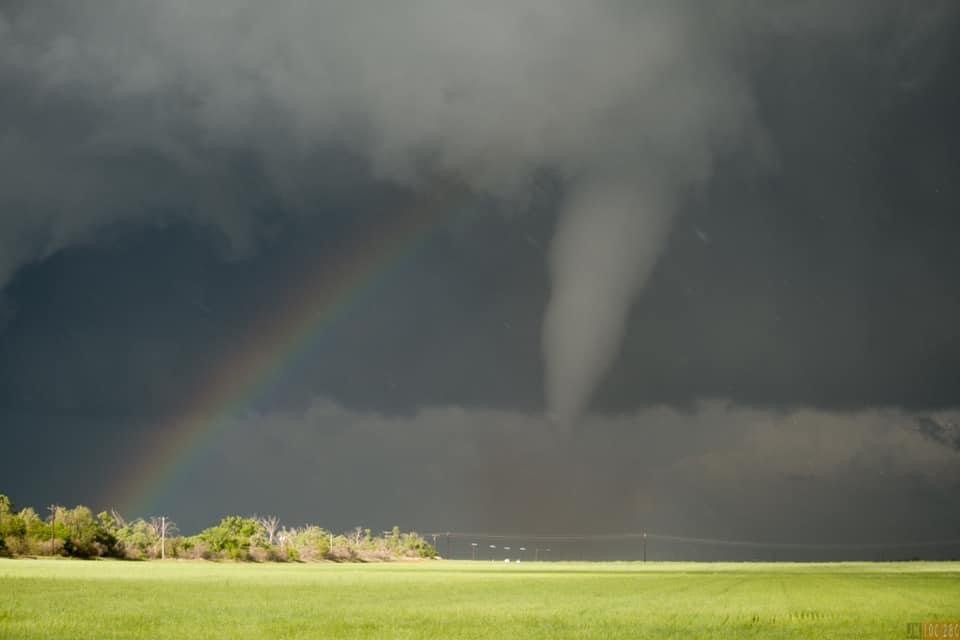
-
Severe Weather April 23rd 2021
JacobChgo19 replied to weatherextreme's topic in Central/Western States
URGENT - IMMEDIATE BROADCAST REQUESTED Tornado Watch Number 100 NWS Storm Prediction Center Norman OK 315 PM CDT Fri Apr 23 2021 The NWS Storm Prediction Center has issued a * Tornado Watch for portions of Southwest Oklahoma Western North Texas * Effective this Friday afternoon and evening from 315 PM until 900 PM CDT. * Primary threats include... A few tornadoes possible Widespread large hail and isolated very large hail events to 3.5 inches in diameter likely Scattered damaging wind gusts to 70 mph likely SUMMARY...Isolated supercell thunderstorms are expected to develop across the watch area this afternoon and early evening. Very large hail and damaging winds are the main threats, but the most intense cells may also pose a risk of tornadoes. The tornado watch area is approximately along and 60 statute miles north and south of a line from 20 miles south southwest of Childress TX to 45 miles east northeast of Wichita Falls TX. For a complete depiction of the watch see the associated watch outline update (WOUS64 KWNS WOU0).

