

cannoliman42
-
Posts
27 -
Joined
-
Last visited
Content Type
Profiles
Blogs
Forums
American Weather
Media Demo
Store
Gallery
Posts posted by cannoliman42
-
-
3" on the nose here in Astoria, Queens. Didn't really stick too much to the roads or sidewalks.
-
8 minutes ago, donsutherland1 said:
Three photos from this morning:
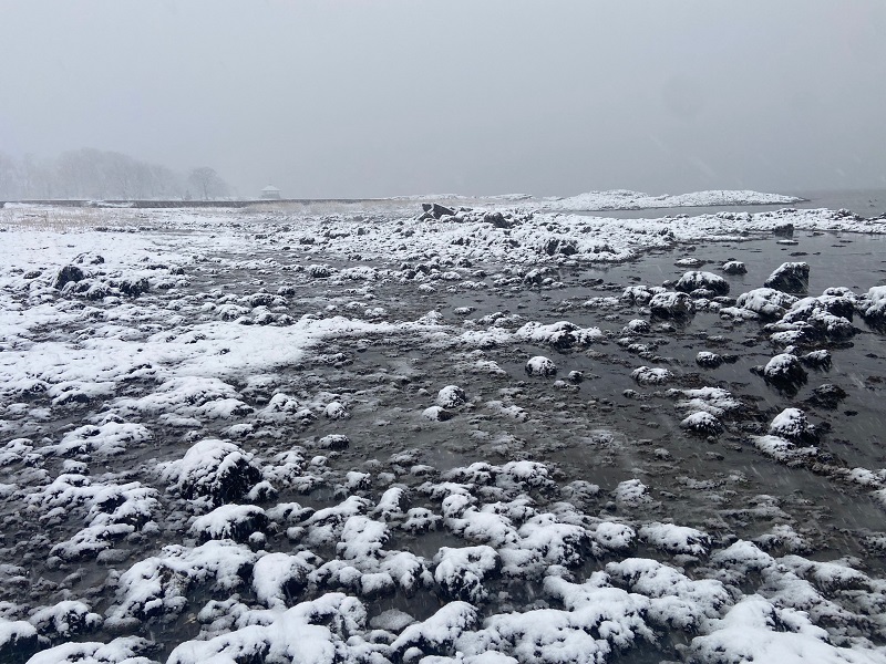
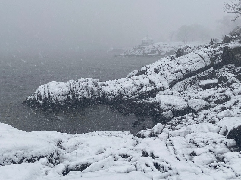
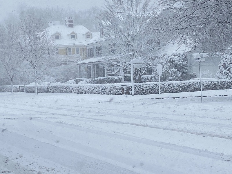
Beautiful. Where are these taken?
-
 2
2
-
-
10 minutes ago, Allsnow said:
Such varying estimates in NYC and Western LI. Certainly one of the weirder maps I've seen out of Upton, but could be factoring in UHI/population density.
Edit: Thought about it some more. Still doesn't make sense to me.
-
2
-
-
Amazing how close the storm with so much variation between models. Also amazing how Upton has been mum since this morning, especially re the Winter Storm Watch for NYC/LI.
-
I'd rather shovel 10 inches of snow over this slop. And being near a subway station means everyone compacts the snow to make it an unshovelable icy mess. I was out there for nearly two hours hacking away.
-
2 minutes ago, Stormlover74 said:
Nam has some nasty icing tomorrow morning after 3 to 5" of snow
.thumb.png.810598da30b29e7067747e0bdaf88751.png)
Near a quarter inch of freezing rain for parts of LI and SNE. Could get nasty.
-
Latest 3K NAM has 4-5 inches for parts of NYC here before a nice thin layer of freezing rain ices it all over around 9-10am. Wake up early and enjoy it.
-
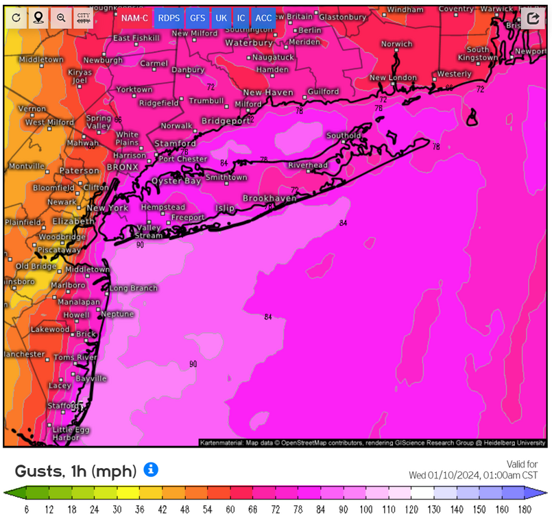
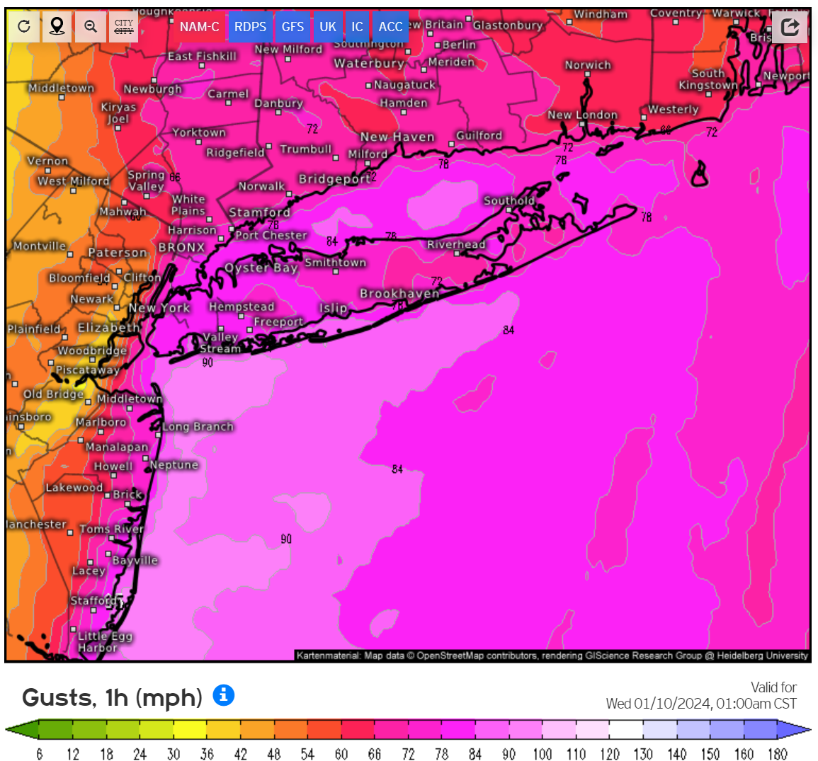
Am I simply reading incorrectly? Is the 3km NAM showing 90 MPH wind gusts off the Rockaways? It's showing 3 hours of 80+ MPH wind gusts for most of Long Island (Queens and Brooklyn included). I saw a peak of 94 mph off the coast of Jones Beach. Does the hi-res NAM typically overdo winds like this compared to other models like the HRRR?
-
59 minutes ago, Sampson said:
Got a place booked up in Saugerties NY tonight. Leaving the island around 1. Hopefully it’s worth it.
Also driving up to Ulster County today. Desperate times call for desperate measures.
-
2
-
-
10 minutes ago, vegan_edible said:
snooze fest thus far in white plains...
Models haven't predicted the storm to start until after midnight. I think the true brunt will be felt from 1am-7am. Winds towards the back end.
-
1
-
-
Tornado warning for Myrtle Beach, SC
-
1
-
-
8 minutes ago, uofmiami said:
44kt on NAM FOUS at LGA at 48hrs, strong winds.
Sustained or gusts? Edit: Disregard... saw the map. Ooof.
-
Mood flakes here in Astoria, Queens! First of the season.
-
The latest 12z FV3 model has 10+ inches of rain for NYC, which is unlikely to verify but certainly raises eyebrows after last week. The 12z NAM and HRR show some areas in Nassau, Queens, Westchester and Fairfield with about 3 inches tomorrow with an area of 5+ inches on the HRRR.
-
18z 3k NAM name has another 5" inches for NYC and Nassau County from 5pm through 2am. HRRR only has another inch for most parts. Surely do not want anymore rain-my parents basement in south Nassau is completely flooded.
-
 2
2
-
-
Almost all subways from Manhattan to Queens have been suspended due to flooding/loss of power in the tunnels. The only one still running is the 7, which hopefully hangs on. Otherwise, a lot of people may be forced to take the LIRR or end up stranded in the City.
-
1
-
-
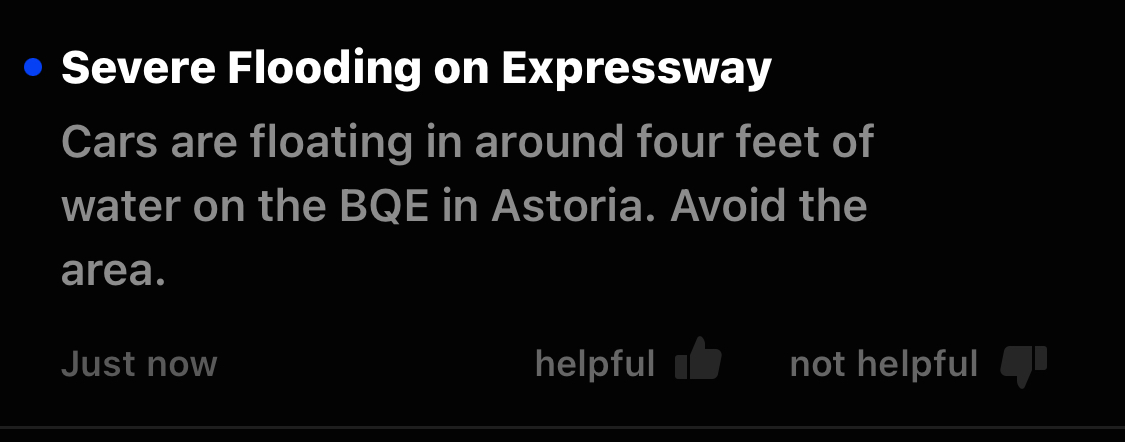
Just got this alert on my phone. Severe flooding on the BQE. Incredible rainfall rates. Haven’t seen this since Ida.

-
 1
1
-
-
Bonkers rainfall rates in NW Queens.
-
1
-
-
Absolutely pouring in Queens right now. Not sure any of the models had heavy rain starting this early (including the most recent HRRR). Goes to show how tough a time these models are having mapping these bands.
-
Both the latest NAM and HRRR have 4+ inches of rain tomorrow for portions of the lower Hudson Valley
-
1
-
2
-
-
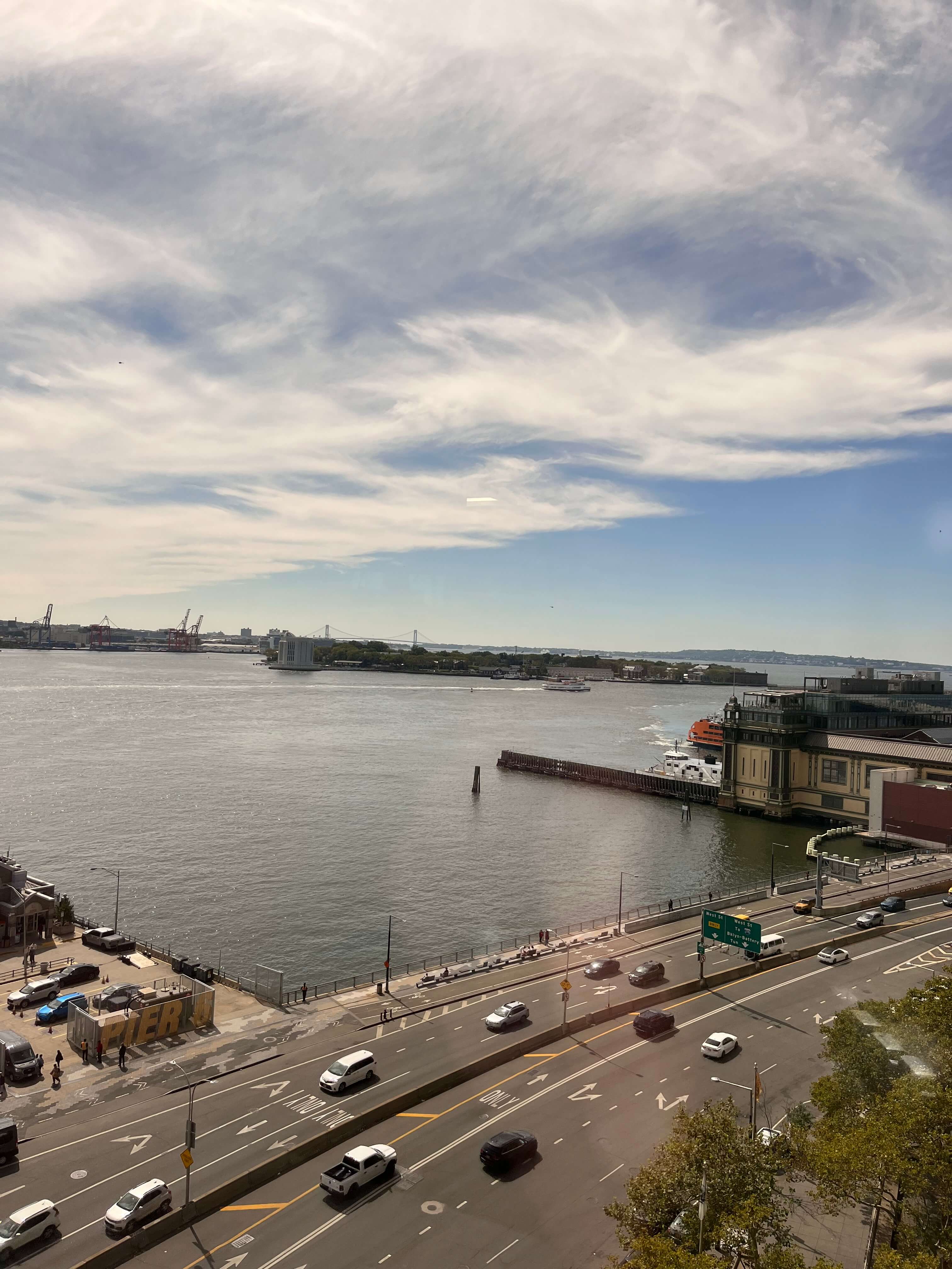
Cool view from my office today. You can see where the cirrus clouds from Lee end. Pretty much has stayed this way all day. Cloudy to the east, blue skies to the west. Impressive cutoff.

-
4
-
 1
1
-
.png.e7b2fb7485a5b13d69414e8b8f6a5741.png)
May 2024
in New York City Metro
Posted
There is a nearly 0% chance of rain tomorrow.