
mikeysed
-
Posts
220 -
Joined
-
Last visited
Content Type
Profiles
Blogs
Forums
American Weather
Media Demo
Store
Gallery
Posts posted by mikeysed
-
-
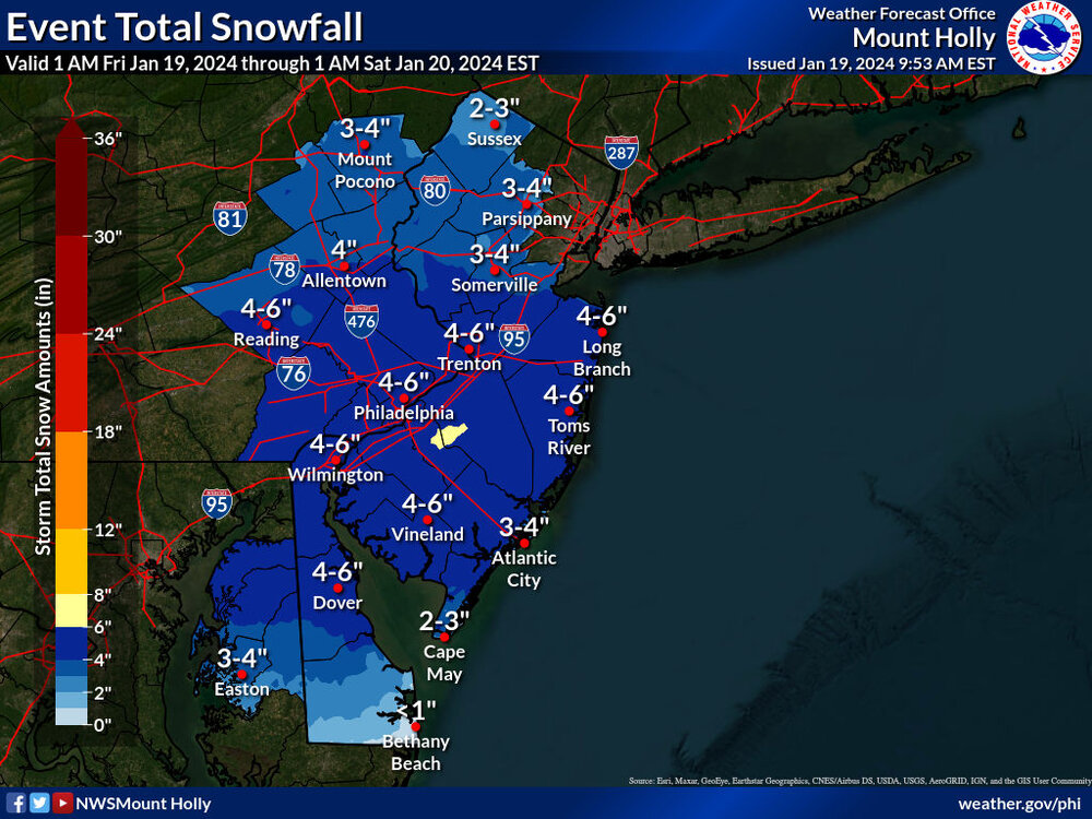
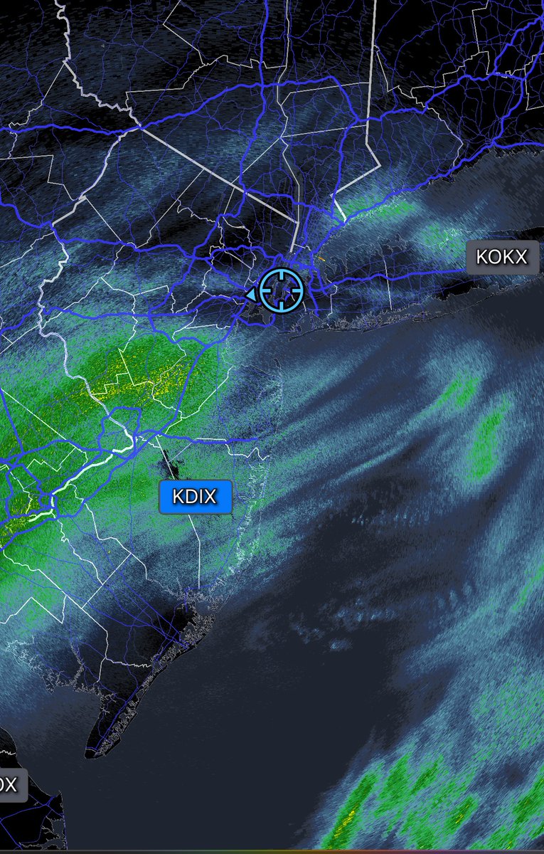
Mt Holly banking on this banding making it to northern morris county:
-
 1
1
-
-
-
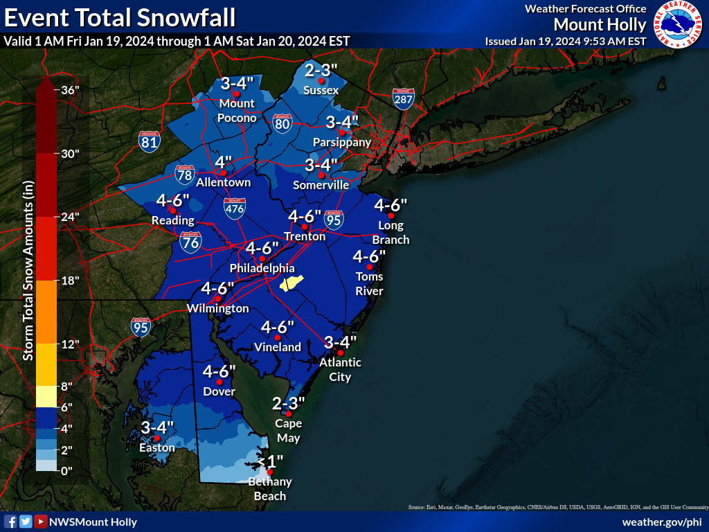
Mt Holly went backwards and upped totals: In the last 12 hours they've shifted a lot of 4-6 to 2-4 now 3-4".
I am assuming they feel the heavier echos will make it more north.
-
1
-
 2
2
-
-
13 minutes ago, mannynyc said:
Let’s see how far north this band can get

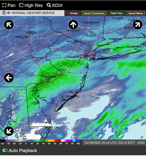
Do you have a link to this radar?
-
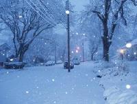
Beautiful virga to begin this 1-2" State of Emergency in Southern Morris County
-
1
-
-
Southern Morris county everything is a sheet of ice.
-
1
-
-
Does Sussex county have any snowpack left or did it melt the 10 to 13 inches?
-
Just about to hit 3" of rain here in Southern morris County. Another inch+ coming Friday. I can't imagine what pine brook area is going to look like come Saturday.
-
1
-
-
2.67 inches of rain so far today. Temp is 56. Highest wind gust 54 mph. Southern morris County.
-
2
-
-
Wish I could upload a video of 2 inch rates an hour. Won't let me. Puking at 1300 ft vernon NJ Sussex county
-
9" Sussex County. Middle of vernon 1300 elevation. Heavy snow. Measured 2 inches last hour. Pulling atm
-
2
-
-
.30 inches in last 15 minutes. Puking snow at vernon nj. Wish I could upload a video. Says it's over bandwidth and not allowing me
-
4 inches and mix in morris County.
4 inches and ripping snow at mid mountain in vernon nj. Heavy snow. 1 inch rates atm
-
1
-
-
3 minutes ago, wdrag said:
12"? I dont have a forecast that high for SC. May occur but worried about sleet freezing rain mid-7A, then back to snow. I hope we can get you 10". We'll know. by 10 or 11 tonight.
Any account for elevation being 1300? Sussex should get about 10. I figure another 2 on the mountain
-
Left Southern Morris County. Currently at Crystal Springs Resort. Expecting 12" on the mountain. Room is at ~1300 elevation, mid mountain. Flurries and 27 degrees. Plus my 12" ruler
-
3
-
-
4 minutes ago, sussexcountyobs said:
Just come out to Vernon tomorrow morning and get a room at Crystal Springs. Awesome hotel. Good bars, great restaurants. Skiing. Appalachian Trail is a 5 minute drive. You will have snow .
I literally did this. I'm leaving at 1030 am tomorrow from southern morris county lol
-
1 minute ago, donsutherland1 said:
The GFS shows snow at HPN until near 42 hours. Then, there's at least some sleet mixing in. Surface temperatures are above freezing, though.
Hi Don, how about for a hearty area of NJ, MMU (Morristown). Thank you
-
1
-
-
After GEFS is the Ukie up?
-
4 minutes ago, RU848789 said:
No, look at the NWS office maps side by side. One can't have a discontinuity of <1" on the NWS-Philly side of the Morris/Somerset borders next to 3-4" on the NWS-NYC side of that same border. Same thing with Middlesex adjacent to Union/SI (0" next to 1-2" in SI and <1" next to 2-3" in Union). There was no collaboration, clearly.

1-2 inches in Parsippany is comical. 4 to 6 minimum. If trends continue tonight, 6 to 8 would be more realistic.
-
1
-
-
3 minutes ago, BoulderWX said:
Morristown area. Last the green as if you’re heading to mendham and Chester if you’re familiar with the area
IMO Mt Holly is way low for morris County. Out of all the NWS areas based on models etc. They seem crazy for 1 to 5 for most of the county.
-
1
-
-
Just now, EastonSN+ said:
Does not line up with Upton too well.
They lowered most areas yet the models increased moderately.
-
2
-
 1
1
-
-
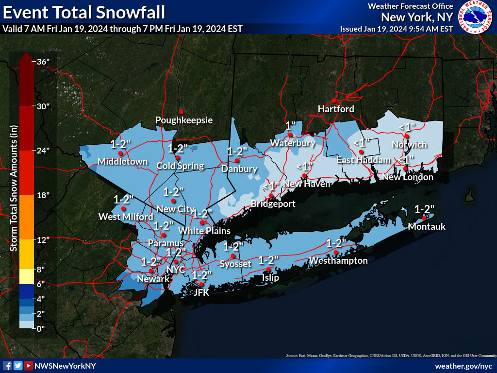
Wow Mt Holly is out to lunch. This is their new map?!

-
1
-
1
-
 2
2
-
-
If this trend continues by tonight NYC could be 6+ and have warning criteria. Would only need a 20 mile swing for that to happen
-
2
-
1
-
1
-
-
Euro caving to the GFS from yesterday
-
2
-

2/13 Significant/Major Winter Storm Discussion & Observations
in New York City Metro
Posted
Mt holly playing catch up. No update from upton yet who's way off in their northern areas.