

Snowman.
-
Posts
812 -
Joined
-
Last visited
Content Type
Profiles
Blogs
Forums
American Weather
Media Demo
Store
Gallery
Posts posted by Snowman.
-
-
OPM really needs to revaluate. Roads are gonna be a disaster. Definitely a questionable decision.
-
 1
1
-
-
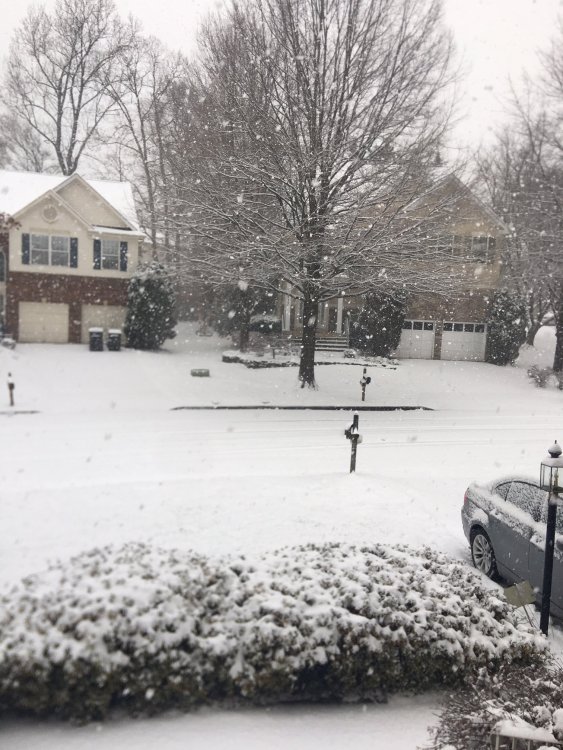
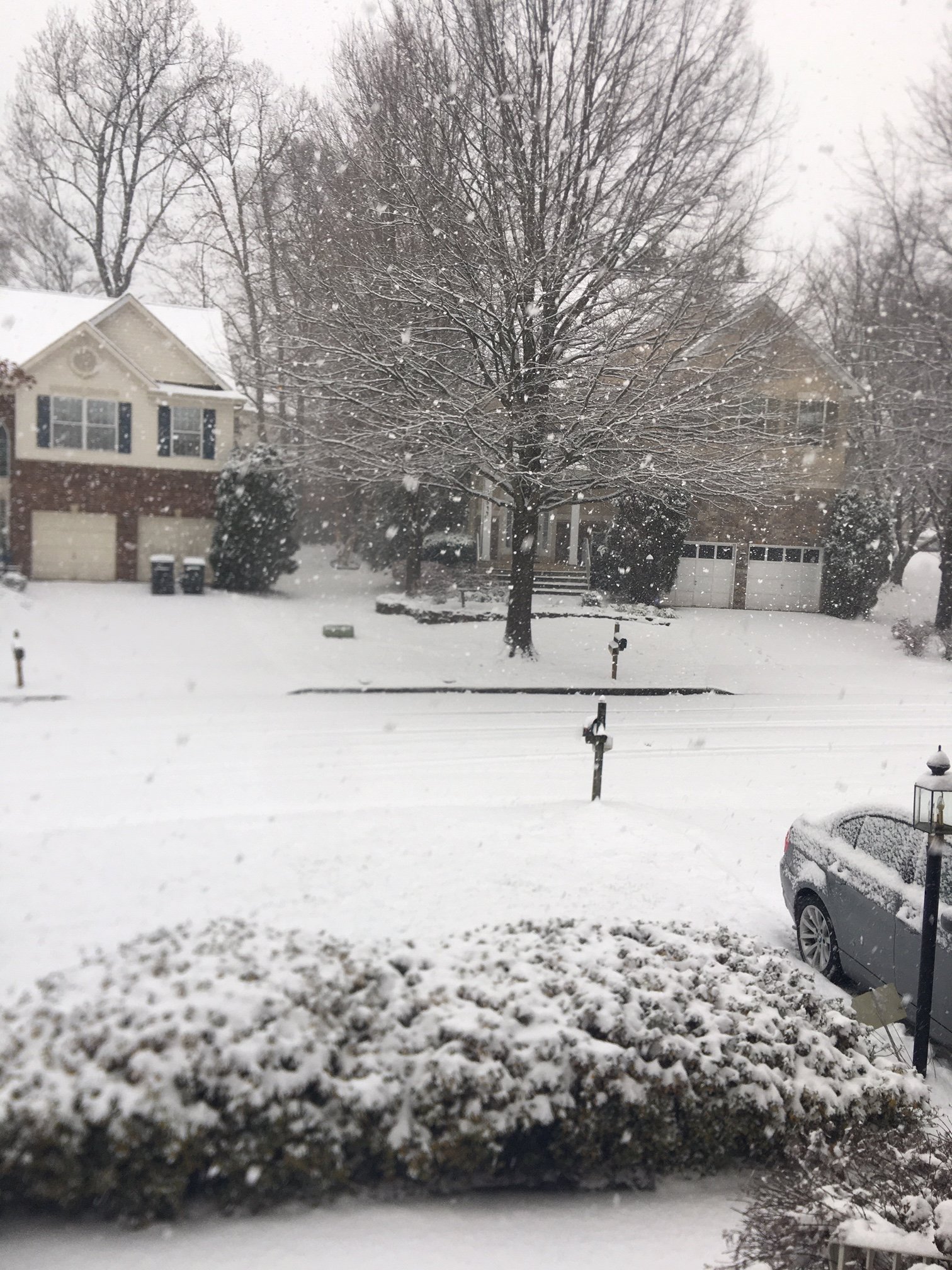
Heaviest snow that I've seen in quite a long time right now in Sterling.
-
Yellow band down by Culpeper looks headed to DC in around 30-45 mins or so.
-
It's snowing pretty darn hard here. Neighborhood roads have caved and everything is covered
-
1
-
-
2 minutes ago, TSSN+ said:

They must be definitely taking the NAM and HRRR into consideration with the upgrade. Probably the right call.
-
1
-
-
Yeah OPM needs to close
-
1
-
-
6 minutes ago, Mordecai said:
NAM’d
Yeah it looks great. That banding setup during the day really adds to some of the totals within the max area. Norlun trough type of setup?
-
3
-
-
Yep light snow has started here in Sterling
-
1
-
-
NAM worse for Loudoun. Tossing
-
 1
1
-
 2
2
-
-
Need the HRRR solution to verify even though it was terrible Monday.
-
The HRRR was absolutely terrible for Monday's event
-
2
-
 1
1
-
-
Under the yellow returns in Sterling. Heavy snow outside! It’s been too long
-
5
-
-
Heaviest snow of the day here in Sterling now. Bigger flake size
-
Radar looks juicy right now for here in Eastern Loudoun.
-
GFS looks solid. Time to enjoy the cold powder. It's been too long.
-
5
-
-
2 minutes ago, jayyy said:
It’s showed this for consecutive runs.. but it’s also the 12k NAM. Assume the 3k is drier; but that’s also still the NAM lol.Yeah 6z increased QPF areawide though compared to prior runs and 3km is always drier seems like.
-
1
-
-
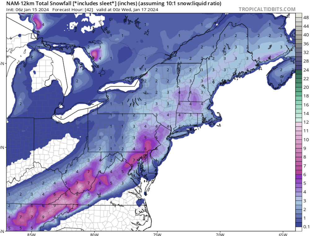
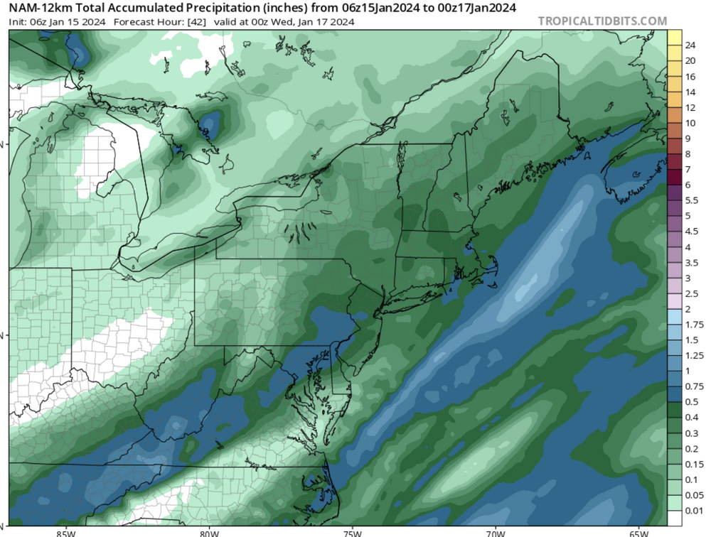
12km NAM looks pretty juicy FWIW
-
3
-
1
-
-
I'm taking a 2-4 inch event all day
-
2
-
-
GFS looks like the UKMet from last night
-
4
-
-
Looks like this event will outdo Mondays event here.
-
Yeah it’s puking under this band
-
1
-
-
Snowing nicely here in Eastern Loudoun. Roads are snow covered.
-
1
-
-
Tonights Euro seems most likely to be accurate with the usual spots jackpotting. No surprise. Central NVA jackpots rarely ever happen.
-
Huge flake size a couple miles north of Sterling. Hearing sleet now.
-
2
-


The Weekend Rule? Saturday 2/17 - The Icon Storm
in Mid Atlantic
Posted
GFS juiced up too