
vespasian70
-
Posts
1,374 -
Joined
Content Type
Profiles
Blogs
Forums
American Weather
Media Demo
Store
Gallery
Posts posted by vespasian70
-
-
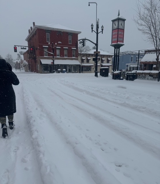
Measured 14" an hour ago, perhaps another inch as fallen with a bit more to go!
-
1 hour ago, buckeye said:
Back from a walk. 12”. With possibly couple more,
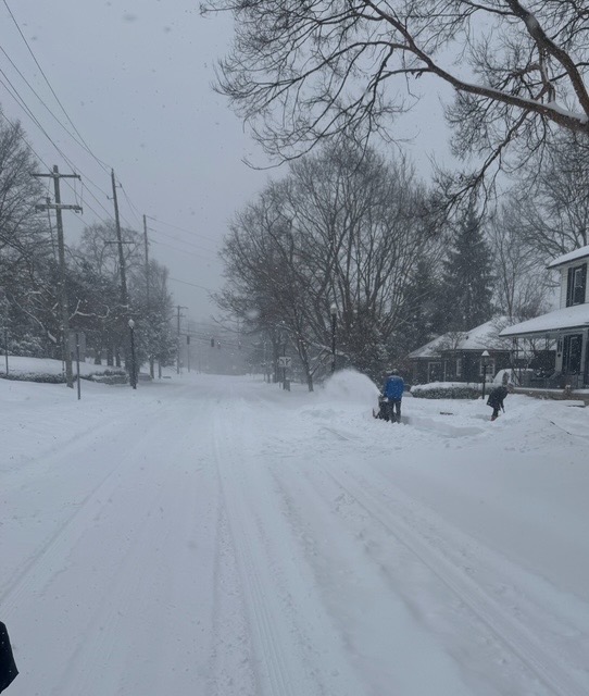
Same here in Newark.
-
10+ here in Newark so far.
-
How much are you thinking for us buck?
-
That band has produced!
-
 1
1
-
-
Hopefully we avoid the dreaded WToD! Hard to believe it's a concern with this polar air in place!
-
Locked and loaded. I think we'll do OK with this one.
-
Ended up with 5" here in Newark. Not bad for the first snow.
-
1
-
-
36 minutes ago, dilly84 said:
NAM juicy for Monday/Tuesday, but consensus seems to be a 3-5" average across Central Ohio. Early season, would definitely take it.
Can't complain about that for the 1st week of December!
-
1
-
-
3 hours ago, TheClimateChanger said:
Hell, with the warming client and already marginal subtropical climate of Cincinnati, this very well could be the heaviest storm for perpetuity.
Snow covered palms in Cheviot.
-
 1
1
-
-
52 minutes ago, dilly84 said:
We did better than I figured. Got a couple inches, but it ripped for about 2hrs and gave us 1.5"
Same here, 2-3" from the clipper, maybe 2" or so from the present storm. Didn't live up to the hype the short rangers were advertising.
On to the next one ...
-
6 hours ago, dilly84 said:
It's becoming increasingly obvious that for whatever reason Central Ohio just doesn't get decent snows anymore. It's still early in the winter, but this one is aggravating.
frustrating hobby to say the least!
how did you do with friday's clipper?
-
7" here on the northside of Newark. Kinda surprised at how quickly it fell.
-
15 hours ago, Steve said:
So we get some cold… but no storms on the 10 day forecast… Lol… then at the end of 10 days…40’s!

End of the week something may be cooking ...
-
9 hours ago, buckeye said:
Gonna join the local Big Foot spotters club.
That's more likely to pan out than a snowstorm in central Ohio.
-
1
-
-
11 hours ago, buckeye said:
So we couldn't buy a sub 980 low tracking through our sub the last several winters.....now the 18z gfs has TWO sub 980 lows not only tracking through the region but taking an almost identical track 72 hrs apart. ok
I guess anything is possible and the most believable part of it is that CMH is on the warm side of both. Actually I still think the weekend storm isn't set in stone yet.... but I've been wrong before.
If this bombs out like the 00Z GFS showed it will certainly be way west of Central OH. We need a weak sauce solution for good snows here with this one ... unless the "bomb" produces a mighty backend snow.
-
Surprisingly picked up @ 2". I wasn't expecting that!
-
1
-
-
2 hours ago, jaf316 said:
I'm only a couple miles from the airport, and I didn't do a real measurement, but eyeballing it, it looks like 2.5 or 3 inches to me.
Things look to be quickly winding down. A nice little event.
On to wednesday!
Yea, picked up @ 3" or 4" here as well. As soon as ILN issued the WSW it fell off the table.
-
3 hours ago, Hoosier said:
Never heard of this wxsphere until now. Looks like the place is hopping though.
Yup...and with a lot of lakes and OH Valley folks too. It reminds me of what this place used to be like. Lol
-
17 minutes ago, dilly84 said:
I'm still here. Heavy snow here currently. In the line of the heaviest stuff for at least 2 or 3hrs. See where we end up.
ILN now saying 4"-6" with Franklin and Licking Counties under a WSW.
Wow....what an over-performer!
-
1
-
-
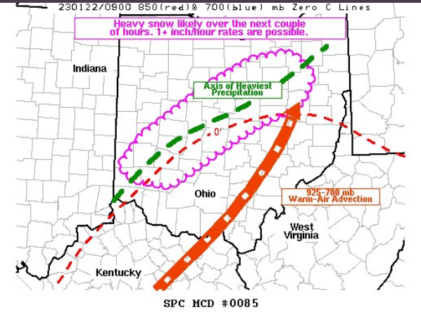
In case anyone missed this ... NWS in Lincoln went on twitter to explain how they use models and why they do what they do.
-
Well, hello beautiful.
")
-
3
-
-
1 minute ago, jaf316 said:
What's wxsphere...?
Another weather forum.
-
7 minutes ago, iluvsnow said:
Where the hell is everyone? NWS forecast for Dayton area is 1-3 and we at 9:45 have 5 inches and more to come. Still in the game for midweek. Wake-up....unless everyone has hybernated.

Buckeye's on his cruise ... most of the rest have jumped ship to wxsphere. Nice to see it's pouring over there ... starting to add up here too!
-
2
-
Let’s talk winter!! Ohio and surrounding states!! 24'-25'
in Lakes/Ohio Valley
Posted
Got down to -15 here. I love snow, brutal cold not so much!