

Conway7305
-
Posts
193 -
Joined
-
Last visited
Content Type
Profiles
Blogs
Forums
American Weather
Media Demo
Store
Gallery
Posts posted by Conway7305
-
-
Yeah I saw the Feb 24th Storm on 0z Euro Looks good now. Would be interested in seeing the ensemble members. Let’s hope it holds. Knowing the way these Miller B systems nudge north this year, wouldn’t surprise me if it jackpots NOVA again. They have gotten lucky all winter. Hope I’m wrong.
-
Weeklies teasing us again Mid March….lol
-
We can’t get a break this winter….NOVA will score again. lol
-
EURO might be a blip. HRRR 12z short range is saying we get 2-3 inches . Doesn’t jump north.
-
1 hour ago, RVAman said:
If we get 3-4 inches on Saturday I'll gladly buy everyone on this thread a beer.
New LR weeklies look great for last week of March…lol
-
 1
1
-
-
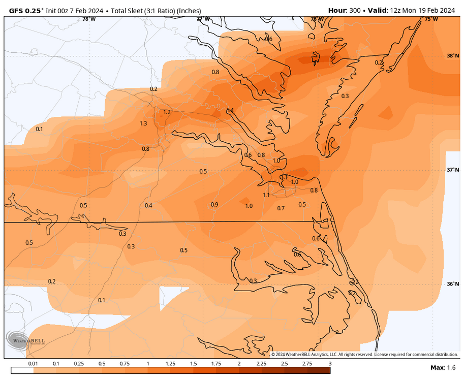
12z EURO has about 2 to 3 inches for our area Saturday. Honestly, if we get that then I’ll be happy the rest of the winter…lol
-
 1
1
-
-
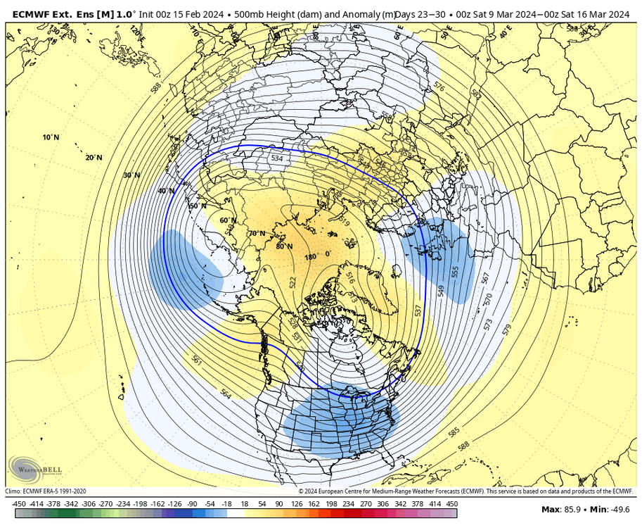
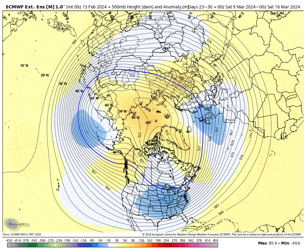
Looks like we’re gonna have to wait until early mid March to possibly get a last-minute save. Looking at the indexes, everything is reversing and forecasted to become warm.. PNA is going negative and that’s gonna kill the Pacific. I’ve been really trying to remain positive, but it’s tough. The forecasted pattern a couple weeks ago was absolutely epic but there was too much just warm air in the country. MJO has stalled in 7 which is a warms phase and never makes it to phase 8. I won’t trust the LR weekiles anymore….lol
Hope I am wrong and we get something next week.
-
1
-
 1
1
-
-
1 hour ago, RIC Airport said:
As I mentioned the other day, there are two opportunities. The 00z GFS and Euro had a rainstorm for around PD and the 12z Euro has already advertised a more southern and colder solution for us so more confidence is needed before taking anything too seriously. Then we'll see how the second threat around evolves in the coming days.

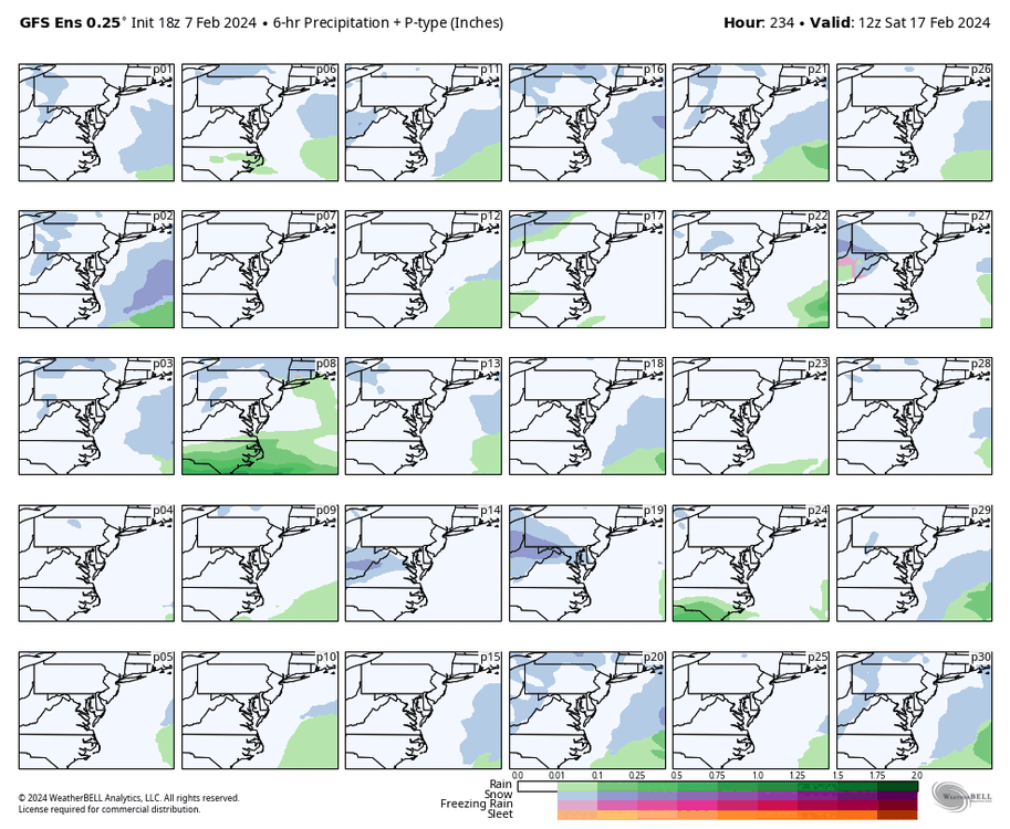
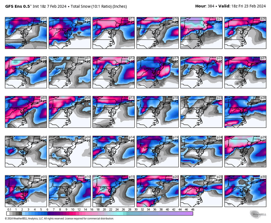
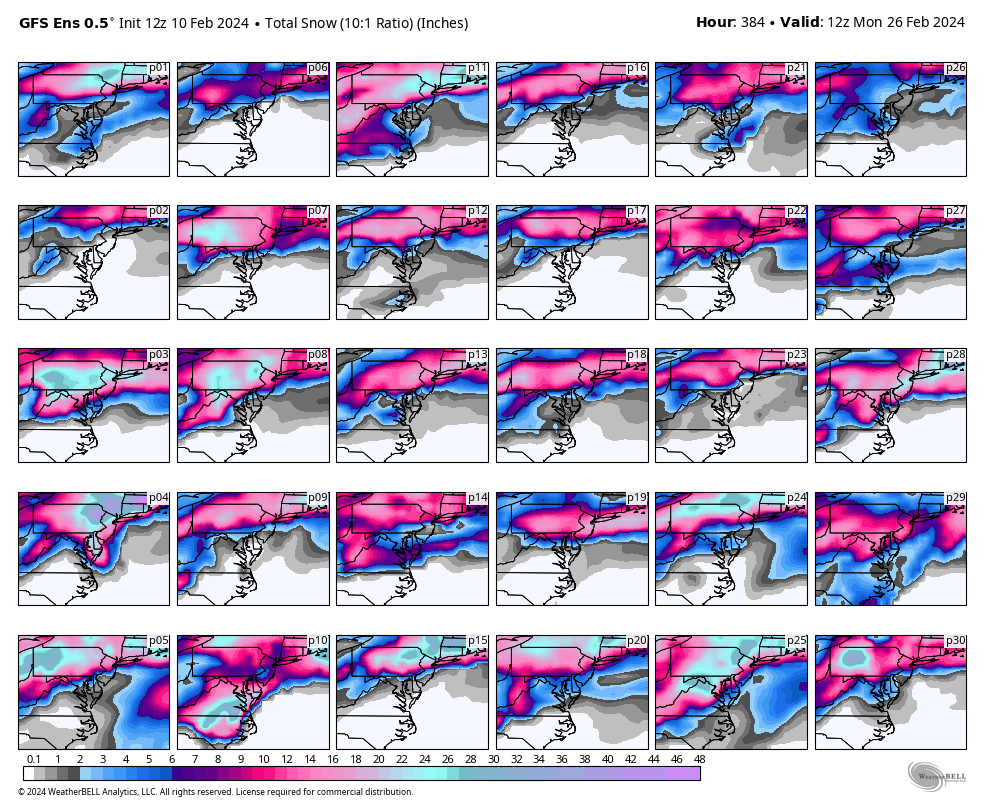
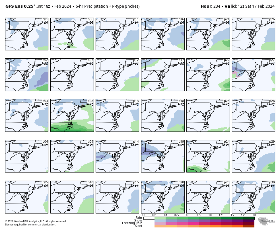
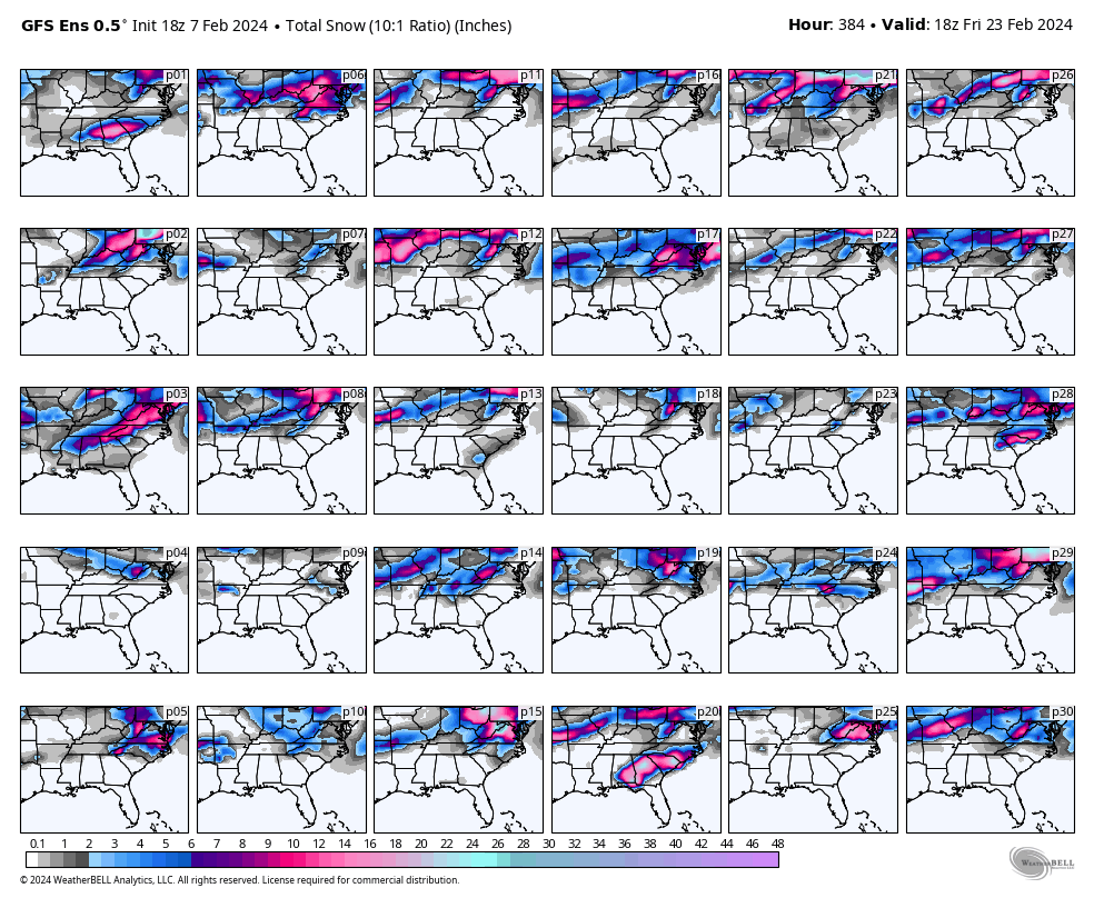
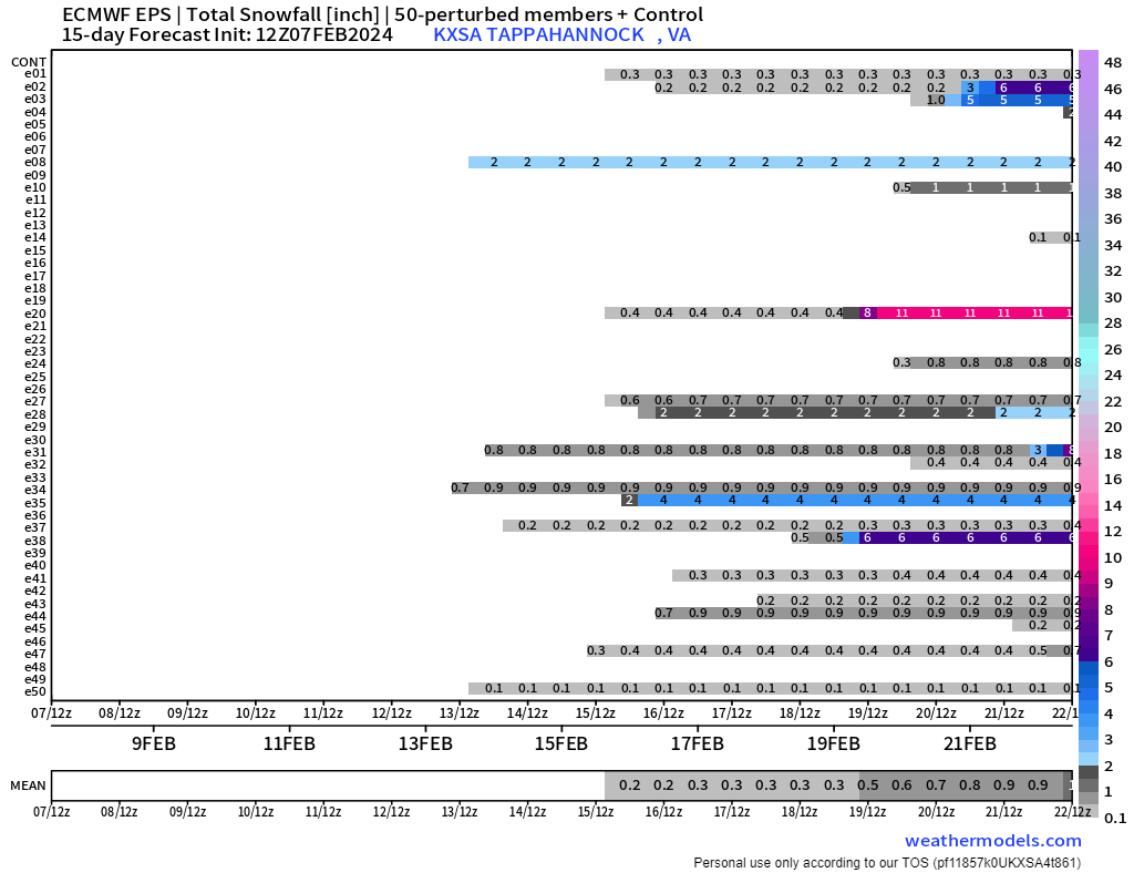
The 12z GEFS had a handful of hits, including another member (p10) that obliterates our area February 23rd-24th. Overall the GEFS was a nice improvement over yesterday's runs, but there is still a lot of spread. I don't know if we should give up on the winter with these signals.


can you show animation on p10 just for laughs…..lol
-
27 minutes ago, RIC Airport said:
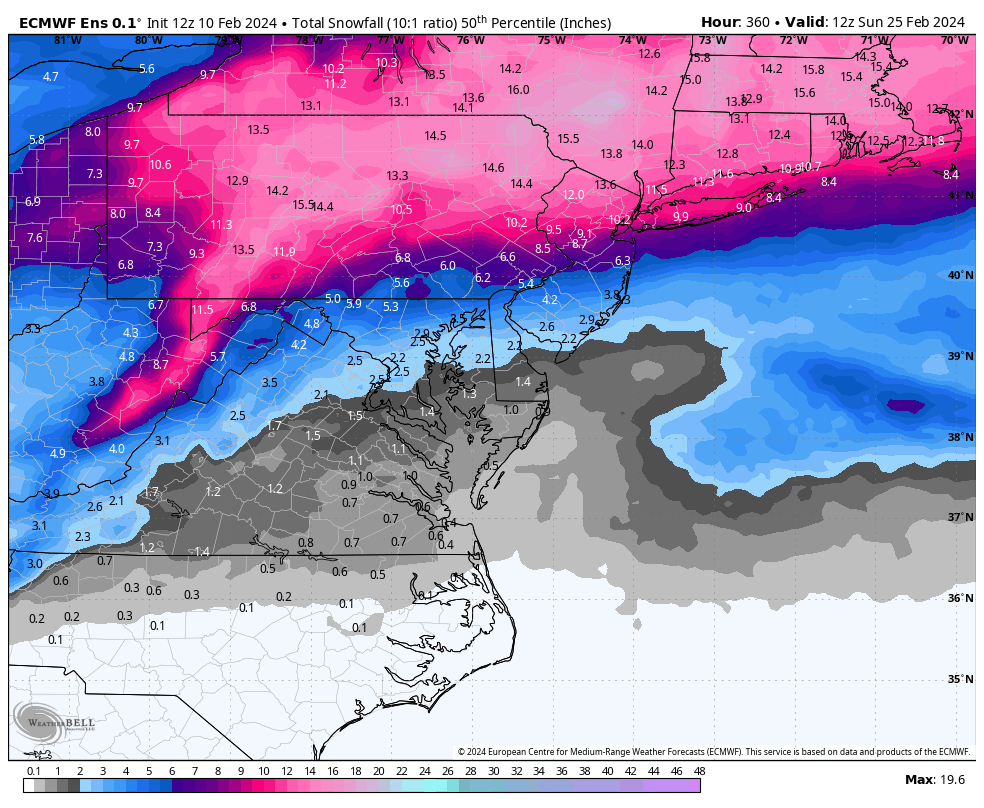
Today's 12z EPS maps are the best we've seen before the mid-January threats. It's been frustrating, for sure, so we'll see. But, there is still a decent signal for the 17th-25th.
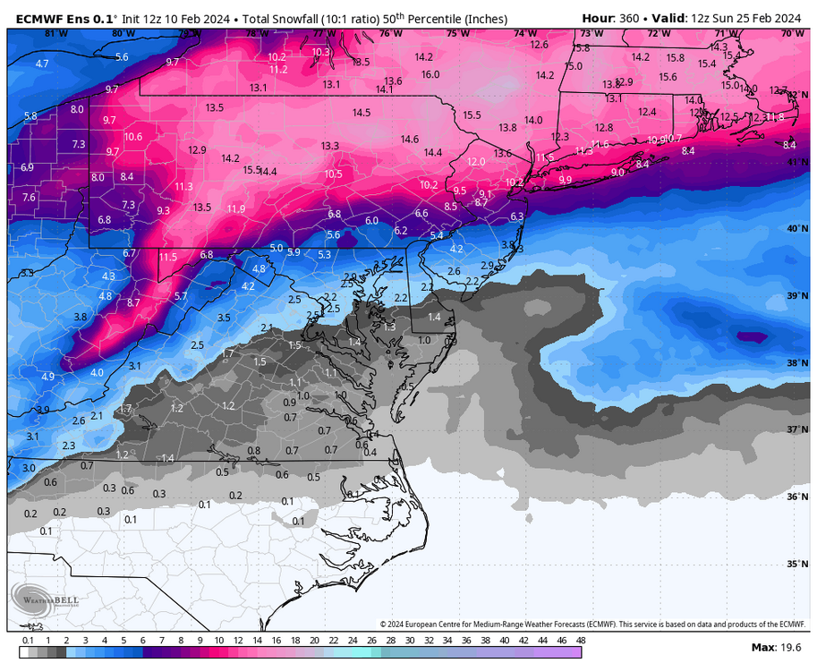
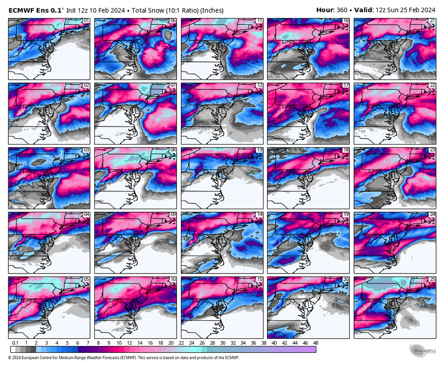
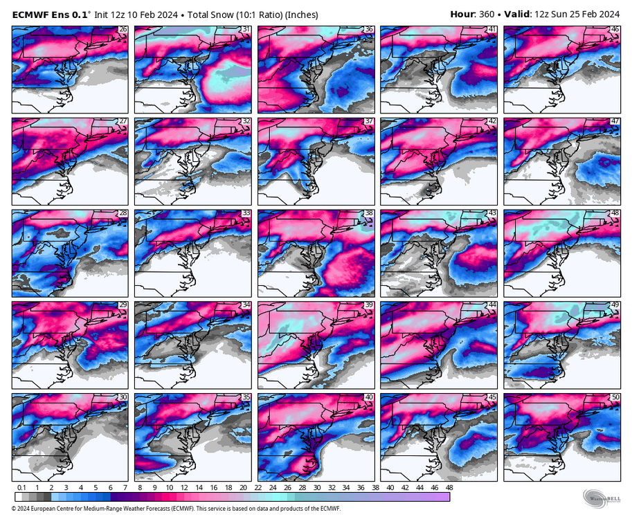

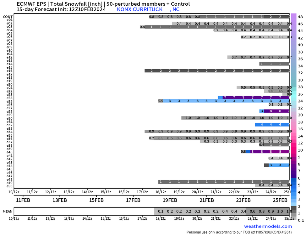
P10 please that’s all I ask for this winter…lol
-
2
-
-
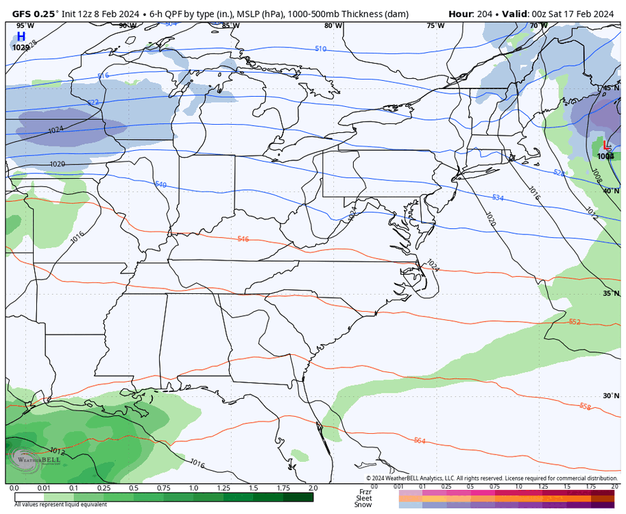
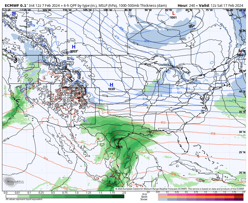
GFS gets some digital blue here PD, majority of precip still south but good trend.
-
1
-
-
If the MJO can scoot into phase 8 end of next week it will help with colder temps.
-
1
-
-
Agreed, need to keep watching, the storms always trend north
-
1
-
-
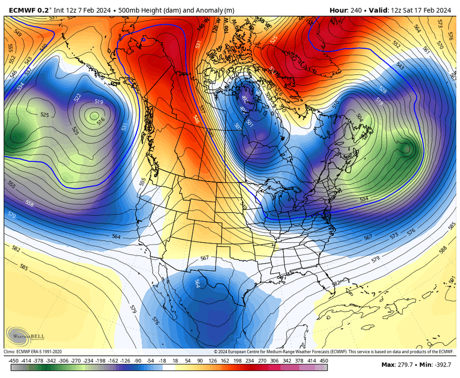
Whats interesting on 12z for PD was the NS and SJ almost phased but the block was too strong and squished it all. Had block been any weaker may have turned out pretty nice. Still time.
-
The block is too strong for PD. Everything is suppressed. Need that block to weaken for storm to move North. Maybe when the block starts to weaken we can see storm chances increase later in week.
-
2
-
-
8 minutes ago, RIC Airport said:
18Z GFS coming in good for Richmond and west for the PD storm.
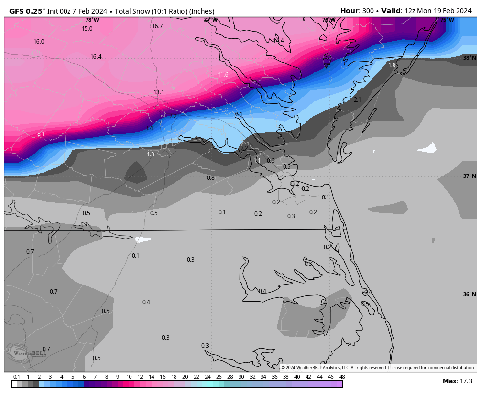
Another hit for the area! I’m a little worried about suppression but I like how it’s trying to pull north up coast. Wish EURO would go out past 240 to compare.
-
1
-
-
We need ridge to setup more towards the plains and not rockies on the EURO. Still plenty of time.
-
1
-
-
2 hours ago, RIC Airport said:

Hey! do you happen to have the ensemble members for l2z GFS.
-
Big time! However, I live in short pump and we only get 4 inches…lol I’m sure the ensemble members will be lit up. Really good to see a storm now and even the V Day storm is looking better.
-
1
-
-
39 minutes ago, RIC Airport said:
18z GEFS is a nice improvement. It's not over, there are some nice hits, best looking chart of the day.


nice!!
-
1
-
-
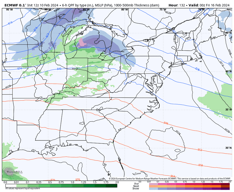
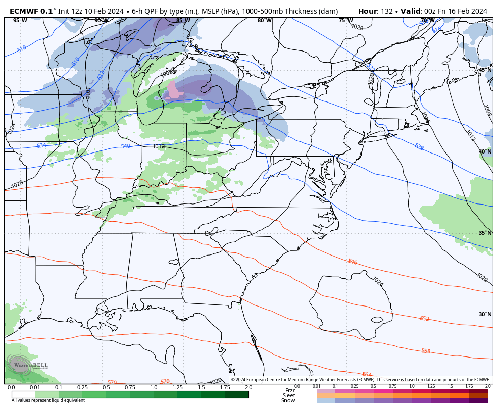
18z GFS PD storm threat went from snow at 0z to rain at 60 degrees for 18z. lol. Cold just vanishes. Let’s see what the overnight models say.
-
15 minutes ago, RIC Airport said:
I remember the 2016 Storm models initially had a rain storm for 5-6 days in LR a then about a week before the storm it trended colder and boom.
-
20 minutes ago, RIC Airport said:
There is the storm at Day 10 on the Euro. EPS will be interesting with this look. The flow is flat looking so hopefully it doesn't track too far south of us. But, verbatim this looks suppressed.

Good news is both GFS and EURO show a storm (Potentially BIG) with juiced up STJ. We don’t want too much of a block, otherwise supression. To little of a block is a cutter or rainstorm. Hoping we find middle ground. NAO block has weakened a little past few runs but still there so that’s good news. Lots of waves coming on shore so no shortage of storms. We just need good timing.
-
8 minutes ago, RIC Airport said:
We are fringed once again, hope we can do a lot better. Like you said, so far away and will change.


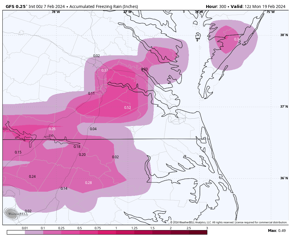
Just happy to finally see a healthy potential storm setup , Richmond right on the snow/sleet line. I’m sure it will change a bunch and maybe even disappear and reappear but there is a good signal for some kind of storm.
-
3
-
-
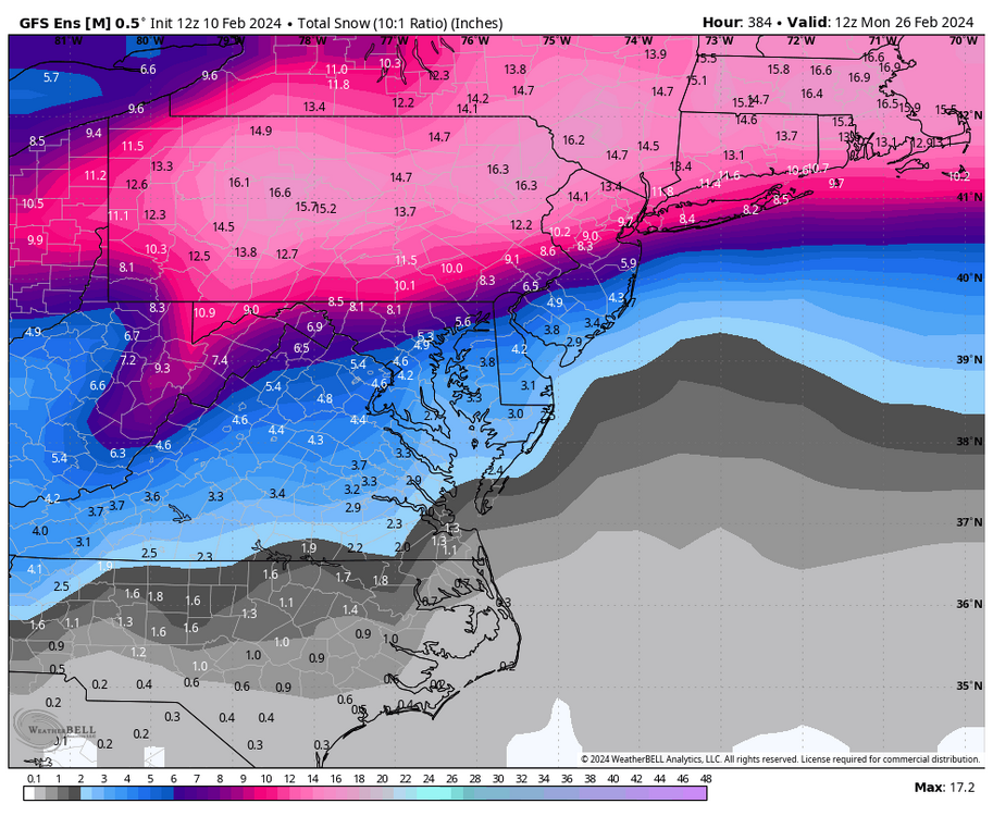
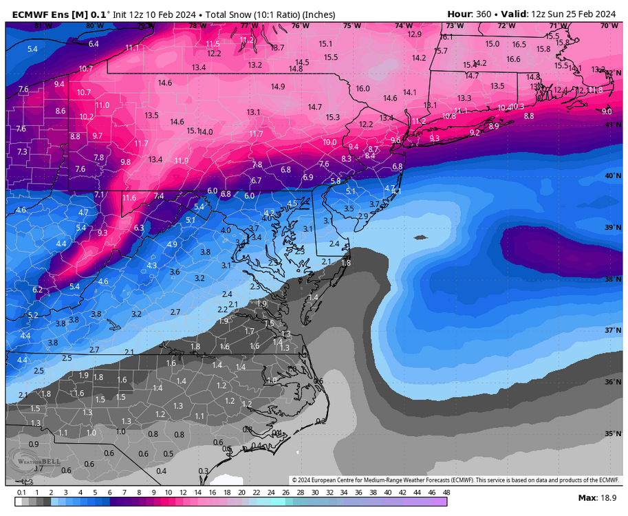
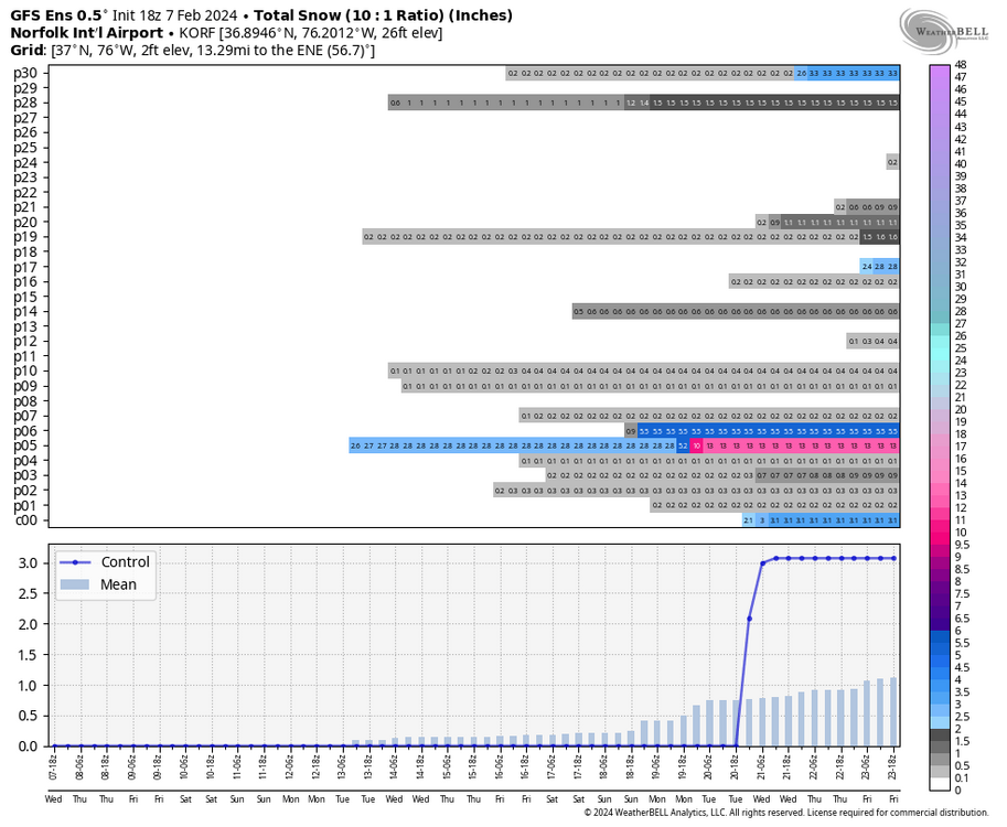
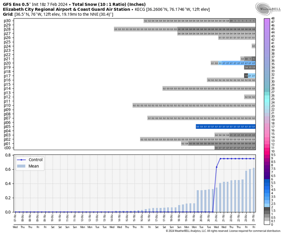
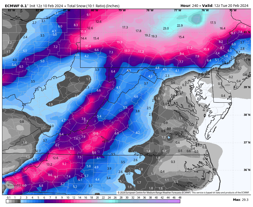
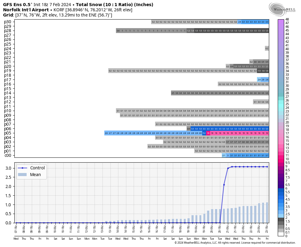
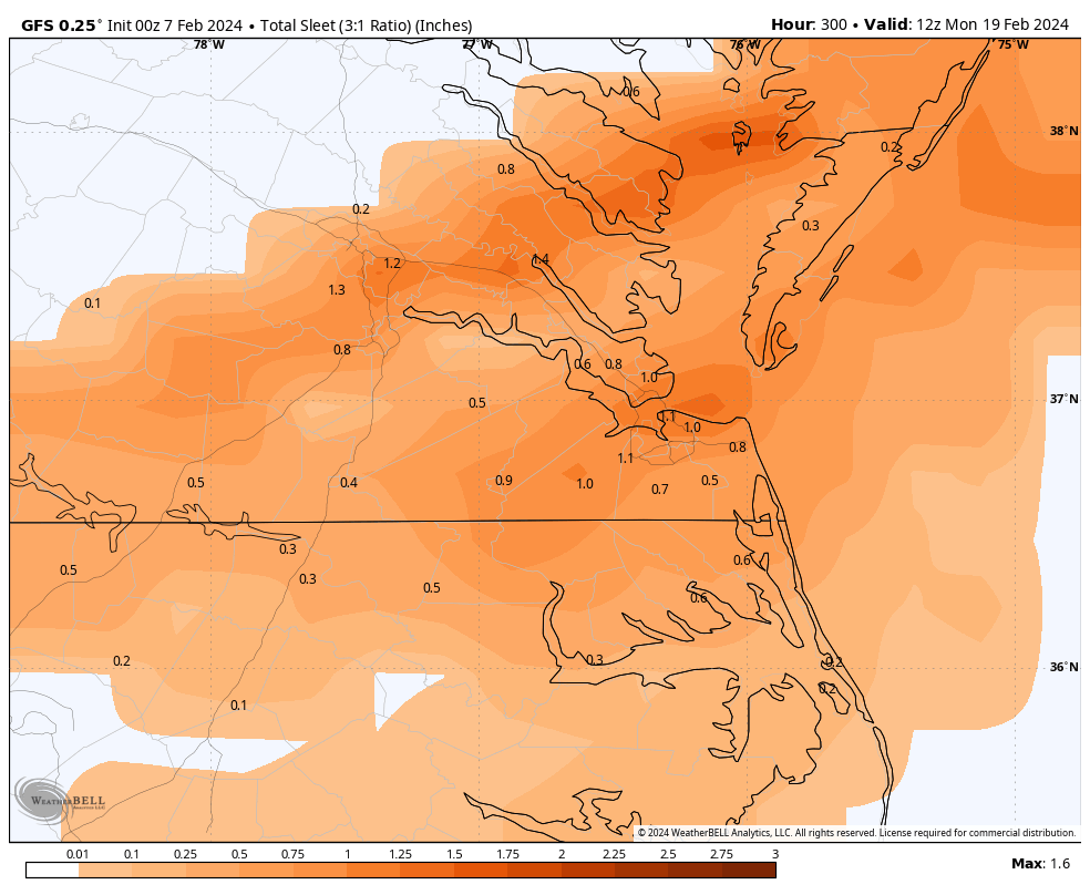
0z GFS has a big hit for just north of us like 30 miles all snow. for PD. Good news is the storm looks big and it is there most importantly on this run. Haven’t seen that kind of Miller A in a while. We still get snow but not as much as North central VA, maybe I am looking at it wrong. Wait till accumulation maps come out.
-
1
-


Richmond Metro/Hampton Roads Area Discussion
in Mid Atlantic
Posted
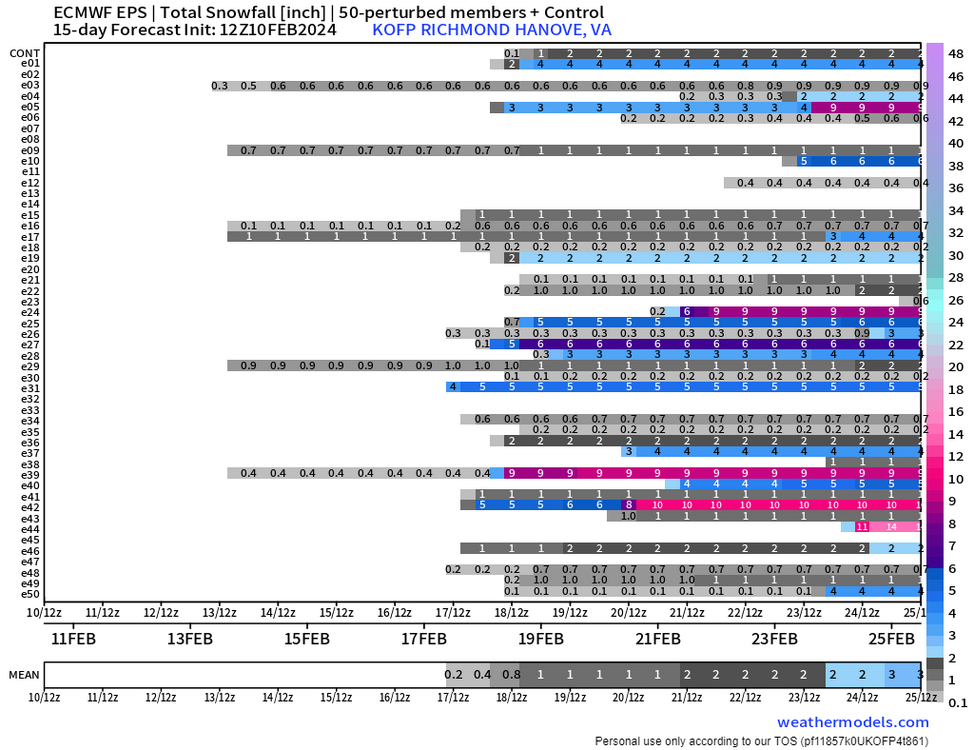
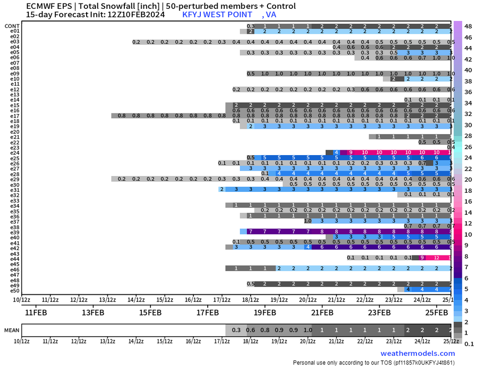
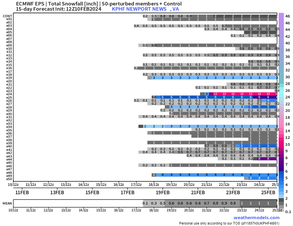
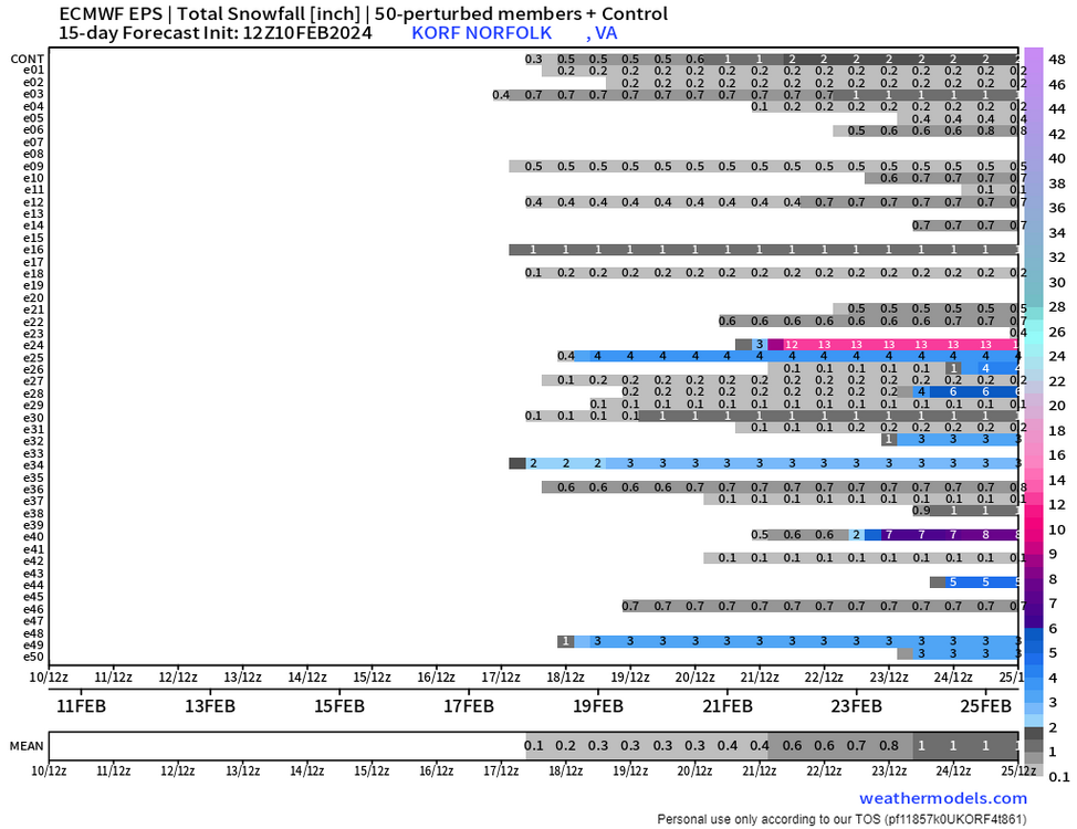
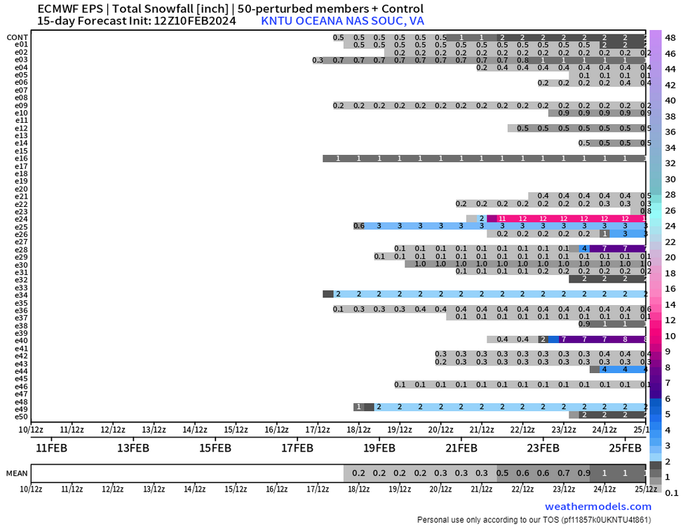
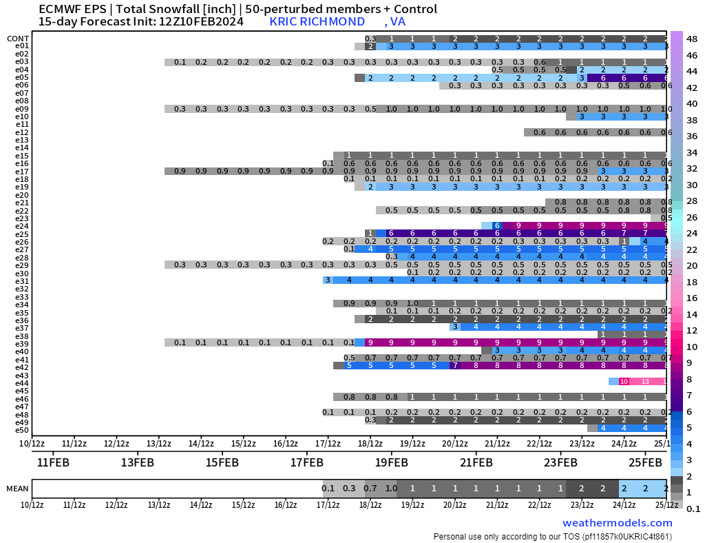
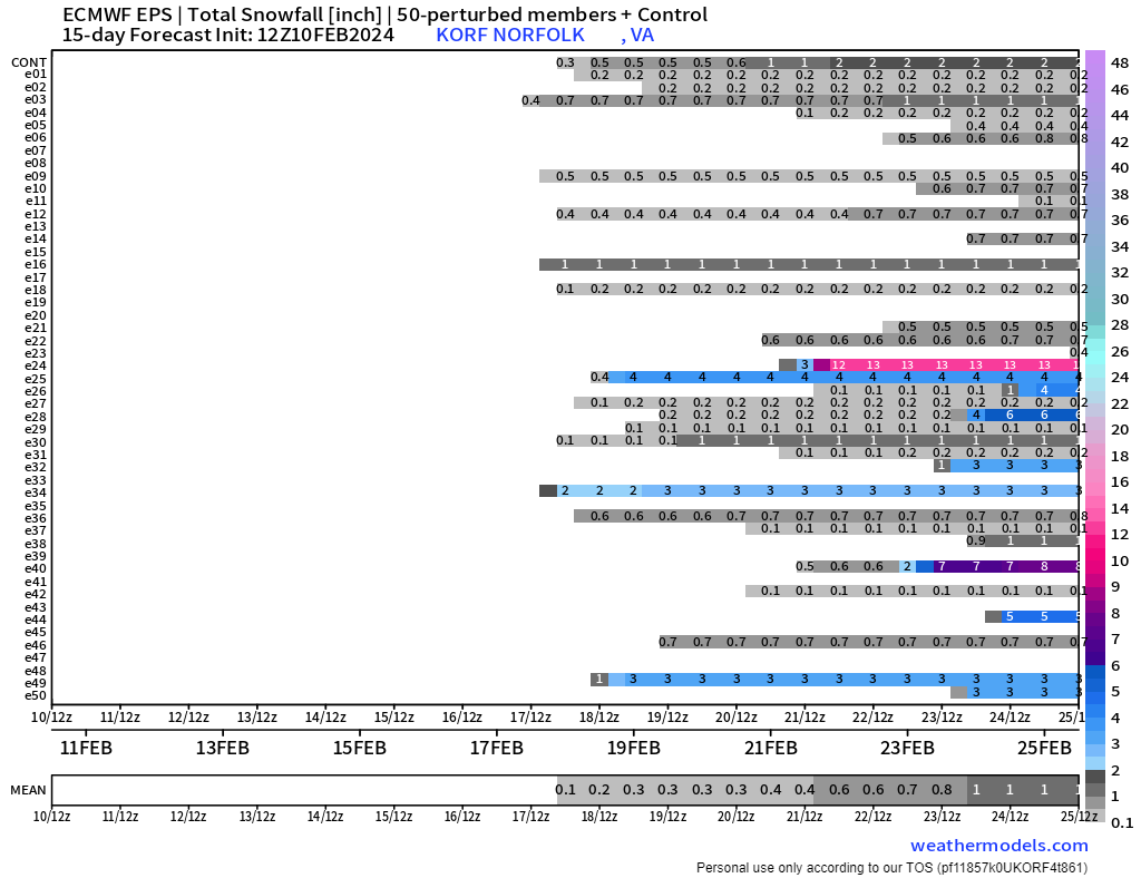
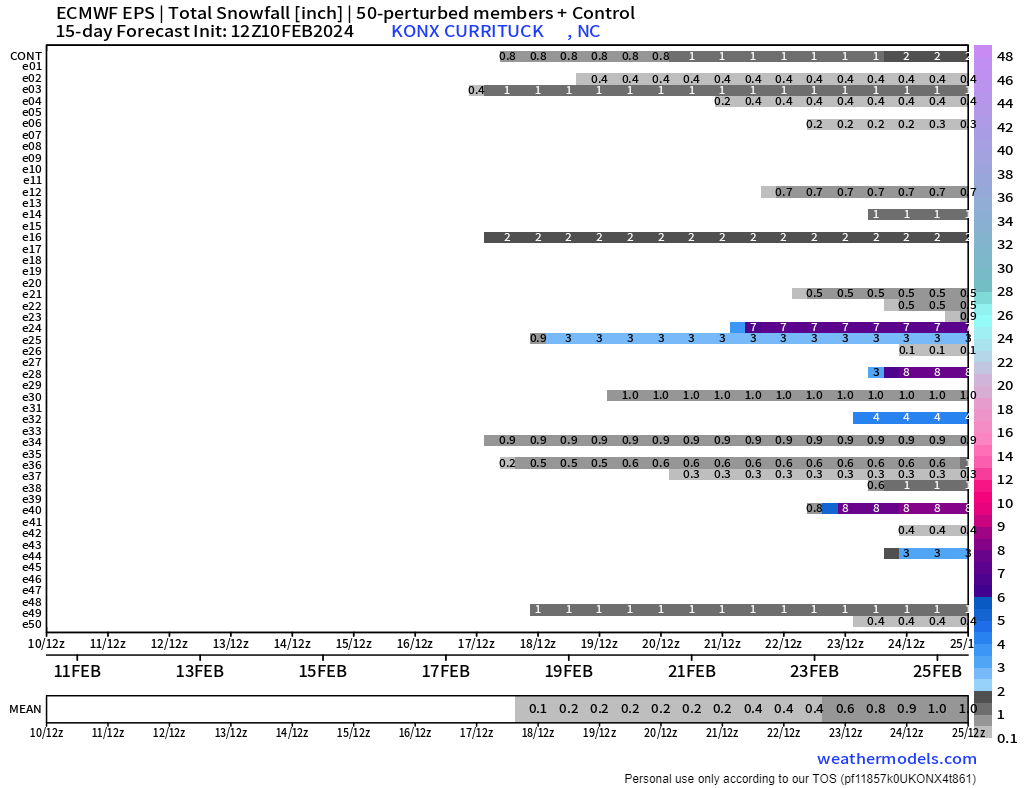
Anyone see P25 on Euro Ensembles for March 3rd. HECS….book it…. lol