

weatherfreeeeak
-
Posts
656 -
Joined
-
Last visited
Content Type
Profiles
Blogs
Forums
American Weather
Media Demo
Store
Gallery
Posts posted by weatherfreeeeak
-
-
No substantial rain for the next 10 days...
-
 1
1
-
-
Rain definitely came in more north than most all models had...
-
50 minutes ago, MJO812 said:
Gfs once again showing a cold shot at the end of this month. Some snow would be nice.
Who wants colder temps and snow after a day like today!
-
1
-
-
16 minutes ago, Rtd208 said:
Picked up 0.59" of rain for the day yesterday.
Current temp 42
We didn’t get as much as expected
-
15 minutes ago, NEG NAO said:
The circus is in town...........

Lol
Would be where the heaviest snow was all year
-
Since nothing to track, you know we’re all waiting for what the euro shows next weekend
-
4 hours ago, MJO812 said:
JB thinks more snow is on the way moving forward with the MJO heading into the cold phases and the shortening of the wave lengths.
I think March 3rd has some opportunity. Fresh cold air comes in Tuesday night. All just Has to come together
-
1
-
 1
1
-
-
What’s next to track

-
1
-
-
27 minutes ago, SnoSki14 said:
That's true but the antecedent airmass is good. The only downside is timing. Had this came overnight I think even the city would've gotten snows.
Also paying close attention to the 26th. A cold front comes through Wednesday giving us a cold airmass ahead of the next shortwave.
With the AO/NAO positive it's very unlikely the shortwave gets as far suppressed like models show right now.
Beyond that it looks warm to start March, maybe even very warm with a large ridge building in the east though it could be transient and doesn't automatically mean it can't snow later on.
The 26th system on the gfs this run is more north in the mid-Atlantic this run vs the Carolinas. Watching the 26th
-
Gfs has the storm a week from now, it’s just in the Carolinas as of now. Curious to see if that trends further north to our area over the next few days
-
Euros thoughts for next week?
-
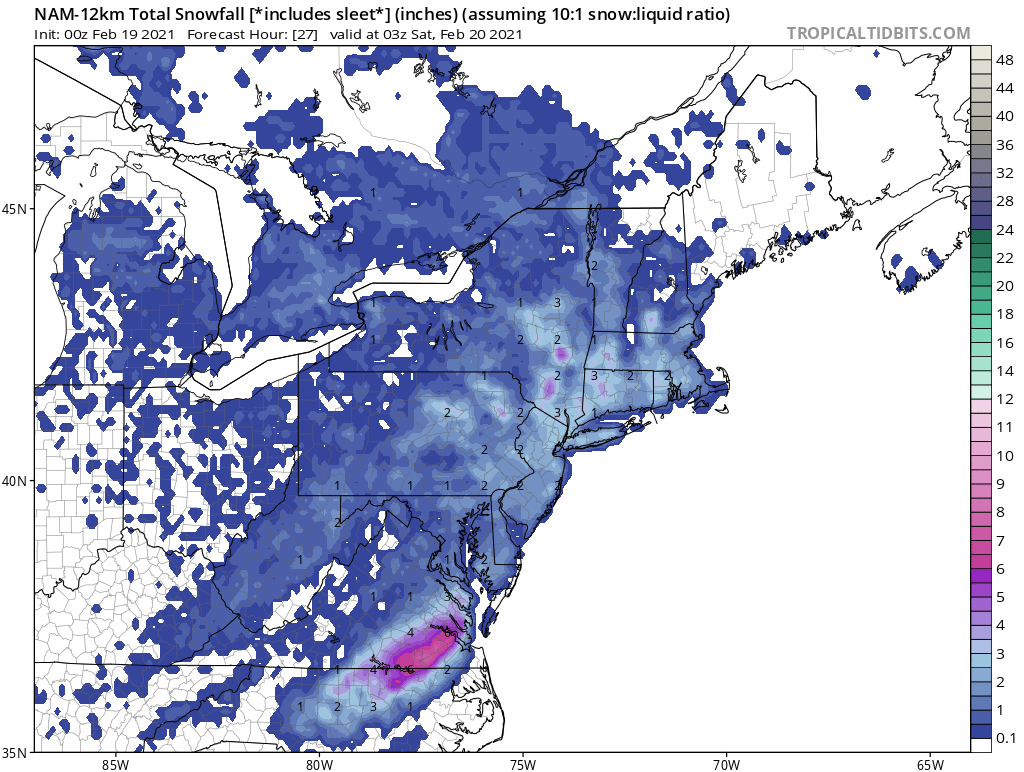
00z NAM says we snow until tomorrow night. Another 2-3 inches in spots, heavier burst around 8-10AM

-
2
-
-
2 minutes ago, weathermedic said:
Is the consensus on here that the NAM was the most correct model with this system?
It’s had an incredible year so far
-
-
HRDPS looks pretty
")
-
Interested to see what the euro does with the evolution based on some of the new trend ideas tonight
-
Any one have the UKIE?
-
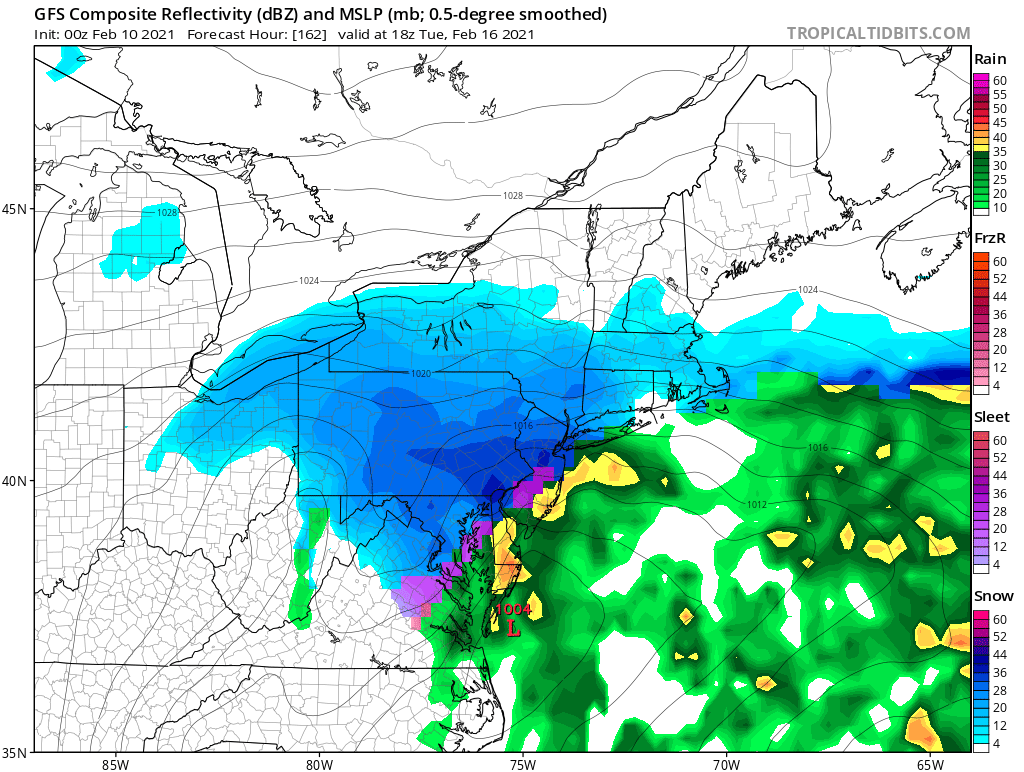
GFS storm a week from now

-
1
-
-
GFS looks odd and disorganized for Vday storm
-
-
7 inches here, see the sun popping out. Nice storm! Snow pack refreshed for sure
-
Weenie band that was just NW of I-95 has deteriorated. Curious to see now how far NW those heavy bands in south central jersey make
-
Did someone say the NAM was going away? If so, what’s replacing it? Know it can have its movement sometimes, but it definitely has its strengths at times and can give good signals
-
Nice snow band forming and pivoting over NE Jersey
June 2021
in New York City Metro
Posted
What’s the euro showing for next weekend? GFS is rainy, CMC isn’t showing much. Having an outdoor party, hoping this time we skip out on the rain