

Entry posted by Ellinwood ·
1,990 views
Just going to start off by saying that forecast confidence is lower than normal. Miller B type storm will form up late tomorrow into Friday and will initially cause mixing/temp issues across the more southern areas. As the coastal intensifies, banding on the back edge of the system could bring locally higher totals from central PA to NJ, NY and maybe even down into northeast MD and northern DE. There's plenty of risk in either direction, especially across central PA into NJ and NYC/LI.
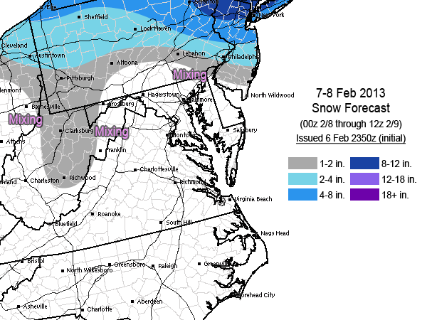
I didn't try too hard to figure out contouring based on strict temperature and boundary layer issue areas since there is not enough certainty to really go into that much detail yet. That's a job that is best saved for tomorrow's update.
0 Comments
Recommended Comments
There are no comments to display.
Create an account or sign in to comment
You need to be a member in order to leave a comment
Create an account
Sign up for a new account in our community. It's easy!
Register a new accountSign in
Already have an account? Sign in here.
Sign In Now