

rogue
-
Posts
95 -
Joined
-
Last visited
Content Type
Profiles
Blogs
Forums
American Weather
Media Demo
Store
Gallery
Posts posted by rogue
-
-
18 minutes ago, Double Action said:
Tampa has an Indian burial ground that protects us. I have heard that and I now fully believe it.
Guess that burial ground was on break in 1921 when Tampa had 150 mph winds in a cat 4 direct hit.
-
 2
2
-
-
14 minutes ago, TradeWinds said:
It just seems that SW shear is acting like a wall. That flow on water vapor seems to be like a wall. Might be reason for the NNW jog.

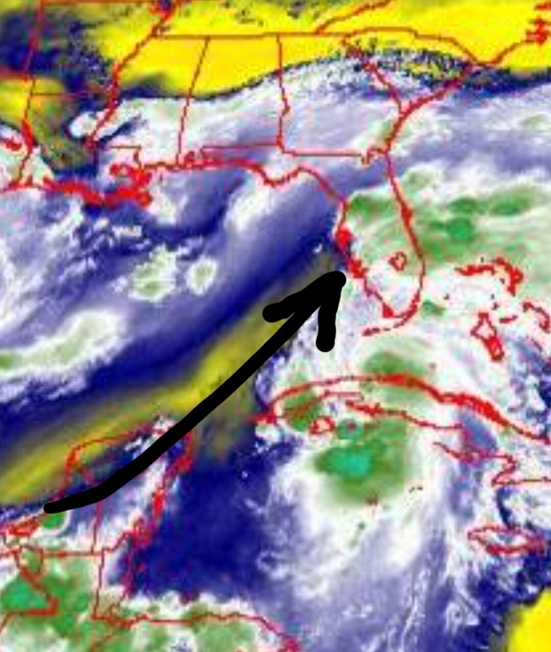
I think folks from Sarasota to Tampa may be in for a closer track than currently projected. The mesoscale models certainly seem to think so. May not make much difference as all the nasty weather is focused at or to the east of the center. However, the other item to note is how much intensification. I know the shear is there but all models show a window of deepening before weakening. The 12z Euro even suggested briefly to hurricane level. That window may hit Sarasota to Tampa which could mean a nastier storm in that corridor than currently forecast. Just saying.
-
18 minutes ago, TradeWinds said:
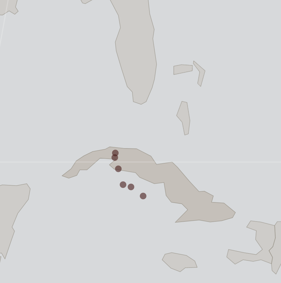
I plotted all estimated center locations by the NHC since 5 AM today. The movement certainly looks like it shifted from NW to NNW. I suspect they'll get better coordinates when the plane flies in but it will look odd to see any jump to the W. The trend favors the east cone track but time will tell.

Interestingly, looks like Elsa went through the gap between the two more mountainous areas to the west and east. Radar images, although easy to misinterpret as precip doesn't necessarily line up neatly with central pressure, does seem to suggest a more northward forward motion of Elsa than the NHC's 325 degrees NW report at 8:00 PM.
-
1
-
-
A slight nudge east on the 12z GFS run while the Canadian brings it onshore at Tampa. Will be interesting to see if the Euro nudges east a bit or not. Not a huge difference in track but 50 miles west/east with a storm skirting the FL coast makes for big impact differential.
-
12Z Euro finally catches on snd shows Elsa as a closed low making landfall around Sarasota and continuing north northeast toward north central FL. Elsa doesn't look very intense but 6"+ rains along and near the track.
Hurricane Ian
in Tropical Headquarters
Posted
Moved to Sarasota 5 years ago. Hate the trends today and tonight. Thought we were going to dodge a bullet again but this seems to have its eye on here.