
ThreeRedheads
-
Posts
1,815 -
Joined
Content Type
Profiles
Blogs
Forums
American Weather
Media Demo
Store
Gallery
Posts posted by ThreeRedheads
-
-
Blizzard Warning for Southern Delaware
Start
End
Friday, January 28, 7:00 PM EST
Saturday, January 29, 7:00 PM EST
Source: U.S. National Weather Service
...BLIZZARD WARNING IN EFFECT FROM 7 PM THIS EVENING TO 7 PM EST SATURDAY... *
WHAT...Blizzard conditions expected. Total snow accumulations of 8 to 13 inches. Winds gusting as high as 50 mph.
* WHERE...Inland Sussex. * WHEN...From 7 PM this evening to 7 PM EST Saturday. *
IMPACTS...Travel could be very difficult to impossible. Areas of blowing snow could significantly reduce visibility.
* ADDITIONAL DETAILS...Snow is expected to begin on Friday evening, with snow becoming heavy after midnight. The most likely time for blizzard conditions is late Friday night through midday Saturday. Blizzard conditions are primarily expected at or within a few miles from the Delaware Bay. Snow will wind down Saturday afternoon.
PRECAUTIONARY/PREPAREDNESS ACTIONS... Travel should be restricted to emergencies only. If you must travel, have a winter survival kit with you. If you get stranded, stay with your vehicle. The latest road conditions for the state you are calling from can be obtained by calling 5 1 1.
-
 3
3
-
-
I really thought that I would never see a snowstorm again when I moved to Southern Delaware. We'll see how this plays out.
Temp 33
Humidity 64
Pressure 30.15
-
8
-
-
Heavy sleet in Herndon.
26°. Not too many cars on the roads, via VDOT cameras. Looks like some ice buildup between lanes.
-
25/14
Bp at 30.32
-
3
-
-
4 minutes ago, Scuddz said:
Damn, I've missed this place...
Me, too. Feels like old times.
-
1
-
-
BWI: 3.7
DCA: 2.3
IAD: 4.2
RIC: .6
Tiebreaker: 1.32
-
Wish I didn't have to go to work in a few.
Western Fairfax County.
-
2
-
-
3" near Dulles. Already shoveled. Prettiest snow of the season.
-
1
-
-
Roads are now covered in Herndon. Thank goodness for liberal leave.
-
2
-
-
Western Fairfax. 30/27

-
6
-
-
32/22. -SN
-
Winter Storm Warning
URGENT - WINTER WEATHER MESSAGE
National Weather Service Baltimore MD/Washington DC
100 PM EST Sat Jan 12 2019

DCZ001-MDZ013-016-504-VAZ036>040-050>057-501-502-505-506-130200-
/O.EXT.KLWX.WS.W.0002.190112T2100Z-190113T2300Z/
District of Columbia-Prince Georges-Charles-
Central and Southeast Montgomery-Nelson-Albemarle-Greene-Madison-
Rappahannock-Orange-Culpeper-
Prince William/Manassas/Manassas Park-Fairfax-
Arlington/Falls Church/Alexandria-Stafford-Spotsylvania-
King George-Northern Fauquier-Southern Fauquier-Western Loudoun-
Eastern Loudoun-
100 PM EST Sat Jan 12 2019

...WINTER STORM WARNING NOW IN EFFECT FROM 4 PM THIS AFTERNOON TO
6 PM EST SUNDAY...

* WHAT...Significant snow expected. Total snow accumulations of
  5 to 10 inches expected.

* WHERE...Portions of northern and central Virginia as well as
  southern Maryland.

* WHEN...From 4 PM this afternoon to 6 PM EST Sunday.

* ADDITIONAL DETAILS...Travel could be very difficult due to
  snow covered and slippery roads.

PRECAUTIONARY/PREPAREDNESS ACTIONS...

A Winter Storm Warning for snow means severe winter weather
conditions will make travel very hazardous or impossible. If you
must travel, keep an extra flashlight, food and water in your
vehicle in case of an emergency.

When venturing outside, watch your first few steps taken on
steps, sidewalks, and driveways, which could be icy and slippery,
increasing your risk of a fall.

The latest road conditions for the state you are calling from can
be obtained by calling 5 1 1.

&&
-
5
-
-
34/20 Western Fairfax
-
We can use both areas of the site to gain more knowledge. The advantage to having our own thread is the fact that we're more familiar with each other and may feel more comfortable asking questions.
I have so many questions, I don't know where to start!
-
Thanks for the thread, Bob. There's A LOT I need to learn.
Trixie-great links! Can't say I understand it all, but it's a starting point.

-
Ellinwood posted this on his site a couple of weeks ago. It was helpful:
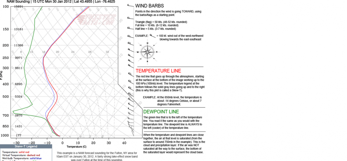
*green line is dewpoint. It was cut off on my screen cap of the legend.
-
Given where I am supposed to be tomorrow I would take a free day in a heartbeat
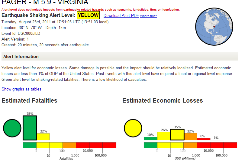
Post traumatic stress syndrome from the quake today?
-
drop ceiling at work so not too surprising. Maybe I will get tomorrow off if the my building is fooked
Unlikely, but nice try.

-
A nuclear power plant located in Louisa County, the epicenter of the earthquake in Virginia, has shut down.
The North Anna Power Station, operated by Dominion Power, has two reactors. The plant declared an "unusual event" in the wake of the 5.9 magnitude quake, which is the lowest stage on the plant's emergency scale.
As a result, the plant has been shut down.
-
My best friend was at the National Cathedral and apparently, there's some damage. When she went out to her car, a water pipe had burst and was spraying water all over. She's shaken up.
-
WHERE IS OEM when we need him?
-
-
Made my day!
-
I guess you're supposed to head outside during an earthquake...
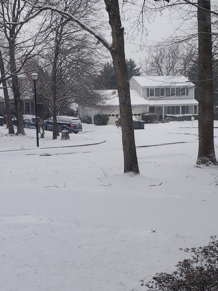
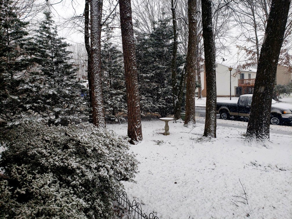
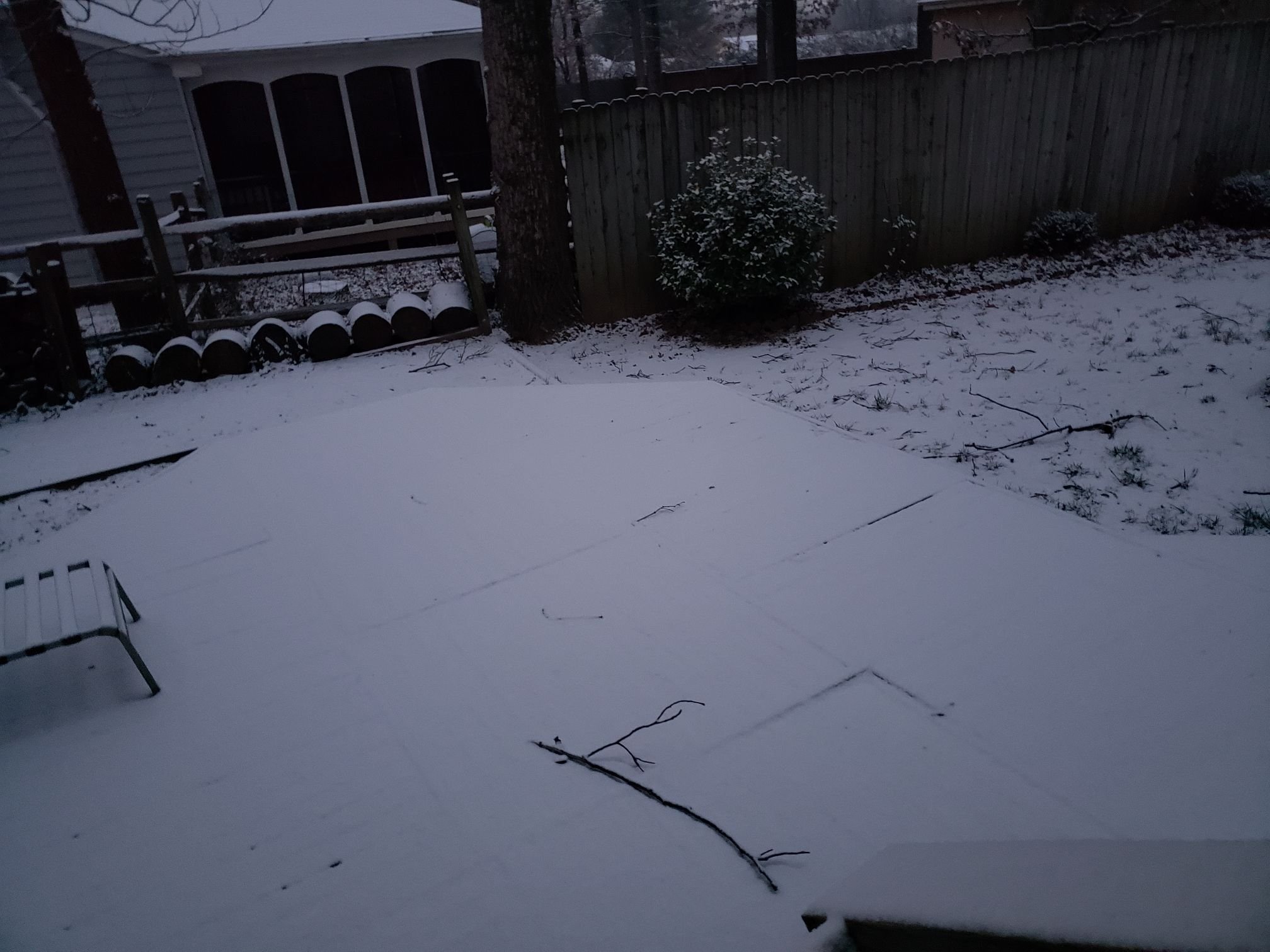
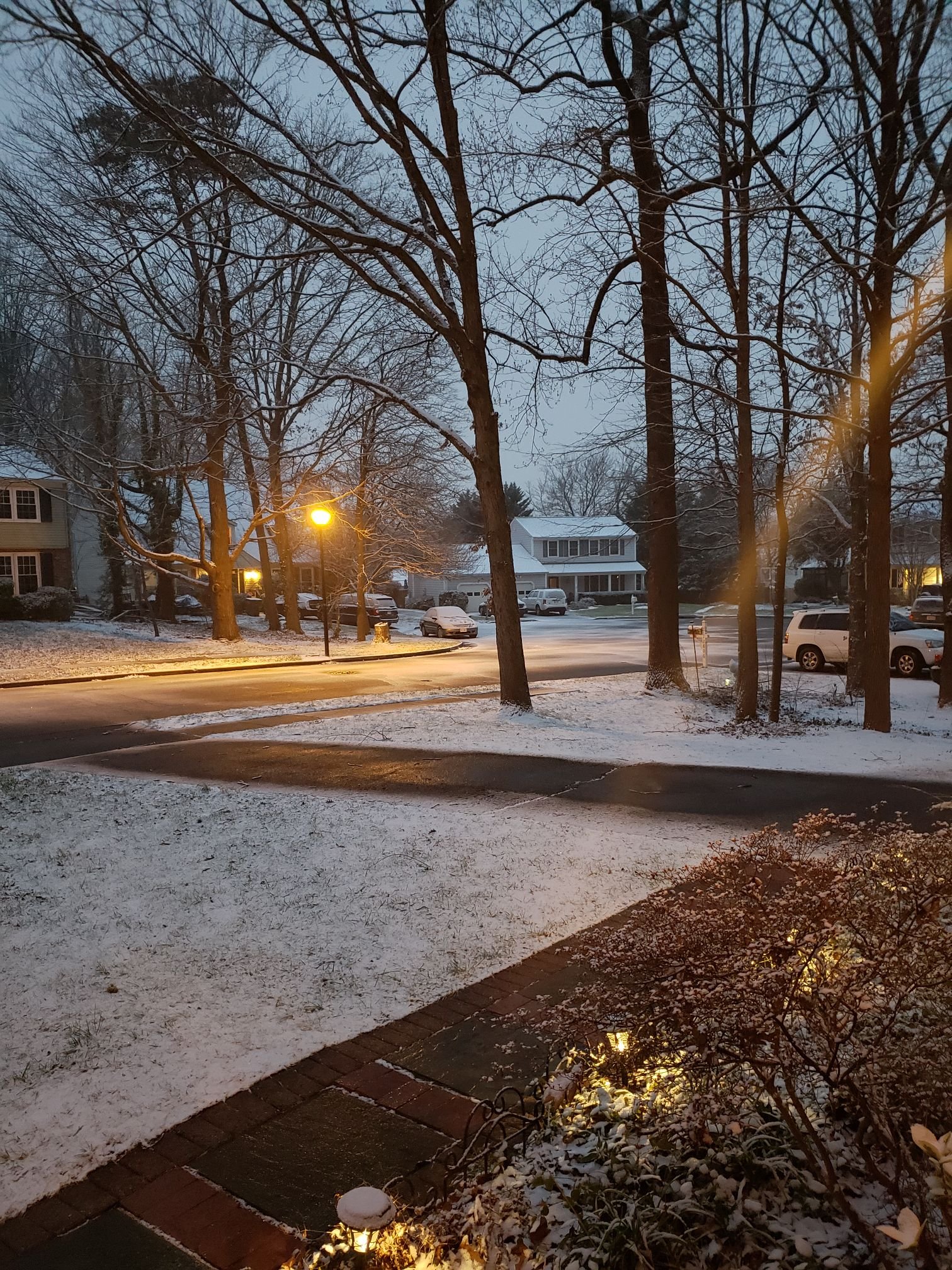
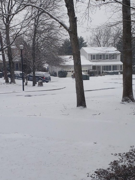
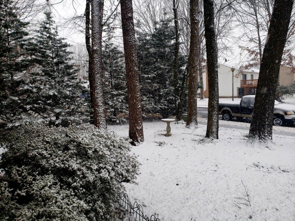
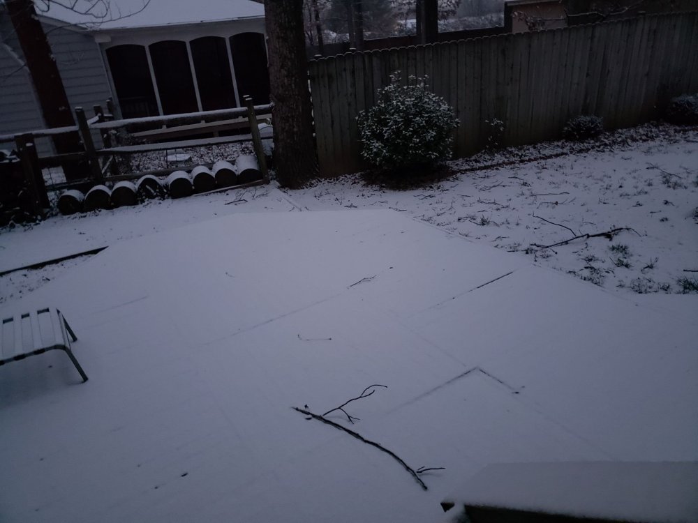
Winter 2021-2022 Photos Thread
in Mid Atlantic
Posted
From the 1/29/22 blizzard in Southern Delaware, about 12 miles from Rehoboth Beach.