

SnowMan
-
Posts
4,136 -
Joined
-
Last visited
Content Type
Profiles
Blogs
Forums
American Weather
Media Demo
Store
Gallery
Posts posted by SnowMan
-
-
Wonder how much snow melt we will see up in North Texas today before tomorrow's storm. Hopefully not too much, but with a high around 20 and the sun angle we could see more than expected.
-
Wow and NAM is more robust with the QPF...
-
4 minutes ago, vwgrrc said:
I'm more leaning towards NAM/HRRR at this range and for the type of event. But I'm not a professional by any mean.
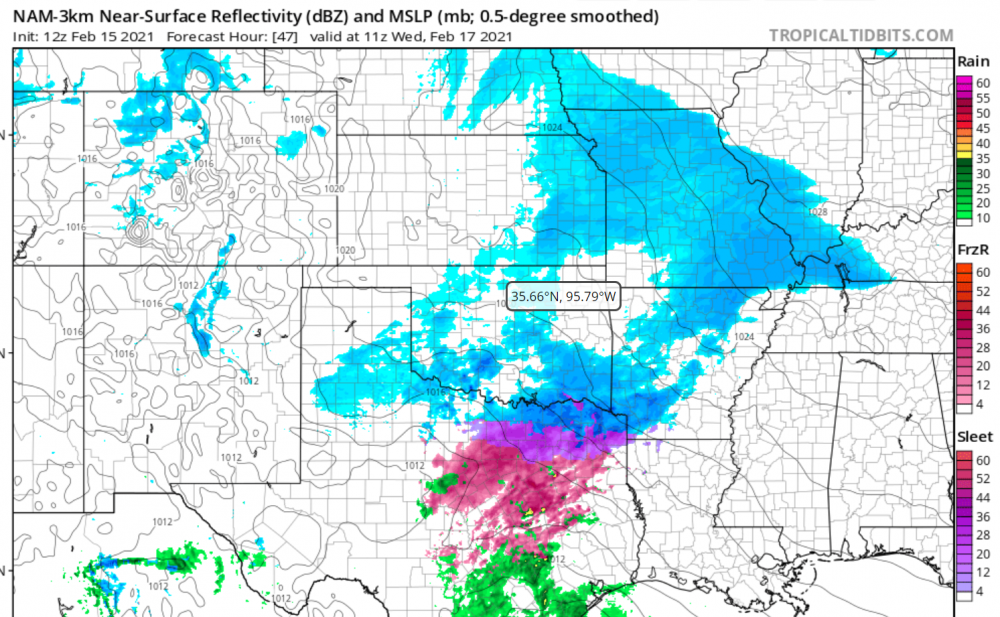
So we in the northwest corner of collin county. Looks like sleet/freezing rain.
-
Just now, vwgrrc said:
I mean there's a chance it could a more sleet/freezing rain even than purely snow. HRRR & NAM seem both indicating that.
Yeah I am pulling up the GFS...new at reading models, but doesn't seem like there is a ton of QPF with this. Although it does look it drops right over our house lol. We are located where the blue/purple is in north texas.
-
1 hour ago, vwgrrc said:
The Wednesday storm will probably give NTX some real power issue looks like

What do you mean exactly? What are you seeing?
-
21 minutes ago, aggiegeog said:
Starting to look like a DFW bullseye with heavy sleet and snow on Wed.
I’m in Celina. Hoping for a massive ice storm.
-
If this happens will it be overhead or will I have to find a clear spot with a good horizon view?
-
it was really little more than some whimpering.
Let's see how it plays out.
I know...just joking around / Im nervous on how it all plays out
-
Nice W. MA has moaned their way to the 24-36 range and meanwhile I get subsidence and only 18 inches
-
Some models don't even turn us over to rain.
You're gonna rain a little...
-
Agreed. And actually it reality is a little further west I am pumped...nice banding
-
Still a little disconcerting to see model differences like this. I think Kev-Will_ray still get into the def band for a time.
Does it make its way up here?
Do you envision it more of a N/S orientation or SW to NE?
-
Hopefully the ratios are good up here so the totals can be inflated lol
-
Probably between 1.75-2.00"
Thx...looks good for 20-24...
-
Any maps that can be posted? I don't have access and would like to see how this area looks
-
Everyone croaked.
Details?
-
Euro goes neg tilt faster, and closes off sooner . NYC destruction *per NYC PBP
What does it mean for our area though?
-
RPM has dropped me in the last 12hrs from 20" to 8"... I think it's on crack !!
You/We will be fine...22-25 inches
-
The euro probably caves a bit too.........but we've said that before and it ends up coming in more westward. lol
I think you look good. I'd rather be in interior Rockingham though.
Thanks. Yeah it's gonna be close...just hope I am on the right side of things lol
-
deform band will be further west. You will be in the good stuff regardless.How does the north shore look for the deform band?
-
Some of these shifts east could be convective feedback right?
-
When does Cory P's flight leave Ft laudy (Snowman) or did it already
I think he said he landed...
-
Thing of beauty...I like that positioning
-
Sref plume mean of 30 inches for here


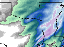
Texas Winter 2021
in Central/Western States
Posted
Yep - up here in Celina - I am looking at 4-6 and hoping for 8 lol