

El Kabong
-
Posts
97 -
Joined
-
Last visited
Content Type
Profiles
Blogs
Forums
American Weather
Media Demo
Store
Gallery
Posts posted by El Kabong
-
-
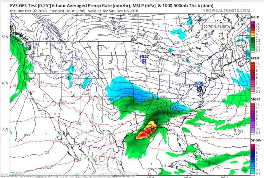
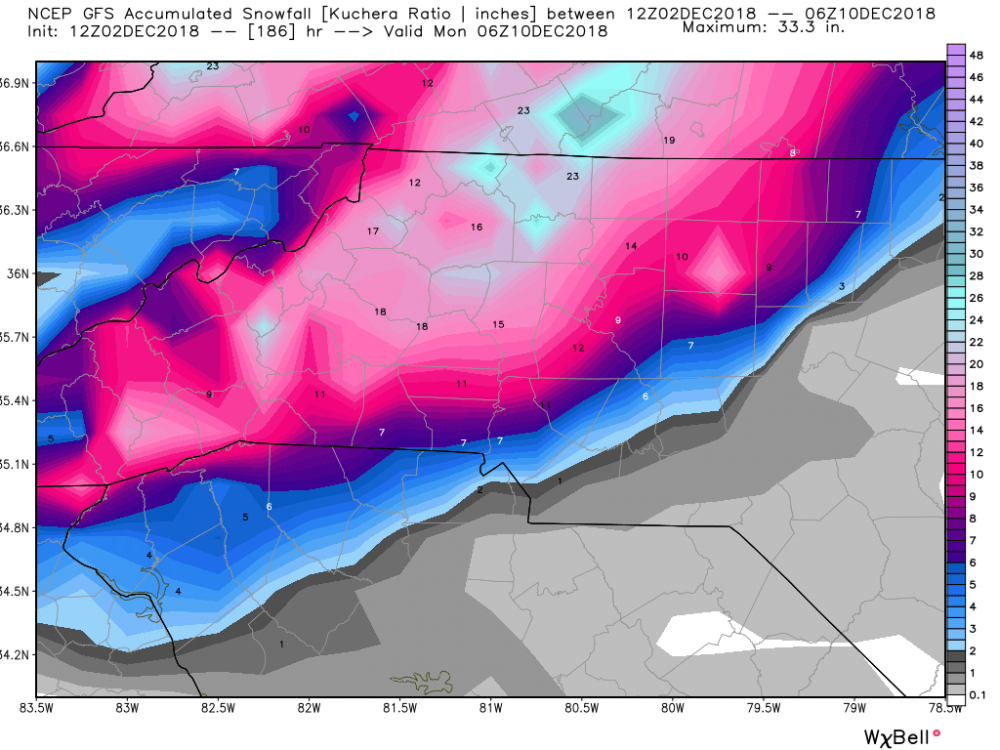
This may have already been posted, but quite an amazing job on the FV3 from 8 days out (at least for the deep south and southern apps portion of the map). This was the first forecast map that was posted in this thread back on 12/2. The 12Z GFS wasn't too far off either for its initial depiction for Sunday. The 12Z GFS snowfall map from that same day shows that the models were already zeroing in on on far NE Georgia, the upstate of SC, and central and western NC as the bullseye for winter weather. Those areas remained remarkably consistent as ground zero throughout the evolution of the storm. We'll see if the models show the same consistency when the next threat materializes, but it's encouraging to see the south's first winter storm of the season handled well by most of the major models. I'll leave it to the professional mets and seasoned amateurs to grade the overall performance of each model, but the "new" GFS appears to have received more than a passing grade (is a B+ too high?).
.png.d694ecd2054dd0eb05d5ec48e3d39dce.png)
-
 2
2
-
Mid to Long Term Discussion 2019
in Southeastern States
Posted
Finally, the CR index update complete with graphic enhancements. I've missed these as well! At least it can bring a laugh or two for what has been a less than joyful winter for snow lovers. Keep the index fun coming, CR!