

Shane
-
Posts
41 -
Joined
-
Last visited
Content Type
Profiles
Blogs
Forums
American Weather
Media Demo
Store
Gallery
Posts posted by Shane
-
-
The convection from gulf fetch on the Texas coast looks to be happening now on WV and radar. Earlier and more than modeled
Looks juicy
-
 1
1
-
-
You need a good mix for sledding
Layer of sleet, then snow with sleet mixed, and then heavy snow with a nice sleet crust. Pack that down and break out the Flexible Flyer
-
1
-
 1
1
-
-
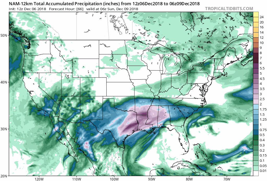
Look at this on the NAM 12k 18z
Looks like the precip changed uniformly for everywhere all at once, not just our storm. That's wonky. Like it's whole resolution changed

-
9 minutes ago, magpiemaniac said:
I’ve been wondering. If you were to piece together the various call maps from adjacent NWS field offices, would the accumulation projections along their border counties match up fairly well? Has anyone ever seen a 10” call for one county and then 2” in a neighboring county forecasted by another NWS office?
Blacksburg NWS has good discussion text
.SHORT TERM /FRIDAY NIGHT THROUGH SUNDAY NIGHT/...
As of 300 PM EST Thursday...

Cold high pressure will continue to move east across the Ohio
Valley to the Mid Atlantic region Saturday evening. Overnight
Saturday into Sunday morning, cold dry air will wedge south into
the Carolinas and southern Appalachian Mountains. Meanwhile
across the south, an upper level low over the Mid West will push
a surface low east across the Gulf States. Bulk of Gulf and
Atlantic moisture with the surface low will stay south of the
area through Saturday evening. Snow will edge northward Saturday
night, starting across the High Country of North Carolina then
spreading across the entire area Sunday morning.

Sunday morning the upper level low tracks over Tennessee and
Kentucky increasing moisture transport over the wedge. The
combination of upslope flow, strong warm air advection and
isentropic lift will bring moderate to heavy snow to areas along
and south of highway 460. With an easterly flow, the higher
accumulations will be across counties along and adjacent to the
Blue Ridge. Going into the afternoon, the surface low tracks off
the Southeast Coast, taking majority of the moisture and lift
with it. However, the area will sit in the deformation zone
between the surface low and upper level trough into Monday
morning. Even though snowfall rates will decrease Sunday night,
persistent light snow will continue to fall into Monday morning.
There is a possibility snow will continue through the day
Monday as the deformation zones hangs over the area, waiting on
a stronger upper level low over the northern Plains to kick
everything to the east on Tuesday.

Before we get to the first guess storm totals, there are
several questions yet to be answered with this event. At the top
of the list is the track of the surface low. A wobble north or
south will dramatically change amounts. Second, is the effect of
the dry air with the wedge. Does this dry air hold off
precipitation or does it contribute to higher totals early due
to fluffiness. Late in the event, snow is expected to be wetter
and heavier, compressing the drier fluffy snow already on the
ground. With all that said, our first guess totals through
Sunday night will range from 12-18 inches across the North
Carolina High Country and Grayson Highlands to 5-10 inches
across the Mountain Empire, New River and Roanoke Valleys to
Southside Virginia. North of highway 460, 2 to 6 inches are
possible. Again these are first guess estimates on a storm that
is 2-3 days away.

Temperatures will drop into the 20s Friday and may warm into
the upper 30s to lower 40s Saturday. Temperatures will again
drop into the 20s Saturday night, but may not get above freezing
Sunday. Clouds and possibly snow will hang around Monday with
temperatures warming above freezing but not making it out of the
30s.
-
Inverted banana high shield still firmly in place on Nam at 81
-
How are the bands going to be oriented during the track of this ?
-
2 minutes ago, SLAMSTORM22 said:
New to the forum... Is GSO Greensboro?
yes
-
6 minutes ago, sarcean said:
Think you might be under estimating the Triad (Greensboro/Winston Salem). I wouldn't group it in the same as Raleigh.
But we will see!
Agree on Greensboro. They tend to get a similar to the SVA Counties to their north. Greensboro is 500' higher than Raleigh after the plain ends around Hillsborough. I would place my boundaries around that elevation change
-
1
-
-
Still amazed at the overall model agreement. Usually by this time Nam is Nope, GFS is maybe next week and Euro says buy a snow blower and everyone is picking shirts or skins to see who caves. All we're seeing is oscillations and noise with almost universal agreement that there's going to be a storm, where it's going to be, and when it's going to happen. It's like yeah, you're pregnant, do you want to know the sex? The reveal party is Saturday night.
-
2
-
-
Since we're in Storm Mode, can posters be more specific about what geography they are referring to when making observations? It's a big storm. "The foothills and mountains" can be anywhere from NE Georgia to Northern Virginia. On some devices, your avatars are not visible, so it's hard to decipher where you're from and where you're talking about. Also, some are more interested in a meta view of the whole event, not just what's happening in your town.
Kthxbai
-
5
-
-
So how many models are in basic agreement now?
-
2 minutes ago, BIG FROSTY said:
Yup, seen it too many times!! I’m right smack in it also.
Sent from my iPad using TapatalkThat's why I'm rooting for the slider with some English on it versus the miller B hybrid. Boo coastal low transfer
-
1
-
-
21 minutes ago, Pilotwx said:
I'M with ya as well I call it, Mountain Shadow effect.
That hole from MT Airy to GSO up to Roanoke seems to set up when a low transfers to the coast
-
1
-
-
29 minutes ago, FallsLake said:
Yep, this is our hobby. It's like playing a board game where you roll the dice every 6 hours.
It's almost just as fun to get virtual snow(or a bust) every 6-12 hours, and there's no shoveling.
-
1
-
 1
1
-
-
The new FV3 snowmap shows a hole developing in South central VA north of GSO. This usually happens when there is a transfer to a coastal low and the initial low "skips over" during transfer. The topography of the blue ridge often marks the western edge of the hole which tends to be triangular from MT. Airy >Roanoke>GSO>. I don't see a transfer to a new low, but the feature on the ground is appearing
-
What was Floyd when it dumped 25" of rain?
December 8-10, 2018 Winter Storm
in Southeastern States
Posted
will the timing of the LP slowdown versus the NS affect suppression?