
MDsnowPRO
-
Posts
179 -
Joined
-
Last visited
Content Type
Profiles
Blogs
Forums
American Weather
Media Demo
Store
Gallery
Posts posted by MDsnowPRO
-
-
8 minutes ago, pazzo83 said:
you actually haven't stated what you think about all this. Do you think it's a good idea to hobble NOAA and NWS with indiscriminate firings? Or are you just going to be a coward and lob attacks at other posters?
Does reducing the noaa work force by 9% equal hobbling?
-
 1
1
-
-
5 minutes ago, goldman75 said:
Myrtle beach just got bumped up from 2-4inches to 4-6. Sleet stayed off shore better than expected
Weather channel has Myrtle beach at 8-12”. For what it’s worth.
-
 2
2
-
-
5 minutes ago, MD13 said:
I think they were well modeled. Still probably in for 3-4 inches but I also haven’t looked at models/thermals recently
With the current 5-8” forecast I figured the sleet wouldn’t last this long. But you’re probably right with 3-4”
-
8 minutes ago, MD13 said:
Still no snow here on JZI/SB but the sleet is crazy
Feel like these heavy sleet bans will really cut down on our snow totals on the islands.
-
7 minutes ago, MD13 said:
Can confirm very heavy sleet, had to turn up our tv volume
Hopefully we get the change over soon. The moisture over us currently is pretty juicy.
-
19 minutes ago, TSG said:
Any CHS posters in here? Looks like yall are getting sleet-bombed right now based on radar
On John’s island outside Charleston. It’s mixed sleet and snow. Pinging off of everything and my deck is covered with mostly sleet.
-
4
-
-
Flurries on I-20 between Atlanta and Athens Ga.
-
 1
1
-
-
10 minutes ago, HKY_WX said:
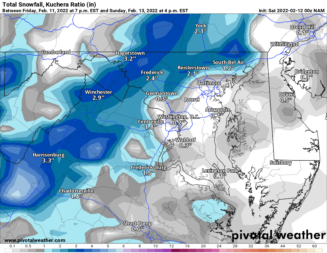
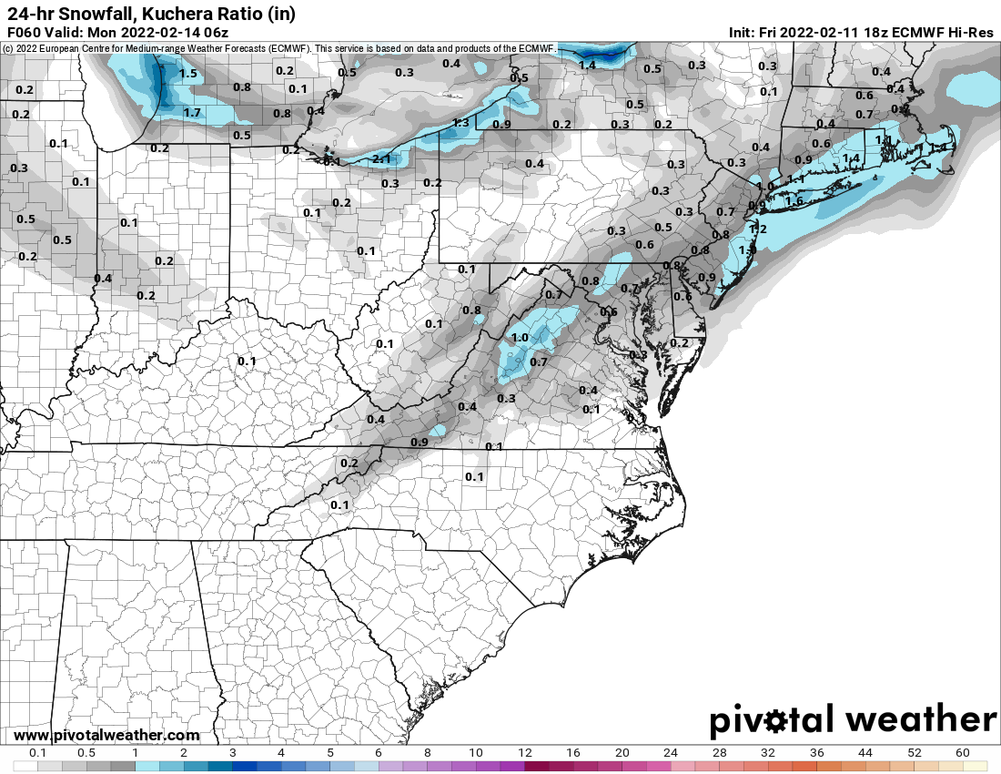
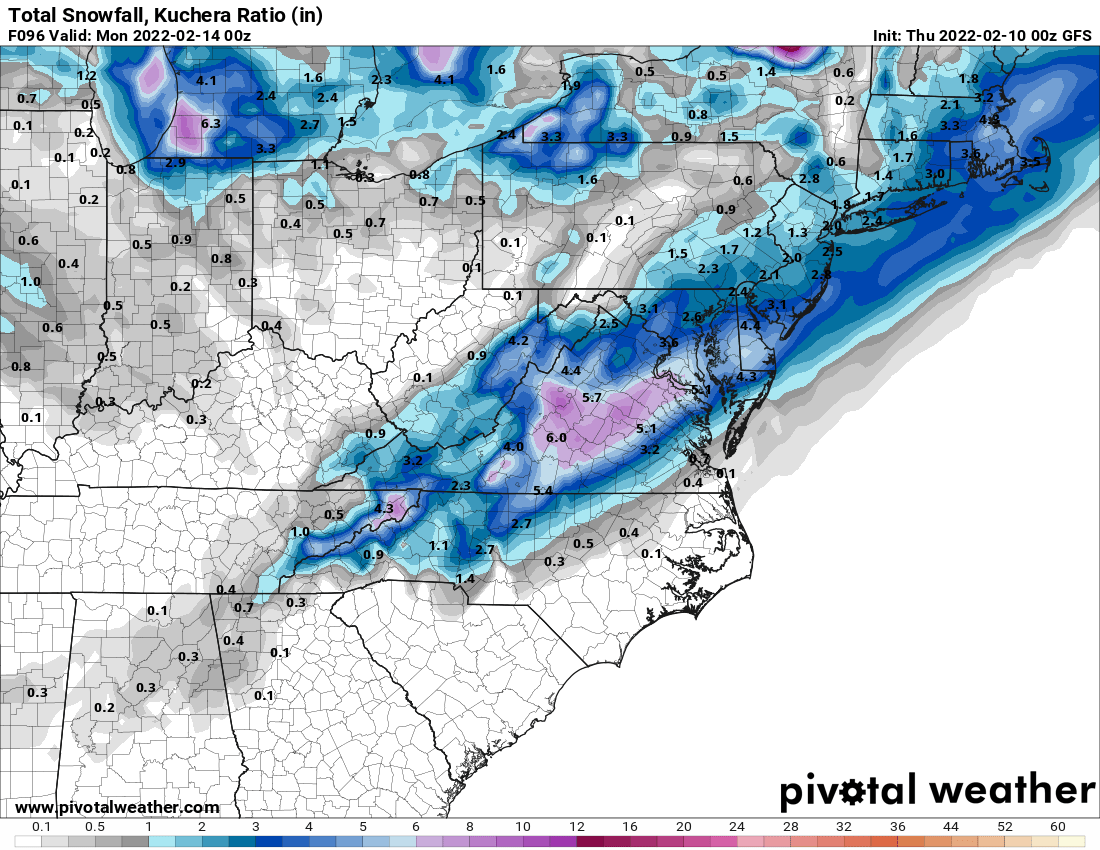
Following up with a totals map. I think we'll continue to see a slow trend NW with the totals up until gametime. The gfs/rgem have consistently oversheared STJ waves this winter resulting in a consistent trend NW over the 36 to 48 hours leading up to the event. Again i wouldn't consider this a dramatic development/trend given the last few days of model runs showing consistent opportunities for this overrunning system. Timing will be important tomorrow in NC as temperatures will be below freezing and anything that falls will start to impact the evening commute immediately.
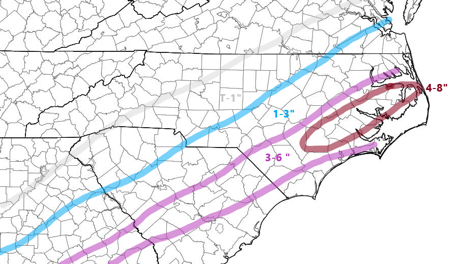
Did you forget to label the coast?
-
26 minutes ago, BooneWX said:
Radar returns are lighting up in TX, LA and even up to Oklahoma and Arkansas. The significance? Not a single model is close to showing what’s currently happening in real time.
I left Kansas/Oklahoma boarder returning from a trip around 3pm est. What was forecasted as a coating and light snow was in reality moderate snow and 1.5-2” when I left. The roads hadn’t been treated and were a nightmare of wrecks. Caught the DOT off gaurd for sure and was over performing.
-
3
-
-
11 minutes ago, StantonParkHoya said:
Can we take a minute and talk about the inland situation for GA/SC and northward? Pretty good rains forecast.
Not just inland. The GA/SC coast looks to get hammered with rain.
-
5 minutes ago, pazzo83 said:
why are we posting 500+ snow maps?
That’s his thing.
-
3 minutes ago, jayyy said:
He is lol
I guess he just jackpotted, as did you lol

-
1
-
 1
1
-
-
3 minutes ago, clskinsfan said:

Don’t get too excited unless your north and west
-
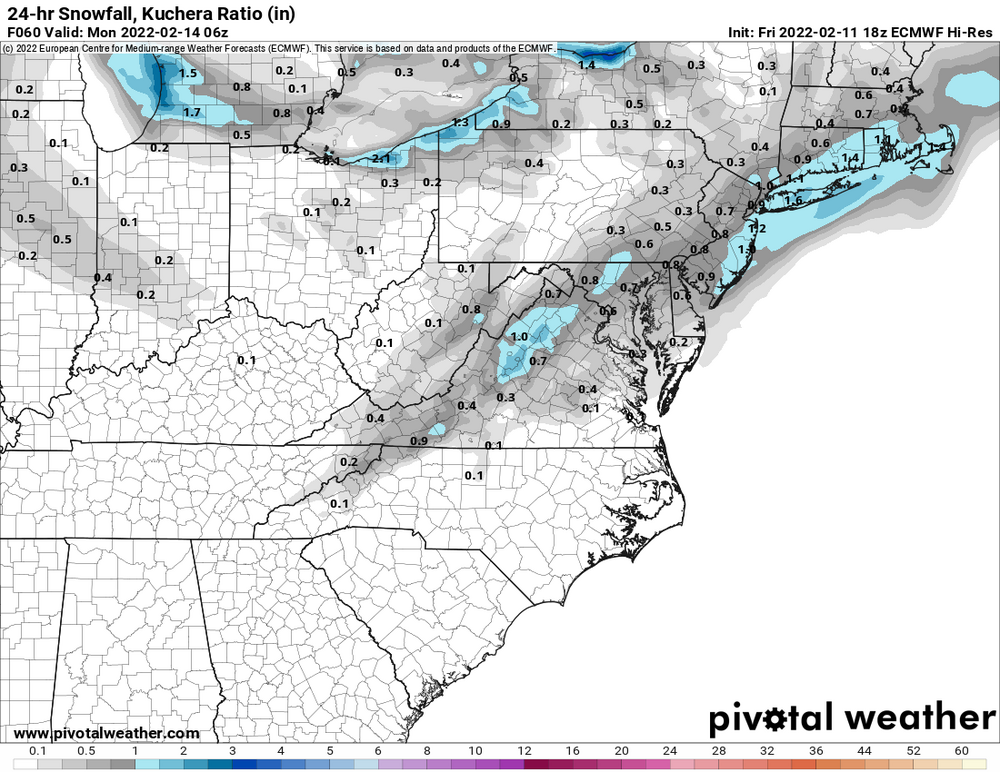
not what we were looking for from the Euro-
 4
4
-
-
-
Just now, jayyy said:
Thread, dare I say?

-
4 minutes ago, 87storms said:
sounds like i need to start preparing for allergy season
Do you have a allergy season routine ?
-
6 minutes ago, stormtracker said:
I haven't even looked at it, but
THE ICON SUCKS
Cold rain. Maybe a backside slush flake north west of 95
-
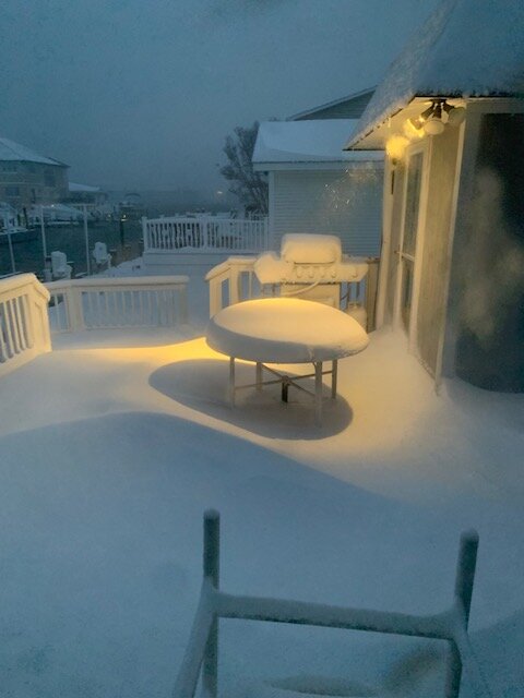
112th street bay side OC-
10
-
-
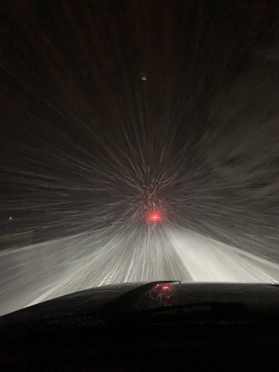
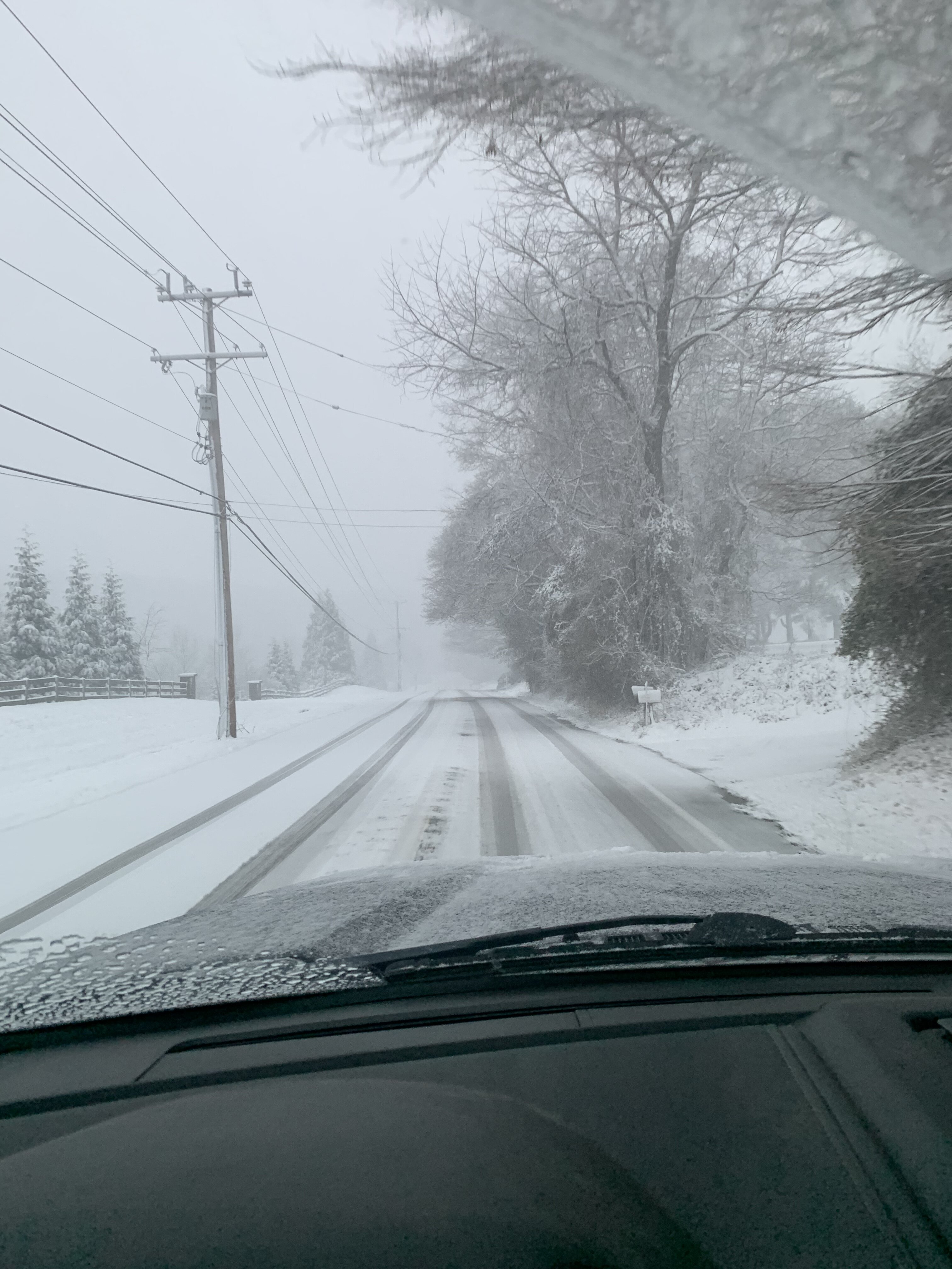
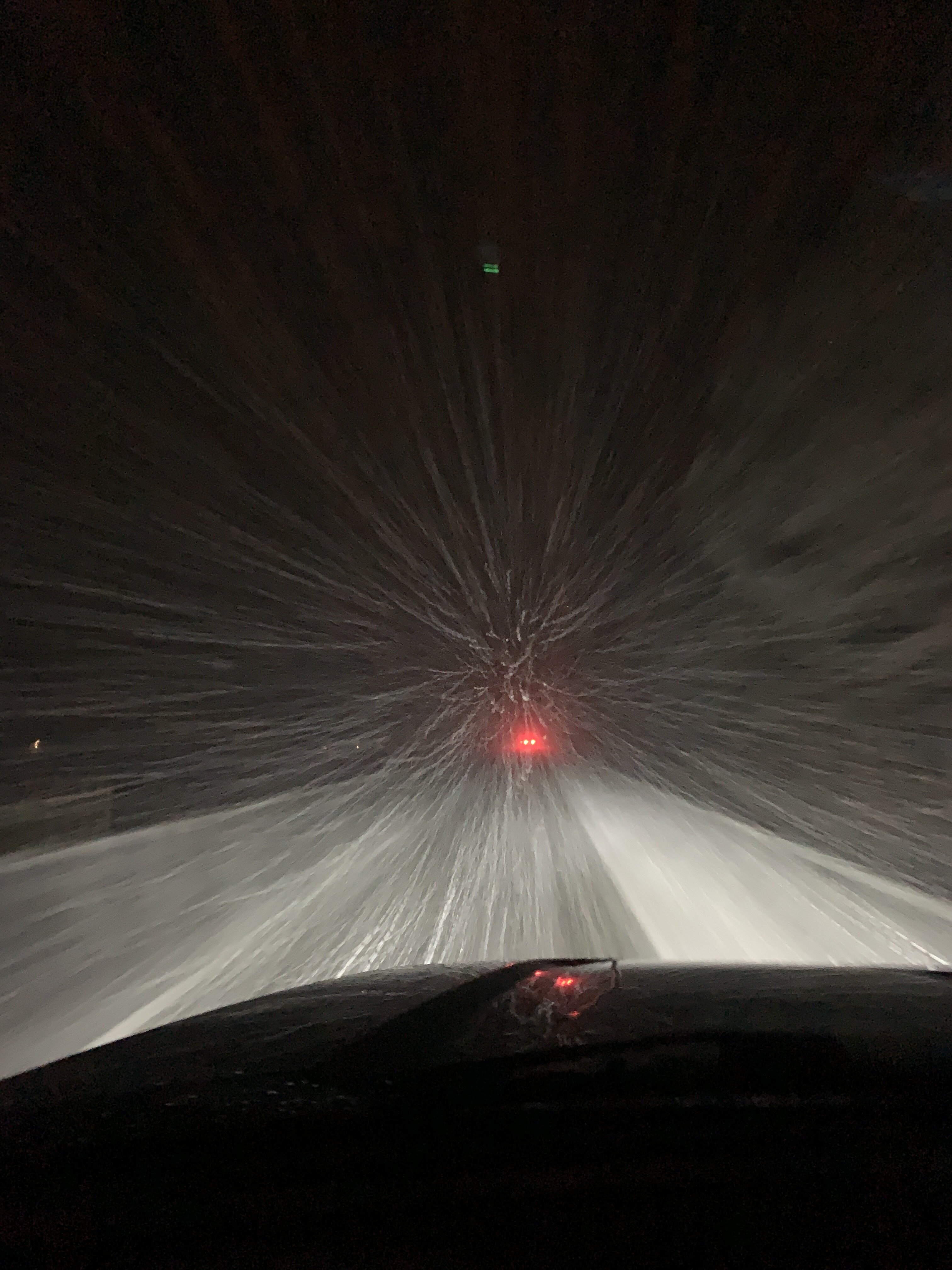
driving through the death band is an adventure. 50 east Trappe, Md
-
20
-
-
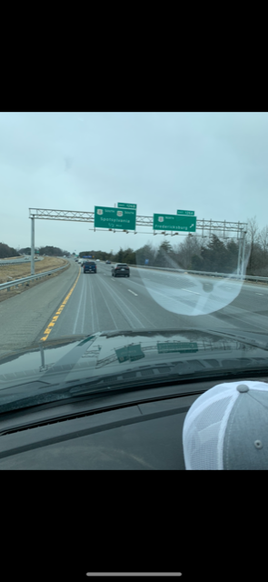
Can safely say this is the first time in my life I cab blame route 50 beach traffic on a plow train.
-
1
-
-
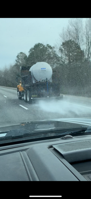
Brine+ 44 degrees Fredericksburg
-
1
-
1
-
-
6 minutes ago, RIC_WX said:
Maybe they got the memo from VDOT Fredericksburg residency?
Funny part about it is there was more brine in NC/SC than southern VA. Jarrett, Va hasn’t been touched.
-
Currently driving on 95 north. Left Charleston, Sc at 7:30. The amount of brine they are applying to the highway in South Carolina is unbelievable. It’s 50 degrees.
-
5
-

February Banter 2025
in Mid Atlantic
Posted
I have lost a job for no reason before. I think a lot of people have. It’s why I decided to become self employed and not be reliant on someone else. I have a lot of sympathy for those who lost their jobs. I’m not on board with it or in favor of it, but I don’t consider it a crippling blow to the organization. I will say, there are a ton of government employees that have worked and abused the system, I’m related to them, I’ve witnessed it. Some of these repercussions in other organizations is due to rampant abuse. Not saying that’s the case with NOAA or NWS, but it’s the case with other organizations.