hypatia
-
Posts
435 -
Joined
-
Last visited
Content Type
Profiles
Blogs
Forums
American Weather
Media Demo
Store
Gallery
Posts posted by hypatia
-
-
Report of damage near Painter Rd. Not far from my folks, but as CoastalWx said it's probably a small area of interest.
-
41 minutes ago, CoastalWx said:
Ryan sent me a thread with what appeared to be a TDS in Middlebury VT.
https://twitter.com/ScottDimmich/status/1375516325611630593
My folks who live in Middlebury near downtown said they had thunder, rain, and wind but no trees down. I was in class so I wasn't watching the radar live, so I don't know where the TDS passed relative to their location, but they said their experience was not particularly intense (no trees down, no damage).
It was boring here in Plattsburgh, but I was well north of the interesting stuff.
-
 1
1
-
-
A few friends of mine had tree damage in Sharon, CT as well.
From Amenia Union Rd:
From Kent, CT:


-
3
-
-
Event summary is out for yesterday's tornadoes.
Public Information Statement
National Weather Service Albany NY
644 PM EDT Mon Aug 3 2020

...NWS DAMAGE SURVEY FOR 08/2/20 TORNADO EVENTS...

.Litchfield County #1...

Start Location...Sharon in Litchfield County, CT
End Location...Sharon in Litchfield County, CT
Date...August 2, 2020
Estimated Time...5:36 PM EDT
Maximum EF-Scale Rating...EF0
Estimated Maximum Wind Speed...80 mph
Maximum Path Width...30 yards
Path Length...0.25 mile
Beginning Lat/Lon...41.86/-73.50
Ending Lat/Lon...41.87/-73.50
* Fatalities...0
* Injuries...0

...Summary...
The National Weather Service storm survey team confirms an EF0
tornado in Sharon, CT. The tornado struck a nursery along the New
York/Connecticut border. Large trees were uprooted. The metal
infrastructure of greenhouses was destroyed. Eyewitnesses reported
garden supplies rotating in the air above the nursery. Down the
road from the nursery, additional uprooted trees were observed.

.Litchfield #2...

Start Location...Falls Village in Litchfield County, CT
End Location...Falls Village in Litchfield County, CT
Date...August 2, 2020
Estimated Time...6:05 pm EDT to 6:10 PM EDT
Maximum EF-Scale Rating...EF1
Estimated Maximum Wind Speed...90 mph
Maximum Path Width...100 yards
Path Length...1.7 miles
Beginning Lat/Lon...41.93/-73.37
Ending Lat/Lon...41.94/-73.34
* Fatalities...0
* Injuries...0

...Summary...
The National Weather Service storm survey team confirms an EF1
tornado in Falls Village, CT. The survey team observed many
snapped and uprooted trees along Lime Rock Station Road near River
Road. Additional downed trees were noted along the path of the
tornado.

EF Scale: The Enhanced Fujita Scale classifies tornadoes into the
following categories:

EF0...Weak......65 to 85 mph
EF1...Weak......86 to 110 mph
EF2...Strong....111 to 135 mph
EF3...Strong....136 to 165 mph
EF4...Violent...166 to 200 mph
EF5...Violent...>200 mph

* The information in this statement is preliminary and subject to
change pending final review of the events and publication in NWS
Storm Data.

$$

OKeefe
-
 1
1
-
-
Another great video of the wall cloud from Depot Hill Rd. Amenia, NY. Lots of detailed cloud motion.
-
Drone video of damage at Paley's Farm Market on the Sharon/Amenia border.
I feel so bad for them. I used to go there for garden supplies ever since I was a kid.-
1
-
-
12 minutes ago, OceanStWx said:
Someone tried to pass that off on BOX when they just hired someone who worked that tornado in Virginia. Oops.
Yep. I thought it was legit until I read the comments under the video.

This one from Tolland, MA seems plausible:
-
1
-
-
Tornado video in Blandford, MA!

Edit: might not have been taken today, but re-uploaded by someone claiming that it was.
-
Damage to greenhouses at Paley's Farm Market in Amenia, NY, right on the border of Sharon, CT:
Beautiful photograph of wall cloud near Amenia, taken by the same photographer:
Drone video, too:
-
1
-
-
1 minute ago, Buffalo Bumble said:
Wow, don’t remember ever seeing a tornado warning issued for that area of the ADKs. Back country campers take cover!
Yes... the radial velocity scan was pretty impressive too not long ago.
-
2
-
-
Tree damage in Falls Village, CT just south of my old high school (Housatonic Valley Regional High School)
-
2
-
-
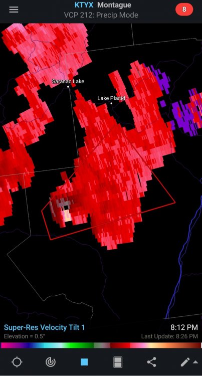
Tornado warning for Franklin/Essex counties in upstate NY.
QuoteBULLETIN - EAS ACTIVATION REQUESTED
Tornado Warning National Weather Service Burlington VT
742 PM EDT Sun Aug 2 2020
The National Weather Service in Burlington has issued a * Tornado Warning for... Southeastern Franklin County in northern New York... Southwestern Essex County in northern New York... * Until 815 PM EDT. *
At 742 PM EDT, a severe thunderstorm capable of producing a tornado was located 8 miles west of Newcomb, moving northeast at 30 mph.
HAZARD...Tornado.
SOURCE...Radar indicated rotation.
IMPACT...Flying debris will be dangerous to those caught without shelter. Mobile homes will be damaged or destroyed. Damage to roofs, windows, and vehicles will occur. Tree damage is likely.
* This dangerous storm will be near... Newcomb around 800 PM EDT.
Other locations impacted by this tornadic thunderstorm include Vanderwhacker Mountain and Tahawus.
PRECAUTIONARY/PREPAREDNESS ACTIONS... TAKE COVER NOW! Move to a basement or an interior room on the lowest floor of a sturdy building. Avoid windows. If you are outdoors, in a mobile home, or in a vehicle, move to the closest substantial shelter and protect yourself from flying debris.
-
From Ryan Hanrahan's Facebook page:
-
1
-
-
Here's another video shot near White Hollow Rd. and Lime Rock Park (near the border of Sharon and Falls Village, CT). It's shot through a window screen, unfortunately.
-
This one convinces me. Sharon, CT (my hometown).
-
5
-
3
-
-
1 minute ago, powderfreak said:
Sean gets very excited, ha, but he knows his stuff too from Lyndon State Meteorology.
Wonder what he’s doing out there, he worked as a lift operator at Stowe last winter, good kid.
I don't know him personally... I will say that he did a good job of targeting a promising cell to chase and dealing with challenging terrain/roads to get a decent view.
But I chuckled when he screamed "monster wedge on the ground!!!! Debris in the air!!!" at what was, at best, a wall cloud.

-
1
-
 1
1
-
-
I found a live feed of a guy who claims to have seen a tornado near Amenia, NY... he also sounds young and overly excitable, so take it with a grain of salt. He does have a decent view of the storm, though.
-
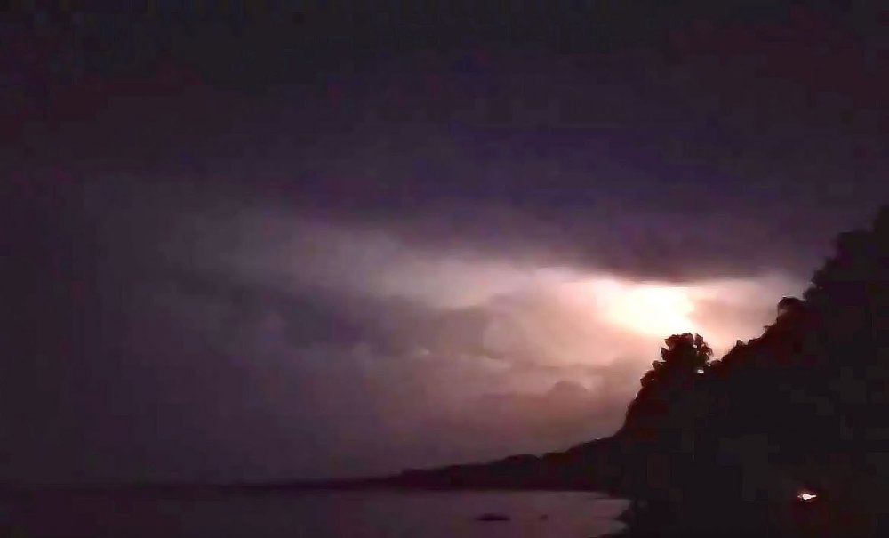
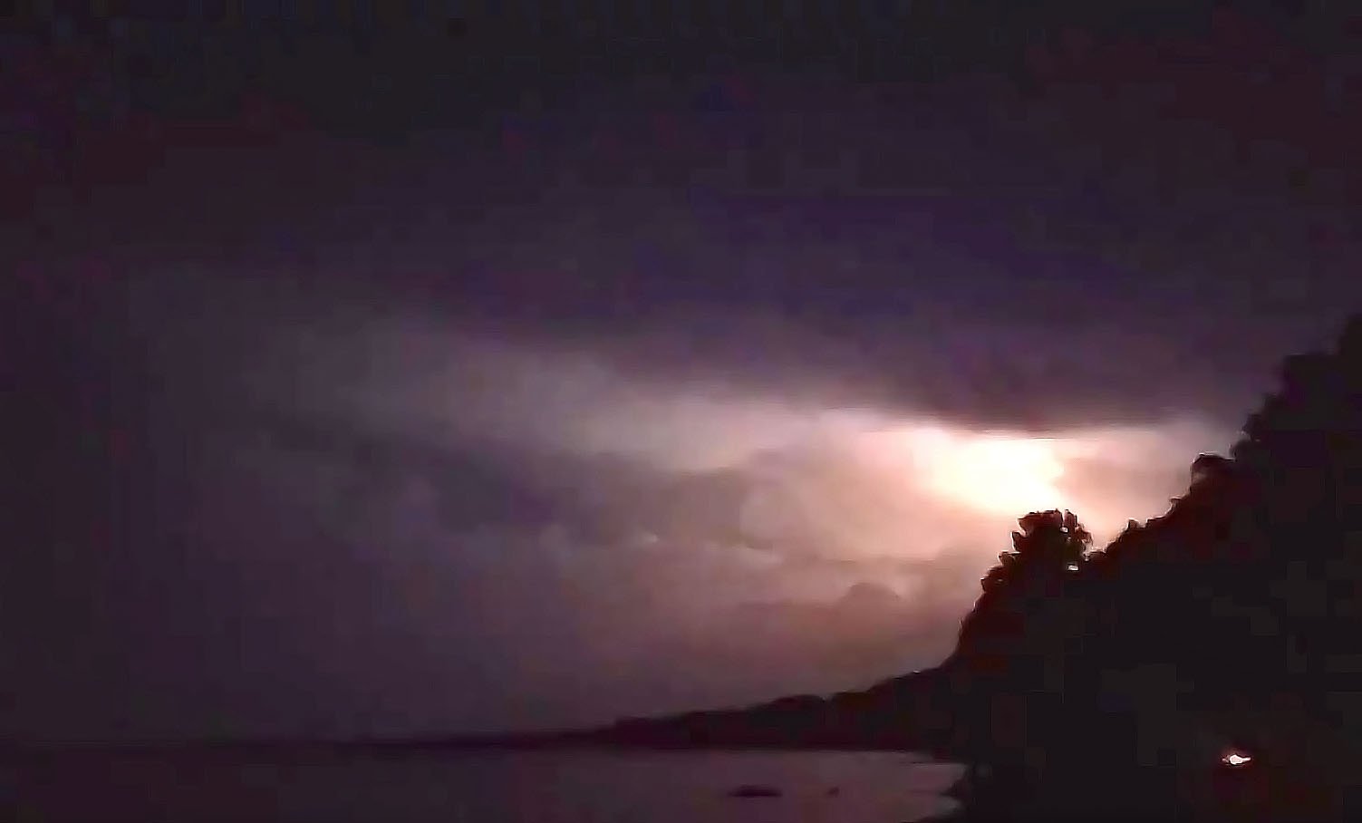
Screen grab from last night's backyard storm chase with a friend. I shot this video from Starr Farm beach on Lake Champlain! So magical with the bullfrogs croaking and the fireflies flashing, along with the beautiful sound of thunder rolling over the lake.
-
3
-
-
I did a little backyard storm chasing this evening and took this video from Starr Farm Beach on Lake Champlain. The storms were right around the international border at the time. Simply beautiful.
-
This was on my facebook newsfeed and it made me laugh.

-
1
-
-
A friend of mine in Richford, VT reports seeing golf ball sized hail.
-
Hotel guest just informed me that he saw trees come down on power lines in the wind near the Shelburne Museum. Sparks flying.
-
Pea sized hail in Shelburne, VT. Got rather windy, but I'm not sure I'd put it above severe criteria. Lovely storm, though. Lights flickering in the hotel I work front desk at.


NNE Warm Season Thread 2021
in New England
Posted
Some other photos show downed trees laying in different directions.