

Lightning
-
Posts
919 -
Joined
-
Last visited
Content Type
Profiles
Blogs
Forums
American Weather
Media Demo
Store
Gallery
Posts posted by Lightning
-
-
14 minutes ago, frostfern said:
Very dark shelf cloud. Could be some strong gusts.
Winds and heavy rain were the best part in Allegan; lightning was so so.
edit. Looks strong at GRR.
-
On 5/25/2024 at 11:05 AM, frostfern said:
It was a good one, though I was half asleep. Could have used a little more rain than what I got but the thunder was nice and loud.

Storm was nice today here in Allegan. Nothing grand but much better than nothing
")
-
11 hours ago, frostfern said:
It was a good one, though I was half asleep. Could have used a little more rain than what I got but the thunder was nice and loud.
Great to hear. We really killed it here with a complete 0.1" downpour.
 Next system looks a bit better but honestly I like the small systems for my area as these bigger ones tend to split particularly for MBY. Might head out to west side of the state tomorrow afternoon, as I think it will do better.
-
8 hours ago, frostfern said:
If the system on Sunday is far enough east I might chase. The problem is storms often don't get into Indiana until after dark. East central Illinois is easier to get to than northwest Illinois because I can go south around Chicago.
How was the storm this morning in your area? Unfortunately they are dying out as they approach here (not surprised).
-
3 hours ago, Chambana said:
Roads are becoming impassable throughout rural Champaign. Just had to drive in reverse with hazards on for 1.5 miles.
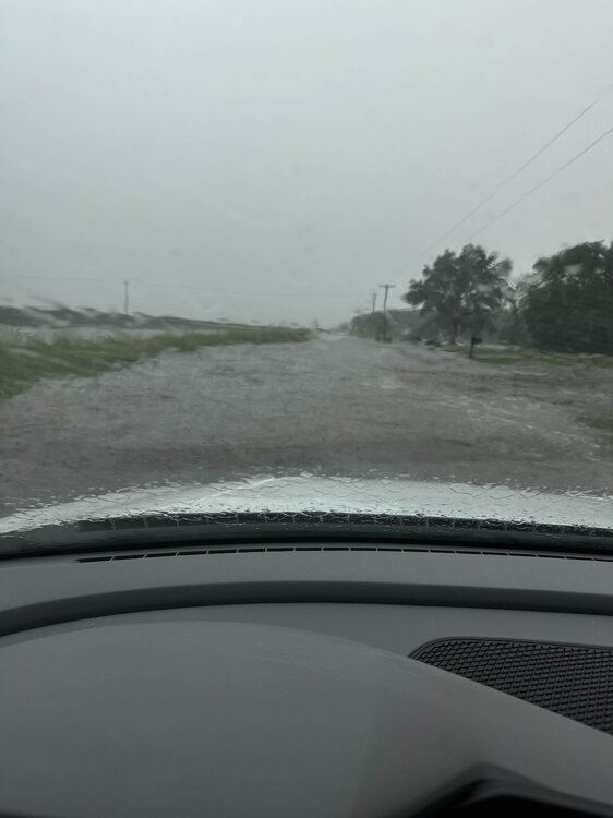
Awesome pics. I love to get events like this!!
-
 1
1
-
-
7 minutes ago, frostfern said:
Michigan is being Michigan though.
Yep with these big systems (that track well to the NW) the t-storms split at LM going north and south into ILL,IN and OH. It is nothing new. I have learned to ignore the models that think MI is a target in April and May with these big systems. I know some models still want to re-ignite in MI tonight
 I would not bet on it but we will see. FYI ... This is meant to be an observation and not a complaint. I have had some decent storms so far just commenting about the 2 large storm systems that have gone NW into ND / northern MN.
-
19 minutes ago, frostfern said:
Don’t really want severe IMBY either, but a 50 dbz cell overhead with some CGs would sure be nice.
Exactly CGs (hence my profile pic). I see yours has updated appropriately too
I also love the heavy rainfalls as I don't have flooding concerns really (it would need to be a Noah level event).
-
11 hours ago, frostfern said:
Miss NW
 .
.
While I love t-storms, I really don't really mind missing the very destructive & tornadic ones.
Not surprised by the results at all. This system was too far west for southern MI.
-
2 hours ago, frostfern said:
Yea. I wasn't able to chase the excitement that hit the southern part of the state last week and it's been zzzzz IMBY lately. Low 60s and clouds. Not much real rain or thunder. Thankfully not cold, but dreary nonetheless.
The Aurora have made up for my weather boredom. I am ready for Tstorm season to begin. I didn't chase them as it was looking good for them to come my way but sadly I was mistaken. Oh well plenty of storms to come in life.
-
9 hours ago, frostfern said:
Rain underperforming up here. Nearby pond water level is still low.
Yeah this system was very disappointing. Hopefully storms will shift our way in the coming weeks.
-
3 minutes ago, KeenerWx said:
Caught the ole dipper in top left corner in this one.

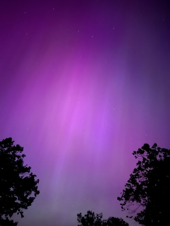
There were times it looked liked the Aurora were pouring out of the big dipper. It was so cool.
-
 2
2
-
-
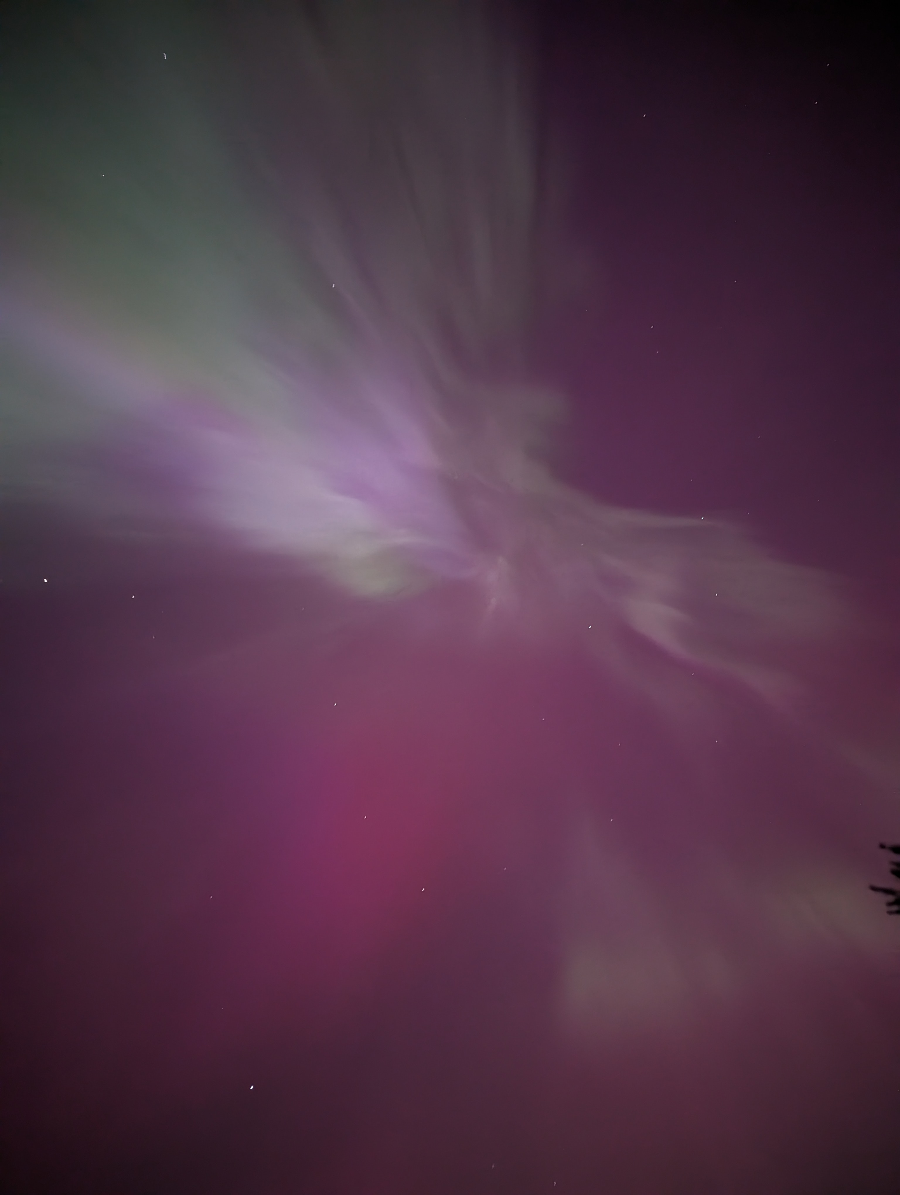
23 minutes ago, Brian D said:
It's possible that the stronger band may have been more S of me. Usually I have the stronger bands up here on regular events that are brighter than this one tonight. Currently, as of 10:45, they are pretty faint now. Love the multi-color mix.
I had that happen a couple times when I went to MTU.
My pictures didn't do it justice. I have seen several and I would say this was the second best show I have ever seen.
-
1
-
-
-
-
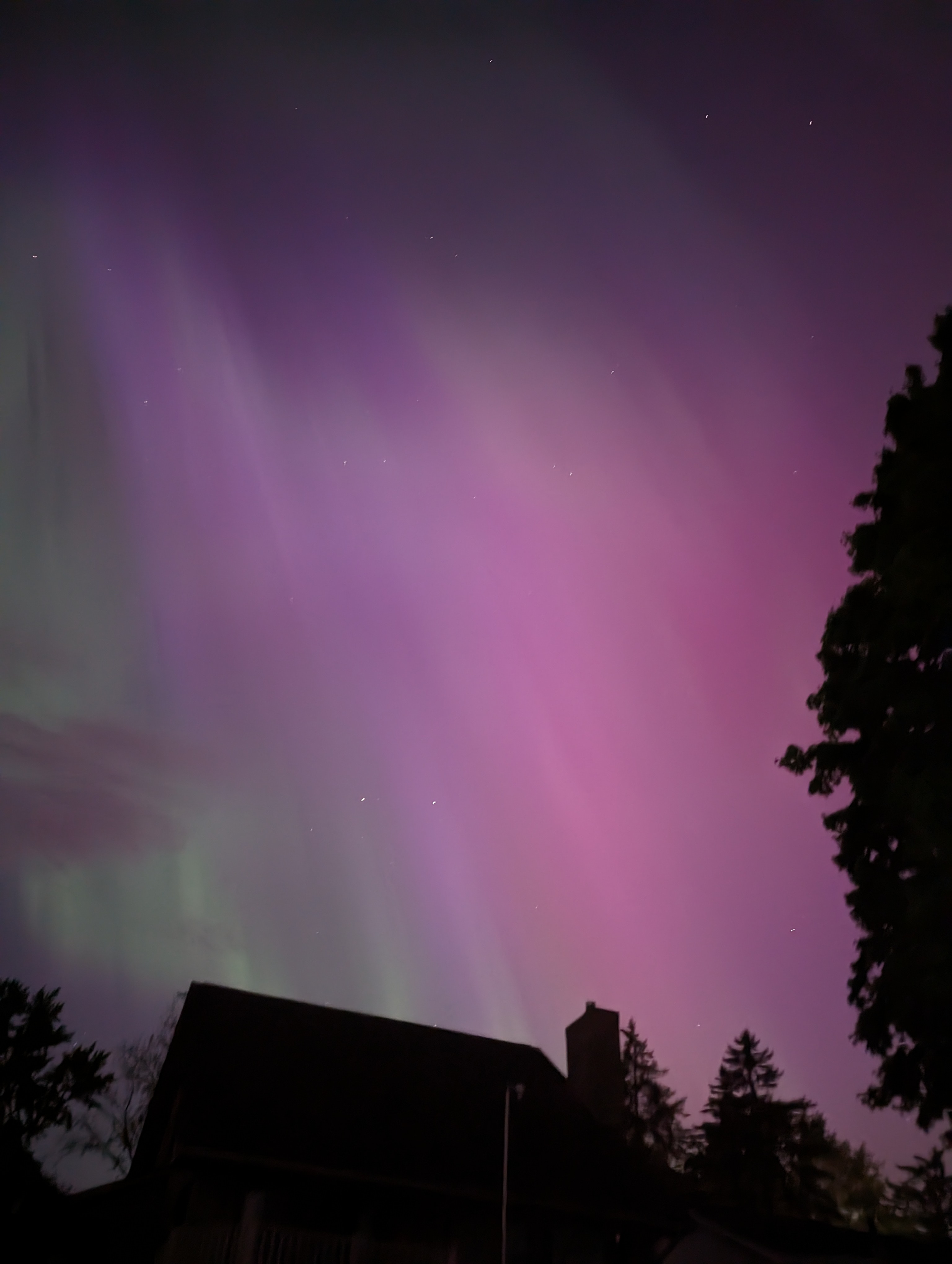
Just awesome. Sorry not the best photos.

-
3
-
-
It is incredible right now. The Aurora Borealis are amazing. Post pics later.
-
Ended up with garden variety storms with 0.6" of rain. Watching radar you could definitely see the stronger convection struggling to get north of 96 by Howell.
-
2
-
-
Nothing really overnight and typical remnants IMBY this morning. Got 1/3" total. At least it is wet. Might get something this afternoon; we'll see.
Overall pattern seems active but not seeing much exciting for my area yet but tis the season of leftovers
-
1
-
-
2 hours ago, frostfern said:
Storms actually missed north yesterday. There was some decent hail near Ludington. This just isn't a Great Lakes setup though. It's a plains setup.
Best bet for stronger convection farther north and east looks to be next week Thursday. Still uncertainty though. Still way better pattern than last year at this time when there were hardly any storms anywhere in the US. Keeping my fingers crossed there is no blocking again this May. That just killed spring storm season last year.
Oh sorry, I was referring the band that lifted north overnight as some models had strong storm well into my area in the morning hours of today (which only turned out to be some okay rain without any thunder).
The stuff in Ludington yesterday was never projected to come close to my area so I honestly wasn't really paying any attention to it. Ludington to Manistee is one area that does well very consistently with t-storms as does Benton Harbor to Coldwater area.
Yeah I am also hoping May is much better t-storm wise. We shall see.
-
20 hours ago, frostfern said:
Hoping a train sets up at some point with this pattern. Nice one over northern lower at this point. Models showing mostly boring stratiform for here though.
 EML is all eaten up by time the front is nearby.
I am not surprised by the results. Heavier stuff remained to our south with these setups. Pretty typical this time of year as the colder Great Lakes seem to keep things in IN and OH; storms just get into the southern 2 rows of MI (Coldwater, Kzoo and Jackson). Tomorrow might be our best chance but even then I am not going to hold my breath as it is just April (not a great storm month for my area normally).
-
Yesterday was my first 80F of the year. Picked up 2/3" rain over the past couple days. April total now at 4.5" overall good but not close to any records.
Definitely enjoying the warmth and humidity!!

-
1
-
-
56 minutes ago, cyclone77 said:
Another nice soaker today with 0.84". Up to 5.57" for April.
You are having quite the April. Drought be gone in your backyard!!
-
1
-
-
What a truly wonderful day out today. Light winds, full sun and 50s
-
2
-
-
1 hour ago, A-L-E-K said:
bottomed out at 39 this morning imby
hopefully the last 30s until fall here
I hear you and you have good chance.
Not gonna happen here. Plenty of 30s to go including tonight's 32F forecast. Shoot my area gets 30s at least once in the summer months (June and August last year)!!


May 24-26 Severe Threat
in Lakes/Ohio Valley
Posted
Awesome event. I love it