

Rowdy2x
-
Posts
33 -
Joined
-
Last visited
Content Type
Profiles
Blogs
Forums
American Weather
Media Demo
Store
Gallery
Posts posted by Rowdy2x
-
-
HRRR once again comes through
-
 1
1
-
-
3 minutes ago, Mason said:
Most impressive lightning this year yet here. Very consistent and loud.
Yeah man...I'm right across the river from you. Core just passed right over. Multiple close strikes. Not fun.
-
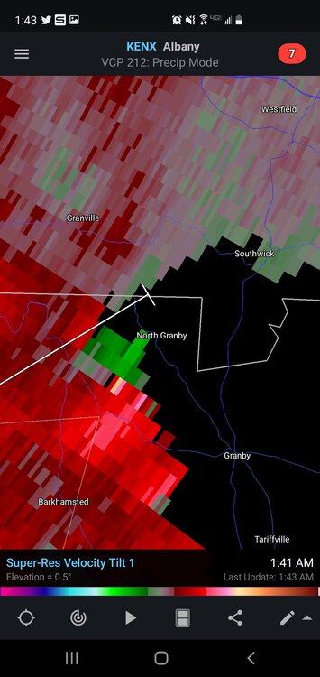
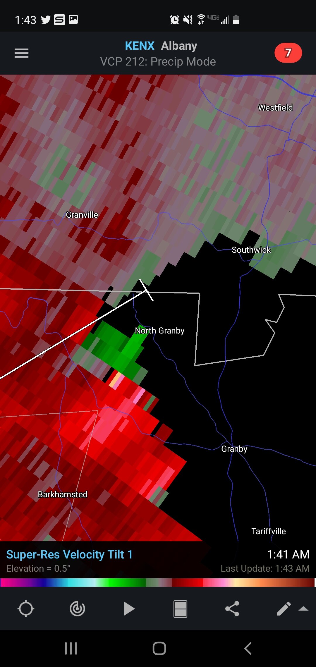
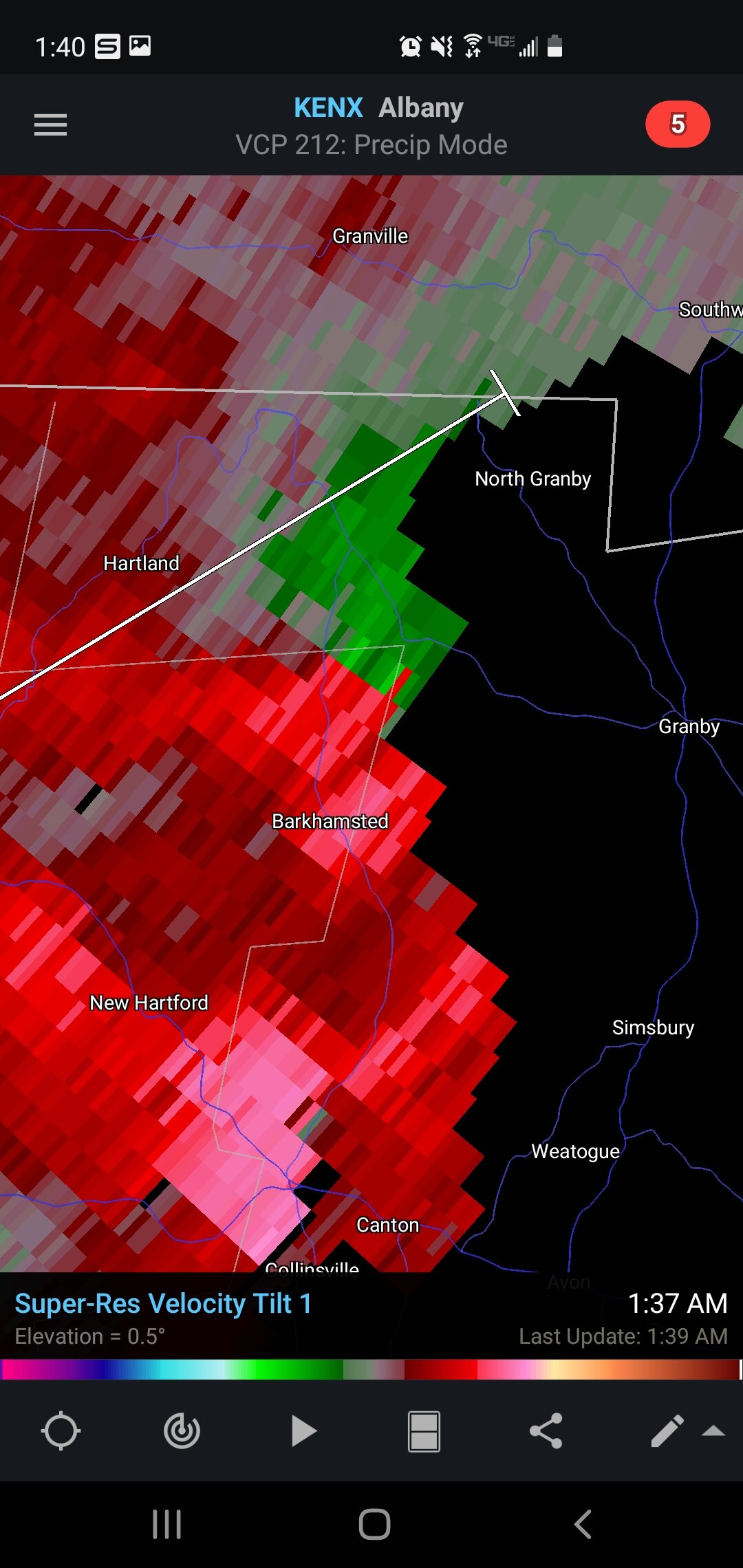
Now North Granby
-
That cell near Barkhamsted looks interesting

-
1 minute ago, weatherwiz said:
Today has played out perfectly! Figured the 3km NAM was right with the initial round with the HRRR being right with the second round.
Yeah. HRRR on point right now with timing and 2nd round development.
-
1
-
-
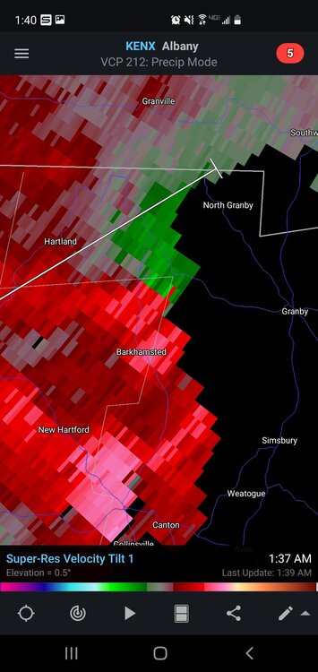
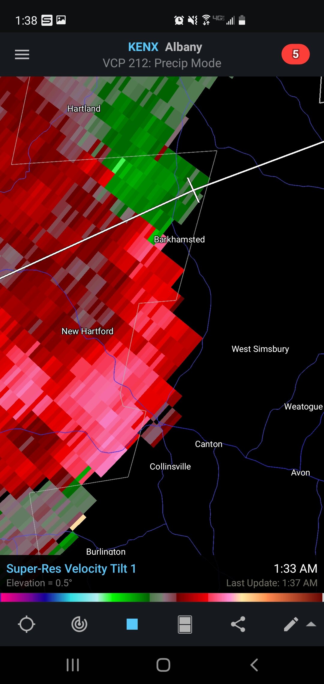
12 minutes ago, Damage In Tolland said:
Both those storms are rotating . One over NW CT and other near New Milford
Yeah. That storm straddling MA/CT has my attention.
-
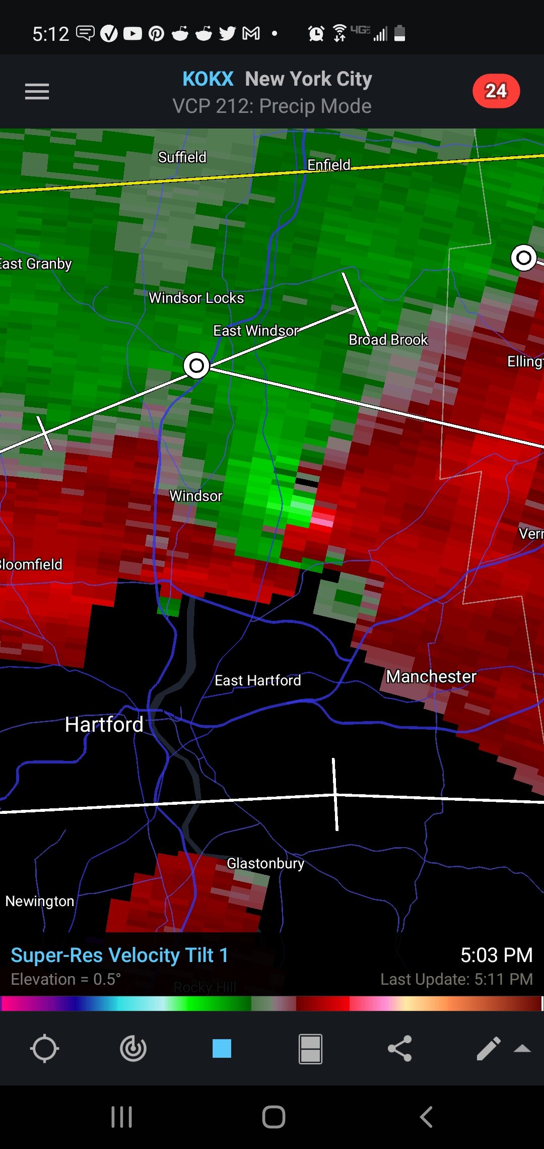
That backside of cell about to enter Litchfield has some decent structure. Showing signs of rotation.
-
-
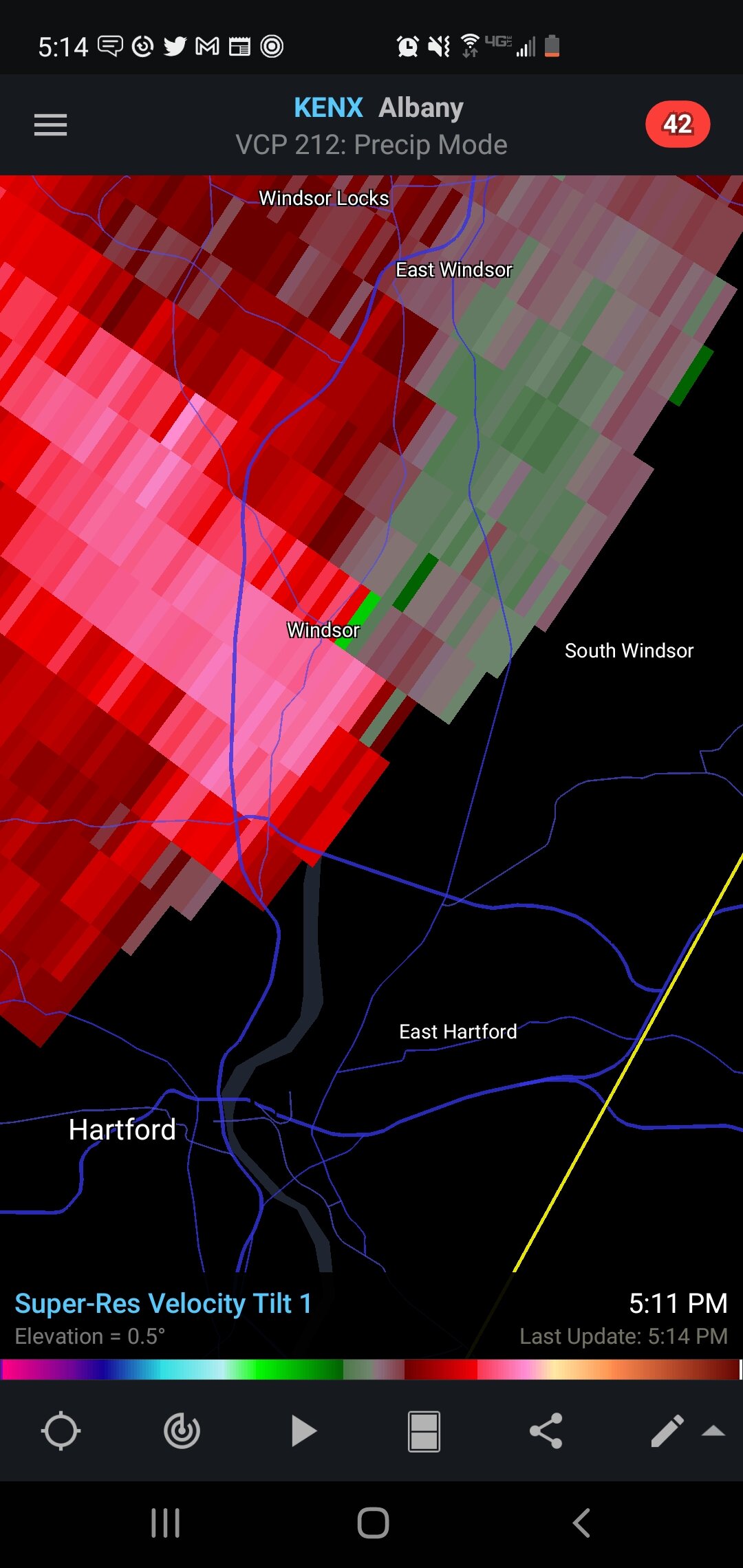
1 minute ago, DotRat_Wx said:
No way there was a tor in Windsor... It looked all straight line....
I don't know. Signature on radar and a wall cloud spotted from Broadbrook would suggest it's possible something came down.
-
1
-
-
26 minutes ago, PowderBeard said:
Might drive up to the Rt. 2 area later on, NAM wants to crush it.
Definitely. Between this and the HRRR, I'm looking at Hampshire county for today. Could get nasty. 5/6PM
-
1
-
-
9 minutes ago, weatherwiz said:
I think it's going to be a pretty interesting period between 6-11 tonight. I am not very confident in how widespread convection will be but I think we'll see some marginal supercell structures. Would like to see a bit more shear but I think there is room for a brief tornado this evening across northern CT
I agree
-
1
-
-
HRRR looks juicy today.
-
1
-
-
31 minutes ago, weatherwiz said:
I am not able to. I am not friends with the person so it won't let me. My friend found it on an Enfield, CT form
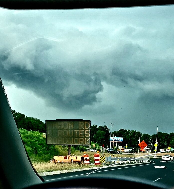
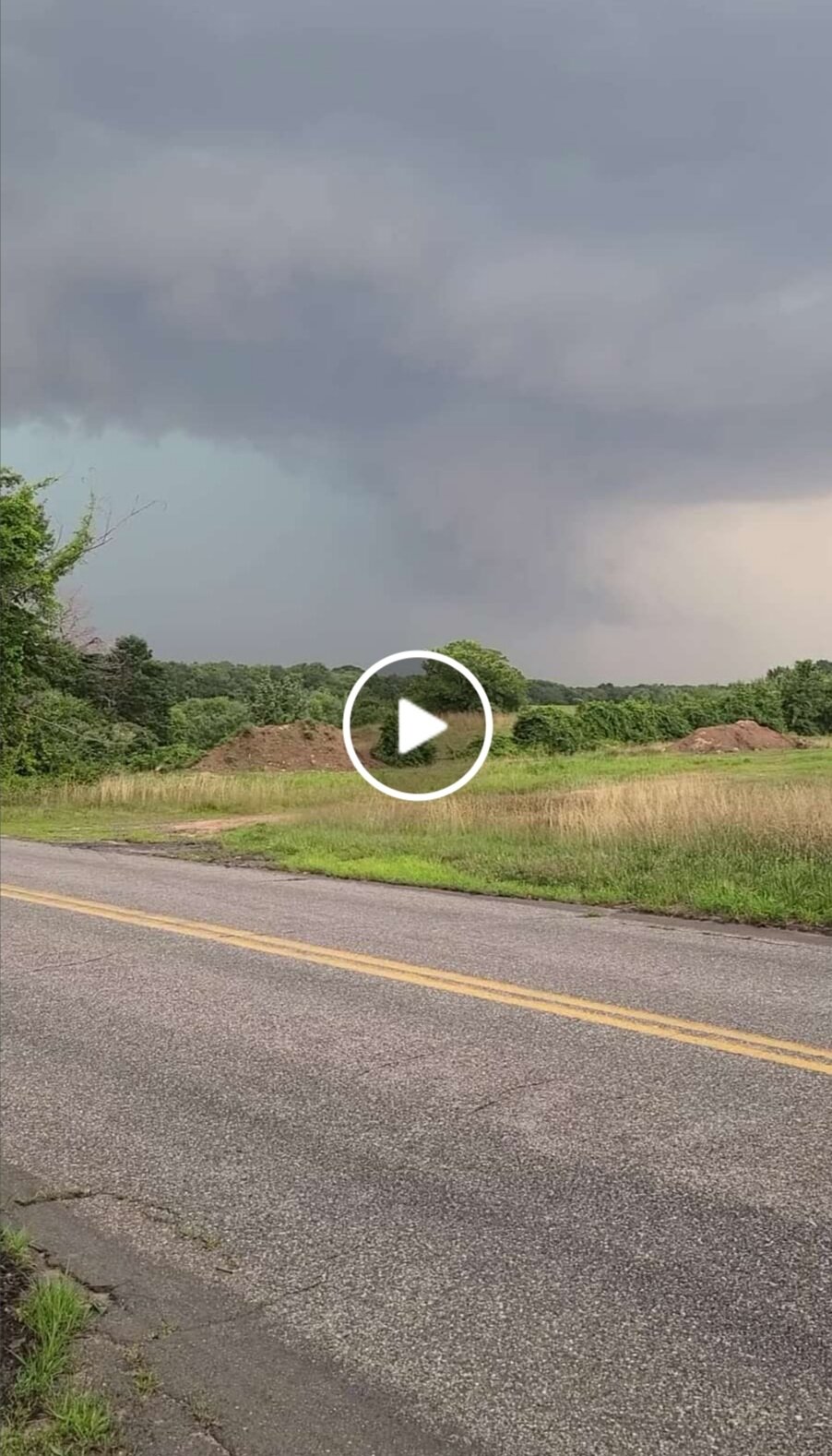
Wondering if this is the post you were referencing... Snapshot below with link included to the video.
https://www.facebook.com/100001468934097/posts/4265266106865645/
Looks like a wall cloud for sure. It would line up with that area of rotation that passed through the east side of Windsor earlier.
-
1
-
-
28 minutes ago, weatherwiz said:
Came across a video on Facebook taken in Broadbrook. Looks like a definite wall cloud. Can’t comment or share post though since I’m not a friend damn
Can you post the link please
-
I'll tell you what....HRRR was on par today.
-
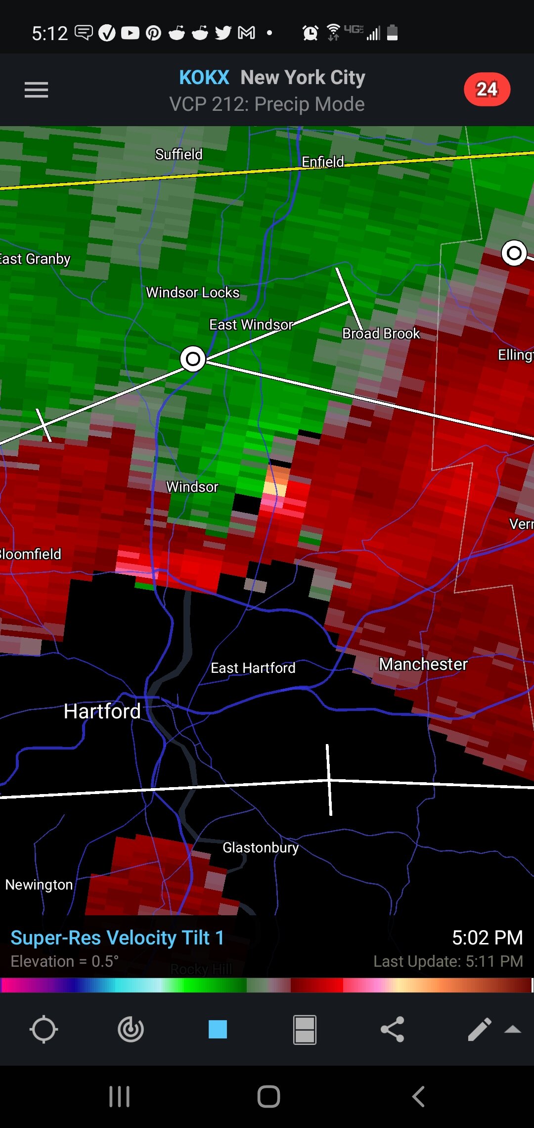
Pretty decent signature in Windsor some time ago...
-
22 minutes ago, radarman said:
Awesome pics
This was the UMass radar a minute or two beforehand.

I appreciate you. Definitely confirms what I was seeing.
-
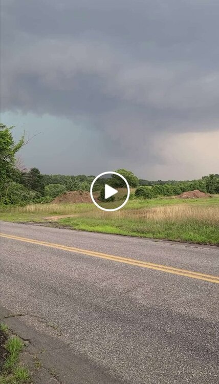
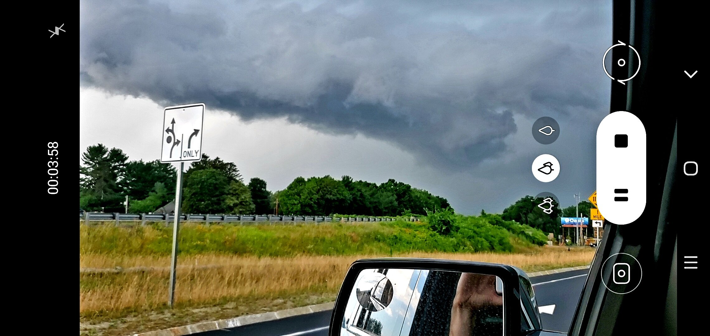
Here's my contribution from Wednesday. These images were taken on the Northampton/Hadley line off of 91N.
This particular cell had shown signs of rotation earlier in the afternoon as it crossed into MA, and as it continued unobstructed towards favorable territory near I91.
Given its structure, and presence of an inflow notch, I decided to pursue and set up south of its heading. This is looking towards its Southwestern most corner.
My internet had dropped so I didn't have access to radar or velocity profiles, but I'd be interested in seeing what it would have looked like in this timeframe on KENX, KBOX and the UMASS radar. Pictures were taken around 4:41pm.
Interesting day to say the least.

-
5
-
-
Just now, ineedsnow said:
Looking better again

Not even close
-
 1
1
-
-
4 minutes ago, ineedsnow said:
Definitely on tornado otg with that storm heading for Danbury
Definitely not on the ground man. It's broad rotation at most in the shot.
-
1
-
-
Just now, DotRat_Wx said:
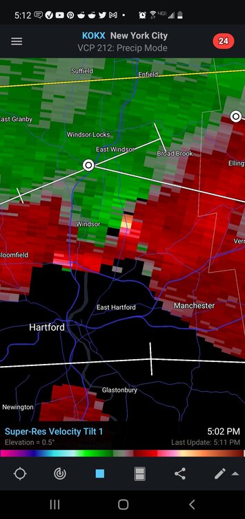
No idea why the new haven rotation isn't warned
Its up now
-
Definitely a wall cloud over Waterbury.
-
1
-
-
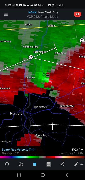
Nasty cell SE of Hartford
-
3 minutes ago, CTValleySnowMan said:
Just took a very nasty ride from Enfield through Longmeadow MA to my parents house on the border on the border with Springfield. Multiple detours , numerous trees and branches down, several trees hanging over wires, a couple wires on fire, debris falling on the car definitely adrenaline-pumping.
Can confirm. Trees down everywhere and the wind is still ripping every few mins


Severe Weather Thread - New England
in New England
Posted
That cell about to enter the Greenwich/Stamford area should be looked at closely