

J_Prothro
-
Posts
54 -
Joined
-
Last visited
Content Type
Profiles
Blogs
Forums
American Weather
Media Demo
Store
Gallery
Posts posted by J_Prothro
-
-
I was in a discord when Jeff City supercell took a left turn and we were all basically saying to TORE it. Thank god for lead time, because I thought there'd be 10+ deaths on that storm. There's been none reported so far. An absolute miracle.
-
Interested to see how that is surveyed. It seemed like it had intense rotation but I don’t know if it was down when it did.
1 hour ago, shaggy said:Sone good video of the tulia tornado on youtube. One chaser got pretty close.
-
-
1 minute ago, wotan said:
Do we know the location on this one?
Somewhere around Rocky. Found other pics in a Facebook post but it's a hard one to embed.
-
Damage pics coming in
-
4 hours ago, BrandonC_TX said:
I'm in the DFW area and we already have a (non-severe) thunderstorm complex knocking on our door right now.
I wonder if we will manage to clear out earlier than expected? That said, there are still storms west of Abilene, one of which is severe, so it doesn't seem like things will clear out. I believe those storms are the ones that were modeled to form the main MCS, but this complex ahead of them might be problematic as they move eastwards.Yeah we are about to get hit again. I don’t think it’ll clear out in time for a second initiation.
-
19 minutes ago, BrandonC_TX said:
Tornado warning now on this storm.
Warned again and has got a good flying eagle look to it
-
Some rotation on that storm near Sonora, TX too
-
3 minutes ago, Torchageddon said:
Can a Lightning lit/transformer blow-up shot make a nighttime tornado and its environment look that vibrant? Typically they look very different from that.
Editing no doubt was involved too. They seem to have taken up exposure or contrast.
-
-
1 minute ago, yoda said:
Looks like tornado has lifted... for now...
Severe Weather Statement
National Weather Service Norman OK
1201 AM CDT Wed May 8 2019

OKC149-080530-
/O.CON.KOUN.TO.W.0041.000000T0000Z-190508T0530Z/
Washita OK-
1201 AM CDT Wed May 8 2019

...A TORNADO WARNING REMAINS IN EFFECT UNTIL 1230 AM CDT FOR NORTH
CENTRAL WASHITA COUNTY...

At 1201 AM CDT, a severe thunderstorm capable of producing a tornado
was located 3 miles south of Bessie, moving northeast at 30 mph.

HAZARD...Tornado and ping pong ball size hail.

SOURCE...Radar indicated rotation.

IMPACT...Flying debris will be dangerous to those caught without
         shelter. Mobile homes will be damaged or destroyed. Damage
         to roofs, windows, and vehicles will occur.  Tree damage is
         likely.

Locations impacted include...
Bessie.
NWS said another cell impacted it before it hit Cordell. But I don’t know if that means it lifted before then or what.
-
Cordell is almost 3,000 people... not good
-
-
Confirmed as of 9 min ago.
-
Howardwick has been hit before too. April 1970, 14 dead.
-
Jeff is saying that vehicles were ran over by the tornado as it crossed the interstate. Sheriff said “major damage” there.
-
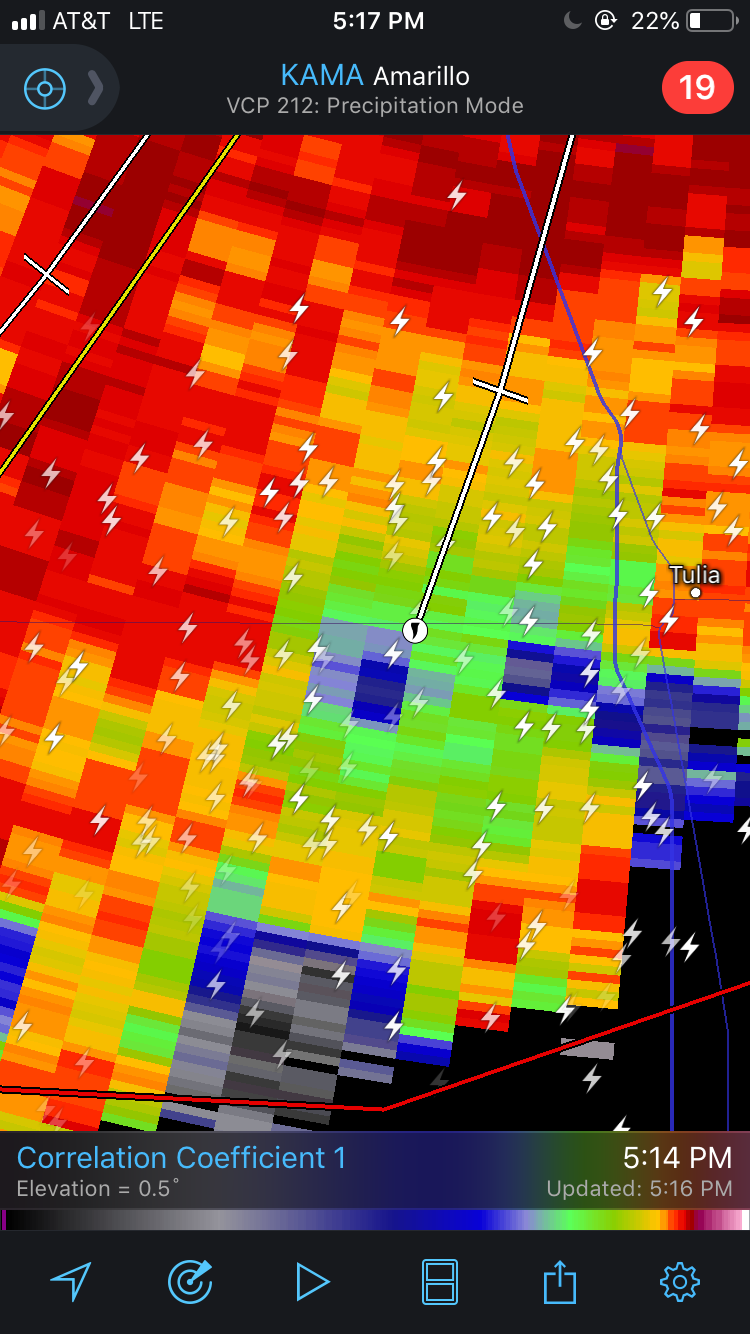
NWS Lubbock went back to confirmed wording on cell by Tulia
-
-
Just now, MUWX said:
I don’t think that’s debris
My bad on that.
-
I don't know if it is still down.
-
Debris ball. Lots of chasers on 27 in front of it. This could get bad.

-
PDS on it now
-
It's down. Multi-vortex.
-
Plainview might be wrapping up again.

Mid to Late May 2019 Severe Threats
in Central/Western States
Posted
I think there'd be deaths if it was a 5