
SEiowaWX
-
Posts
12 -
Joined
-
Last visited
Content Type
Profiles
Blogs
Forums
American Weather
Media Demo
Store
Gallery
Posts posted by SEiowaWX
-
-
I ended up with 3.3" on my snow board near Ottumwa. Very wet snow sticking to everything. I'm not sure officially but this has to be one of the earliest 3" snows for quite sometime in my neck of the woods. Nice little event! On to the next one...
-
 4
4
-
-
1 hour ago, cyclone77 said:
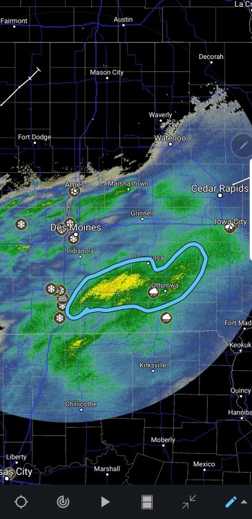
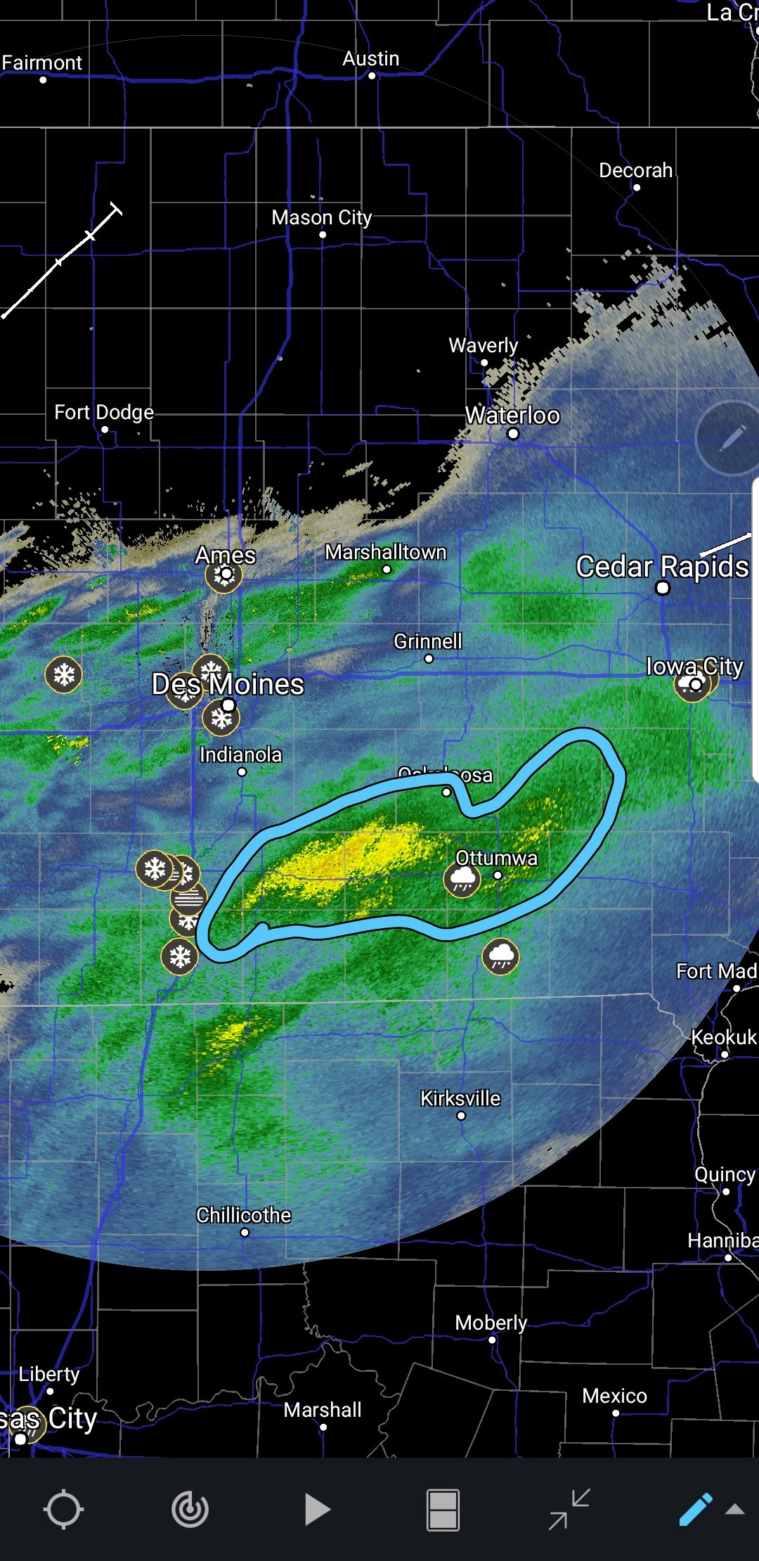
Lol @ 12 tor reports from IA today with no watch.
Moderate risk yesterday not one tornado report, marginal risk today tornado outbreak... welcome to Iowa lol
-
Picked up 1.17" of rain off this one. Had some afternoon thunderstorms drop pea size hail yesterday. Lots of standing water and must creeks are bank full.
-
0z nam continuing the east trend...
.thumb.png.2e1643143dc220a5685ccab8399426ef.png)
-
6 hours ago, cyclone77 said:
Seasonal snowfall accumulation to date.

Picked up 4.2" on this last storm bringing our total since Nov 1st to 58.1". Record for Ottumwa is 63.9" in 1977-1978. Certainly looks like we're going to break it.
-
1
-
-
About 2" of snow and 0.2 of sleet imby. Back to a rain/sleet mix now.
-
Back to a heavy sleet/freezing rain in this band.
-
1
-
-
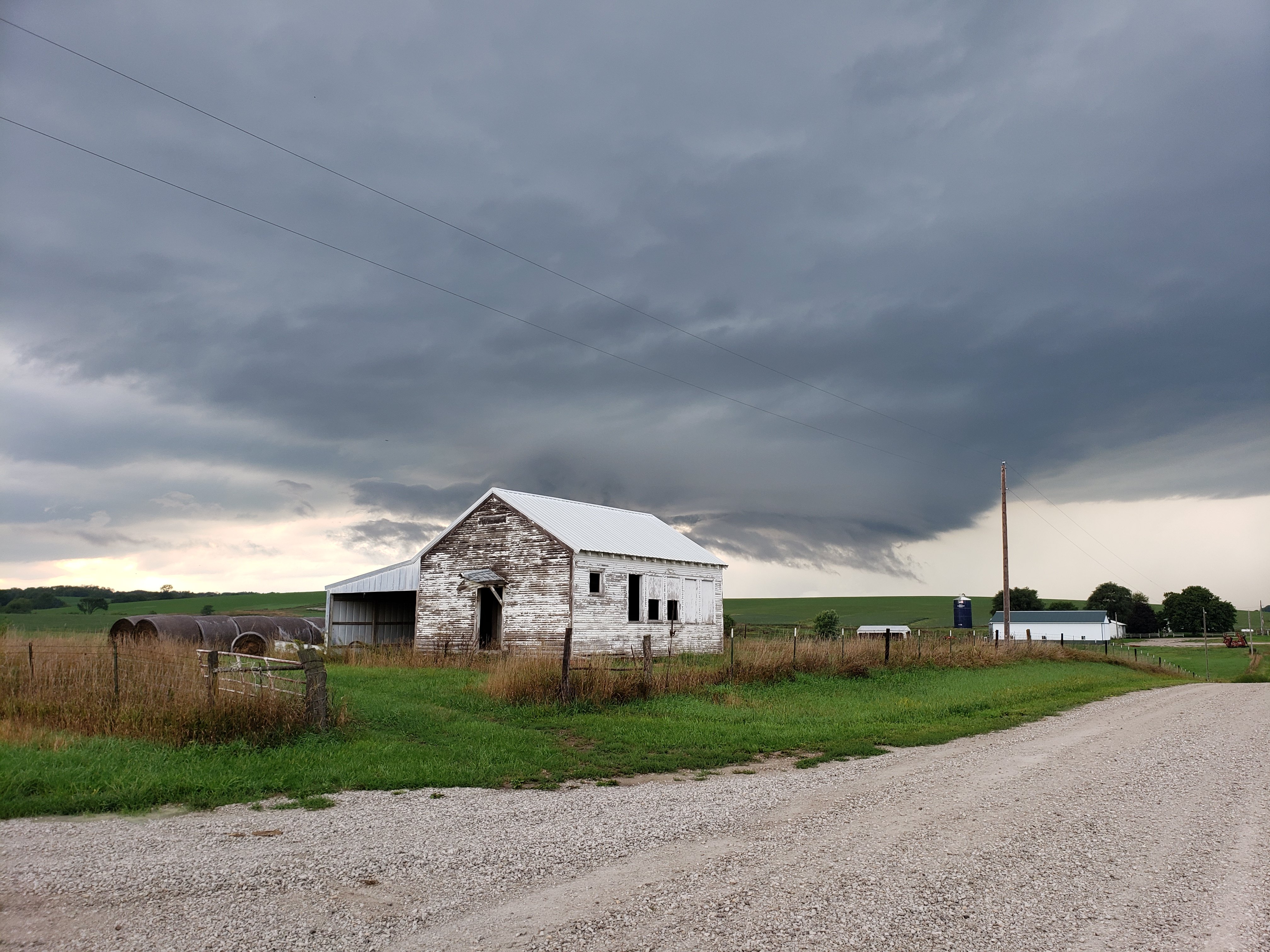
And so it begins started out with freezing rain and sleet all snow for last half hour. Looks like another solid event for southeast iowa.
-
23" on the ground here. up to 47" since November 1st. Wind was brutal today some massive drifts in rural areas. Pretty extreme for my area. This will likely be a historic winter for southern iowa!
-
2
-
-
Setting at 31 degrees here. Started as freezing drizzle switched to sleet for 15 minutes now all snow! Looks like we're in for another wallop here in SE iowa after days of less then an inch forcast.
-
2 hours ago, cyclone77 said:
Looks like there could be an area of 7-10" in south-central IA from near Osceola to a little west of Ottumwa. That area is having a hell of a winter, as they cashed in with some of the heaviest amounts from both the Nov 25th and last weekend's storm.
It's been one heck of a winter so far! I've had 31.2" since Nov 1st!
-
1
-
.png.590f8a4cb1abe7132d974f1b48853767.png)
December 2019 Discussion
in Lakes/Ohio Valley
Posted
1.19" in the gauge this morning. Good soaking rain especially for this time of year...