

tornadohunter
-
Posts
115 -
Joined
-
Last visited
Content Type
Profiles
Blogs
Forums
American Weather
Media Demo
Store
Gallery
Posts posted by tornadohunter
-
-
12Z GFS be like:

-
Really wish this NW flow would go away...very persistent...wants to keep threats south of i64....
-
 1
1
-
-
The GFS continues to show potential severe for next weekend. GFS likes the southern half of our subforum on saturday.
Sunday shows a threat for Illinois.
Euro is somewhat onboard but seems to be some timing differences to be resolved.
-
With severe weather season just around the corner, i feel it would be good to have a thread to discuss short range events that dont deserve their own thread and medium range threats.
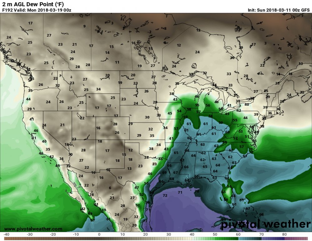
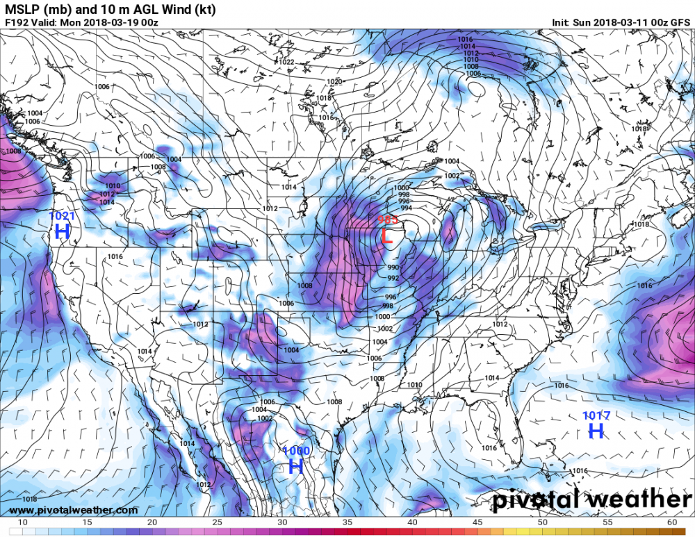
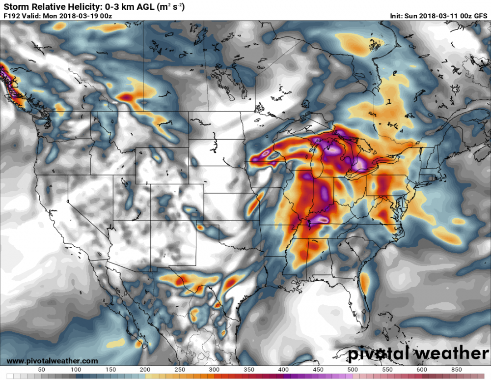
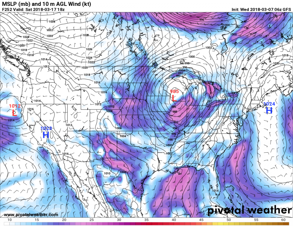
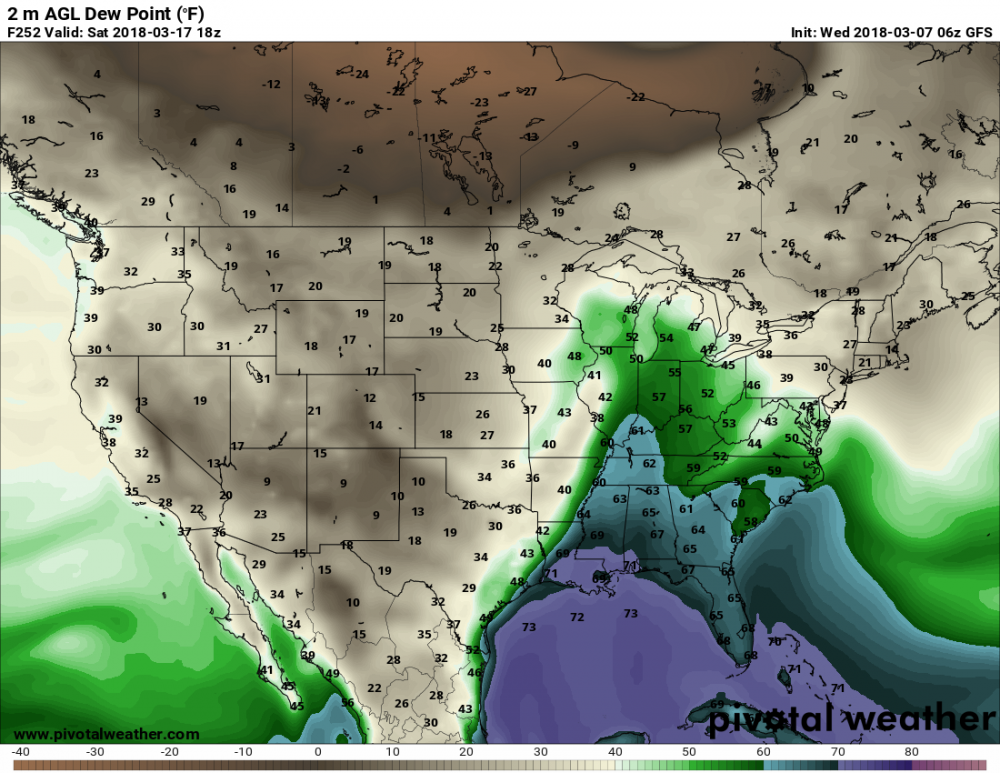
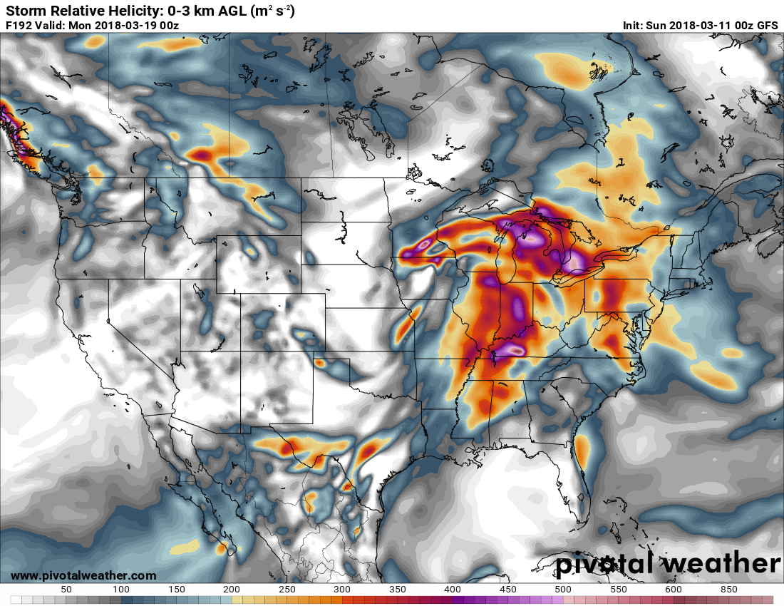
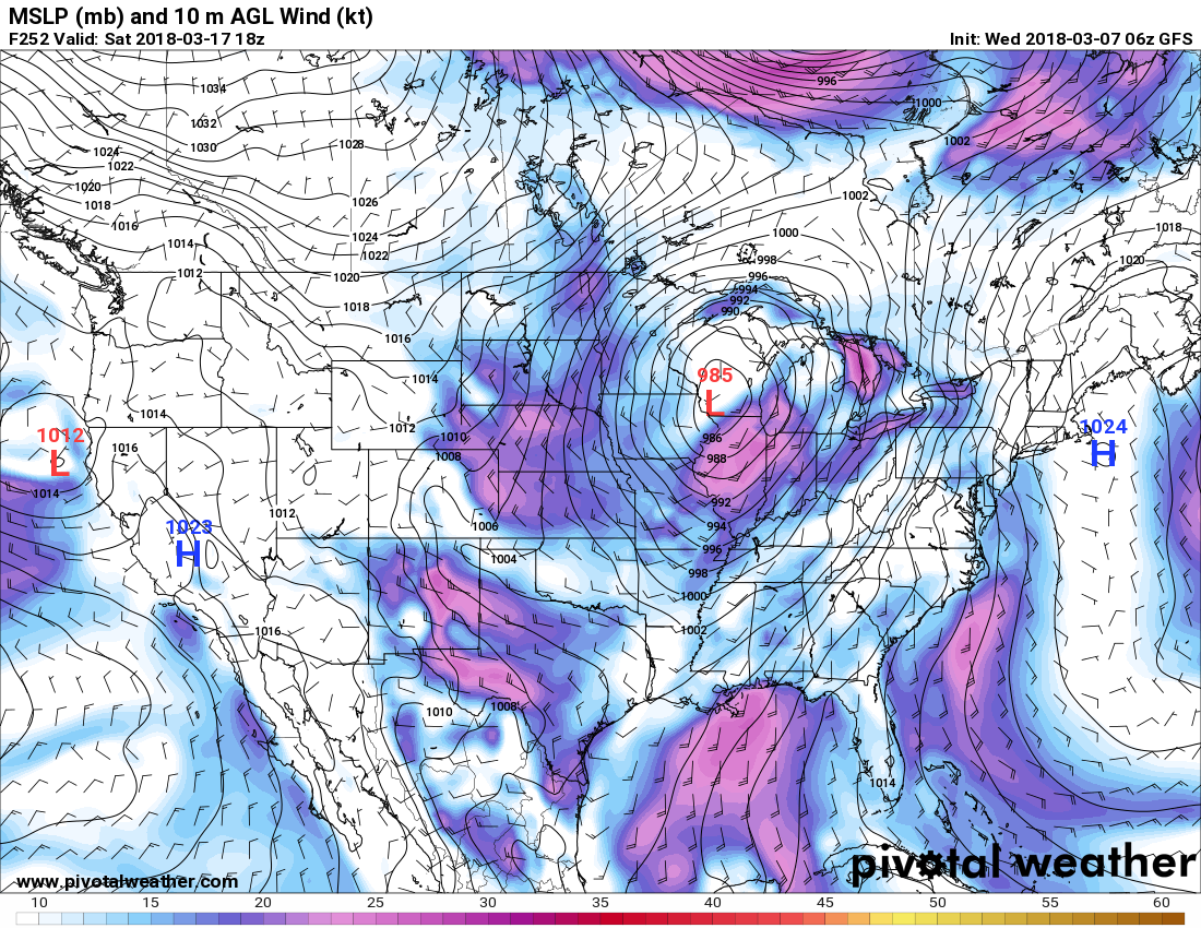
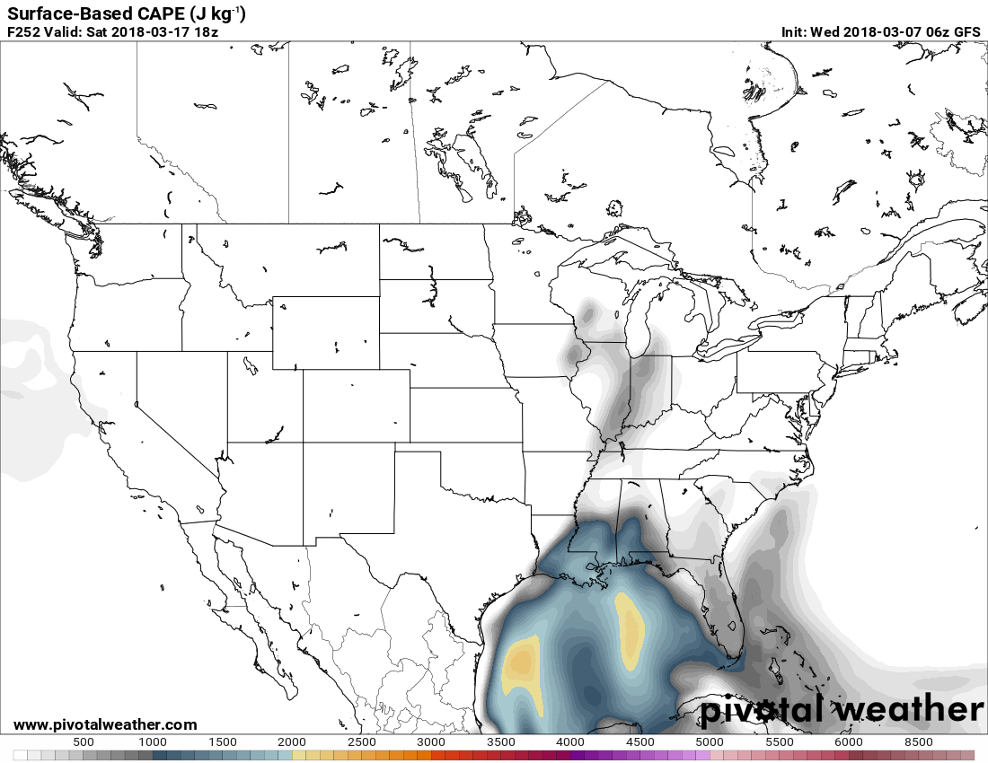
3/17 is looking interesting. CFS has hinted at this for a couple days and now the GFS is starting to see it as well.

-
1
-
-
Tornadoes: 1789
First High Risk: March 4th - Centered over West tennessee
-
3 hours ago, Quincy said:
Confidence in this range is relatively good through day 10 and just wow. There were hints from a few weeks out that this period would improve, but now that's far from the case. This may be one of the worst late May/early June stretches (at least for photogenic and/or longer-lived tornadoes) for tornadoes in a while. Yes, there were a few events and some local accidents, like Wisconsin, but otherwise it's largely been a dud in the Plains. Bigger days have largely been busts or filled with messy storm modes. There have been very few long-lived supercells over terrain west of I-35. Most events (from a chaser/photographer perspective) have been "right place at the right time," otherwise a lot of hair pulling, highly challenging events
The last couple of CFS runs are as quiet for a 7-10 stretch as they have been since early May. The support across the board is fairly consistent with general troughing in the East and few, if any notable shortwaves impinging on the Plains.
As we move into June, you'd expect that eastern Colorado and vicinity will have a few events (even with marginal/questionable environments) and northwest flow can eventually be more meaningful in terms of severe across the Midwest/Great Lakes as the calendar shifts deeper through June, otherwise, it looks like a snoozefest. There's always the potential for a mesoscale accident, but...
So #2017in
-
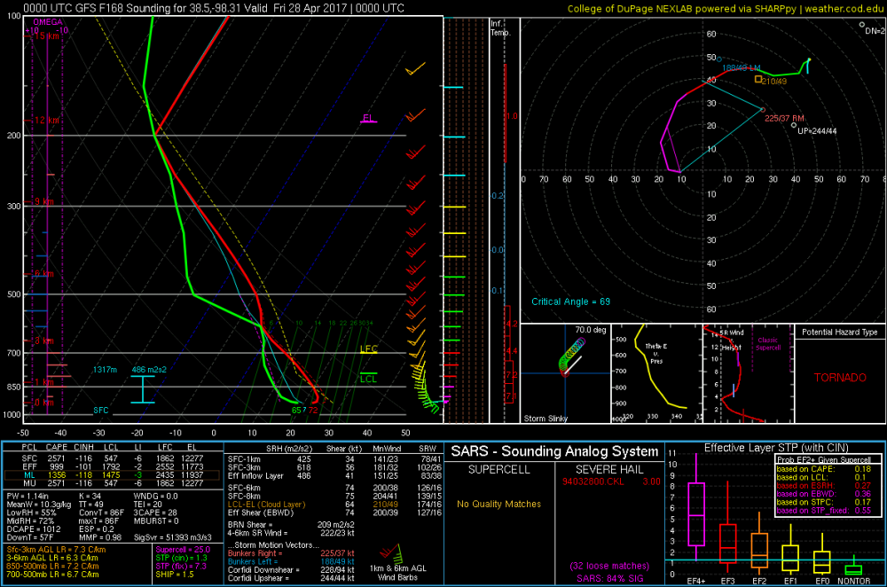
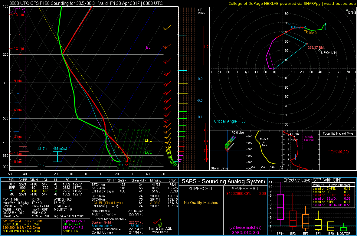
Impressive sounding and hodo for Kansas on thursday

Spring/Summer 2018 Banter and Complaint Office
in Lakes/Ohio Valley
Posted
Looking at the cfs is just depressing. Cool pattern sticks around till at least may. First week of may in the 40s and 50s. Gonna be a long month with no severe