

Chris_B
-
Posts
37 -
Joined
-
Last visited
Content Type
Profiles
Blogs
Forums
American Weather
Media Demo
Store
Gallery
Posts posted by Chris_B
-
-
6 minutes ago, StormyClearweather said:
ICONic (relative to everything else, anyway).

Lock it up .
-
7 minutes ago, stormtracker said:
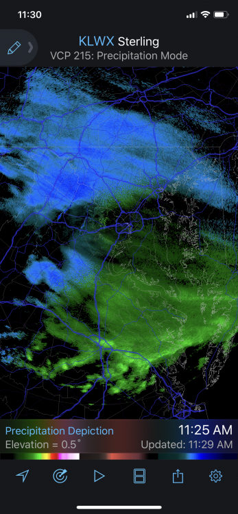
It's going to be a wetter run. Confirmed it's wetter coming in
-
 1
1
-
 6
6
-
-
1 hour ago, understudyhero said:
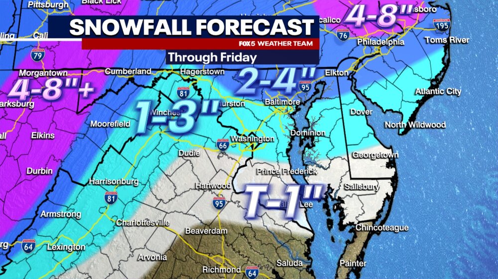
I recognize none of those towns on that map outside DC, Richmond and Baltimore. Are those real places?
Doubtful
-
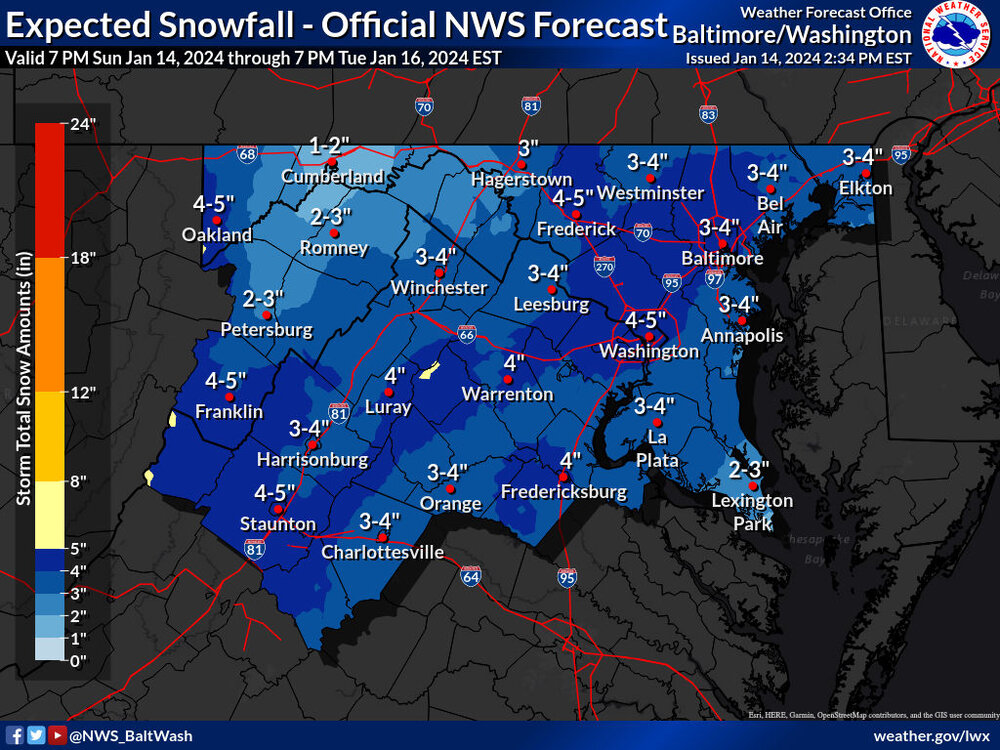
I'll take 3". Now for the models to catch up to the local news
 .
.
-
2
-
-
Did they jinx it?
-
2
-
 2
2
-
-
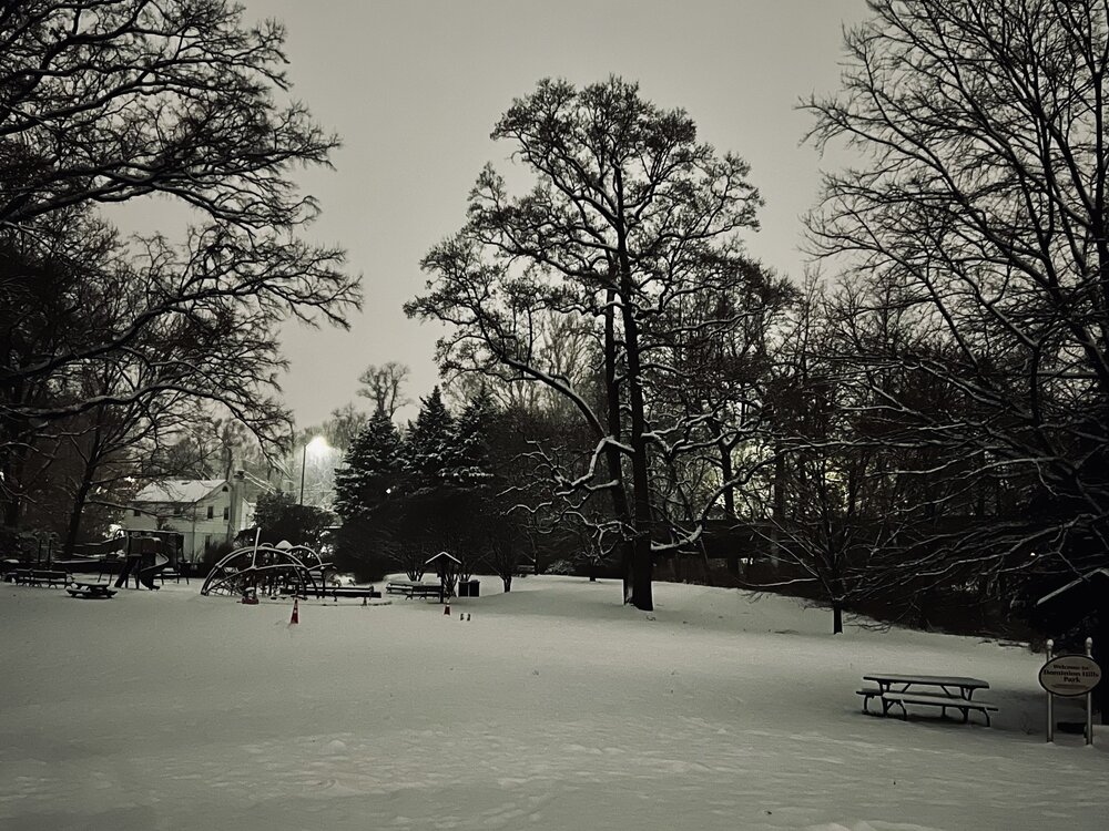
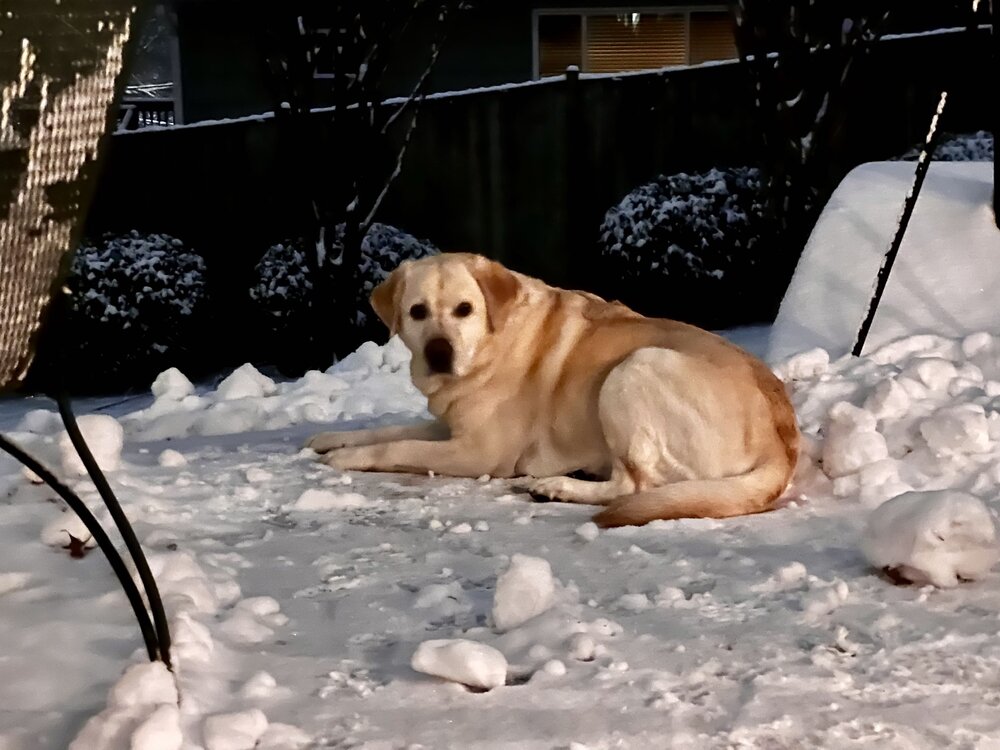
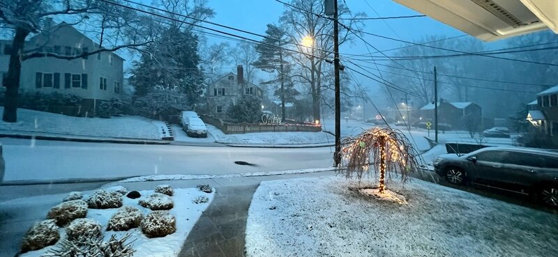
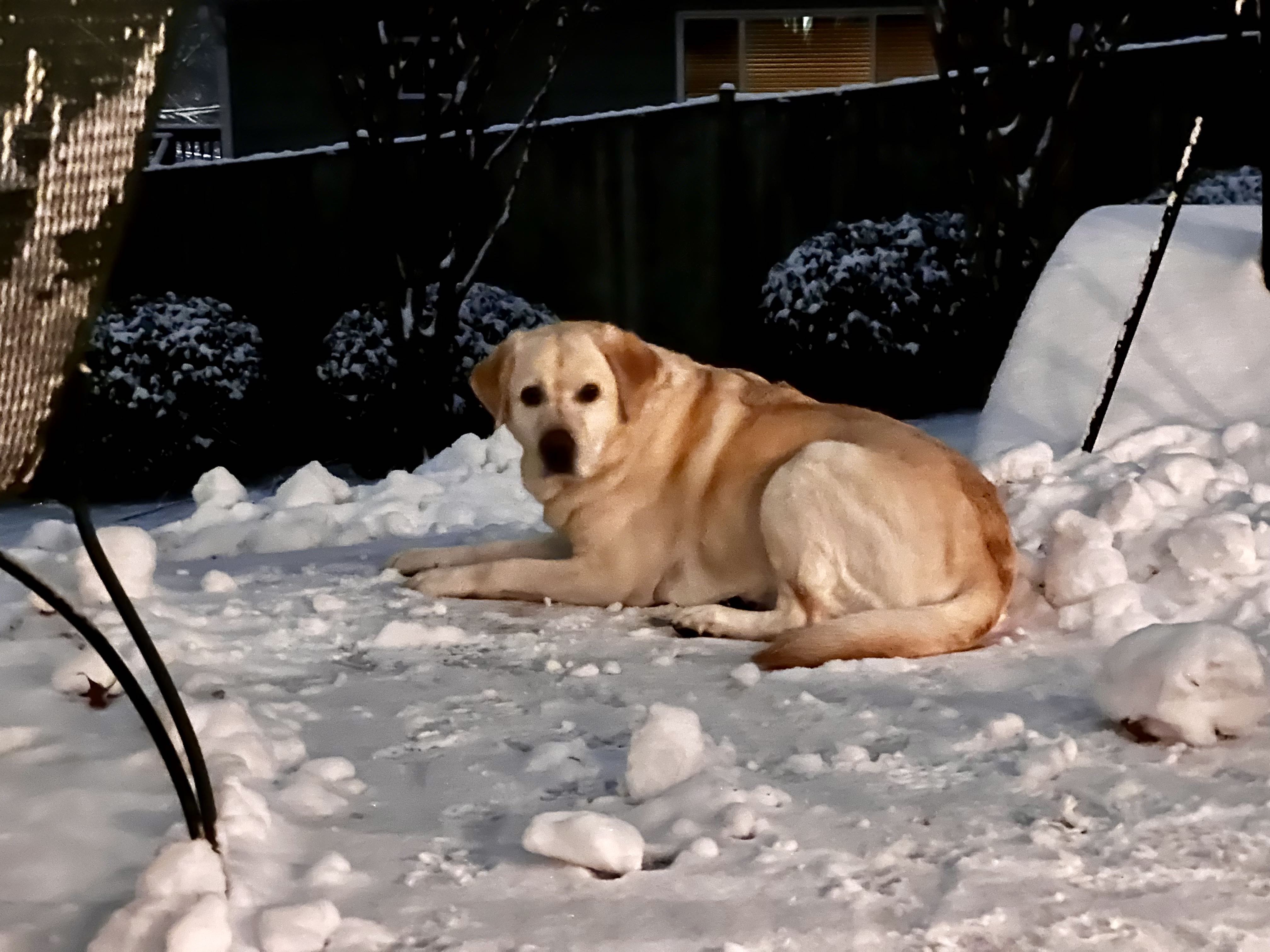
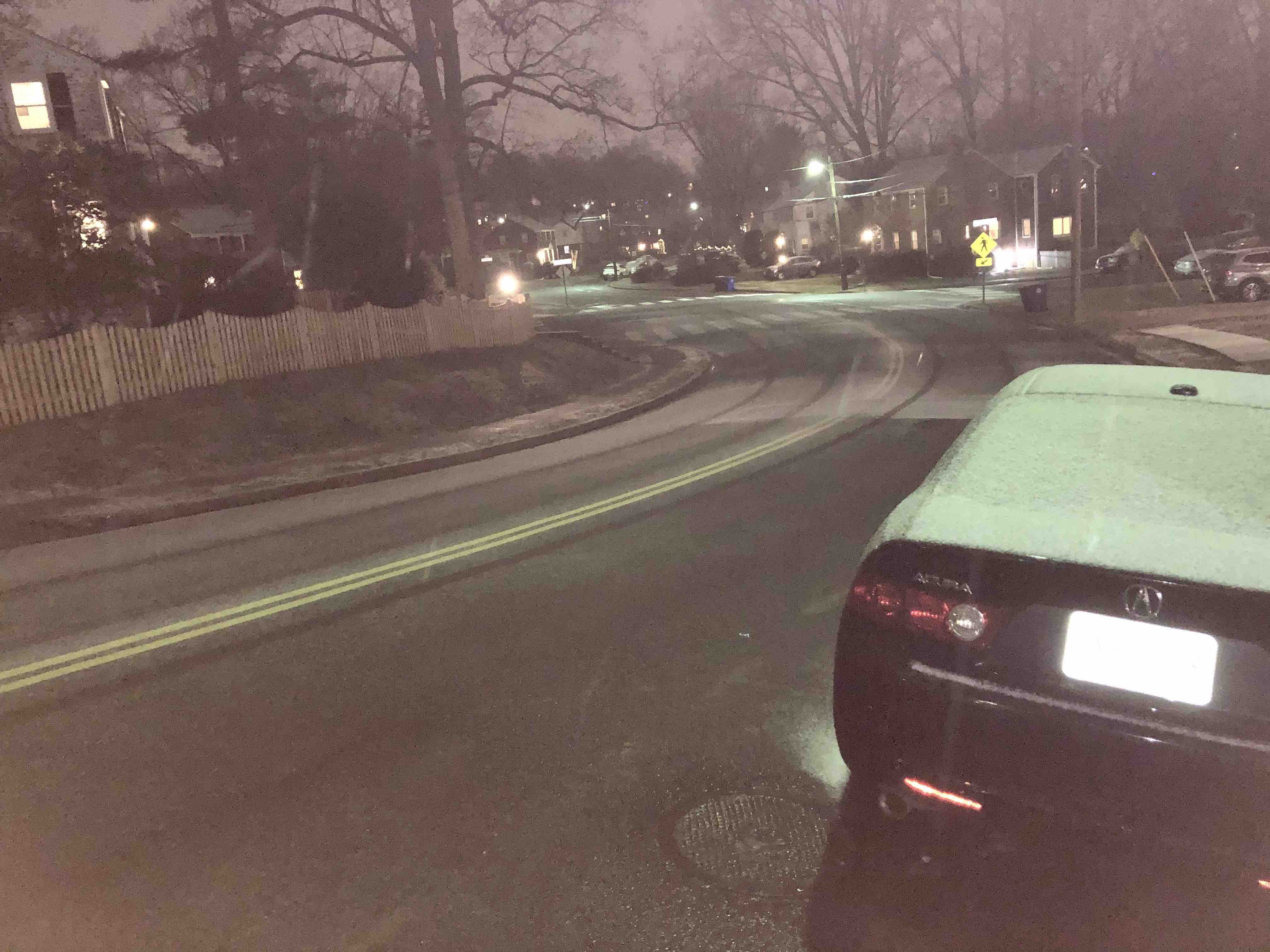
A nice night for a walk.
-
11
-
-
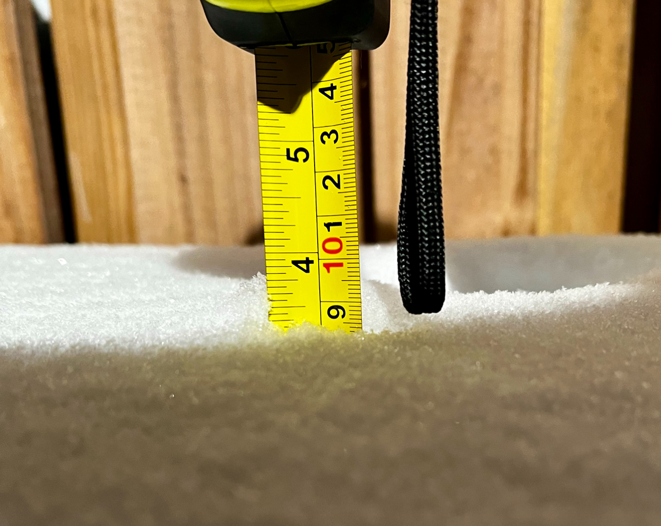
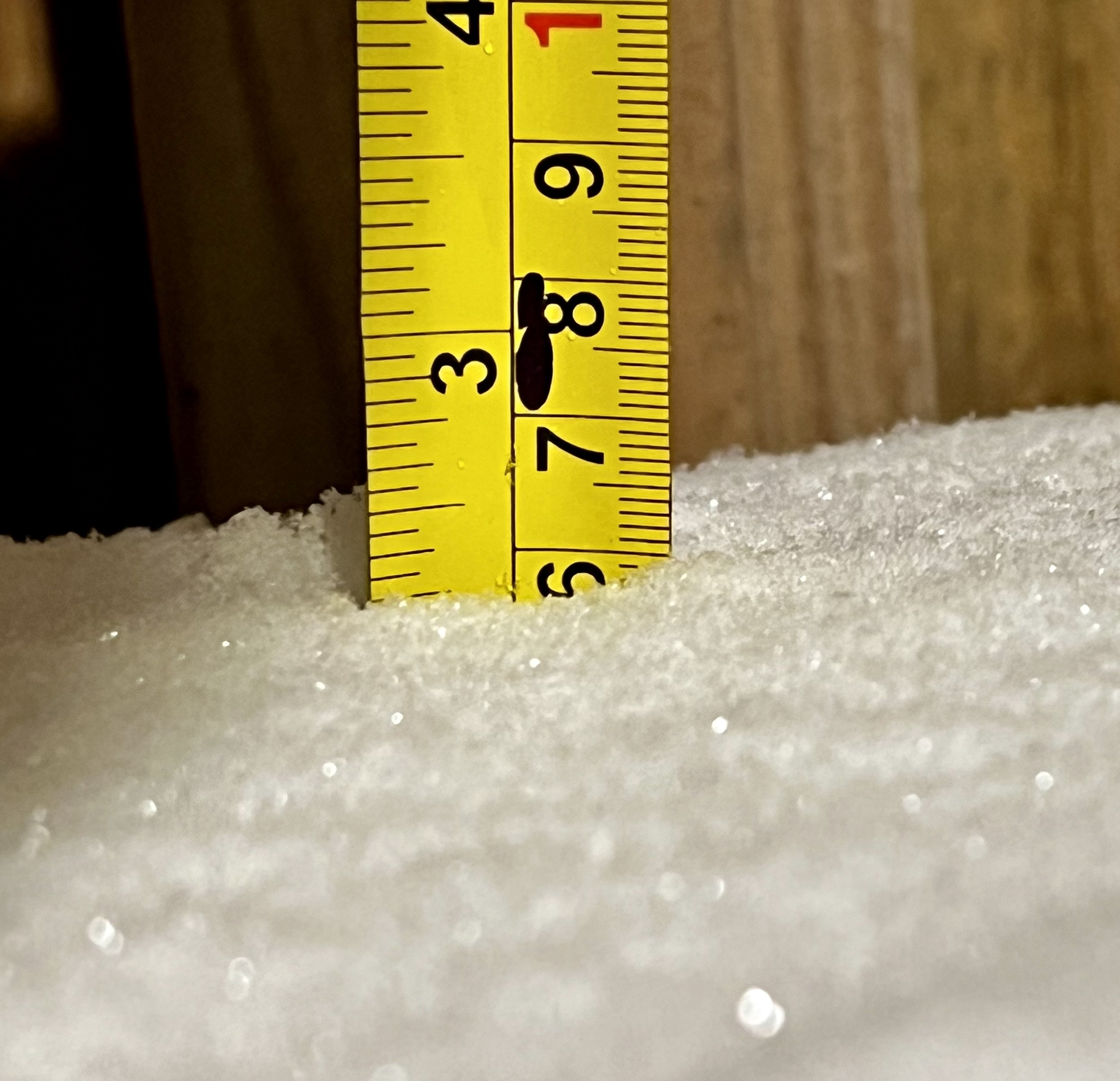
3.5” in Arlington at 9:30 pm. Take that OPM.

-
6
-
-
About 2 1/4" so far with compaction. Bring on the fatties.
-
4
-
-
We are keeping a close eye on the storm here in N. Arlington.
-
11
-
-
23 minutes ago, Terpeast said:
OPM, your on the clock.
-
7
-
-
2 minutes ago, NorthArlington101 said:
It could be ptype BS, but it’s “ice” for everyone outside the mountains. Rain as you go SE of DC
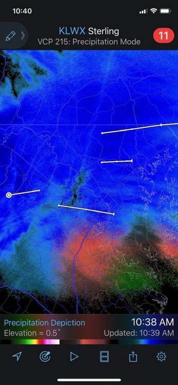
Flips back to a little snow at 54That outcome will have better chance of closings around DC. Ice during commute is no bueno
-
34 minutes ago, Buddy1987 said:
Lived just north of Waterbury from birth up until 10 years ago. Still have a bunch of family there. Have had some absolute doozies up there. Most memorable one was 38”. It snowed 3-4”/hr for hours on end. Was incredible to see.
Missed this sob by one weekend. Was just up for a wedding last weekend. Man what could’ve been.
Grew up in Waterbury in 70’s/80’s. Some epic snows back then. Always fun to see a front end loader clearing your street.
-
1
-
-
3 minutes ago, BristowWx said:
22 -SN and just cracked open a bottle of Old Elk..haven’t had it before but I hear good things
Can confirm good things. Enjoy
-
7 minutes ago, yoda said:
Mmmmhmmm
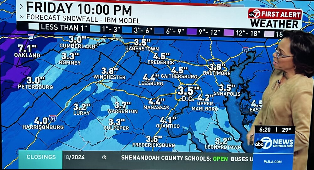
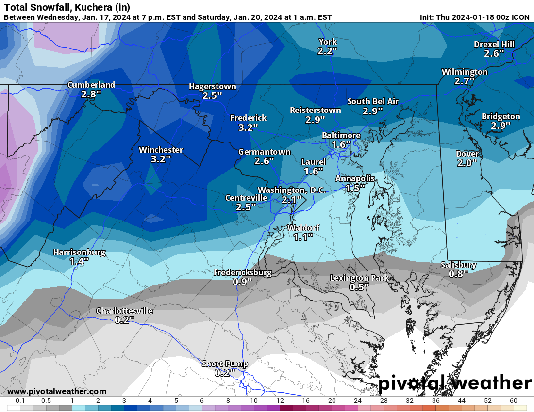
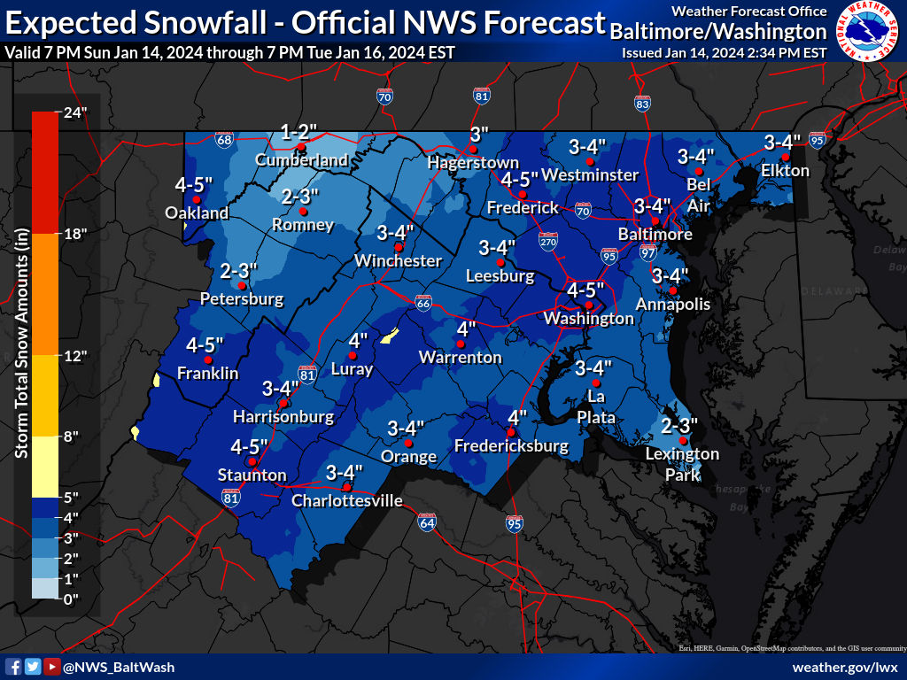
RGENT - WINTER WEATHER MESSAGE
National Weather Service Baltimore MD/Washington DC
659 PM EST Thu Jan 6 2022

DCZ001-MDZ005-006-008-011-013-014-016-018-503>508-VAZ052>054-502-
506-071200-
/O.CON.KLWX.WW.Y.0003.220107T0200Z-220107T1200Z/
District of Columbia-Carroll-Northern Baltimore-Cecil-
Southern Baltimore-Prince Georges-Anne Arundel-Charles-Calvert-
Northwest Montgomery-Central and Southeast Montgomery-
Northwest Howard-Central and Southeast Howard-Northwest Harford-
Southeast Harford-Prince William/Manassas/Manassas Park-Fairfax-
Arlington/Falls Church/Alexandria-Southern Fauquier-
Eastern Loudoun-
659 PM EST Thu Jan 6 2022

...WINTER WEATHER ADVISORY REMAINS IN EFFECT UNTIL 7 AM EST
FRIDAY...

* WHAT...Snow. Total snow accumulations of 2 to 4 inches, with
  localized amounts up to 5 inches.

* WHERE...The District of Columbia, portions of central,
  northeast, northern and southern Maryland and northern Virginia.

* WHEN...Until 7 AM EST Friday.

* IMPACTS...Plan on slippery road conditions. The hazardous
  conditions could impact the morning commute.

* ADDITIONAL DETAILS...Snow may fall at 1 inch or greater per hour
  overnight. Visibility will drop down to one quarter mile or
  less during the heaviest snow.

-
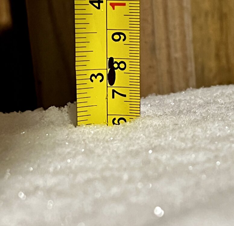
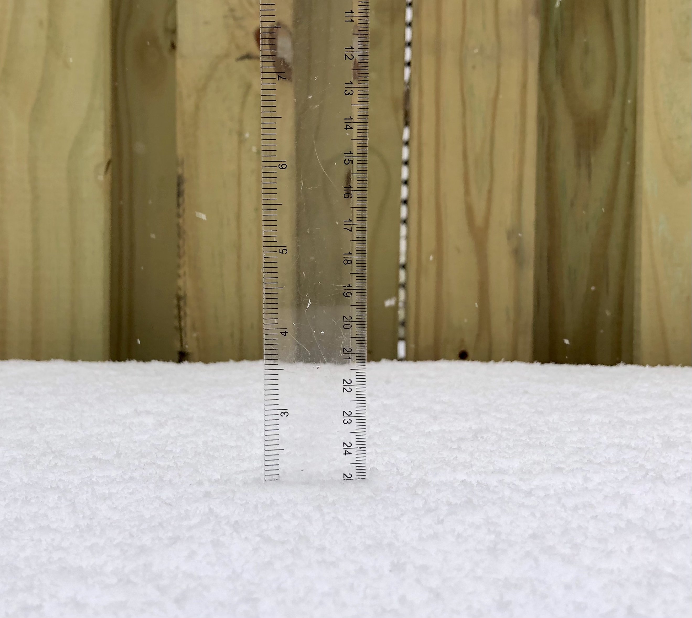
Around 8.5” in N Arlington according to my calibrated slanted ruler measurement at 12:40pm
-
1
-
-
Road just caved in N Arlington. 30 degrees and about 1” on the grass
-
4
-
-
Snow in N. Arlington. Feels like the best rates of the winter.
-
Anyone have links to the RPM? I normally troll TT so somewhat model challenged.
Thanks
-
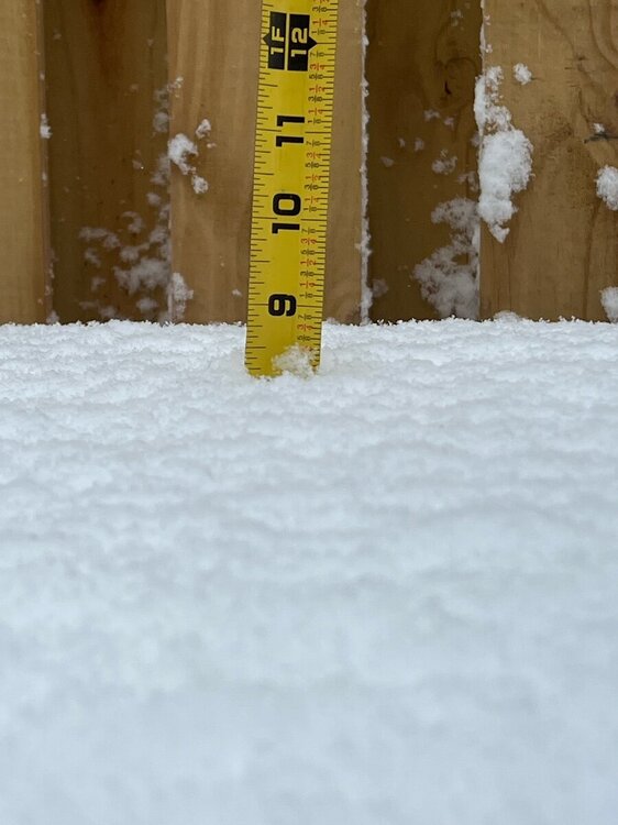
2"+ in N. Arlington at 11 AM. 30°F.

-
1
-
-
Caving in N. Arlington 31 degrees. Let's see if this holds.

-
Gotta love the DC snow force field
-
Holding off the sleet for the moment
-
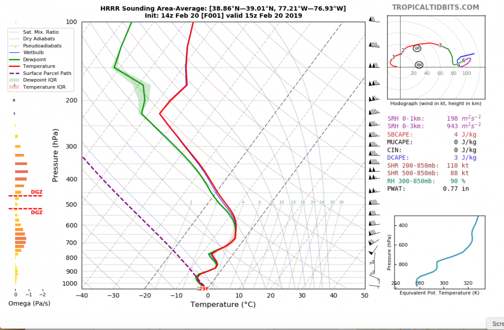
I'm assuming that this sounding implies were are not into the sleet for awhile
-
2.25" in N. Arlington 28 degrees


Jan 19th Storm OBS Thread
in Mid Atlantic
Posted
With a couple more olive dranks, dam strait you can.