
NCIWxGuy
-
Posts
19 -
Joined
-
Last visited
Content Type
Profiles
Blogs
Forums
American Weather
Media Demo
Store
Gallery
Posts posted by NCIWxGuy
-
-
Tonight's Euro is gonna be a mood-setter for the Chicago area...
-
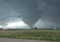
Not sure what to say about the 00z HREF other than, a) the variability in PBL mixing across members probably has massive implications on the tornado threat tomorrow, and b) woof.
-
Was becoming fairly pessimistic about Friday given the HRRR, but I'm beginning to wonder if it's overmixing off the dryline. Most other CAMs, including the 00z WRFs, not only keep dewpoints in the upper 50s to low 60s but also initiate supercells in the Panhandle. Feels like a moderately high ceiling, low floor scenario between Lubbock and Liberal, KS (for reachable areas on my end) for a post-00z show, although potential certainly extends further north as well.
-
Friday is a potentially very interesting day on the High Plains. At first glance, it has many of the looks of an extensive dryline tornado event from McCook to Lubbock with another appealing triple point play into the Sandhills, but wave timing and other factors will probably preclude this caliber of event. I'm particularly interested to see if we can pull something off here in the TX Panhandle, but am worried that the NAMs are undermixing down the dryline and overdoing the moisture. Capping isn't progged to be particularly strong down here, a nice change of pace given the extreme drought. Moisture and CI aside, the ceiling is potentially high should things align sufficiently. A slightly earlier wave timing would aid things here *a lot*. Otherwise, I'm hopeful for somewhat late CI with a couple supercells maturing just before the sunset hour can work its magic.
-
The 12z NAM has entered the chat.
-
 1
1
-
-
-24/-52 at Peru. We might make a run to at least tie our all-time record low of -26 if we can drop 2 more degrees before the low occurs in 90 minutes or so. Will almost certainly do so tomorrow night.
I knew it was coming, I just don't know I ever fully expected it to live up to the forecast. This is gonna be one to remember.
-
-17 for the official low at VYS, and although not as extreme as some of you guys up north, it breaks the previous record of -13.
-
Measured 6.5" at about 8pm. Hit some dry pockets and it stopped snowing for an hour or two earlier. Might still be able to hit 7". A bit of blowing/drifting occurring, too.
-
Measured 5.8" just now. Hit a lull over the past couple hours but still slowly accumulating. Have a feeling it's going to be a slow climb from here on out to our final total, probably around 7", might hit 8.
-
 1
1
-
-
1 minute ago, RCNYILWX said:
Did you report to my office (LOT) with that total? Really impressive for this early in event.
Sent from my SM-G965U using Tapatalk
I'll report it to DVN (I'm in Putnam County). Had some areas up to 5.5" but the approximate median from measuring many spots was 4.7".
-
1
-
-
Up to 4.7". Frustrating to see that heavy band from Pontiac to the Quad Cities sit 5 miles to my south, but we're still way higher than expectations. We probably end up in the 6-8" range, and leaning toward the higher end of that.
-
Already picked up 3" here near Peru. Measured 2" about an hour ago, so rates are pretty hefty. Thinking we could end up over 6", which seemed unthinkable 12-18 hours ago.
-
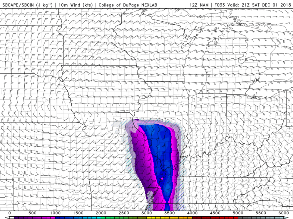
I know this isn't getting much attention here, but tomorrow actually looks halfway decent for low-topped supercells across portions of the LSX and ILX CWAs. Models differ exactly on placement, but it looks to set up somewhere between eastern Missouri and central Illinois. NAMs (what I used for graphics here) are a bit further west than most guidance I've seen.
Precip shield is progged to move out of SW IL by 13-15z, allowing clearing to destabilize the atmosphere potentially on the order of 1000-1500 j/kg, with much of that concentrated in the lowest levels. Surface winds should be backed at least somewhere in the warm sector. Storms should fire near boundary in far eastern Missouri or western Illinois, and have the potential to rotate and produce a few tornadoes. The environment is somewhat reminiscent to me of 12/23/15 in west-central Illinois, where wind profiles were similar but I'm fairly sure CAPE was only on the order of several hundred j/kg.

-
7 minutes ago, CoalCityWxMan said:
Anyone concerned about a dry slot in NC IL?
Yeah noticing radar trends are not great for Marshall/Putnam and nearby areas. Light snow here in Putnam Co now. Concerned it might end up fairly underwhelming if something doesn't happen fast.
-
Transition to snow almost complete here in Granville, northern Putnam County. A couple hours earlier than I was thinking last night.
-
1
-
-
1 minute ago, SchaumburgStormer said:
I didn’t see the 6z euro. Was it still amped? 12z running now.
Saw someone post this graphic of it on twitter, but it cuts off at I-39. You can infer totals though.

-
Another slight tick SE with the 12z GEFS. The 06z mean didn't get >6" south of I-80 in LOT's CWA, and mean low track is also a hair south.

-
1
-
Pre-Christmas (Dec 21-23rd) Winter Storm
in Lakes/Ohio Valley
Posted
Hahahahaha the 12z run already had the low over LAF, I guess we're shooting at least LaSalle/Peru for this run...RIP (but not rippage)