

HVSNOWSTORM
-
Posts
9 -
Joined
-
Last visited
Content Type
Profiles
Blogs
Forums
American Weather
Media Demo
Store
Gallery
Posts posted by HVSNOWSTORM
-
-
45 minutes ago, snywx said:
Welcome to the forum.. You live in quite the weenie spot. The drive up from Pine Bush on 52 has some impressive elevation gain right to Cragsmoor.
I just mover here in September I used to live in Highland. I live literally right at the top of the mountain in cragsmoor on 52. So I'm excited to see how the elevation affects winter here. The temps on normal day are usually 4-8F cooler than pine bush or ellenville.
-
3 minutes ago, RippleEffect said:
remember everything trends south this year so far at least it has!
Hoping man. Idk tho.
-
44 minutes ago, eduggs said:
Everything at least as far north as the CT/MA border looks like sleet there. But I can definitely imagine a little sleet mixed in at the onset for the northern burbs.
12z Ukie was good for the HV even NNJ.
.thumb.png.637f6f2e4e42ec7bf413483dfeee4c8d.png)
-
-
2 minutes ago, 40/70 Benchmark said:
I wouldn't read too much into it given that the EPS mean is virtually unchanged...actually edged north at 06z.
6z gfs was also slightly colder than 0z and pushed the ice/ snow further south
-
 1
1
-
-
Just now, SouthCoastMA said:
That 0z EURO is about best case for my area. Would a more suppressed storm on the 19th help out the potential on the 21/22nd?
Agreed hard to imagine any better for those S of I90 as well.
-
1 minute ago, Baroclinic Zone said:
Definitely not flatter. i like that the flow over the northeast is compressed. Keeps this from cutting west. If we can keep the confluence ahead of it for a bit longer, we can see a Euro scenario. If it pulls out quicker, we see the GFS solution with the C/NNE hit.
it really is a fine line.
-
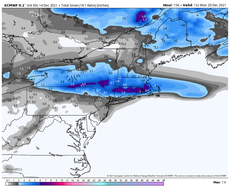
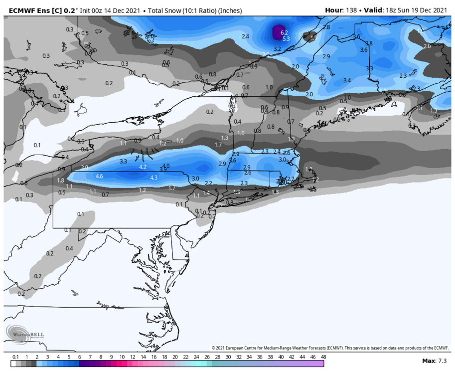
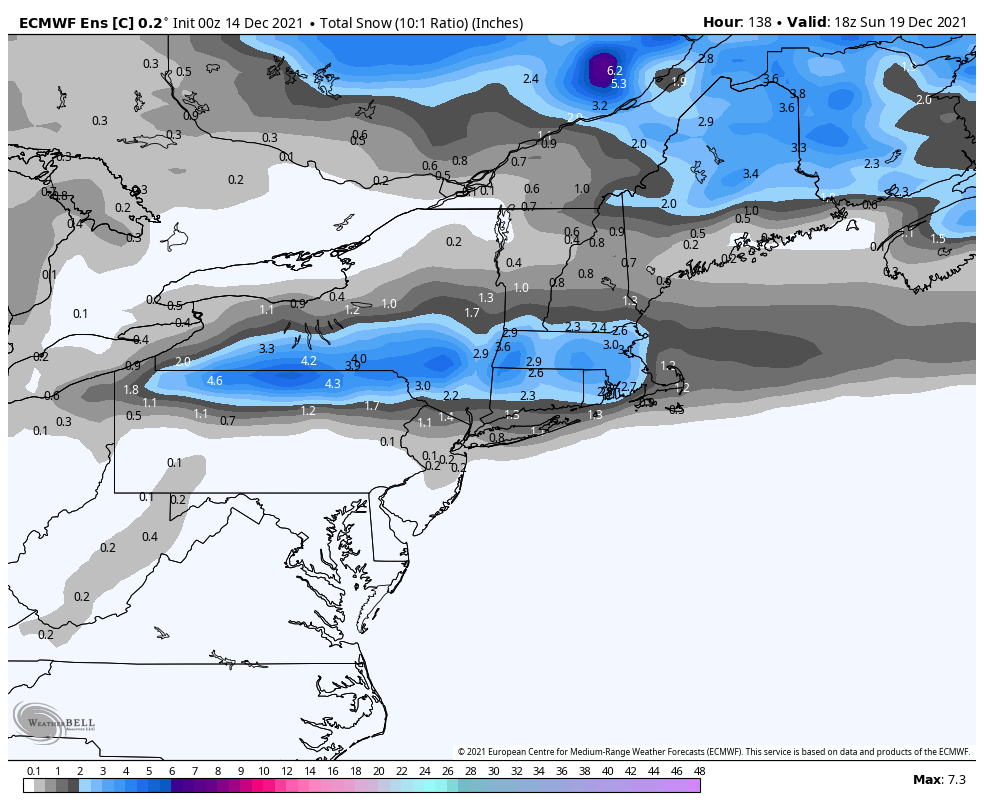
0z euro for the 19th and 0z control look better for the HV.
-
 1
1
-
.png.bf0d91c78e098604763dd0074964345d.png)


December 2021
in New York City Metro
Posted
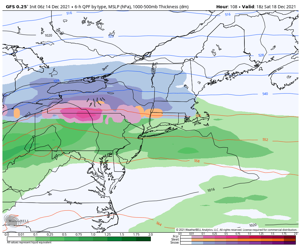
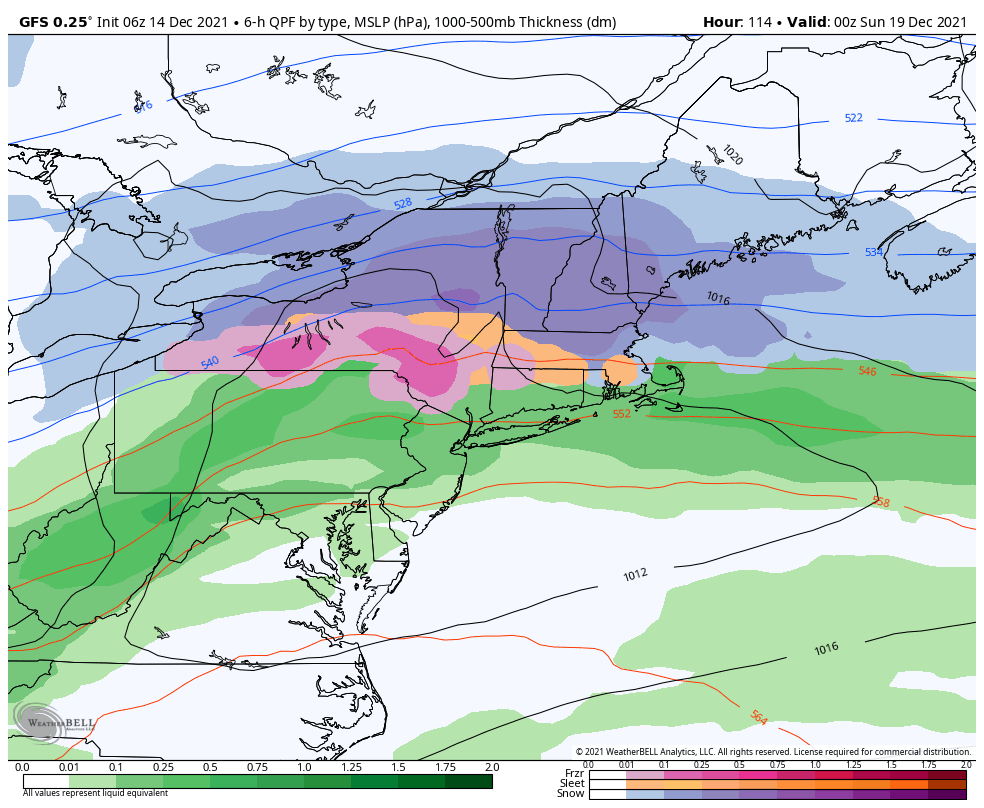
NAM looks way south more ice and snow further south. Either way I look to be in for a pretty good ice event here. Hopefully NAM is trending towards the Euro, def took a big step in that direction. Also major icing.
0z
18z
0z
18z