ILwxchr
-
Posts
97 -
Joined
-
Last visited
Content Type
Profiles
Blogs
Forums
American Weather
Media Demo
Store
Gallery
Posts posted by ILwxchr
-
-
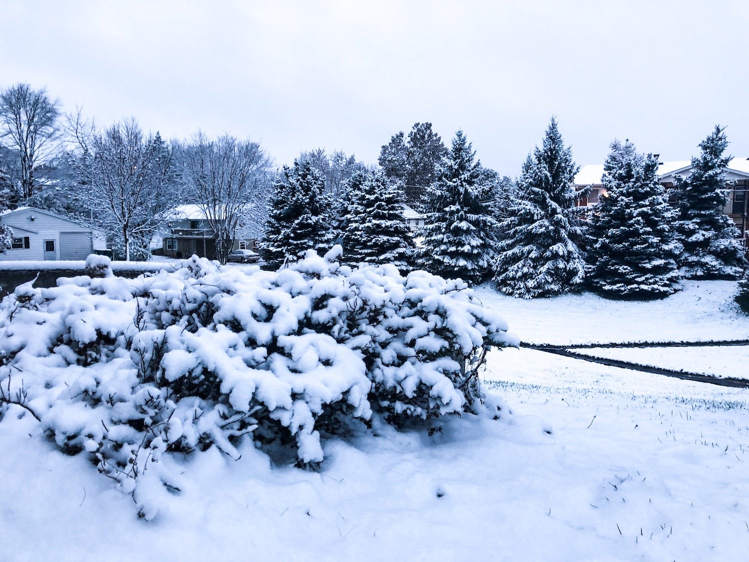
Not much here other than a light glazing of ice. Although I can't complain with how crazy this winter is, we could use a break. Seems like its been snowing every couple days.
-
Picked up probably 0.10" to 0.15" of freezing rain this morning, followed by a lot of rain that only froze on the pavement. Now we are seeing some fat flakes. I'm going with around 2" for here at home (Galesburg) before its all said and done later today. Not a blockbuster storm or even really that impressive, but its something I suppose. Onto later this week I guess...
-
I shot this earlier this morning along I-74 south of the Quad Cities. Numerous vehicles in the ditch including some that were flipped over. Getting quite a bit of ice up here. Going to be heading to the cities this evening to document the snow portion of the system. Looking like a solid 4-6" if you believe the HRRR....probably like concrete too.
-
 1
1
-
-
12z NAM (12k and 3k) sticking with this same idea of snowfall further SE along the low track from Missouri into NW IL. Interesting.
-
6z NAM tracking the low up through Northwest IL. But shows an unusual setup for a heavier period of snow over much of Central/Northwest IL into Iowa. Not sure if I buy that or not considering it basically is where the low is tracking and one would expect some sort of dry slot there....or maybe not. We shall see if future model runs hold onto this new idea.
-
1
-
-
Averaged out 5.75" for a measurement here south of Galesburg imby. So close to the 6" mark, hurts lol. BUT we got a rare heavy snow observation at the airport and shot some good video, so I'm happy. Video can found here:
https://www.youtube.com/watch?v=cBz6fADTs9g
-
1
-
-
1 minute ago, StormChaser4Life said:
Where did you see that? My grids still showing in the 30's
Its in the Winter storm Warning text.
-
 1
1
-
-
Newest NAM (18z) has the QC getting 9" of snow. Has my backyard almost 6". Going to be close here for significant snow I think. Might head up to the quad cities later this evening to document it. Should start seeing the first flakes here within a few hours I'd think.
-
I'm back in Galesburg for this one, considering heading to either Macomb (where my apartment is) or Davenport/Eldridge (where my mom lives). Synoptic snows look pretty good down here, so I may just stay put. Could see some whiteout conditions, HRRR is advertising winds of 20-25 knots out of the northeast, with higher gusts. Even if we don't see the highest snowfall, I think the wind could be enough to cause issues. Snowfall ratios may be lower down south as well, which could lead to lower totals, but also concrete like snow again.
-
1
-
-
3 minutes ago, IMADreamer said:
I take my yard stick out to the yard and try to get three decent measurements and average them.
This is what I did today and usually do when there is a wind component. Usually works for me.
-
I ended up with around 13" in Macomb, IL. Its still snowing outside so might tack a bit onto that but I probably won't go measure....already got my car stuck 3 times today...and difficult to measure because the wind is kicking up now. Most of the snow was heavy and wet though. Here is one of my many videos I shot today:
https://www.youtube.com/watch?v=98bf5stDyXA
Pretty crazy storm for what it was really. Second double digit snowstorm this season and its been a pretty lame "winter". Next weekend looks interesting as well.
-
5
-
-
Looks like around 9 inches so far here on the northeast side of Macomb IL. Lot of other reports surrounding me similar in nature. Lot of stuff moving in from Missouri. Hoping to hit double digits by the time its over. Got stuck this morning, which was fun.
-
Got hammered overnight in Macomb, IL. I estimated anywhere from 7 to 9 inches this morning. Measured 7.0" at 6am, but haven't been out since. I shot some pretty good video of numerous cars stuck and even a snowplow stuck early this morning. Some of the roads were the worst I've ever been on and I got my 4 wheel drive SUV stuck twice. Some light and variable winds is creating some minor drifting on the backside of my apartment complex.
https://www.youtube.com/watch?v=Md4hzwW6TcM&t=4s
-
1
-
-
I am in Macomb, IL and we are already seeing the ground covered and snowfall coming down at a constant light to moderate rate. I'm going to make a call of about 8-9 inches here by the time its said and done. I think the main show will be a deformation band tomorrow morning into afternoon as the ULL pushes to the northeast into Southern IL. Could see some hefty snowfall rates. Crazy to think that our only 2 real snow events of the season and they are both doozies (this one and November blizzard).
-
1
-
-
Winter Storm Warning now for Macomb, IL. I don't get the difference between a warning for 5-8 versus an advisory for 5-7. I get the whole 8" in 24 hour thing, but in my opinion this minor difference is confusing the public. I'd just go with a blanket warning or advisory, but that's why I don't get paid to forecast I guess.
-
 1
1
-
-
I'm going to be in Macomb, IL for this one, going to call about 7" in town. I think higher further south and 6" as far north as 34. Although newer model runs (12z NAM, Canadian, Euro etc) want to give my hometown of Galesburg 8" or so. So its a tough call on where I'm riding this one out.
-
4 hours ago, cyclone77 said:
From DVN
...Very Strong Winds Expected Tuesday...

.Very strong winds will develop Tuesday and usher colder air into
the region. A brief burst of strong winds with gusts up to 40 mph
is possible 6 to 8 AM Tuesday morning. However, the prolonged
very strong winds of 25 to 30 mph with gusts up to 55 mph will
develop around mid morning Tuesday and continue into Tuesday
evening.
Wondering if someone reaches High Wind Warning criteria tomorrow....
-
On 12/31/2018 at 2:08 PM, (((Will))) said:
It is all snow.
Not here it wasn't. Most places picked up heavy rainfall and very little snowfall in eastern IA/northwest IL.
-
Classic mid-latitude cyclone on satellite, very impressive looking storm imo, sad that this isn't all snow. We had some really heavy rain here in Western IL this morning. I bet we would have a swath of at least 6 to 10 inches if this were all snow. December 31st and we are seeing rain....:(
-
1
-
-
Little bit of icing and a dusting of snow north of Davenport this morning. First winter weather we have seen in a while it seems like. Stark contrast from yesterday's temperatures in the 50s. Brisk west winds gusting 30-35 this morning making for a cold morning.
-
If it weren't for the temperatures being in the 50s here on Thursday, it would be a downright miserable day. Probably still will be with 1-2" of rain in December. Anything less than frozen precip in December is gross. Unless its severe weather lol.
-
1
-
-
38 minutes ago, weatherbo said:
Same here this morning. Never been so excited for an inch of snow before

Could be measuring snow in feet, however!


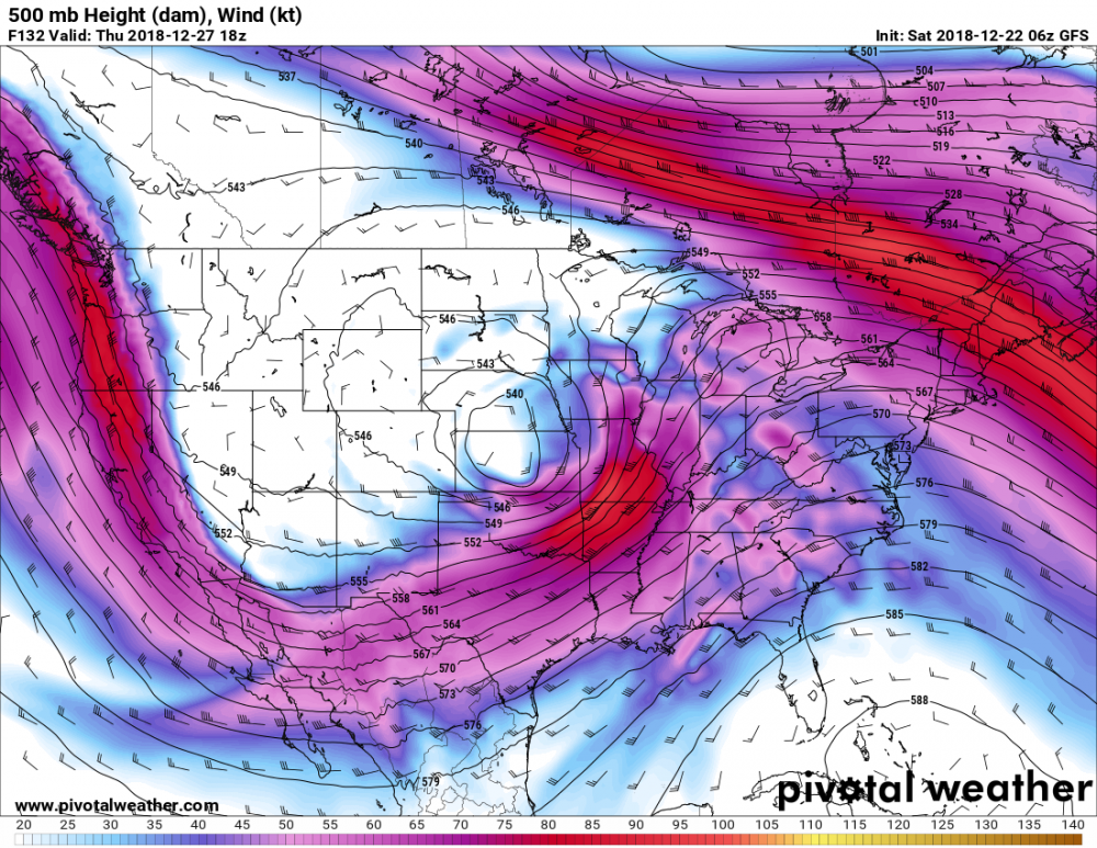
I would narrow that window from 240 hours down to about 152 hours to get a better scope on this single system. Looks like that is showing several systems on these maps.
-
Yeah i am concerned about the potential for a high plains blizzard (out of this subforum) on the backside of this. Whole month reminds me of Dec 2011 where the only decent snowstorm was a low that tracked across the high plains producing blizzard conditions.
-
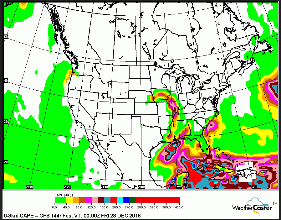
Might even be some thunderstorms to contend with on Thursday afternoon and evening. 3km CAPE is maximized ahead of a strong mid level jet. Dew points are progged on the GFS and FV3 to get into the mid 50s in Central IL with some upper 50s to near 60 further south. At least something to watch.


Winter 2018-19 Grade Thread
in Lakes/Ohio Valley
Posted
I'd give it an A here. Best winter for me since 2013-14. Basically experienced every weather phenomena out there: Tornado outbreak (12/1), significant ice storm (2/12), extreme cold (1/29-1/31), blizzard (11/25-26), major snowstorm (1/12-13), river flooding (January), high wind warning (Feb 23-24). Had our first snow flurries in mid-October and just picked up 1.4" of snow yesterday. Hopefully our last snow of the season. Ready for severe weather season.