

jharv
-
Posts
26 -
Joined
-
Last visited
Content Type
Profiles
Blogs
Forums
American Weather
Media Demo
Store
Gallery
Posts posted by jharv
-
-
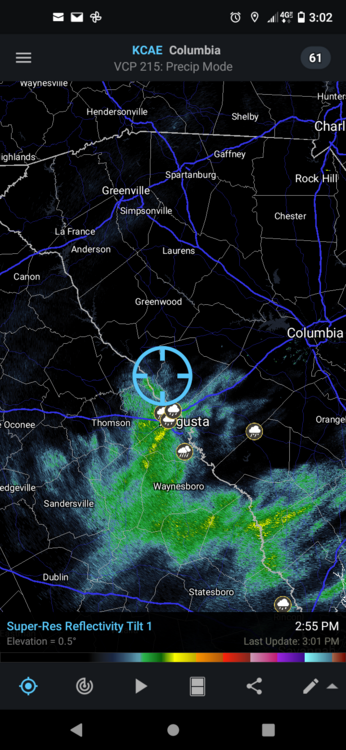
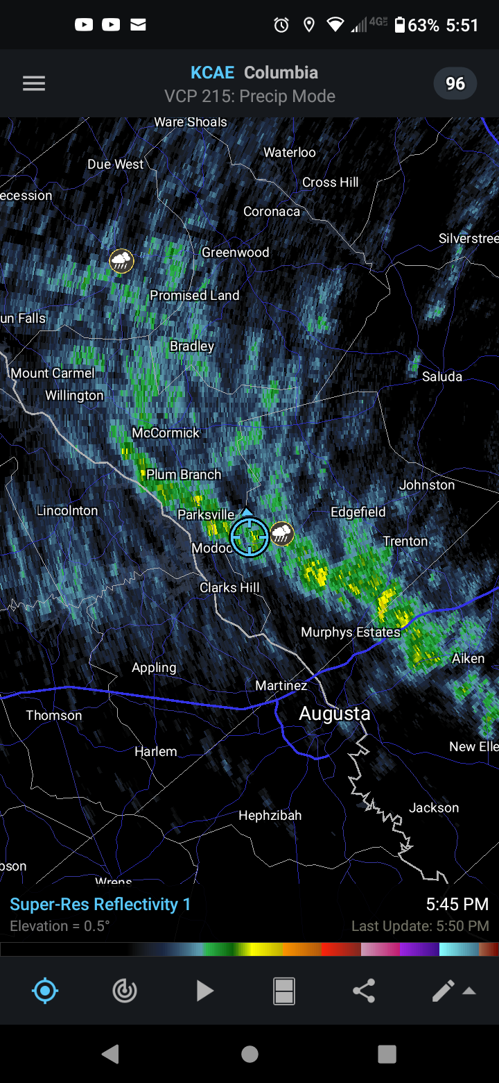
Brief period of hail/graupel in this line coming through north of Augusta, GA

-
 1
1
-
-
On 12/22/2022 at 12:22 AM, GaWx said:
Latest highest SLP in MT is ~1053 mb. Keep in mind that this isn't based on station measured pressures as they have to be converted to SLP and much of MT is up several thousand feet.
These SLPs will be rising considerably tonight. I can already say that the UKMET is going to verify way too low. This makes me wonder about how it converts to SLPs. Something's off bigtime.
Map with current SLPs:
Guessing no records broken since no follow up post? I checked a few hours after this update and saw 1054.
-
2 minutes ago, Lookout said:
Been snowing light to moderate since around 5pm but it took quite a while to get to freezing.(around 7).now its 30.7. A rather dry snow at that..getting close to an inch but a lot was eaten up with those above freezing temps. Its a shame to have another snow event with temps not below freezing for a good part of it. . It seems so wrong to see flakes wasted on cooling.
That said getting any snow at all twice in a week, much less two accumulating ones, is a for sure win in my book.. Radar shows another half hour or so (some of the heaviest of the entire evening is right now). So over 4.30 hours worth for a storm all models showed none at all over multiple runs isn't too bad.
Thanks, for the update. Didnt realize you were in Athens. Wondered what those returns were like over there. Sounds like about the same here just north of Augusta hoping I have several more hours of it though.
-
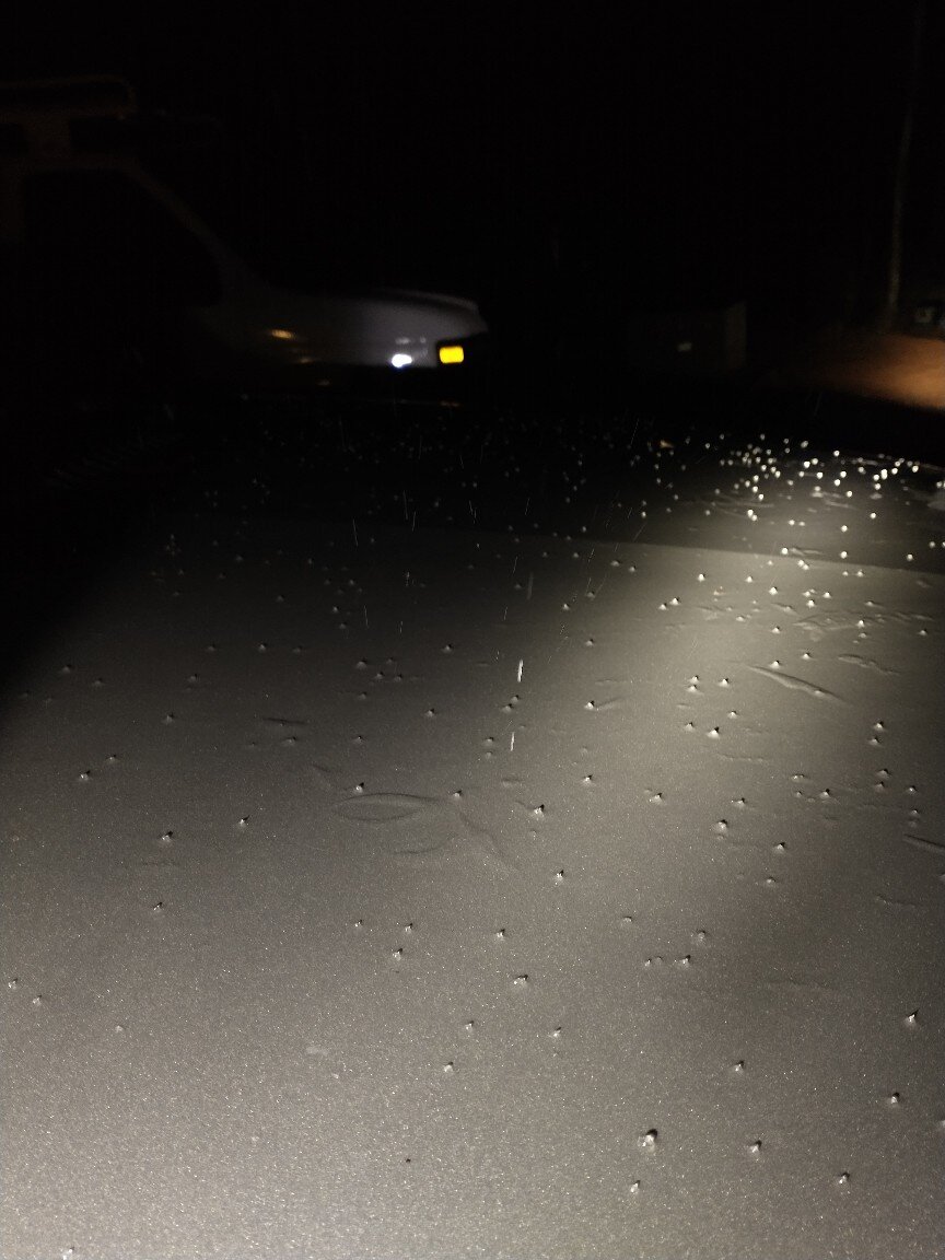
Ice pellets mixed with rain here just north of Augusta GA. The temp is just hitting freezing point and something neat is happening. The sleet pellets are triggering the freezing process on my truck hood. Note the sporadic lumpy areas. Its the little things, ya know?


-
3
-
-
For those curious about downstream, I currently have a light rain that corresponds to these returns. Temp 35 Dewpoint 30
-
1
-
 2
2
-
-
23 minutes ago, Amos83 said:
The time around next weekend to first part of Feb holds the best change for a significant winter storm IMO as the current pattern we are in starts to break down. You can typically count a big storm somewhere as patterns break down and readjust.
Yep, been thinking the same. I wouldnt exactly call this a bitter artic outbreak but historically our best storms come on the tail end of a cold outbreak.
-
Middle SC back in the game all of the sudden!
-
14 minutes ago, ILMRoss said:
One thing I'd like to add- I think sometimes everyone (mets, hobbyists, whoever) can fall into the pitfall of humanizing models too much- I see some "I trust the Euro over everything" like the Euro is a close friend you've been gossiping with, or "the GFS has been hot this month" as if the GFS is Klay Thompson. This isn't a message saying not to rely on models for known strengths and accounting for known biases- but at the end of the day every model is just a supercomputer taking in data, running it through different recipes of the same planetary laws and equations, and spitting stuff out and I think it's good not to get too caught up with the narrative behind each model.
Easy for you to say, caught my wife with the NAM lastnight.
-
 5
5
-
 1
1
-
-
I know most of you guys are focused on North Carolina and snow, but should I give any credence to the 12-24 hours of freezing rain/sleet that has been showing up for GA/SC on the last 4 GFS runs?
-
3
-
-
2 hours ago, olafminesaw said:
I appreciate your insight. Definitely just kidding around here. Hard to get excited about something 6 days away when it's currently snowing outside, but wow, who thought we'd get such a stellar pattern out of this winter
Its alot easier to look 6 days ahead when 1.5 inches of rain just fell @33-34 degrees!


-
1
-
 1
1
-
-
9 minutes ago, burrel2 said:
33.7 at I-20 in West Georgia. Cc radar says snow should be falling there. Anybody reporting ground truth?
Not seeing anything obvious along I-20 on webcams.
-
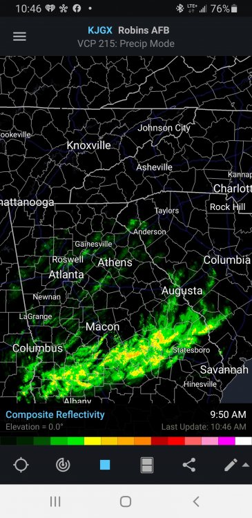
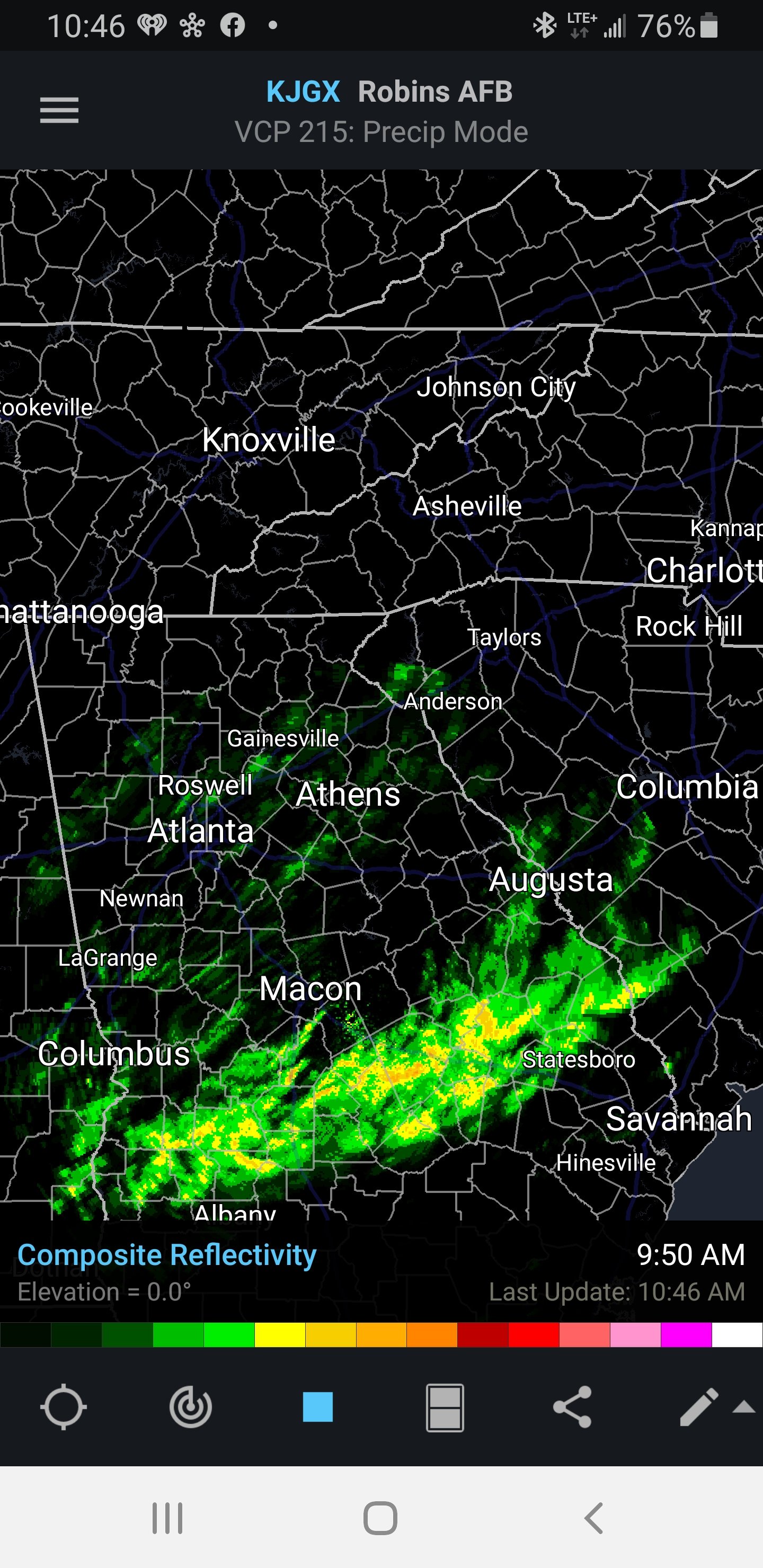
The little "wisp" of returns that just swept through Augusta GA had some sleet pellets mixed with rain. Probably the extent of what we will see.
-
1
-


Mid to Long Range Discussion ~ 2023
in Southeastern States
Posted
Not sure what factors affect the AQI, but this is forest service controlled burn season in my area. We end up with smoke haze quite often during Jan-March.