January 30-February 1 Winter Storm
January 26, 2021
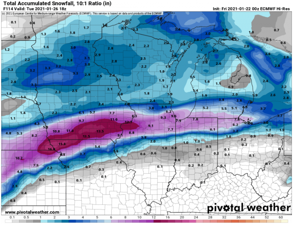
Since we can always take the medium range guidance to the bank... Anyway, looks like the next trackable storm for the sub. Besides the snow, the progged strength/position of the surface high could offer up an icy transition zone.
2
1,000 replies