
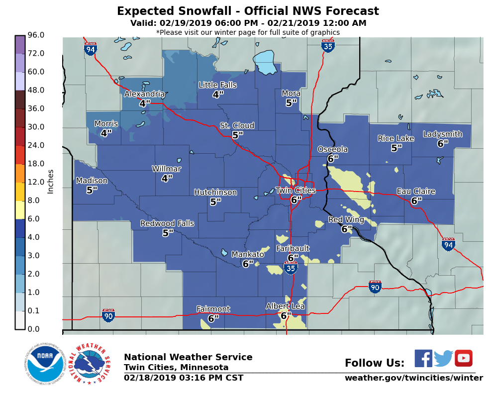
I haven't started a thread in ages so sure why not. Hopefully I won't be a storm killer. Models consistently showing a pretty moisture laden system mid-week with a mixed bag of precip. The main surface system stays pretty south but an inverted trough extends far north and provides a focus for a quick hitting intense burst of wintry precip