
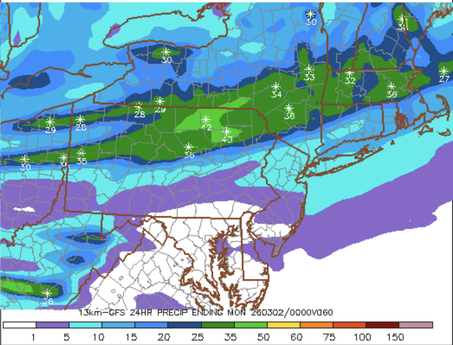
The guidance has shown an increasing signal for another brief period of snow in this fast flow pattern, this time on Sunday. Today's GFS was the most robust yet. This looks well timed with an intrusion of cold from Canada. Could we be trending toward an advisory level event?
Discuss
