
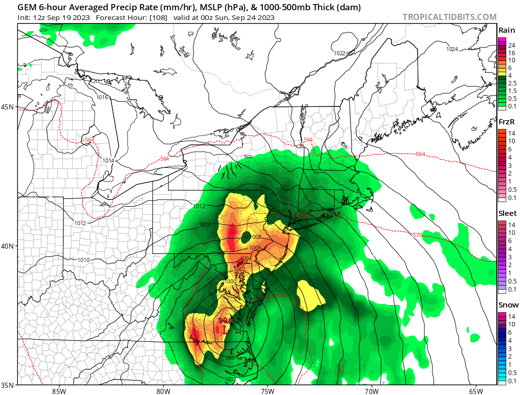
The models are pretty much unanimous in developing a non-tropical surface low off of the SE US coast late this week that could then transition into either or both a STC and a TC. Ultimately, the biggest impact to land could end being heavy rain well up the E cost as @jconsorhas mentioned elsewhere.
I found these seven TCs that formed from a nontropical origin that later hit the SE US as an H:
-Arthur 2014: early July; developing weak Nino; cat 2 into NC
-Gaston 2004: late Aug; weak

