
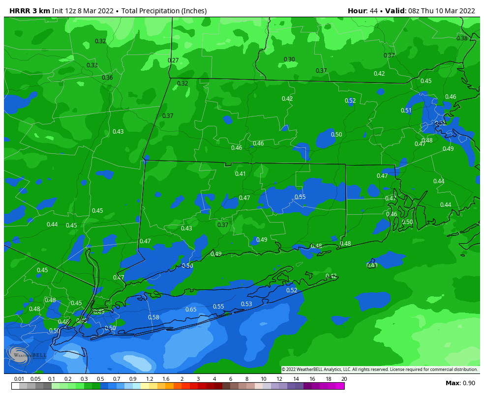
Models continuing to show a swath of snow from the Pike south through CT RI and SE Mass with good banding signals showing up. Will add some images soon. With marginal temps and snow mostly falling during daylight hours, would think minimal accumulations on the roads with the exception of any snow falling heavy enough before the sun gets too high tomorrow AM in southern areas. However 1-3/2-4” snow on cold surfaces possible.
