
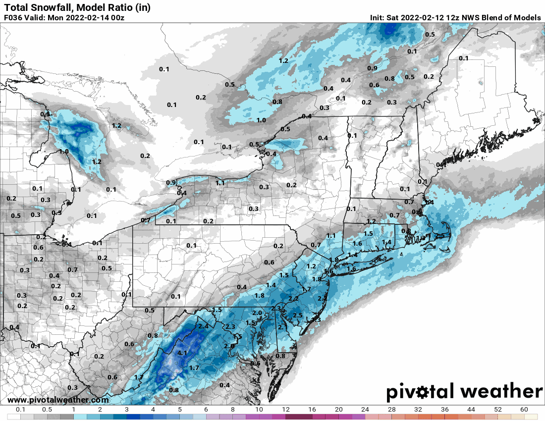
Models coming in juicier and farther N and W. Starting to look like after low 60s today, arctic front plows thru later with plummeting temps and a mix of rain and snow breaking out by midnight or shortly after. Coating to an inch in most spots, mostly on grass/cars. So heavier bursts over extreme SE PA with some isolated spots seeing up to 2 or 3".