
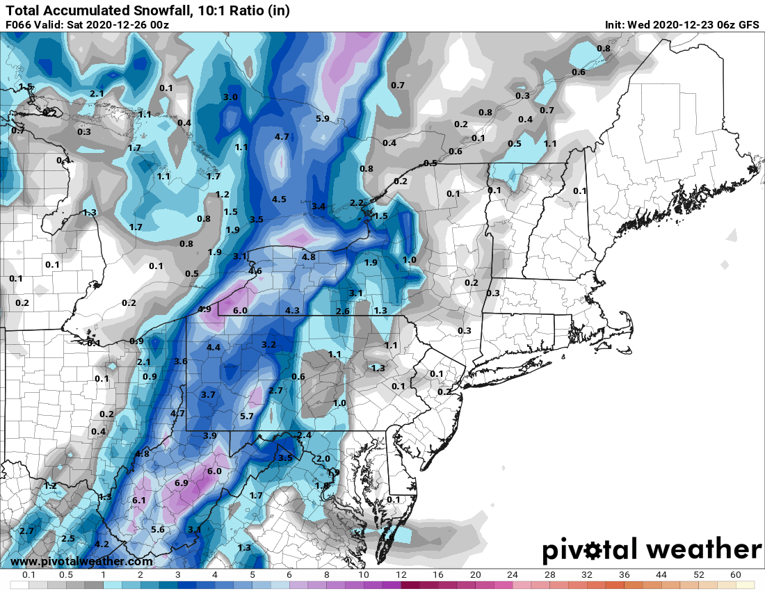
WSW in effect for 1'+ of snow for the area
Forecast discussion:
.LONG TERM /THURSDAY NIGHT THROUGH MONDAY/...
...Heavy Lake Effect Snow Possible Christmas through December
26...
The aforementioned system will started to rapidly wrap colder
air into the area as the increasingly-curved upper jet structure
advances northward through the area on Thursday night. This will
rapidly drop 850 hPa temperatures from SW to NE across the area
as it does so and change precipitation from ra

