
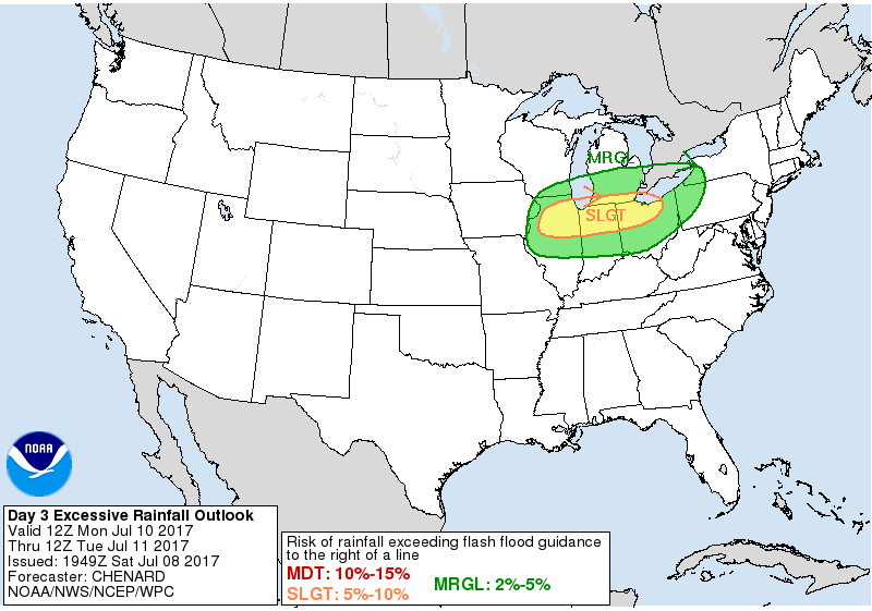
As of now, we have a marginal risk area for Sunday and Monday. It's a pretty classic summer pattern that will feature a big reservoir of heat/high dewpoints with the potential for multiple disturbances (sometimes hard to pinpoint very well in advance) passing through the region, resulting in periodic MCS activity capable of severe weather and possibly flooding.
Quite possible this pattern will still be around beyond the 14th, but running the thread through then for now.