
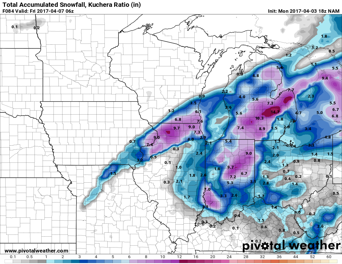
Not sure this will end up being something significant/thread worthy, but there would appear to be increasing potential for a late season snow event mid to late week.
Models are suggesting just enough cold air wrap-in/dynamic cooling for a band of wet snow developing on Wednesday. The devil is in the details of course, and small adjustments in the thermal profiles could have significant ramifications. One thing that looks likely is that the system will be fairly slow moving, so there will