
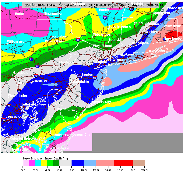
I'll tell you what. I initially doubted this storm tremendously given the height pattern and upper air blocking breakdown, but it's becoming clear that this could very well mean business if tonight's model guidance even has a semblance of a clue. I know there were plenty of people calling last weeks storm "mundane" (which it did end up being for most people), but this is the exact opposite of that should it come to fruition. The upper level shortwave is absolutely loaded with tons of vorticity--