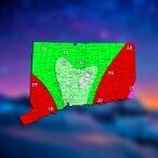
Greg Posted February 9, 2021 Share Posted February 9, 2021 If one excludes the GEM/RGEM, storm-total liquid-equivalent precipitation remains rather remarkably consistent across the deterministic and global ensemble guidance at around 0.3-0.4". Other than across Cape Cod and the South Coast where rain may mix in, this would ordinarily only support an Advisory-type snowfall around 3-5" at SLRs of 10 to 13:1. However, both 00z NAM and GFS indicate a zone of 850 mb speed convergence and associated W-E band of 850 mb frontogenetic forcing with some -EPV lifting N/NE from central CT/central RI this afternoon. This should support the development of localized bands of moderate to potentially heavy-intensity snows for a few-hr period near and north of the Mass Pike, coinciding with the PM commute. These bands are supported by 00z HREF 1-hrly snowfall progs, which suggest inch per hour snow rates could be achievable in the winter storm warning area, with low visbys to boot. In addition, WPC runs experimental Snowband Probability graphics which depict the potential for mesoscale snowbands, and a number of members indicate the potential for such bands during the 19-23z timeframe. These are often challenging to pinpoint and it`s not out of the question areas in northern CT and northwest RI could get in on these bands as well; Omega in the snow growth region is also a lot less, which should keep us from seeing the intense snow rates we saw from e.g. Sunday. But, snow amounts were increased around 1-2" inches in the winter storm warning area to around 5-7" (isolated/local higher in persistent steady-state bands), around 3-6" across northern CT, Providence County in RI and up towards Norfolk and the Greater Boston area. Amounts taper further south and east to the 2-4" range for southeast MA into central RI, and generally 1-3" near the South Coast/Cape where rain may mix in at times. 2 Link to comment Share on other sites More sharing options...
Kitzbuhel Craver Posted February 9, 2021 Share Posted February 9, 2021 Just now, DotRat_Wx said: This is weird, I wanted to argue. Have a nice day? I'm ron burgundy? Lol, ninja’d that... But in all seriousness, I said congrats up north, looks like a better shot at verifying up that way. 2 Link to comment Share on other sites More sharing options...
powderfreak Posted February 9, 2021 Share Posted February 9, 2021 Very cold snowfall too. 3/4sm vis snow at 8F to start, but now up to 13F. 1 Link to comment Share on other sites More sharing options...
40/70 Benchmark Posted February 9, 2021 Share Posted February 9, 2021 13 minutes ago, HoarfrostHubb said: OMG at the whining Not me, for once LOL I don't care enough about the small ones. 1 Link to comment Share on other sites More sharing options...
Damage In Tolland Posted February 9, 2021 Share Posted February 9, 2021 4 minutes ago, ORH_wxman said: 2-5"....not seeing much warning snowfall potential. Maybe a narrow stripe can get 6 or 7 if everything breaks right in the next 8 hours. If that stuff south of LI could link up with the northern bands, then it would get exciting, but it seems they don't do that until offshore. But we watch... Solid band stretched across CT now. Huge flakes . 1” per hour rates . For now anyway Link to comment Share on other sites More sharing options...
TauntonBlizzard2013 Posted February 9, 2021 Share Posted February 9, 2021 Sorry for stating the obvious. Everything is awesome. Carry on 3 Link to comment Share on other sites More sharing options...
Greg Posted February 9, 2021 Share Posted February 9, 2021 I guess the forecast is depending on a combination of good ratios to make up for the 0.2" - 0.4" of LE predicted. Link to comment Share on other sites More sharing options...
HalloweenGale Posted February 9, 2021 Share Posted February 9, 2021 Just now, Damage In Tolland said: Solid band stretched across CT now. Huge flakes . 1” per hour rates . For now anyway Stretching E from HFD to PVD? That IS a nice band. Link to comment Share on other sites More sharing options...
Baroclinic Zone Posted February 9, 2021 Share Posted February 9, 2021 Just now, radarman said: The 3km nammy point and click soundings on TT the last 24-48 hours didn't line up omega and the DGZ particularly well. And these tiny flakes do suggest shallow lift. I think you would have found the best omega/DGZ was further N in that band early on and now that we have the SLP in the strengthening stages its collapsing it all further S and E. This current band should congeal as it comes E and where that sets up, you'll see the highest totals. Does not look widespread though. 1 Link to comment Share on other sites More sharing options...
40/70 Benchmark Posted February 9, 2021 Share Posted February 9, 2021 9 minutes ago, STILL N OF PIKE said: Light snow Nashua 22F Heading into mass at 330, seeing if I can convince owner to close for PM. I think convincing anyone to close anything is a tall task at present. Link to comment Share on other sites More sharing options...
Thunderblizzard Posted February 9, 2021 Share Posted February 9, 2021 Riding the line here right now... actually picked up in intensity some. Link to comment Share on other sites More sharing options...
TalcottWx Posted February 9, 2021 Share Posted February 9, 2021 3 minutes ago, TauntonBlizzard2013 said: Sorry for stating the obvious. Everything is awesome. Carry on I don't like further south... Maybe a few locations do OK but... I feel like you're right for your location. We'll see Link to comment Share on other sites More sharing options...
HIPPYVALLEY Posted February 9, 2021 Share Posted February 9, 2021 6 minutes ago, HoarfrostHubb said: Yeah. I think you are right that the BOX stuff is overdone. 3-5", prob lower end in your area Hoping for 5-6" here but that might bust We’ll be ok Link to comment Share on other sites More sharing options...
wxeyeNH Posted February 9, 2021 Share Posted February 9, 2021 14F Light snow vis 1 mile 1.25" new Snow growth has been good at time and cycles. Has anyone every notice that sometimes when the flakage is small big dendrites will mix back in. They become more numerous but get smaller until the whole flake population is somewhat larger. Then the whole thing cycles again. Link to comment Share on other sites More sharing options...
PWMan Posted February 9, 2021 Share Posted February 9, 2021 Steady very light snow now - pixie dust Link to comment Share on other sites More sharing options...
Henry's Weather Posted February 9, 2021 Share Posted February 9, 2021 Flurries in the ville Link to comment Share on other sites More sharing options...
CoastalWx Posted February 9, 2021 Share Posted February 9, 2021 We flurries. Link to comment Share on other sites More sharing options...
ineedsnow Posted February 9, 2021 Share Posted February 9, 2021 Flake size increasing a bit Link to comment Share on other sites More sharing options...
Hoth Posted February 9, 2021 Share Posted February 9, 2021 You smell something, Rabbit? Link to comment Share on other sites More sharing options...
Baroclinic Zone Posted February 9, 2021 Share Posted February 9, 2021 Think someone tossed a jet engine near TAN ASOS. 1 Link to comment Share on other sites More sharing options...
DomNH Posted February 9, 2021 Share Posted February 9, 2021 Just some pixie dust stuff so far. Looks on track for another 2-4'' to me. Link to comment Share on other sites More sharing options...
HoarfrostHubb Posted February 9, 2021 Share Posted February 9, 2021 1 minute ago, Baroclinic Zone said: Think someone tossed a jet engine near TAN ASOS. Or dumped a big pile of dung onto it. 45F? Link to comment Share on other sites More sharing options...
powderfreak Posted February 9, 2021 Share Posted February 9, 2021 1/2sm moderate snow at the ASOS now. Winter as it should be with cold baking soda falling. KMVL 091554Z AUTO 17003KT 1/2SM SN FZFG VV016 M10/M12 Link to comment Share on other sites More sharing options...
Baroclinic Zone Posted February 9, 2021 Share Posted February 9, 2021 Just now, HoarfrostHubb said: Or dumped a big pile of dung onto it. 45F? Only running 15F above surrounding stations. Link to comment Share on other sites More sharing options...
Damage In Tolland Posted February 9, 2021 Share Posted February 9, 2021 Put it in wrong thread.. we’ve been under a nice 1” per hour band with big fluffy flakes . Not quite as heavy as Sunday but very low viz. 1 Link to comment Share on other sites More sharing options...
Great Snow 1717 Posted February 9, 2021 Share Posted February 9, 2021 25 minutes ago, 40/70 Benchmark said: I think convincing anyone to close anything is a tall task at present. ...unless someone is a school employee......... Link to comment Share on other sites More sharing options...
weathafella Posted February 9, 2021 Share Posted February 9, 2021 Light steady snow commenced within the last 20 minutes. Tiny flakes still Link to comment Share on other sites More sharing options...
Colonel Badger Posted February 9, 2021 Share Posted February 9, 2021 16 minutes ago, DomNH said: Just some pixie dust stuff so far. Looks on track for another 2-4'' to me. Really? I'd be surprised at this point to get anymore than 1" and kinda think we just get a covering. Link to comment Share on other sites More sharing options...
PWMan Posted February 9, 2021 Share Posted February 9, 2021 Actual (albeit small) flakes now instead of the dust/sand we had before. 28 and dead calm. Link to comment Share on other sites More sharing options...
DomNH Posted February 9, 2021 Share Posted February 9, 2021 2 minutes ago, Colonel Badger said: Really? I'd be surprised at this point to get anymore than 1" and kinda think we just get a covering. I'm not particularly excited but I think we at least eek out 2'' of fluff. Link to comment Share on other sites More sharing options...

Recommended Posts
Create an account or sign in to comment
You need to be a member in order to leave a comment
Create an account
Sign up for a new account in our community. It's easy!
Register a new accountSign in
Already have an account? Sign in here.
Sign In Now