CNY_WX Posted February 7, 2020 Share Posted February 7, 2020 6 minutes ago, TugHillMatt said: Latest trends now have SYR out of the heaviest band. Cazenovia to Utica now looking like the prime spot. Hopefully no more farther east. This has been such a tight situation. One set of model runs I am thinking no more west...no more rest...then it's no more east...no more east...hah What trends are you looking at? 1 1 Link to comment Share on other sites More sharing options...
Syrmax Posted February 7, 2020 Share Posted February 7, 2020 14 minutes ago, BGM Blizzard said: Latest BGM update saying 2-4"/hour rates possible within meso band. So it will snow for 3 hours in some places and that's it? Got it. Just trying to match that up with forecast map. Link to comment Share on other sites More sharing options...
rochesterdave Posted February 7, 2020 Share Posted February 7, 2020 Nobody really knows exactly where that band ends up. Because it’s following a baroclinic zone it will slide as opposed to rotate (I think). Anyone from Roc to Albany is game. Roc-SYR will do fine with enhancement at the back end. 1 Link to comment Share on other sites More sharing options...
TugHillMatt Posted February 7, 2020 Share Posted February 7, 2020 2 minutes ago, CNY_WX said: What trends are you looking at? A number of the 00Z runs HRRR and RAP look great though. Not saying any of the models look bad for us...they all look great...just the heaviest looks like it may set up east of us. Link to comment Share on other sites More sharing options...
rochesterdave Posted February 7, 2020 Share Posted February 7, 2020 Looks damn good for Syracuse here 2 Link to comment Share on other sites More sharing options...
Syrmax Posted February 7, 2020 Share Posted February 7, 2020 45 minutes ago, tim123 said: My car slid down my driveway tonight. It sure is icy out. That's nasty. And a covering of snow on top after tomorrow. One of the few times the salt trucks will be of great value, other than for causing traffic tie ups tooling along at 35 mph on highways. Link to comment Share on other sites More sharing options...
CNY_WX Posted February 7, 2020 Share Posted February 7, 2020 Latest observation from KROC has snow starting to mix in. KROC 070354Z 04011KT 3SM -FZRAPLSN BR OVC005 M02/M03 A2939 RMK AO2 SNB42 SLP962 P0002 I1003 T10221033 1 Link to comment Share on other sites More sharing options...
Syrmax Posted February 7, 2020 Share Posted February 7, 2020 5 minutes ago, TugHillMatt said: A number of the 00Z runs HRRR and RAP look great though. Not saying any of the models look bad for us...they all look great...just the heaviest looks like it may set up east of us. Seems like banding often tends to set up N&W of where modeling shows it pre-storm along with axis of heaviest qpf. But we'll see. Will be fun to observe. 1 Link to comment Share on other sites More sharing options...
TugHillMatt Posted February 7, 2020 Share Posted February 7, 2020 1 minute ago, Syrmax said: Seems like banding often tends to set up N&W of where modeling shows it pre-storm along with axis of heaviest qpf. But we'll see. Will be fun to observe. Good point. It will indeed be fun to observe. 1 Link to comment Share on other sites More sharing options...
rochesterdave Posted February 7, 2020 Share Posted February 7, 2020 Lake Placid looks to have less mixing issues tomorrow. I’ll take some pics! Goodnight. 2 Link to comment Share on other sites More sharing options...
TugHillMatt Posted February 7, 2020 Share Posted February 7, 2020 I just went for a jebwalk in the light freezing rain. Trees and cars getting iced over. Road was ok...I could tell it was starting to get slippery, especially on the colder sides of the roads. 1 Link to comment Share on other sites More sharing options...
wolfie09 Posted February 7, 2020 Share Posted February 7, 2020 Quite slick out there, down to 26.4°, freezing drizzle.. Link to comment Share on other sites More sharing options...
tim123 Posted February 7, 2020 Share Posted February 7, 2020 Keep noticing hrrr ever so slightly pushing heavier snow west every run. Link to comment Share on other sites More sharing options...
96blizz Posted February 7, 2020 Share Posted February 7, 2020 31 minutes ago, wolfie09 said: Quite slick out there, down to 26.4°, freezing drizzle.. I can attest. Made it home safely to my family 4.5 hours from Jersey. Glad I chose the route I did. Roads not too bad but the fog was unreal at times. Enjoying a very tasty cold IPA as a reward and to calm my nerves! Then some rest for the show tomorrow! 1 Link to comment Share on other sites More sharing options...
Polarbear Posted February 7, 2020 Share Posted February 7, 2020 1 hour ago, 96blizz said: I can attest. Made it home safely to my family 4.5 hours from Jersey. Glad I chose the route I did. Roads not too bad but the fog was unreal at times. Enjoying a very tasty cold IPA as a reward and to calm my nerves! Then some rest for the show tomorrow! Looks like you made out good then... good deal! 1 Link to comment Share on other sites More sharing options...
Syrmax Posted February 7, 2020 Share Posted February 7, 2020 KBGM upping totals and expanding Warnings south and east in their CWA. Not sure why so late. Did they just start looking at models other than the GFS? This shouldnt be allowed. Can never verify their accuracy as their forecasts continually change. IMO they roll with the 6-9" call for SYR when Warnings were first issued. Link to comment Share on other sites More sharing options...
LakeEffectKing Posted February 7, 2020 Share Posted February 7, 2020 8 minutes ago, Syrmax said: KBGM upping totals and expanding Warnings south and east in their CWA. Not sure why so late. Did they just start looking at models other than the GFS? This shouldnt be allowed. Can never verify their accuracy as their forecasts continually change. IMO they roll with the 6-9" call for SYR when Warnings were first issued. I think the main issue has always been how much qpf was going to fall as ZR/IP and the ratios early on. I'm in Cazenovia now, and we are icing up fast! 06z RGEM just coming in, and seems to want to turn over to SN+ a bit earlier than previous runs, for most of CNY. Link to comment Share on other sites More sharing options...
TugHillMatt Posted February 7, 2020 Share Posted February 7, 2020 And then BUF lowered totals on their map. I can definitely hear sleet pellets hitting the windows here now. Link to comment Share on other sites More sharing options...
Geez150 Posted February 7, 2020 Share Posted February 7, 2020 Yup same here, only 3"-6" now for my area and no way am I betting on the 6". Still showing 8"-14" for the tug, and the weird thing is only show 5"-10" for old forge. Would have thought the OF would do better being more east of tug. Link to comment Share on other sites More sharing options...
TugHillMatt Posted February 7, 2020 Share Posted February 7, 2020 BUF and BGM rarely seem to collaborate on things. One boosts totals, while the other lowers...or vice versa. They are like the GFS and Euro. Huge difference in their maps this morning. Link to comment Share on other sites More sharing options...
Thinksnow18 Posted February 7, 2020 Share Posted February 7, 2020 The bust is real. About 1/4" of snow overnight...radar looks like shit...might squeak out 2 or 3" today...that went poof faster than a Copperfield illusion... 2 Link to comment Share on other sites More sharing options...
lakeeffectkid383 Posted February 7, 2020 Share Posted February 7, 2020 7 minutes ago, Thinksnow18 said: The bust is real. About 1/4" of snow overnight...radar looks like shit...might squeak out 2 or 3" today...that went poof faster than a Copperfield illusion... I can’t believe I woke up to only a dusting and radar looking like that. It’s honestly unreal. The winter of 19-20 lives on in infamy! 2 Link to comment Share on other sites More sharing options...
Geez150 Posted February 7, 2020 Share Posted February 7, 2020 5 minutes ago, Thinksnow18 said: The bust is real. About 1/4" of snow overnight...radar looks like shit...might squeak out 2 or 3" today...that went poof faster than a Copperfield illusion... I was thinking the same. Link to comment Share on other sites More sharing options...
CNY-LES FREAK Posted February 7, 2020 Share Posted February 7, 2020 Super heavy snow right now as we kiss the taint, lol!Sent from my SM-G970U using Tapatalk Link to comment Share on other sites More sharing options...
Geez150 Posted February 7, 2020 Share Posted February 7, 2020 2 minutes ago, WesterlyWx said: I can’t believe I woke up to only a dusting and radar looking like that. It’s honestly unreal. The winter of 19-20 lives on in infamy! Maybe the boys out east do good still, hopefully. But for us guys in wny, on to the next one? Link to comment Share on other sites More sharing options...
CNY-LES FREAK Posted February 7, 2020 Share Posted February 7, 2020 It's just begun, give it a chance to consolidate! It's a 996 SLP in SPA moving slowly NE, lovely. H700 just closed off as well so its intensifying before our eyes!Sent from my SM-G970U using Tapatalk Link to comment Share on other sites More sharing options...
CNY-LES FREAK Posted February 7, 2020 Share Posted February 7, 2020 Mesoscale Discussion 0104 NWS Storm Prediction Center Norman OK 0432 AM CST Fri Feb 07 2020 Areas affected...northern WV...western into north-central PA...parts of western NY Concerning...Heavy snow Valid 071032Z - 071400Z SUMMARY...Snowfall rates are forecast to increase to around 1 inch per hour (locally higher) during the 530-900am EST period. DISCUSSION...Radar mosaic shows a precipitation shield gradually expanding in coverage across the upper OH Valley early this morning. Recent (4-5am EST) surface observations at Parkersburg, WV and Cambridge, OH in the upper OH Valley have recorded heavy snow as strengthening mid-level forcing for ascent rapidly approaches the region from the southwest. Model forecasts show a northeast-translating area of strong 700-mb frontogenesis moving from northern WV/southwest PA at 5am EST into north-central PA by 8am EST. Concurrent with the frontogenetic forcing, SREF model guidance indicates 1 inch per hour rates will accompany this northeast-translating forcing for ascent. Therefore, 1 inch per hour snowfall rates (locally higher during sub-hour bursts) appear likely this morning beginning in northern WV and developing northeast across western PA into parts of western NY. Link to comment Share on other sites More sharing options...
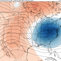
CNY-LES FREAK Posted February 7, 2020 Share Posted February 7, 2020 Link to comment Share on other sites More sharing options...
PaulyFromPlattsburgh Posted February 7, 2020 Author Share Posted February 7, 2020 5 minutes ago, CNY-LES FREAK said: Beautiful. Right on pace! We had freezing rain all night with some solid accretion. All colleges and schools cancelled. Link to comment Share on other sites More sharing options...
TugHillMatt Posted February 7, 2020 Share Posted February 7, 2020 Yup, large snowflakes falling here under the bright banding. Link to comment Share on other sites More sharing options...

Recommended Posts
Create an account or sign in to comment
You need to be a member in order to leave a comment
Create an account
Sign up for a new account in our community. It's easy!
Register a new accountSign in
Already have an account? Sign in here.
Sign In Now