radarman Posted January 11, 2017 Share Posted January 11, 2017 6 minutes ago, Ginx snewx said: Euro ens plop another 5-8 feet in the next 10 days out there As I will be heading out to Crystal in 2 weeks after AMS, hoping that the river flows through the Cascades before heading S into Cali. The Pac NW has been quite chilly and may well remain so. It could be lighter snow than they're used to, though perhaps not quite as epic as the Sierras. Link to comment Share on other sites More sharing options...
powderfreak Posted January 11, 2017 Share Posted January 11, 2017 4 minutes ago, Ginx snewx said: Did you see the groomed picnic tables/ I really laughed about that today Yeah that was hilarious. Never know wjats under that snow. Needless to say they are buried with packed powder conditions on the picnic tables lol. Link to comment Share on other sites More sharing options...
Ginx snewx Posted January 11, 2017 Share Posted January 11, 2017 3 minutes ago, powderfreak said: Yeah that was hilarious. Never know wjats under that snow. Needless to say they are buried with packed powder conditions on the picnic tables lol. Imagine that could be quite dangerous though. Link to comment Share on other sites More sharing options...
Ginx snewx Posted January 11, 2017 Share Posted January 11, 2017 7 minutes ago, radarman said: As I will be heading out to Crystal in 2 weeks after AMS, hoping that the river flows through the Cascades before heading S into Cali. The Pac NW has been quite chilly and may well remain so. It could be lighter snow than they're used to, though perhaps not quite as epic as the Sierras. Euro ens say crushed Link to comment Share on other sites More sharing options...
radarman Posted January 11, 2017 Share Posted January 11, 2017 10 minutes ago, powderfreak said: Yeah that's what they argue and Rocky Mtn skiers argue otherwise haha. The old Dueling Banjos column in Powder Magazine used to argue both points each winter, it was hilarious. But the wind also packs it quite a bit. Like you'll see someone drop into a Squaw Valley bowl after 10 feet of snow and he's ripping it like it's a groomer of wind-buff. That is definitely true, particularly on the real open stuff near the ridgelines. It's a race to get out there to the big features first thing in the morning, but that first run in super deep wind slab can be a bit disconcerting if you aren't willing to just cut it loose and go big.... which the locals are totally comfortable doing But of course with so much terrain there are plenty of sheltered areas and on any given day open areas on different aspects that aren't as wind packed. FWIW I think we mostly all prefer in ski on snow that is at least reasonably light if not pure blower... but much like the woods here in early Dec, this year, it's great to get the big dense stuff on the base and go from there. Before this storm cycle it was a mediocre at best start for Tahoe so the fam out there is stoked for the heavy dump. Link to comment Share on other sites More sharing options...
ORH_wxman Posted January 11, 2017 Share Posted January 11, 2017 13 minutes ago, radarman said: As I will be heading out to Crystal in 2 weeks after AMS, hoping that the river flows through the Cascades before heading S into Cali. The Pac NW has been quite chilly and may well remain so. It could be lighter snow than they're used to, though perhaps not quite as epic as the Sierras. Looks like PAC NW gets hammered next week. Then it might be bluebird for a while if the PNA ridge verifies...but we're a long ways out for locking that it and they looked to get smoked first...that deep trough carving into the west will make for low snow levels too after about D7. Link to comment Share on other sites More sharing options...
Ginx snewx Posted January 11, 2017 Share Posted January 11, 2017 Hitman, this impress you? kirkwood Link to comment Share on other sites More sharing options...
Hitman Posted January 11, 2017 Share Posted January 11, 2017 2 hours ago, ORH_wxman said: A chunk of the region is without power (and most of the roads have been locked down for days now), so it's probably pretty tough to get a lot of good pics. We'll probably have to wait until Friday to get great pics...some awesome bluebird pics too it should be. The best webcam I've been watching is the Boreal mountain webcam...it's a good quality cam: http://www.rideboreal.com/the-mountain/webcams/mountain excuses, excuses don't those people know what's important. Link to comment Share on other sites More sharing options...
Hitman Posted January 11, 2017 Share Posted January 11, 2017 Just now, Ginx snewx said: Hitman, this impress you? kirkwood That's what I'm looking for. That's awesome. Link to comment Share on other sites More sharing options...
ORH_wxman Posted January 11, 2017 Share Posted January 11, 2017 Alpine meadows: Link to comment Share on other sites More sharing options...
Hitman Posted January 11, 2017 Share Posted January 11, 2017 58 minutes ago, Ginx snewx said: Yep and wow Hitman might be impressed a little That's just a dream. I mean, forget about the skiing, I was just love to be there. Link to comment Share on other sites More sharing options...
ORH_wxman Posted January 11, 2017 Share Posted January 11, 2017 Ginxy drift fetish pic on I-80 near Truckee: Link to comment Share on other sites More sharing options...
eyewall Posted January 11, 2017 Share Posted January 11, 2017 3 minutes ago, Hitman said: That's just a dream. I mean, forget about the skiing, I was just love to be there. Yeah these shots are incredible! I would love to see that just once! The latest single chair blog is out: http://madriverglenweather.blogspot.com/ Link to comment Share on other sites More sharing options...
Hitman Posted January 11, 2017 Share Posted January 11, 2017 3 minutes ago, eyewall said: Yeah these shots are incredible! I would love to see that just once! The latest single chair blog is out: http://madriverglenweather.blogspot.com/ unplug the toaster. Link to comment Share on other sites More sharing options...
radarman Posted January 11, 2017 Share Posted January 11, 2017 6 minutes ago, eyewall said: Yeah these shots are incredible! I would love to see that just once! The latest single chair blog is out: http://madriverglenweather.blogspot.com/ that guy deserves a weenie or two for talking precip type at day 12 for interior New England. Also he mentioned how the -PNA has "plagued" us but I am not so sure a -PNA is really a bad signal on the whole in the N Greens, though without any blocking then it courts danger obv. Link to comment Share on other sites More sharing options...
Ginx snewx Posted January 11, 2017 Share Posted January 11, 2017 12 minutes ago, ORH_wxman said: Ginxy drift fetish pic on I-80 near Truckee: holy wave Link to comment Share on other sites More sharing options...
powderfreak Posted January 11, 2017 Share Posted January 11, 2017 9 minutes ago, Ginx snewx said: holy wave Nice barrel. Lets make this thread the Western US ski resort burial thread along with the Eastern Ski Season thread, haha. Over the next few days just pics of deepness if you find them. Link to comment Share on other sites More sharing options...
powderfreak Posted January 11, 2017 Share Posted January 11, 2017 15 minutes ago, radarman said: that guy deserves a weenie or two for talking precip type at day 12 for interior New England. Also he mentioned how the -PNA has "plagued" us but I am not so sure a -PNA is really a bad signal on the whole in the N Greens, though without any blocking then it courts danger obv. Going to take a hit the next couple weeks keeping up with the holy grail winter of 2000-2001. We are already primed though if we have a big February or March it'll get real deep in a hurry. Crazy disparity though as eyewall has been buying toaster stocks for a month now while I've been more or less in heaven. All pretty much in the same county, just different sides. Link to comment Share on other sites More sharing options...
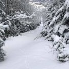
Ginx snewx Posted January 11, 2017 Share Posted January 11, 2017 Sunday river late this afternoon 6-8 at elevation Link to comment Share on other sites More sharing options...
ORH_wxman Posted January 11, 2017 Share Posted January 11, 2017 3 minutes ago, powderfreak said: Going to take a hit the next couple weeks keeping up with the holy grail winter of 2000-2001. We are already primed though if we have a big February or March it'll get real deep in a hurry. Crazy disparity though as eyewall has been buying toaster stocks for a month now while I've been more or less in heaven. All pretty much in the same county, just different sides. 2000-2001 was pretty slow too in January...monster Feb and Mar. Same exact thing down in ORH...still the biggest snow depth I've ever seen in person at home was March 2001...one of those patterns where ORH was more like NNE and the cutoff was more like from Ray to Kevin...SE of there kind of got the shaft (not horrendous, but not very good either). Link to comment Share on other sites More sharing options...
ORH_wxman Posted January 11, 2017 Share Posted January 11, 2017 2 minutes ago, Ginx snewx said: Sunday river late this afternoon 6-8 at elevation That looks familiar. Is that Blind Ambition on Jordan Bowl? Hard to tell the steepness on those pics...could be flying monkey or poppy fields too. Link to comment Share on other sites More sharing options...
Ginx snewx Posted January 11, 2017 Share Posted January 11, 2017 3 minutes ago, ORH_wxman said: That looks familiar. Is that Blind Ambition on Jordan Bowl? Hard to tell the steepness on those pics...could be flying monkey or poppy fields too. Looks like Flying monkey to me Blind Ambition has those peach colored Birch trees Link to comment Share on other sites More sharing options...
Ginx snewx Posted January 11, 2017 Share Posted January 11, 2017 9 minutes ago, ORH_wxman said: 2000-2001 was pretty slow too in January...monster Feb and Mar. Same exact thing down in ORH...still the biggest snow depth I've ever seen in person at home was March 2001...one of those patterns where ORH was more like NNE and the cutoff was more like from Ray to Kevin...SE of there kind of got the shaft (not horrendous, but not very good either). I pinnacled at 24" depth March 10th 2001 at home , don't know what ORH had. Of course I was in Maine that week where depths were 4 feet at the base and over 7 at the top Link to comment Share on other sites More sharing options...
CT Rain Posted January 11, 2017 Share Posted January 11, 2017 I was hoping to do Mount Snow next Saturday - but next week could be a close the blinds kinda deal. I can't believe I still haven't been up north. Definitely going to do a weekend in Stowe in March. Link to comment Share on other sites More sharing options...
powderfreak Posted January 11, 2017 Share Posted January 11, 2017 29 minutes ago, ORH_wxman said: 2000-2001 was pretty slow too in January...monster Feb and Mar. Same exact thing down in ORH...still the biggest snow depth I've ever seen in person at home was March 2001...one of those patterns where ORH was more like NNE and the cutoff was more like from Ray to Kevin...SE of there kind of got the shaft (not horrendous, but not very good either). Yeah I do remember one storm right around January 1st or December 30-31st? Coastal type system that brought a foot or so to ALB up through VT but no idea what it did elsewhere. I'm sure your memory is probably a bit clearer on that one. I just remember we weren't supposed to get hit and it just kept coming west (ahh those where the days when coastals came west, lol). But aside from that system I remember a lot of little stuff until it really went gang-busters in February and March. March had like three different 18-24"+ events for the VT ski resorts...capped with a bluebomb on March 30th or something like that. Link to comment Share on other sites More sharing options...
powderfreak Posted January 11, 2017 Share Posted January 11, 2017 A friend's photo from Tahoe Vista which is north shore of the Lake. Link to comment Share on other sites More sharing options...
ORH_wxman Posted January 11, 2017 Share Posted January 11, 2017 6 minutes ago, powderfreak said: Yeah I do remember one storm right around January 1st or December 30-31st? Coastal type system that brought a foot or so to ALB up through VT but no idea what it did elsewhere. I'm sure your memory is probably a bit clearer on that one. I just remember we weren't supposed to get hit and it just kept coming west (ahh those where the days when coastals came west, lol). But aside from that system I remember a lot of little stuff until it really went gang-busters in February and March. March had like three different 18-24"+ events for the VT ski resorts...capped with a bluebomb on March 30th or something like that. The Dec 30, 2000 stystem is the one you are thinking of....in ORH we got 10" and a horrific dryslot as the main band pivoted out into E NY, but can't really complain as it was a decent storm anyway. Then we got nickeled and dimed quite a bit in January...the only storm over 5" I think was Jan 20th...and not by much either. Then we had the epic system on Feb 5th, 2001 and then the blockbuster March. The blue bomb on 3/30 was interesting...ORH was right on the line for that one...it was like 3" of slush in south Worcester and up north it was literally like 9" of mashed potatoes...by the time you got to weenie ridge in Princeton, it was like 16" of birch bending paste. That was the year where driving around on like April 10th, there was still over a foot of snow on the ground even in open fields and sunny areas despite it not having snowed for 10 days. It was remarkable. Link to comment Share on other sites More sharing options...
Ginx snewx Posted January 11, 2017 Share Posted January 11, 2017 7 minutes ago, powderfreak said: A friend's photo from Tahoe Vista which is north shore of the Lake. did they get power back? Link to comment Share on other sites More sharing options...
radarman Posted January 11, 2017 Share Posted January 11, 2017 12/30/00 was good for 18+" in S VT. Recall reflecting on the end of the millenium in deep snow in the woods at Stratton. Felt good about it. Link to comment Share on other sites More sharing options...
mreaves Posted January 11, 2017 Share Posted January 11, 2017 50 minutes ago, powderfreak said: A friend's photo from Tahoe Vista which is north shore of the Lake. Haha, compared to some of those other pictures, it looks like they got the relative shaft. Link to comment Share on other sites More sharing options...

Recommended Posts
Archived
This topic is now archived and is closed to further replies.