RubiksDestroyer Posted February 29, 2016 Share Posted February 29, 2016 I figured now would be as good a time as any to make this. Link to comment Share on other sites More sharing options...
JoshM Posted February 29, 2016 Share Posted February 29, 2016 I figured now would be as good a time as any to make this. Just not feeling the love on this one. I think it'll be about as exciting as buying socks. Link to comment Share on other sites More sharing options...
No snow for you Posted February 29, 2016 Share Posted February 29, 2016 This will be a non event for South Carolina if anyone cares Link to comment Share on other sites More sharing options...
wncsnow Posted February 29, 2016 Share Posted February 29, 2016 Looks like a pretty decent chance here near the NC border with the track and 850's shown on the EURO, the timing isn't great for the trail race I am helping run here on Saturday however.. Link to comment Share on other sites More sharing options...
IWC Posted February 29, 2016 Share Posted February 29, 2016 Rain in RDU ok... Link to comment Share on other sites More sharing options...
Brick Tamland Posted February 29, 2016 Share Posted February 29, 2016 Well, if it happens, then great. If not, then it won't feel too bad knowing spring and warmer weather is here soon. Nothing to lose with this one. Link to comment Share on other sites More sharing options...
RubiksDestroyer Posted February 29, 2016 Author Share Posted February 29, 2016 Well, if it happens, then great. If not, then it won't feel too bad knowing spring and warmer weather is here soon. Nothing to lose with this one. Yeah, I pretty much agree with you. It'd be awesome if we got something nice out of this, but if not... Oh well. Link to comment Share on other sites More sharing options...
mackerel_sky Posted February 29, 2016 Share Posted February 29, 2016 Roxboro special! Link to comment Share on other sites More sharing options...
packfan98 Posted February 29, 2016 Share Posted February 29, 2016 Did the EPS trend better too??? Link to comment Share on other sites More sharing options...
fountainguy97 Posted February 29, 2016 Share Posted February 29, 2016 Eps is much improved. Similar mean to the euro op. But eps has trended south. If that continues two more times it's a nc storm. Couple big dogs in the mix too Link to comment Share on other sites More sharing options...
FallsLake Posted February 29, 2016 Share Posted February 29, 2016 Too many NC posters in here. Where are all the GA folks? I'm suppose to cover for them today. So what do you guys think for the GA mountain areas; any hope? Link to comment Share on other sites More sharing options...
snowbird1230 Posted February 29, 2016 Share Posted February 29, 2016 GSP does not even acknowledge the possibility of a storm for the mountains Link to comment Share on other sites More sharing options...
mackerel_sky Posted February 29, 2016 Share Posted February 29, 2016 GSP does not even acknowledge the possibility of a storm for the mountainsThey are hugging whatever models shows no snow, been doing it the last 2-3 days, one day it was the Euro, the next the GFS ! Link to comment Share on other sites More sharing options...
NWNC2015 Posted February 29, 2016 Share Posted February 29, 2016 Just giving a closer look to the 12z EURO by hour 93 #Boone is where you want to be for this storm. I wouldn't rule out 3 or 4". I would be worried, but not a total loss, if you are south of a line from Mars Hill....Morganton...Hickory. There I think more mixing and much less accumulations under 1". Timing is good for Friday morning. Most areas outside of the central/northern mountains will likely see everything melted by afternoon. Further north to my backyard and east areas out to Winston...isolated 1-2" possible where its cold enough...most spots probably under 1" too. Link to comment Share on other sites More sharing options...
FallsLake Posted February 29, 2016 Share Posted February 29, 2016 18z NAM has one low developing off the SC coast and another in Kentucky at hour 84. 850 line runs from NE NC SW to near Charlotte. Not a lot of precip at this point. http://mag.ncep.noaa.gov/Image.php?fhr=084ℑ=data%2Fnam%2F18%2Fnam_namer_084_850_temp_mslp_precip.gif&model=nam&area=namer¶m=850_temp_mslp_precip&group=Model+Guidance&preselected_formatted_cycle_date=20160229+18+UTC&imageSize=M&ps=model Link to comment Share on other sites More sharing options...
CAD_Wedge_NC Posted February 29, 2016 Share Posted February 29, 2016 I have a mix in the forecast for Friday morning now. Winter's last stand? Link to comment Share on other sites More sharing options...
mackerel_sky Posted February 29, 2016 Share Posted February 29, 2016 That's a smart thing to do this winter. Well, actually any winter in the SE.Very good point! It's the Packbacker way, and serves him well! Link to comment Share on other sites More sharing options...
mackerel_sky Posted February 29, 2016 Share Posted February 29, 2016 Just giving a closer look to the 12z EURO by hour 93 #Boone is where you want to be for this storm. I wouldn't rule out 3 or 4". I would be worried, but not a total loss, if you are south of a line from Mars Hill....Morganton...Hickory. There I think more mixing and much less accumulations under 1". Timing is good for Friday morning. Most areas outside of the central/northern mountains will likely see everything melted by afternoon. Further north to my backyard and east areas out to Winston...isolated 1-2" possible where its cold enough...most spots probably under 1" too. After this dumpster fire of a winter, seeing flakes period , is a win! Seeing flakes in March after this winter, I'm going to Disney World! Link to comment Share on other sites More sharing options...
FallsLake Posted February 29, 2016 Share Posted February 29, 2016 18z NAM simulated radar. Definitely looks like some ramp up on precip from the off shore low. http://mag.ncep.noaa.gov/Image.php?fhr=084ℑ=data%2Fnam%2F18%2Fnam_namer_084_sim_radar.gif&model=nam&area=namer¶m=sim_radar&group=Model+Guidance&preselected_formatted_cycle_date=20160229+18+UTC&imageSize=M&ps=model Edit: Does look like some teen dew point attempt to move in northern NC at hour 60: http://www.twisterdata.com/index.php?prog=forecast&model=NAM&grid=221&model_yyyy=2016&model_mm=02&model_dd=29&model_init_hh=18&fhour=60¶meter=DPTF&level=2&unit=M_ABOVE_GROUND&maximize=n&mode=singlemap&sounding=n&output=image&view=large&archive=false Link to comment Share on other sites More sharing options...
IWC Posted February 29, 2016 Share Posted February 29, 2016 After this dumpster fire of a winter, seeing flakes period , is a win! Seeing flakes in March after this winter, I'm going to Disney World! My My Aren't we TESTY Link to comment Share on other sites More sharing options...
BIG FROSTY Posted February 29, 2016 Share Posted February 29, 2016 issa gots snows in mys 4cast. .THURSDAY NIGHT...RAIN LIKELY. A CHANCE OF SNOW AFTER MIDNIGHT.LITTLE OR NO SNOW ACCUMULATION. LOWS IN THE LOWER 30S. CHANCE OFPRECIPITATION 60 PERCENT..FRIDAY...MOSTLY CLOUDY IN THE MORNING...THEN BECOMING PARTLYSUNNY. A CHANCE OF SNOW IN THE MORNING. A CHANCE OF RAIN. HIGHSIN THE MID 40S. CHANCE OF PRECIPITATION 50 PERCENT. It gonna b a biggon! Link to comment Share on other sites More sharing options...
FallsLake Posted February 29, 2016 Share Posted February 29, 2016 About as good as we can expect from RAH at this time: .LONG TERM /WEDNESDAY THROUGH MONDAY/...AS OF 315 PM MONDAY...IN THE WAKE OF THE COLD FRONT DEPARTING THE AREA WEDNESDAYMORNING...SHOWERS WILL BE COMING TO AN END BY MIDDAY IN THE COASTALPLAIN AND COLD ADVECTION/WIND GUSTS WILL BE STRONGEST DURING THEMORNING HOURS. AS SUCH..TEMPS MAY RISE ONLY VERY SLOWLY DURING THEMORNING...REACHING THE MID 40S NW TO MID 50S SE BY WEDNESDAYAFTERNOON. HIGH PRESSURE WILL QUICKLY BUILD OVERHEAD WEDNESDAYNIGHT...RESULTING IN LOWS IN THE LOWER 30SGENERALLY BROAD CYCLONIC FLOW WILL BE ESTABLISHED OVER THE EASTERNUS LATE THIS WEEK AS A VORTEX WOBBLES OVER EASTERN CANADA. A PERIODOF FLATTER FLOW ALOFT WILL BRIEFLY DEVELOP THURSDAY AS ANOTHERSHORTWAVE RACES FROM THE PACIFIC NORTHWEST TOWARD CENTRAL PLAINS.THIS SYSTEM...WHICH IS STILL A COUPLE DAYS AWAY FROM REACHING THE USUPPER AIR NETWORK...IS EXPECTED TO SWING RAPIDLY ACROSS THE EASTERNSTATES FRIDAY NIGHT...WITH THE ASSOCIATED SURFACE LOW ACROSS THECAROLINAS. THE GFS CONTINUES TO SHOW A MORE NORTHERN TRACK THANTHE COLDER AND MORE SOUTHERN ECMWF TRACK. BOTH MODELS ARECONSISTENT IN A 1025MB HIGH OVER NEW ENGLAND...SO THE TRACK OF THELOW WILL BE CRITICAL TO THE CHANCE OF RAIN MIXING WITH OR CHANGINGTO SNOW ANYWHERE EAST OF THE MOUNTAINS EARLY ON FRIDAY...MAINLY NEARTHE VA BORDER IF THAT. THIS SYSTEM SHOULD BE A QUICK MOVER AND THETHERMAL PROFILES/THICKNESSES ARE MARGINAL FOR ACCUMULATING SNOW...SOEARLY INDICATIONS ARE THAT IT WILL BE A LOW OR NON-IMPACT EVENT.THAT SYSTEM WILL QUICKLY EXIT ON FRIDAY...WITH ANOTHER SYSTEM ON ITSHEELS SUNDAY...THOUGH THAT ONE APPEARS TO BE DRIER. TEMPS LOOK TOBE BELOW NORMAL SATURDAY...LOW/MID 50S...REBOUNDING BACK TOWARDNORMAL UPPER 50S AND LOWER 60S ON SUNDAY&& Link to comment Share on other sites More sharing options...
NWNC2015 Posted February 29, 2016 Share Posted February 29, 2016 issa gots snows in mys 4cast. 1-2" for you Link to comment Share on other sites More sharing options...
BIG FROSTY Posted February 29, 2016 Share Posted February 29, 2016 1-2" for you I take that, and say bring on the Golfing weather... Cedar Brook!!!! lol Link to comment Share on other sites More sharing options...
mackerel_sky Posted February 29, 2016 Share Posted February 29, 2016 I take that, and say bring on the Golfing weather... Cedar Brook!!!! lolYour score should be about the same as an average August day! 95+. Link to comment Share on other sites More sharing options...
FallsLake Posted February 29, 2016 Share Posted February 29, 2016 18z GFS looks to be a little bit colder at hour 78 with the 850 line almost down to the NC/SC boarder. There is also a good bit more precip pushing up from the SW. http://mag.ncep.noaa.gov/Image.php?fhr=078ℑ=data%2Fgfs%2F18%2Fgfs_namer_078_850_temp_mslp_precip.gif&model=gfs&area=namer¶m=850_temp_mslp_precip&group=Model+Guidance&preselected_formatted_cycle_date=20160229+18+UTC&imageSize=M&ps=model Link to comment Share on other sites More sharing options...
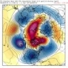
Jon Posted February 29, 2016 Share Posted February 29, 2016 CIPS median snow for the event...not bad for how it will most likely turn out. Probably too much around DC though. Link to comment Share on other sites More sharing options...
Cold Rain Posted February 29, 2016 Share Posted February 29, 2016 I'm suppose to cover for them today. So what do you guys think for the GA mountain areas; any hope? Thinking they should do ok for this one. Link to comment Share on other sites More sharing options...
JoshM Posted February 29, 2016 Share Posted February 29, 2016 18z GFS better IMO, HP is a tad stronger, still not there tho. Give me a 1035+ high and a Low about 50-75mph further off the coast and I would be a happy camper. Link to comment Share on other sites More sharing options...
superjames1992 Posted February 29, 2016 Share Posted February 29, 2016 The 12z Para Euro looks about the same as the 12z op Euro, FWIW. Link to comment Share on other sites More sharing options...

Recommended Posts
Archived
This topic is now archived and is closed to further replies.