Floydbuster Posted August 17, 2016 Share Posted August 17, 2016 The dominant ridging in the Atlantic this year makes me concerned about Cape Verde systems becoming more west-runners than models would seem to indicate. TD-6 (Fiona) will likely eventually never threaten land except perhaps Bermuda, however, I have a feeling the increasing African monsoon will soon create an amount of storms and hurricanes in the next 6 weeks or so, and some way well run west. Of course the dreaded track is the Andrew/Frances/Ike track. Tugging northwest towards a weakness, and then shunted back due west strengthening towards land. Link to comment Share on other sites More sharing options...
MJO812 Posted August 18, 2016 Share Posted August 18, 2016 0z CMC at 228 but interesting Link to comment Share on other sites More sharing options...
downeastnc Posted August 18, 2016 Share Posted August 18, 2016 2 minutes ago, Snow88 said: 0z CMC at 228 but interesting Yeah its all by itself with it though....has another storm just east of the Bahamas as well....its pretty typical CMC tropical fantasy crap lol...still that basically right over top of me Link to comment Share on other sites More sharing options...
Kmlwx Posted August 18, 2016 Share Posted August 18, 2016 The CMC is not even worth posting for tropical stuff. If you watch it with any regularity it's no stranger to this. Link to comment Share on other sites More sharing options...
Eskimo Joe Posted August 18, 2016 Share Posted August 18, 2016 Mind as well bank on it. That's move-in day for my new house. Link to comment Share on other sites More sharing options...
nesussxwx Posted August 18, 2016 Share Posted August 18, 2016 Some GFS Ensembles are starting to show hits. Link to comment Share on other sites More sharing options...
Epicnova Posted August 18, 2016 Share Posted August 18, 2016 GFS model at 348hrs showing a near miss for New England. Link to comment Share on other sites More sharing options...
USCAPEWEATHERAF Posted August 18, 2016 Share Posted August 18, 2016 12z CMC and 12z GFS both show either a hit or a miss for SNE in terms of a tropical cyclone making landfall in SNE. Link to comment Share on other sites More sharing options...
wxeyeNH Posted August 18, 2016 Share Posted August 18, 2016 9 minutes ago, USCAPEWEATHERAF said: 12z CMC and 12z GFS both show either a hit or a miss for SNE in terms of a tropical cyclone making landfall in SNE. Lol Uscape. I like your post. Models show a hit or a miss for SNE. I guess that covers all bases. Seriously we might have something to finally watch with a system at low latitudes moving west. Link to comment Share on other sites More sharing options...
Floydbuster Posted August 19, 2016 Share Posted August 19, 2016 Invest 99L must be watched very carefully by residents of the Leeward Islands. Link to comment Share on other sites More sharing options...
USCAPEWEATHERAF Posted August 19, 2016 Share Posted August 19, 2016 I think we need to watch what Fiona does here in SNE, just a hunch and a way the Teleconnections are going on the ensemble forecasts. A trending positive PNA and a relatively negative NAO spell East Coast troughing and Greenland Blocking, spells a landfall of a hurricane situation for SNE. Link to comment Share on other sites More sharing options...
Floydbuster Posted August 19, 2016 Share Posted August 19, 2016 Jeez...the long-range GFS shows a 907 mb Hurricane. Link to comment Share on other sites More sharing options...
Scott747 Posted August 19, 2016 Share Posted August 19, 2016 Future Gaston has potential. Link to comment Share on other sites More sharing options...
USCAPEWEATHERAF Posted August 21, 2016 Share Posted August 21, 2016 If Fiona can survive the following 36 hours and manage to stay a tropical cyclone, then she power up to a category one hurricane by the time she hits Bermuda. Also Invest 90L looks amazing and could be Gaston before 99L and become our first major hurricane of the season. Link to comment Share on other sites More sharing options...
hawkeye_wx Posted August 21, 2016 Share Posted August 21, 2016 The GFS and HWRF have now dropped 99L. The euro never jumped aboard that ship. *sigh*. There really isn't much to it on satellite, so I'm not surprised. It's just some weak, dry spin that would require a lot of work over several days just to reach TD status. It sure has been tough to be a hurricane geek following the Atlantic basin in recent years. Link to comment Share on other sites More sharing options...
MJO812 Posted August 21, 2016 Share Posted August 21, 2016 Maybe it's not dead after all Link to comment Share on other sites More sharing options...
Yanksfan Posted August 21, 2016 Share Posted August 21, 2016 27 minutes ago, Snow88 said: Maybe it's not dead after all As long as the wave doesn't interact with Hispanolia, it should develop. Conditions are ripe. Link to comment Share on other sites More sharing options...
MJO812 Posted August 21, 2016 Share Posted August 21, 2016 1 hour ago, NutleyBlizzard said: As long as the wave doesn't interact with Hispanolia, it should develop. Conditions are ripe. Waters are ripe if it doesn't interact with land Link to comment Share on other sites More sharing options...
Superstorm93 Posted August 21, 2016 Share Posted August 21, 2016 Sinking air should keep it in check. GFS/GEFS/UKM/ECM/EPS all backed off. Highly doubt anything will come from it Sent from my XT1585 using Tapatalk Link to comment Share on other sites More sharing options...
Kmlwx Posted August 21, 2016 Share Posted August 21, 2016 Sometimes there is too much emphasis put on water temps. If the thing never closes off a circulation or develops convection the water temps don't matter. And even if it does develop - very warm water temps do not guarantee it'll go bonkers or anything. I'm hesitant to say 99L will develop beyond TD or TS. Models certainly have backed off. They seemed to like the next wave better but then many are fishing that one. Link to comment Share on other sites More sharing options...
MJO812 Posted August 21, 2016 Share Posted August 21, 2016 12z GGEM has a hurricane hitting the southeast coast and then it rides the coast ( ala Irene ) Looks like the GFS also brings it back Link to comment Share on other sites More sharing options...
hawkeye_wx Posted August 21, 2016 Share Posted August 21, 2016 43 minutes ago, Snow88 said: 12z GGEM has a hurricane hitting the southeast coast and then it rides the coast ( ala Irene ) Looks like the GFS also brings it back Yeah, the morning GFS has a weak low adrift in the Bahamas. If a low can get into that area and find a favorable atmosphere, a lot can happen. Katrina formed from a weak junk disturbance that barely made it through the mid-Atlantic TUTT and ended up adrift in the western Bahamas and we know what happened there. Link to comment Share on other sites More sharing options...
hawkeye_wx Posted August 21, 2016 Share Posted August 21, 2016 Interesting... the 12z euro is solidly holding onto 99L for the first time, drifting a weak low into the Bahamas where it could develop. Link to comment Share on other sites More sharing options...
USCAPEWEATHERAF Posted August 21, 2016 Share Posted August 21, 2016 I'm very worried for the East Coast from Florida northwards about the possibilities of 99L becoming a weak tropical storm before the NE Lesser Antilles and then intensifying rapidly over the Bahamas and then off the East Coast, the atmosphere can produce a monster in these waters, we all know that. Link to comment Share on other sites More sharing options...
hawkeye_wx Posted August 22, 2016 Share Posted August 22, 2016 GFS is struggling to hold onto 99L as any significant entity once reaching the Bahamas. However, the 12z euro is one of those "uh oh" runs. It begins to strengthen 99L over the Bahamas and then, due to the model popping a ridge over the east coast, takes it wnw across south Florida as a low end cane, with further strengthening in the eastern gulf. 99L's level of organization when it reaches the Bahamas is going to be a big deal. Link to comment Share on other sites More sharing options...
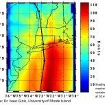
MJO812 Posted August 23, 2016 Share Posted August 23, 2016 Link to comment Share on other sites More sharing options...
USCAPEWEATHERAF Posted August 23, 2016 Share Posted August 23, 2016 The Max intensity potential index that shows at what intensity a particular location in the Atlantic OCean can sustain if perfect conditions existed, show that wherever 99L goes just east of the NW Bahamas, that area can sustain or allow to develop a <880mb, 190+mph category five hurricane. Link to comment Share on other sites More sharing options...
tmagan Posted August 23, 2016 Share Posted August 23, 2016 44 minutes ago, USCAPEWEATHERAF said: The Max intensity potential index that shows at what intensity a particular location in the Atlantic OCean can sustain if perfect conditions existed, show that wherever 99L goes just east of the NW Bahamas, that area can sustain or allow to develop a <880mb, 190+mph category five hurricane. There has never been an under 900 mb hurricane recorded measurement east of Florida. Link to comment Share on other sites More sharing options...
USCAPEWEATHERAF Posted August 23, 2016 Share Posted August 23, 2016 10 hours ago, tmagan said: There has never been an under 900 mb hurricane recorded measurement east of Florida. I'm telling you the potential chart shows it. http://wxmaps.org/pix/atlpot.png this is my source Link to comment Share on other sites More sharing options...
Drz1111 Posted August 23, 2016 Share Posted August 23, 2016 That's a terrible cite. The vast VAST majority of tropical cyclones don't achieve maximum potential intensity. Emmanuel's own papers show that. Link to comment Share on other sites More sharing options...

Recommended Posts
Archived
This topic is now archived and is closed to further replies.