BoulderWX Posted February 12, 2014 Share Posted February 12, 2014 wow, at the wxbell depiction of the 18z 4k NAM -- unreal weenie run right there.. Link to comment Share on other sites More sharing options...
REDMK6GLI Posted February 12, 2014 Share Posted February 12, 2014 CCB is going to be a big part of the storm for NJ, SWCT and HV. Biggest question to me is can it keeps its intensity as it moves east across NYC-LI and so on? The LP staying closed off is going to help this alot when it start moving east S. of LI. Link to comment Share on other sites More sharing options...
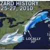
earthlight Posted February 12, 2014 Share Posted February 12, 2014 Link to comment Share on other sites More sharing options...
Heisy Posted February 12, 2014 Share Posted February 12, 2014 Check out this vertical motion over NYC region on 36 hour RGEM, thats epic (bottom right) Link to comment Share on other sites More sharing options...
friedmators Posted February 12, 2014 Share Posted February 12, 2014 CCB is going to be a big part of the storm for NJ, SWCT and HV. Biggest question to me is can it keeps its intensity as it moves east across NYC-LI and so on? The LP staying closed off is going to help this alot when it start moving east S. of LI. The 4km shows the CCB weakening completely before making it across LI. Link to comment Share on other sites More sharing options...
PB GFI Posted February 12, 2014 Share Posted February 12, 2014 The back end tomorrow nite as per 4k NAM Looks like 4 hours of 1 -2 inches of snow from Trenton thru CNJ NWNJ into the Hudon valley and into NYC and then across LI (Not sure if the intensity is the same thru the island ,weakens it a bit .) But if Upton is right combine that with 50 mph gusts , and there white out conditions from CNJ on North . 12 on the front and if this verifies , Many people will be at the high end of there forecast range . Link to comment Share on other sites More sharing options...
IsentropicLift Posted February 12, 2014 Share Posted February 12, 2014 Ignoring the Euro ensemble mean thermal profiles the track and QPF distribution look similar to the 18z NAM for the CCB. Link to comment Share on other sites More sharing options...
REDMK6GLI Posted February 12, 2014 Share Posted February 12, 2014 The back end tomorrow nite as per 4k NAM Looks like 4 hours of 1 -2 inches of snow from Trenton thru CNJ NWNJ into the Hudon valley and into NYC and then across LI (Not sure if the intensity is the same thru the island ,weakens it a bit .) But if Upton is right combine that with 50 mph gusts , and there white out conditions from CNJ on North . 12 on the front and if this verifies , Many people will be at the high end of there forecast range . The LP staying closed off as it passes south of LI must be able to help keep the CCB together in its entirety as it moves east across LI though right? Link to comment Share on other sites More sharing options...
PB GFI Posted February 12, 2014 Share Posted February 12, 2014 The CCB is not completely weakened across Long Island . In the heart of this coming east its 35 plus DBZ It seems to be more on the order of 20 dbz as it gets E of KNYC Link to comment Share on other sites More sharing options...
REDMK6GLI Posted February 12, 2014 Share Posted February 12, 2014 The CCB is not completely weakened across Long Island . In the heart of this coming east its 35 plus DBZ It seems to be more on the order of 20 dbz as it gets E of KNYC So light-moderate precip as it heads across LI as i was saying all along? 20dbz doesnt sound like anything special to write home about at all to be honest Link to comment Share on other sites More sharing options...
chietanen Posted February 12, 2014 Share Posted February 12, 2014 IS that seriously 24-30"??? The WB snow maps for the 4km NAM have some areas in the region (lower HV into central NJ) at close to 30". EDIT: actually, they have a max of 33.6", which looks to be in Putnam County. Likely overdone but a lot of snow nonetheless. Link to comment Share on other sites More sharing options...
jm1220 Posted February 12, 2014 Share Posted February 12, 2014 The 4km shows the CCB weakening completely before making it across LI. The western half of Long Island probably gets a few inches from it. There are very good radar returns overhead for 4-5 hours. Granted, the worst of it is west of there over N NJ and the Hudson Valley. Verbatim, the 18z 4k NAM has over a foot of snow from about the William Floyd Pkwy west. Link to comment Share on other sites More sharing options...
Saturn510 Posted February 12, 2014 Share Posted February 12, 2014 Is someone going to 5 POST the NAM. Holy crap. Come friday we will either laugh the hell out of it or think its the best model ever. Link to comment Share on other sites More sharing options...
Guest Pamela Posted February 12, 2014 Share Posted February 12, 2014 So light-moderate precip as it heads across LI as i was saying all along? 20dbz doesnt sound like anything special to write home about at all to be honest ...there is no guarantee it will set up over NJ exactly as modeled by the 18z NAM...usually these things end up displaced a bit northeast of where they are modeled...if I were to guess...it would set up along the eastern slopes of the Berkshires / Litchfield Hills down to Fairfield County...where the wind smacks up against these hills. Link to comment Share on other sites More sharing options...
friedmators Posted February 12, 2014 Share Posted February 12, 2014 The western half of Long Island probably gets a few inches from it. There are very good radar returns overhead for 4-5 hours. Granted, the worst of it is west of there over N NJ and the Hudson Valley. Verbatim, the 18z 4k NAM has over a foot of snow from about the William Floyd Pkwy west. Tough for me to think that verifies exactly although we are bulls-eyed it sounds like down here in Edison. Link to comment Share on other sites More sharing options...
simpsonsbuff Posted February 12, 2014 Share Posted February 12, 2014 If I'm reading this correctly, here's the 18z RGEM at 1pm tmmw at 850... Look at that little pocket of -2 and colder temps right near the city... indicative of the dynamics... Link to comment Share on other sites More sharing options...
liwxfan Posted February 12, 2014 Share Posted February 12, 2014 ...there is no guarantee it will set up over NJ exactly as modeled by the 18z NAM...usually these things end up displaced a bit northeast of where they are modeled. Link to comment Share on other sites More sharing options...
PB GFI Posted February 12, 2014 Share Posted February 12, 2014 Any mix/rain I think will be minimal with the dry slot forecast to go over our region. I agree I think its 12 on the front 3 hours of snizzle , the surface is 32 - 33 then then the deformation zone rips thru . Last Feb I got 10 in 5 hours in CN - would love to see that again w 50 mph gusts Link to comment Share on other sites More sharing options...
CSheridan12 Posted February 12, 2014 Share Posted February 12, 2014 Every time you've posted this map after a run I've said to myself "that can't be true" and then the next one you post is more unbelievable. Link to comment Share on other sites More sharing options...
IsentropicLift Posted February 12, 2014 Share Posted February 12, 2014 If you take where the Euro put the best CCB and move it a bit northeast or east like William said you basically get the 18z NAM. Even though this run has brought out my inner weenie, I still will air on the side of caution. That backend band is going to continue to fluctuate from run to run. Link to comment Share on other sites More sharing options...
PB GFI Posted February 12, 2014 Share Posted February 12, 2014 So light-moderate precip as it heads across LI as i was saying all along? 20dbz doesnt sound like anything special to write home about at all to be honest Its just 1 models solution , don't take it to heart . Link to comment Share on other sites More sharing options...
bluewave Posted February 12, 2014 Share Posted February 12, 2014 Its just 1 models solution , don't take it to heart . The RGEM lines up a bit further east than the Euro is showing. Link to comment Share on other sites More sharing options...
PB GFI Posted February 12, 2014 Share Posted February 12, 2014 The 4k NAM thinks there`s 6 to 9 inches of snow in the band from Trenton just NYC in 3 hours Link to comment Share on other sites More sharing options...
forkyfork Posted February 12, 2014 Share Posted February 12, 2014 the "backlash" is from a TROWAL, not exactly a CCB (but they're related) Link to comment Share on other sites More sharing options...
Nibor Posted February 12, 2014 Share Posted February 12, 2014 I keep seeing these images and I still can't quite figure out what the legend is. Are the numbers in mm and is it in QPF? Link to comment Share on other sites More sharing options...
TWCCraig Posted February 12, 2014 Share Posted February 12, 2014 I keep seeing these images and I still can't quite figure out what the legend is. Are the numbers in mm and is it in QPF? It's that amount of snow in inches x 10. So 120 would be 12" of snow. Link to comment Share on other sites More sharing options...
NorthShoreWx Posted February 12, 2014 Share Posted February 12, 2014 I keep seeing these images and I still can't quite figure out what the legend is. Are the numbers in mm and is it in QPF? Inches of snow (with an implied decimal...i.e., divide by 10). If correct, there would be 30" amounts in the LHV and even 18" here. All of the yellows are at least 24" Link to comment Share on other sites More sharing options...
jm1220 Posted February 12, 2014 Share Posted February 12, 2014 The RGEM lines up a bit further east than the Euro is showing. SN_000-048_0000.gif What an absolute crush-job. The VV panels on the models today show likely the strongest snow rates here since Jan 26, 2011, and that's just the front end. That was 12" in 4-5 hours. I'm not sure overrunning can sustain snow rates like that and ratios will be lower than that this time, but it's going to be an incredibly fun 6-8 hours. Link to comment Share on other sites More sharing options...
Drz1111 Posted February 12, 2014 Share Posted February 12, 2014 LWX is saying that based on WV loops, the storm is coming west. Link to comment Share on other sites More sharing options...
IsentropicLift Posted February 12, 2014 Share Posted February 12, 2014 The 18z GFS has most of the snow from the front end and then dry slot before a weak version of the trowel. It hammers interior New England though. Hopefully it was just the GFS being the GFS. Link to comment Share on other sites More sharing options...

Recommended Posts
Archived
This topic is now archived and is closed to further replies.